Satellite images show wildfires burning in Quebec
2 years ago
170
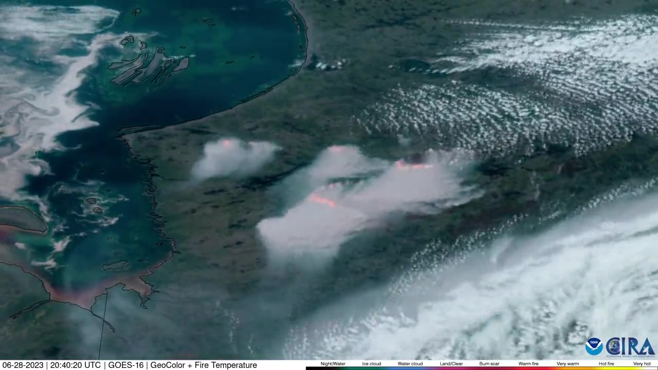
Multiple wildfires were burning in Quebec, Canada, on Wednesday, June 28, satellite images by the Cooperative Institute for Research in the Atmosphere (CIRA) showed. There were at least 72 fires affecting the province, fire officials said. The smoke from these wildfires blew into the Midwestern US, affecting air quality across multiple states on Wednesday. Credit: CIRA via Storyful
Loading comments...
-
 2:29:34
Brandon Gentile
4 days agoHow To Retire 10 Years Early with Just 0.1 Bitcoin
1.11K1 -
 3:19:34
Laura Loomer
5 hours agoEP135: Champagne Communism: Zohran Mamdani's Ugandan Compound EXPOSED
28.4K7 -
 28:39
28:39
The Why Files
3 days agoCryptids Vol. 4 | Bunyips, Yowie and Australian Nightmare Fuel
45.6K38 -
 1:07:06
Mike Rowe
18 days agoThe Fight For America's Heartland | Salena Zito #442 | The Way I Heard It
30.3K47 -
 2:43:30
TimcastIRL
5 hours agoSouth Park Goes FULL CHARLIE KIRK, Latest Episode ROASTS Trump Again | Timcast IRL
210K79 -
 LIVE
LIVE
SpartakusLIVE
6 hours agoThe Return of the KING of Content
454 watching -
 10:05
10:05
MattMorseTV
9 hours ago $6.53 earnedHe actually did it...
55.1K23 -
 1:32:39
Anthony Rogers
1 day agoEpisode 376 - Todd Schowalter
25.7K -
 3:42:07
megimu32
5 hours agoOTS: Movie Tie-In Games + Remakes: Let’s Play Memory Lane
41.1K5 -
 1:15:06
Adam Does Movies
12 hours ago $1.02 earnedTalking Movies + Ask Me Anything - LIVE
28.6K1