Guam Needs To Evacuate. Fire Map & Very Strong Typhoon. 5/23/2023
2 years ago
7
Paypal - https://www.paypal.com/paypalme/John445739
Address - JOHN ESTEP
PO:BOX.121
WAR WV 24892-0121
Here are the URL's to the Satellites i use..
U.S.G.S. Earthquakes - https://earthquake.usgs.gov/earthquakes/map/
Buoy Cams - https://www.ndbc.noaa.gov/buoycams.shtml
https://avcams.faa.gov/? Cams on Land.. fbclid=IwAR1_ZtsDUj2CGyksWhQdgXFyGk58gllxQvBe6TyzONG
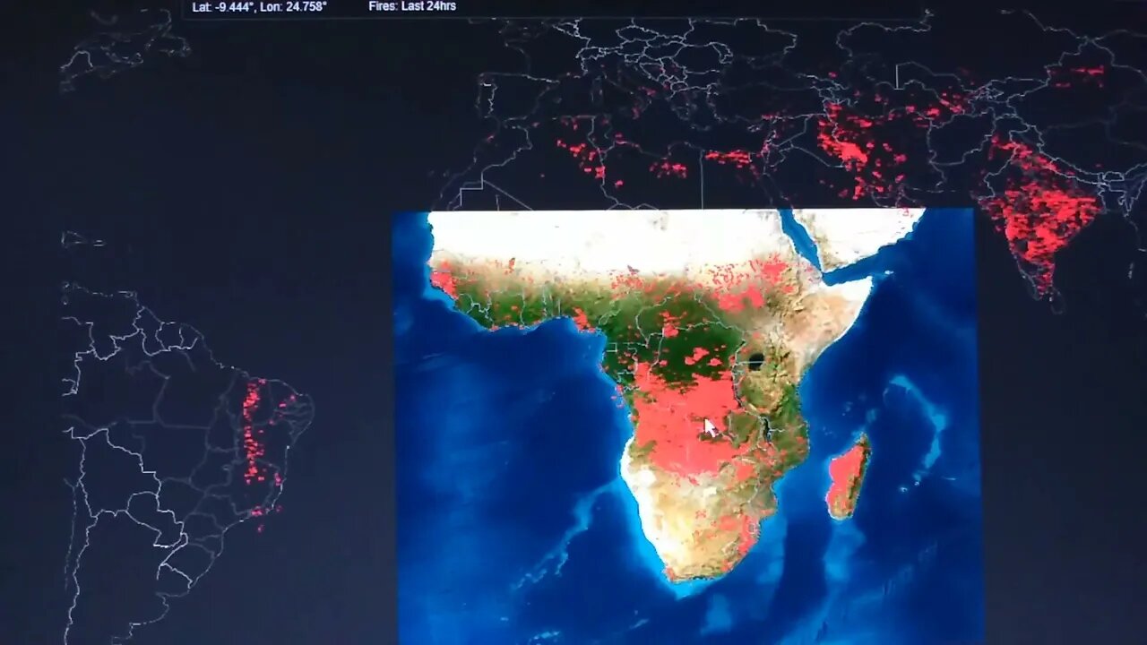
Firms Fire Map
https://firms.modaps.eosdis.nasa.gov/map/#d:24hrs;@-17.9,28.6,14z
Loading comments...
-
 1:16:31
Omar Elattar
9 months agoThe Untold Story: How Vans Became a $3 Billion Dollar Shoe Empire In 75 mins
5.82K5 -
 LIVE
LIVE
Lofi Girl
2 years agoSynthwave Radio 🌌 - beats to chill/game to
292 watching -
 1:56:31
The Pascal Show
16 hours ago $1.17 earnedGHISLAINE FLIPS?! DOJ Receives SECRET LIST of 100 Epstein Associates!”
5.39K2 -
 10:17
10:17
Dr Disrespect
11 days agoIt's Time To Get Serious
178K27 -
 2:15:09
Badlands Media
23 hours agoDevolution Power Hour Ep. 375: Obama’s Orders, Ukraine’s Collapse & the Inversion of Justice
292K106 -
 2:32:03
BlackDiamondGunsandGear
13 hours agoAFTER HOURS ARMORY w/ DLD & John from GOA & FLR
26.6K3 -
 1:05:28
Man in America
14 hours agoTREASON? Obama, Hillary, and Soros in the New World Order Agenda EXPOSED w/ Mel K
86.8K80 -
 2:22:46
The Connect: With Johnny Mitchell
14 hours ago $6.07 earnedOne Man's Mission To Stop Human Trafficking: How A Billionaire Mercenary Saved Hundreds Of Children
23.8K18 -
 2:35:13
Tundra Tactical
10 hours ago $12.41 earned🔫 California Ammo Win, Sig Sauer P320 Controversy, Meme Review & Would You Rather! 🎉🔥
40.3K6 -
 16:24
16:24
Forrest Galante
7 hours ago6 Deadliest Man Eaters to Ever Exist
28.1K6