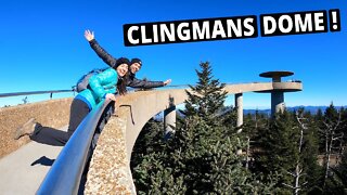
Phenomenal Views Of The Smoky Mountains | Clingmans Dome
Here we walk to the highest point in the smoky mountains at Clingman's Dome in North Carolina. At the top, you'll find the breathtaking 360-degree panoramic views.
Equipment We Use 🎥
Main Camera - https://amzn.to/3fTXmKf
GoPro– https://amzn.to/36LZl1z
Drone - https://amzn.to/3AZMzHq
Camera Shotgun Mic - https://amzn.to/39XVEar
Tony’s Backpack – 5.11 RUSH12 – https://amzn.to/3vZZpCd
Water Filter - https://amzn.to/3Ptp9Sd
Tony's Hiking Shoes - https://amzn.to/3F9YEgo
_________________________________________________________________________________________
Merch:
http://www.redbubble.com/people/build...
GET IN CONTACT:
Email - buildthedream777@gmail.com
Website - https://buildthedreamnow.com
SUPPORT MY WORK - https://account.venmo.com/u/Tony-Hossri
_____________________________________________________________________________________________
Clingmans Dome is a mountain in the Great Smoky Mountains of Tennessee and North Carolina in the southeastern United States. Its name in Cherokee is Kuwahi or Kuwohi[4] (ᎫᏩᎯ or ᎫᏬᎯ), meaning "mulberry place." At an elevation of 6,643 feet (2,025 m), it is the highest mountain in the Great Smoky Mountains National Park, the highest point in the state of Tennessee, and the highest point along the 2,192-mile (3,528 km) Appalachian Trail. It is also the third highest point in mainland Eastern North America, after Mount Mitchell (6,684 feet or 2,037 metres) and Mount Craig (6,647 feet or 2,026 metres).
Description
Clingmans Dome has two subpeaks: 6,560-foot (2,000 m) Mount Buckley to the west and 6,400-foot (1,950 m) Mount Love to the east. The headwaters of several substantial streams are located on the slopes of Clingmans Dome, namely Little River on the north slope, and Forney Creek and Noland Creek (both tributaries of the Tuckasegee River) on the south slope. The mountain is located entirely within the watershed of the Tennessee River.[5]
Clingmans Dome is protected as part of the Great Smoky Mountains National Park. A paved road connects it to U.S. Highway 441 at Newfound Gap 6.7 miles (10.8 km) away.[6] The 45-foot (14 m) concrete observation tower, built in 1959 and listed on the National Register of Historic Places, offers a panoramic view of the mountains. An air quality monitoring station, operated by the Environmental Protection Agency, is the second highest in eastern North America.
The Southern Appalachian spruce-fir forest which covers Clingmans Dome occurs only at the highest elevations in the southeastern United States, and has more in common with forests at northern latitudes than with the forests in the adjacent valleys. Clingmans Dome stands prominently above the surrounding terrain, rising nearly 5,000 feet (1,500 m) from base to summit. The forest on and around Clingmans Dome has experienced a large die-off of Fraser fir caused by the non-native insect, balsam woolly adelgid.[5]
https://en.wikipedia.org/wiki/Clingmans_Dome
Who are we?
We believe that life doesn't have to be the same day every day. You can Build The Dream life through exploration, travel, & adventure.
DISCLAIMER: This video and description contains affiliate links, which means that if you click on one of the product links, I’ll receive a small commission. This helps support the channel and allows us to continue to make videos like this. Thank you for the support!
#Hikes #Scenic #trails #scenictrail #tennessee #views
#mountains #mountleconte #hiking #hikingadventures #trails #greatsmokymountains #buildthedream #endangeredforest
-
 15:30
15:30
PS Adventures
3 years agoHiking to Clingmans Dome - the Highest Point in the Smoky Mountains! | SMNP
21 -
 8:49
8:49
RedBeardedPredators
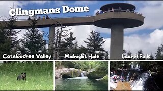
11 months agoGreat Smoky Mountain National Park | Clingmans Dome, Cataloochee Valley, Midnight Hole, and More!!!
16 -
 30:35
30:35
Cody and Kellie
3 years agoBeautiful Mountain Top Camping | Dome Life
141 -
 29:21
29:21
BryanDeLay
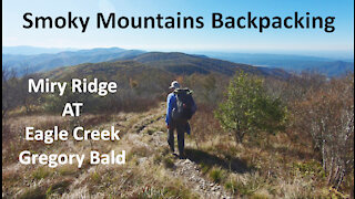
2 years agoSmoky Mountains Backpacking: Miry Ridge, AT, Eagle Creek, Gregory Bald
52 -
 10:30
10:30
Sojourner
1 year ago $0.02 earnedRoad Trip: Hot Springs, Mount Whitney, and Ancient Pine Forest
2822 -
 22:31
22:31
Adventure Is Out There
1 year agoNEW Sanctuary Treehouse Resort Full Tour | Great Smoky Mountains (Sevierville, TN)
931 -
 0:31
0:31
HikingViking
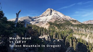
9 months agoSPECTACULAR Mount Hood Wilderness Views from the Cloud Cap Inn Zone! | Timberline Loop | 4K | Oregon
1104 -
 11:52
11:52
Adventure Is Out There
9 months agoThe Townsend Wye Swimming Hole & Burger Master | Great Smoky Mountains of Tennessee
321 -
 0:28
0:28
HikingViking
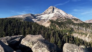
8 months agoGORGEOUS Mount Hood Wilderness Views from Cloud Cap Boulder Zone! | Timberline Loop | 4K | Oregon
392 -
 24:38
24:38
BryanDeLay
2 years agoSmoky Mountains Backpacking: Deep Creek, Indian Creek, Deep Low Gap, Mingus Creek
92