Big Floods Across the Wasatch Front? -- Hear from Expert Consultant
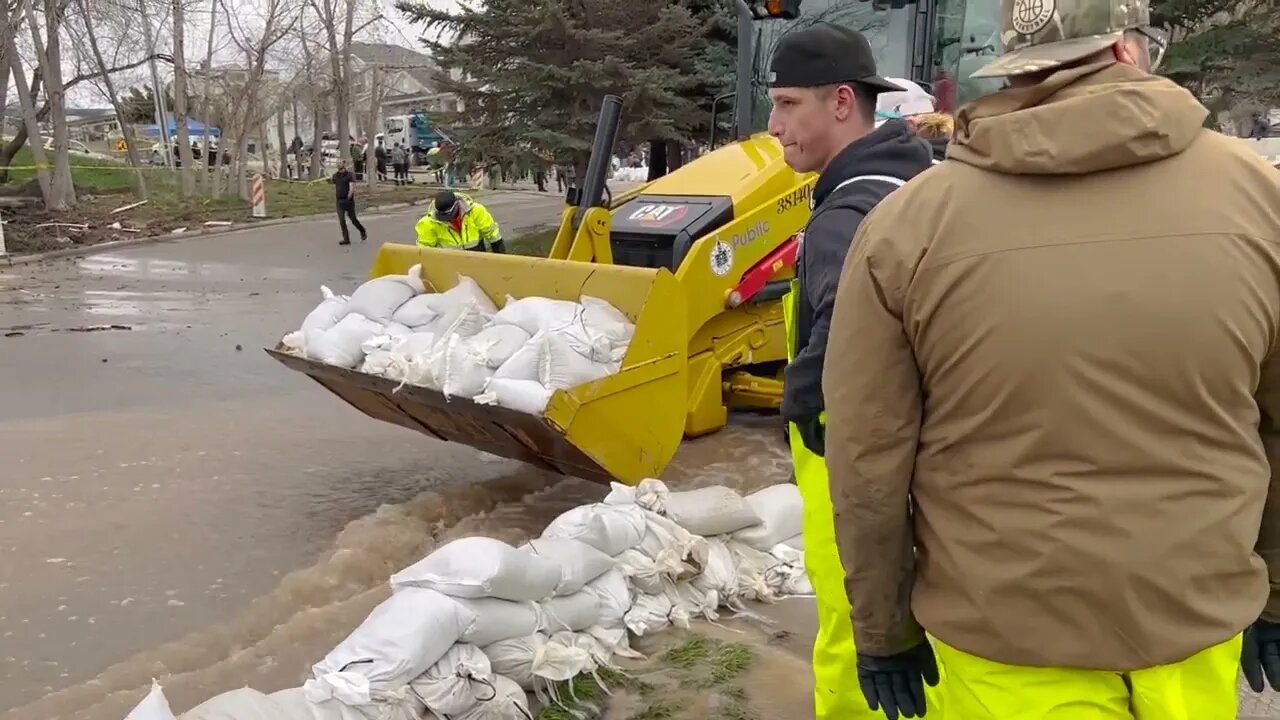
Brian McInerney is a former chief hydrologist for the National Weather Service. He has come out of retirement to consult for Salt Lake County concerning how to best handle the massive runoff we are about to receive. McInerney appeared as a guest on a Utah Stories podcast where he offered several insights. The unprecedented nature of this year's snowpack is due to a few factors. Usually, there are just two major atmospheric rivers that might dominate the weather pattern in January, but this winter saw around 30. These “rivers” have dumped more than 900 inches of snow. Why now? Is this due to climate change?
“It could be,” McInerney says. “For every degree centigrade, you raise the atmospheric temperature, you get a seven percent increase in atmospheric moisture.” Heat has a compounding impact on the amount of moisture clouds can draw from the Pacific.
“It's literally ten times the carrying capacity of the Mississippi River in one band, in one atmospheric river,” he explains. “And it’s low-level moisture and it takes just a little bit of a bump for it to go up, and that is usually the mountains of California, and then it precipitates out a phenomenal amount.”
Visit UtahStories.com for more and to subscribe to our free digital newsletter. There you can also support our journalism by subscribing to our print magazine for $3 per month.
Follow us on:
Instagram @UtahStories
Twitter @UtahStories
-
 LIVE
LIVE
BonginoReport
1 hour agoJim Acosta Interviews AI Model of Parkland Shooting Victim - Hayley Caronia (Ep.105)
9,223 watching -
 LIVE
LIVE
Kim Iversen
1 hour agoEuropeans REFUSE to Visit the U.S.—Fear of Detention Under Trump | Is Iran Preparing for WAR?
4,714 watching -
 1:57:50
Redacted News
2 hours agoTrump is making a HUGE mistake and MAGA is P*SSED | Redacted w Natali and Clayton Morris
89.8K142 -
 LIVE
LIVE
Dr. Drew
4 hours agoBorder Czar Tom Homan: How Did An Illegal Alien Become A COP? w/ Dr. Michael Goodkin on Ivermectin Trial Fraud & Alex Krainer on Europe's Collapse – Ask Dr. Drew
943 watching -
 31:10
31:10
Michael Franzese
2 hours agoThe Hidden Connection behind the Wave of Attacks EXPOSED
12.4K10 -
 59:44
59:44
Preston Stewart
8 hours agoPokrovsk: Ukraine's Most Dangerous Front
533 -
 4:42:31
Barry Cunningham
6 hours agoREACTING TO THE PRESIDENT TRUMP INTERVIEW ON CNBC! (THE CONTRAST OF COMMUNISM AND MORE NEWS))
85.3K9 -
 22:00
22:00
Jasmin Laine
2 hours ago“$750B GONE”—U.S. HUMILIATES Carney Over Climate Lies in BRUTAL Public Takedown
2.39K10 -
 LIVE
LIVE
StoneMountain64
5 hours agoBATTLEFIELD 6 BETA Training and Prepping
288 watching -
 1:14:11
vivafrei
4 hours agoAcosta AI Interview: Journalism or Exploitation? The War of the Jeans! Cincinnati Update & MORE!
80.9K19