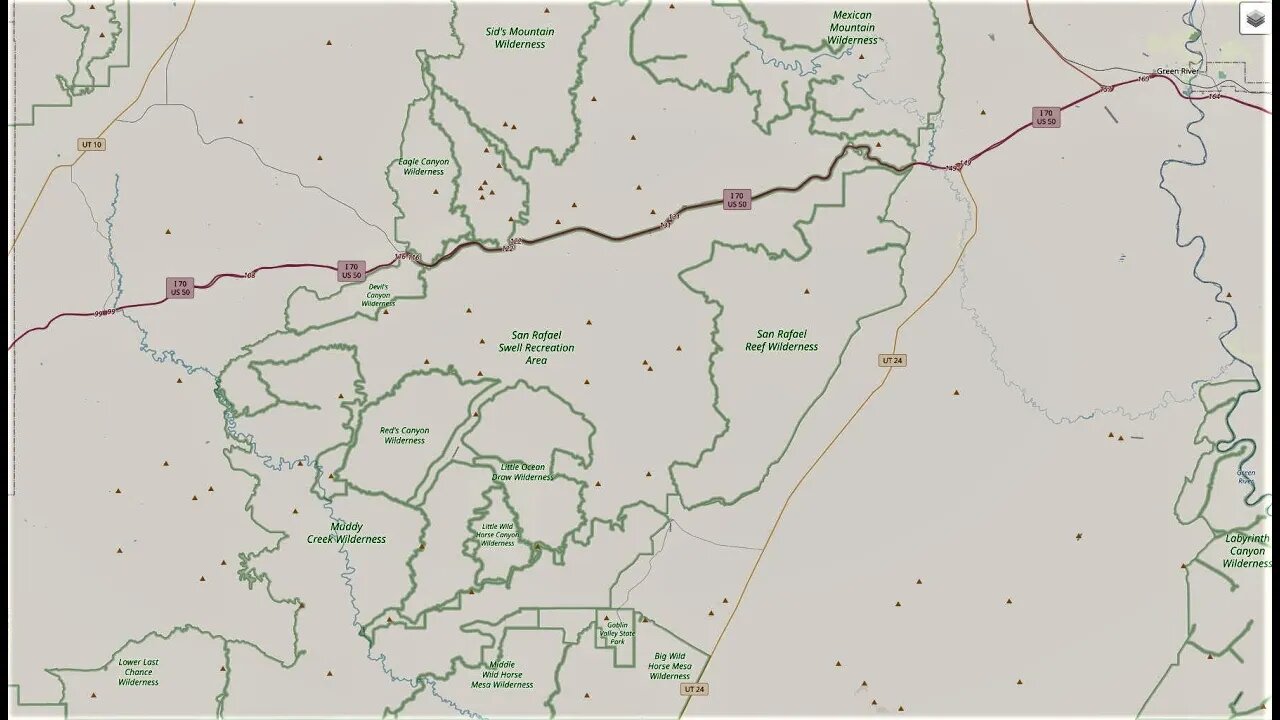
Reds Canyon Loop Part 2 - Lower San Rafael Swell
"Reds Canyon Loop" is an incredibly gorgeous trail in the south end of the San Rafael Swell in Central Utah. Starting at a high elevation, you can see the beautiful canyon that you will be descending into. Once in the canyon, you can see where the trail gets its name. Winding through the red cliffs, you will wish you could spend days down here. As you exit the trail to the north, you are treated with more spectacular views of the surrounding areas. This is an absolute must do in the Swell!
Highest Elevation: 6905 Ft
Length: 26 Miles
Road Conditions: Graded Dirt/Gravel
Road/Trail Difficulty: B-Easy
Emery County Road: 1019
The San Rafael Swell, however, is an enormous geologic feature, located on 2,000 square miles of BLM land slightly southeast of the center of Utah. The Swell is bisected by Interstate 70; otherwise, it hardly contains a trace of man. It is a vast, open, remote landscape dotted by the mesas and rock towers that are the quintessential formations of the Utah desert. Explore it up close on the network of roads south of I-70 within the Swell, like McKay Flat and Hondu Arch Roads.
To get to McKay Flat Road and then to Hondu Arch Road — which leads to the impressive Hondu natural arch on the west side of the southern Swell — take Temple Mountain Road (Exit 131 off of I-70). There will be several junctions with smaller roads along the way — stay on the main road. After about 10 miles you’ll reach the junction of Heart of Sinbad Road, where you will continue west. About 3.5 miles later, you will reach McKay Flat Road. From here, it is 18 miles to the Hondu Arch. Continue south until McKay Flat Road intersects with Hondu Arch Road, which you will take to the west.
The journey will take you past fierce, beautiful landscapes with rock towers, mesas, and arches that expose the colorful rock layers of the Swell, from the limestone and sandstone of the Permian, to the shale and mudstone of the Cretaceous. You will also pass by one old uranium mine before reaching a stunning view of the Hondu (also spelled “Hondoo”) Arch, a keyhole formation at the road’s end.
When they are in good condition these roads are fit for passenger cars — but check out the current conditions and the weather report before you go because storms can render them impassable. Remember that if something goes wrong you could be a long way from help: make sure your car is running well, that you’ve got a full tank of gas, and bring a good map. Also, watch out for grazing cattle (sometimes they hang out on the roads). Otherwise, enjoy the seemingly otherworldly scenes of the Swell — as well as the solitude of the desert.
-
 2:50:07
Badlands Media
14 hours agoDEFCON ZERQ Ep. 013: Global Shifts, Spiritual Warfare, and the Return to Source
58.7K64 -
 6:21:11
SpartakusLIVE
9 hours agoLIVE from SUPER SECRET, VIP Location || BEACH FRONT into Verdansk
75.1K7 -
 1:20:01
Flyover Conservatives
1 day ago"The Testosterone Levels of a Baby Bird" - America’s Health Crisis w/ Dr. Troy Spurrill | FOC Show
46.6K1 -
 2:28:15
PandaSub2000
1 day agoSonic Racing CrossWorlds | ULTRA BESTIES & GAMES (Original Live Version)
29.4K1 -
 4:56:36
Drew Hernandez
11 hours agoDISGRACED SCOTUS REJECTS ALEX JONES' INFOWARS FREE SPEECH APPEAL
41.8K18 -
 3:58:57
GrimmHollywood
10 hours ago🔴LIVE • GRIMM'S TUESDAY FRIGHT NIGHT with LEEMIDA • LITTLE NIGHTMARES 3 • PART 1 •
16.8K -
 2:20:19
FusedAegisTV
7 hours agoGame & Rant #69 | CNN Mad Men Like To Look At Women, Nurse Joy Blackface? WTF Pokémon
11.6K1 -
 45:11
45:11
MattMorseTV
9 hours ago $27.88 earned🔴Dems. MELT DOWN over LEAKED MESSAGES.🔴
99.4K109 -
 2:59:56
SOLTEKGG
6 hours ago🔴LIVE - MORNING BATTLEFIELD 6 | Best BF6 settings
5.75K -
 3:07:30
EzekielMaxwellVT
8 hours agoVTuber/VRumbler - Final Fantasy XIV Online - Dawntrail - Descent to the Foundation
4.1K