Worst Weather Yellowknife
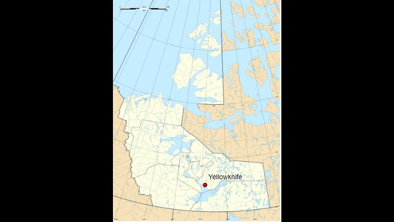
Yellowknife (/ˈjɛloʊnaɪf/; Dogrib: Sǫǫ̀mbak’è)[11] is the capital, largest community, and only city in the Northwest Territories, Canada. It is on the northern shore of Great Slave Lake, about 400 km (250 mi) south of the Arctic Circle, on the west side of Yellowknife Bay near the outlet of the Yellowknife River.
Yellowknife and its surrounding water bodies were named after a local Dene tribe, who were known as the "Copper Indians" or "Yellowknife Indians", today incorporated as the Yellowknives Dene First Nation. They traded tools made from copper deposits near the Arctic Coast. Its population, which is ethnically mixed, was 20,340 per the 2021 Canadian Census.[4][5] Of the eleven official languages of the Northwest Territories, five are spoken in significant numbers in Yellowknife: Dene Suline, Dogrib, South and North Slavey, English, and French. In the Dogrib language, the city is known as Sǫǫ̀mbak’è (Athabaskan pronunciation: [sõːᵐbakʼe], "where the money is").[12][13] Modern Yellowknives members can be found in the adjoining, primarily Indigenous communities of Ndilǫ and Dettah.
The Yellowknife settlement is considered to have been founded in 1934,[2] after gold was found in the area, although commercial activity in the present-day waterfront area did not begin until 1936. Yellowknife quickly became the centre of economic activity in the NWT, and was named the capital of the Northwest Territories in 1967. As gold production began to wane, Yellowknife shifted from being a mining town to a centre of government services in the 1980s. However, with the discovery of diamonds north of the city in 1991,[14] this shift began to reverse. In recent years, tourism, transportation, and communications have also emerged as significant Yellowknife industries.[15]
History
Further information: Timeline of Yellowknife history
Traditionally, First Nations people of the Yellowknives Dene culture occupied this region. By the 1930s, they had a settlement on a point of land on the east side of Yellowknife Bay, Dettah.[16] The current municipal area of Yellowknife was occupied by prospectors who ventured into the region in the mid-1930s.[17]
A Klondike-bound prospector, E.A. Blakeney, made the first discovery of gold in the Yellowknife Bay area in 1898. The discovery was viewed as unimportant in those days because of the Klondike Gold Rush and because Great Slave Lake was too far away to attract attention.[18]
In the late 1920s, aircraft were first used to explore Canada's Arctic regions. Samples of uranium and silver were uncovered at Great Bear Lake in the early 1930s, and prospectors began fanning out to find additional metals.[19] In 1933 two prospectors, Herb Dixon and Johnny Baker, canoed down the Yellowknife River from Great Bear Lake to survey for possible mineral deposits. They found gold samples at Quyta Lake, about 30 km (19 mi) up the Yellowknife River, and some additional samples at Homer Lake.[20]
Yellowknife from Back Bay. In the 1930s, the area was home to a number of prospectors.
The following year, Johnny Baker returned as part of a larger crew to develop the previous gold finds and search for more. Gold was found on the east side of Yellowknife Bay in 1934 and the short-lived Burwash Mine was developed. When government geologists uncovered gold in more favourable geology on the west side of Yellowknife Bay in the fall of 1935, a small staking rush occurred.[21] From 1935 to 1937, one prospector and trapper named Winslow C. Ranney staked in the area between David Lake and Rater Lake with few commercial results. The nearby hill known as Ranney Hill is his namesake and a popular hiking destination today. Con Mine was the most impressive gold deposit and its development created the excitement that led to the first settlement of Yellowknife in 1936–1937. Some of the first businesses were Corona Inn, Weaver & Devore Trading, Yellowknife Supplies and post office, and The Wildcat Cafe. Con Mine entered production on 5 September 1938. Yellowknife boomed in the summer of 1938 and many new businesses were established, including the Canadian Bank of Commerce, Hudson's Bay Company, Vic Ingraham's first hotel, Sutherland's Drug Store, and a pool hall.
The population of Yellowknife quickly grew to 1,000 by 1940, and by 1942, five gold mines were in production in the Yellowknife region. However, by 1944, gold production had ground to a halt as men were needed for the war effort. An exploration program at the Giant Mine property on the north end of town had suggested a sizable gold deposit in 1944. This new find resulted in a massive post-war staking rush to Yellowknife.[22] It also resulted in new discoveries at the Con Mine, greatly extending the life of the mine. The Yellowknife townsite expanded from the Old Town waterfront, and the new townsite was established during 1945–1946. The Discovery Mine, with its own townsite, operated 81 km (50 mi) to the north-northeast of Yellowknife from 1950 to 1969.[23]
Mid 20th-century Yellowknife; the community was incorporated as a municipality in 1953.
Between 1939 and 1953, Yellowknife was controlled by the Northern Affairs department (now Indigenous and Northern Affairs Canada) of the Government of Canada. A small council, partially elected and partially appointed, made decisions. By 1953, Yellowknife had grown so much that it was made a municipality, with its own council and town hall. The first mayor of Yellowknife was Jock McNiven. In September 1967, Yellowknife officially became the capital of the Northwest Territories. This important new status sparked what has been coined as the third boom in Yellowknife. New sub-divisions were established to house an influx of government workers.[24]
In 1978 the Soviet nuclear-powered satellite Kosmos 954 crashed to Earth near Yellowknife. There were no known casualties, although a small quantity of radioactive nuclear fuel was released into the environment, and Operation Morning Light—an attempt to retrieve it—was only partially successful.[25]
A new mining rush and fourth building boom for Yellowknife began with the discovery of diamonds 300 km (190 mi) north of the city in 1991.[26] The Giant Mine was the subject of a bombing during a labour dispute in 1992 that resulted in one of the deadliest mass murders in Canada with 9 deaths.[27][28] The last of the gold mines in Yellowknife closed in 2004. Today, Yellowknife is primarily a government town and a service centre for the diamond mines. On 1 April 1999, its purview as capital of the NWT was reduced when the territory of Nunavut was split from the NWT. As a result, jurisdiction for that region of Canada was transferred to the new capital city of Iqaluit. Consequently, Yellowknife lost its standing as the Canadian capital city with the smallest population.[29]
Geography
Yellowknife was scoured down to rock during the last glacial period, making the landscape very rocky, and slightly rolling, with many small lakes.
Yellowknife is on the Canadian Shield, which was scoured down to rock during the last ice age.[30] The surrounding landscape is very rocky and slightly rolling, with many small lakes in addition to the larger Great Slave Lake.[31] Trees such as spruce and birch are abundant in the area, as are smaller bushes, but there are also many areas of relatively bare rock with lichen.[32] Yellowknife's high latitude causes a large variation between day and night. Daylight hours range from five hours of daylight in December to 20 hours in June. Civil Twilight lasts all night from late May to mid-July.[33]
Climate
Yellowknife has a subarctic climate (Köppen: Dfc). Although winter is predominantly polar, rapid heat waves emerge at the summit of summer due to the immense path south.[34] The city averages less than 300 mm (12 in) of precipitation annually, as it lies in the rain shadow of mountain ranges to the west.[35] Due to its location on Great Slave Lake, Yellowknife has a frost-free growing season that averages slightly over 100 days.[30] In an occasional year, the first fall frost does not come until October.[36] Most of the limited precipitation falls between June and October, with April being the driest month of the year and August having the most rainfall. Snow that falls in winter accumulates on the ground until the spring thaw.
Heavy ice fog can develop on the coldest winter mornings
Yellowknife experiences very cold winters and mild to warm summers. The average temperature in January is around −26 °C (−15 °F) and 17 °C (63 °F) in July.[35] According to Environment and Climate Change Canada, Yellowknife has the sunniest summer in the country, averaging 1,034 hours from June to August.[37] The lowest temperature ever recorded in Yellowknife was −51.2 °C (−60.2 °F) on 31 January 1947, and the highest was 32.6 °C (90.7 °F) on 2 August 2021.[35] Yellowknife averages 2256.5 hours of bright sunshine per year or 43.5% of possible daylight hours, ranging from a low of 15.4% in December to a high of 63.0% in June.[35] Due to its warm summer temperatures, Yellowknife is well below the Arctic tree line in stark contrast to areas farther east in Canada on similar parallels.
In 2014, Environment Canada ranked Yellowknife as having the coldest winter and longest snow cover season of any city in Canada, while also experiencing the sunniest spring and summer of any city in Canada.[38]
-
 3:54:07
SynthTrax & DJ Cheezus Livestreams
1 day agoFriday Night Synthwave 80s 90s Electronica and more DJ MIX Livestream AI ART SHOWCASE Edition
32.9K5 -
 2:21:34
TheSaltyCracker
6 hours agoThreatening Trump is Bad Idea ReeEEEStream 05-16-25
128K160 -

Saycred Angel Live
4 hours ago🍻FRIDAY FAMILY FIGHT NIGHT🍻!TANGIA | !GIVEAWA
17.5K3 -
 DVR
DVR
Alex Zedra
4 hours agoLIVE! Come hang
38.2K4 -
![[LIVE] Halo: The Master Chief Collection | Practice Before Brrrap Pack Tourney TOMORROW!](https://1a-1791.com/video/fww1/b5/s8/1/h/M/3/K/hM3Ky.0kob-small-LIVE-Halo-The-Master-Chief-.jpg) LIVE
LIVE
Joke65
4 hours ago[LIVE] Halo: The Master Chief Collection | Practice Before Brrrap Pack Tourney TOMORROW!
28 watching -
 LIVE
LIVE
BigTallRedneck
2 hours agoRARE OUT OF CHARACTER STREAM
26 watching -
 5:04:46
Kim Iversen
9 hours agoTrump’s Middle East Tour Leaves Israel Out in the Cold
267K76 -
 7:42:06
Spartan (Pro Halo esports Player)
10 hours agoSWTOR for a bit, then pro scrims @ 7 EST
25.9K1 -
 52:42
52:42
Sarah Westall
6 hours agoMore Hidden Financial News & Central Banker’s Dictatorship Disguised as Liberalism w/ Andy Schectman
38.7K3 -
 6:20:44
FanatikGaming
8 hours ago $0.80 earned🎉💪FANATIK FRIDAY ALL THE WAY🔥💯--- #1 Arena Goat - 🔥RL & Apex Ranked🔥 - 🦾BTTB!🦾
13K1