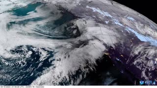
Large bomb cyclone impacts western US coastline, satellite imagery shows
A bomb cyclone impacted much of the west coast of the United States on March 28, according to satellite imagery from the Cooperative Institute for Research in the Atmosphere (CIRA). A bomb cyclone impacted much of the west coast of the United States on March 28, according to satellite imagery from the Cooperative Institute for Research in the Atmosphere (CIRA). By Tuesday, upper Northern California had begun feeling the first effects of the storm, with more than 14,000 people in Del Norte, Siskiyou and Shasta counties losing power for several hours, according to the Los Angeles Times. An animation from CIRA shows the storm swirling off the west coast of the United States between 4 pm on March 28, and 1 am on March 29.
Credit: CIRA/NOAA via Storyful
-
 1:05
1:05
JTN2020
1 year agoSatellite imagery shows another high impact storm approaching California
101 -
 1:03
1:03
JTN2020
1 year agoSatellite images show powerful storm hitting California
74 -
 1:33
1:33
INANUTSHELL
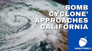
1 year agoNATIONAL WEATHER SERVICE WARNS CALIFORNIA AS ‘BOMB CYCLONE’ APPROACHES
42 -
 1:28
1:28
Top Usa NEWS FEEDER
1 year agoA “bomb cyclone” and further flooding in California
46 -
 1:29
1:29
INANUTSHELL
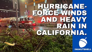
1 year agoA POWERFUL BOMB CYCLONE SLAMS INTO CALIFORNIA WITH HURRICANE-FORCE WINDS AND HEAVY RAIN
6 -
 5:51
5:51
MaryGreeley
6 months agoCalifornia Rough Waves Caused By Pacific Storm Send 8 People To Hospitals
1021 -
 1:42
1:42
Last World News Channel
1 year agoNorthern California slammed by bomb cyclone
6 -
 2:46
2:46
InfoWars/Newswars
1 year agoNearly Two Dozen Dead as ‘Bomb Cyclone’ Hits US
36 -
 2:19
2:19
BreakingNewsArea66
1 year agoAnother atmospheric river hits California with heavy rain and the chance of major flooding.
3 -
 1:48
1:48
The Great Awakening
1 year agoBomb Cyclone hitting my Beautiful California biggest storm in 10 Years
562