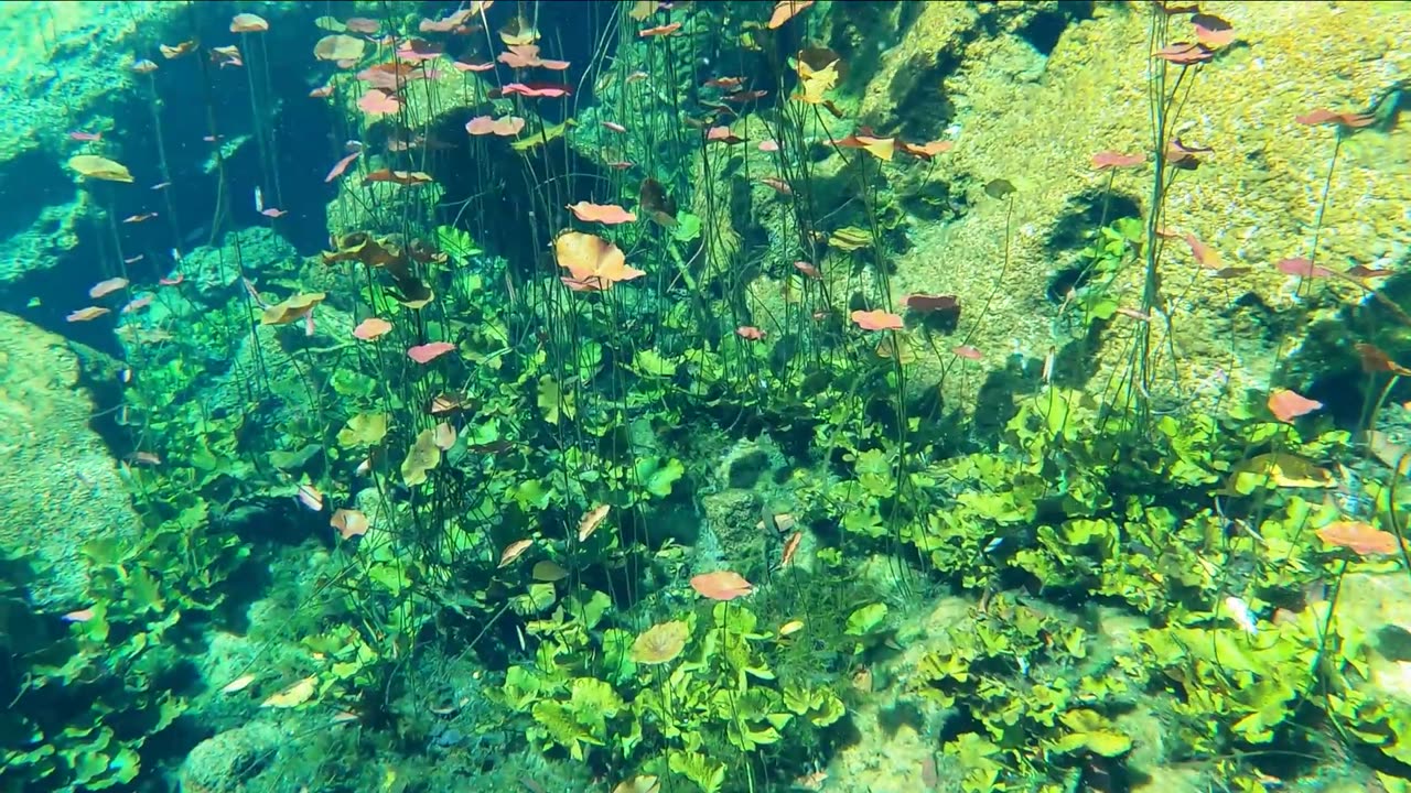
Snorkelling a Cenote in Reviera Maya, Mexico
The Riviera Maya is a tourism and resort district south of Cancun, Mexico. It straddles the coastal Federal Highway 307, along the Caribbean coastline of the state of Quintana Roo, located in the eastern portion of the Yucatán Peninsula. Historically, this district started at the city of Playa del Carmen and ended at the village of Tulum, although the towns of Puerto Morelos, situated to the north of Playa del Carmen, as well as the town of Felipe Carrillo Puerto, situated 40 km to the south of Tulum, are both currently being promoted as part of the Riviera Maya tourist corridor.
The Riviera Maya was originally called the "Cancun–Tulum corridor", but in 1999 it was renamed as the Riviera Maya with the aid of Miguel Ramón Martín Azueta. At the time, he was the municipal president of Solidaridad, Quintana Roo. The Riviera Maya includes the municipalities of Solidaridad in the north and Tulum in the south, and extends approximately 40 km inland, to the border with the state of Yucatán.
Cenote water is often very clear, as the water comes from rain water filtering slowly through the ground, and therefore contains very little suspended particulate matter. The groundwater flow rate within a cenote may be very slow. In many cases, cenotes are areas where sections of the cave roof have collapsed revealing an underlying cave system, and the water flow rates may be much faster: up to 10 kilometers per day.
-
 LIVE
LIVE
The Bubba Army
21 hours agoCharlie Kirk's Killer On The Run - Bubba the Love Sponge® Show | 9/11/25
17,539 watching -
 16:58
16:58
Actual Justice Warrior
2 days agoBLM's Original HOAXER Killed By Black Crime
62.3K51 -
 LIVE
LIVE
RealAmericasVoice
3 days agoHOME OF REAL NEWS
6,460 watching -
 2:04:21
Badlands Media
17 hours agoDevolution Power Hour Ep. 388: Assassination, Inflection Points, and the Battle Ahead
352K117 -
 2:08:03
Inverted World Live
10 hours agoCharlie Kirk Assassinated | Ep. 106
124K60 -
 3:01:07
TimcastIRL
12 hours agoCharlie Kirk Assassinated, Suspect In Custody | Timcast IRL
671K1.1K -
 5:44:49
Redacted News
14 hours agoTurning the Tide: 9/11 Justice in 2025 — Day 1 with Sen. Ron Johnson, Richard Gage and More
204K90 -
 2:48:00
TheSaltyCracker
12 hours agoYou're Being Hunted ReeEEStream 9-10-25
326K674 -
 13:09:56
LFA TV
1 day agoBREAKING: CHARLIE KIRK ASSASSINATED - WEDNESDAY 9/10/25
405K133 -
 1:31:08
I_Came_With_Fire_Podcast
12 hours agoCheck Fire: God Bless Charlie Kirk
115K32