Off-Line Hill Shade Maps: How To, Part 2
How I make off-line hill shade maps using the MAPC2MAPC application.
This is a great tool for this process and also for converting maps from one format to another. For example, the USGS historical topo maps are available in Geo-TIFF format where the extents are encoded in the image. These could be imported then saved in, for example, the sqlite.db format for OsmAnd.
After months of trying various combinations, it looks like it is possible to make an accurate hill shade map for off-line use. I used the OSMand app. on Android which seems to offer some great map management tools. I was using this hill shade map as an overlay on top of the off-line vector map in the app. This way, I can adjust the transparency of the hill shade map to show details from the vector map, if required. The hill shade map could also be used as the base map or as an underlay to another base map.
I stress on the importance of getting accurate coordinates in this process. This hill shade data is inherently very accurate (~ 1 meter/pixel). All you can do is make it less accurate unless you are diligent in getting accurate latitude/longitude extents to enter when calibrating the image. Having a map that is not properly calibrated is no good when you're trying to find some faint trail out in the bush, BTDT!
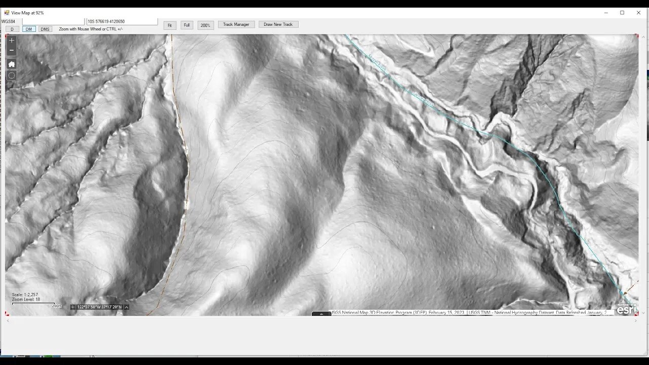
The thumbnail for this video is what you see in the "View" tab of Mapc2Mapc. I am barely scratching the surface of what this application can do in this video. If you've used this application and have some helpful hints, drop a comment below.
OsmAnd (IOS and Android) - Create Offline Raster & Vector Maps:
https://osmand.net/docs/technical/map-creation/create-offline-maps-yourself
Mapc2Mapc (Windows only):
https://www.the-thorns.org.uk/mapping/
USGS National Map Viewer w/ Hill Shade layers:
https://apps.nationalmap.gov/viewer/
If you're looking for hill shade maps of Washington State, use the Washington DNR Lidar Portal instead:
https://lidarportal.dnr.wa.gov/
Awesome resource. If you know any other states that offer similar tools, post up in the comment section below. I've looked for one for California and found nothing of use.
@barteisenberg video on MAPC2MAPC:
https://youtu.be/Y_fekLfcUOc
More to come, moving the map to your mobile device...
Subscribe for more content like this
Comment, rate, share & click the bell icon
And as always, thanks for watching
#USGS #HillShade #osmand
-
 2:07:27
Steven Crowder
6 hours agoWho Belongs: What the Future of the American Right Wing Looks Like
407K274 -
 1:29:28
NAG Podcast
21 hours agoSay Something Beyond W/MikeMac: DARKSIDE - Ep.11
17K2 -
 35:24
35:24
The Rubin Report
5 hours ago'Real Time' Crowd Goes Quiet as Bill Maher & Democrat Have a Tense Exchange About Zohran Mamdani
108K47 -
 1:21:33
Rebel News
3 hours agoTrump says he can play dirty, Canada-US trade talks off, BC to launch anti-tariff ad | Rebel Roundup
27K12 -
 2:26:58
Nikko Ortiz
5 hours agoValid Crashout's... |Rumble Live
21.4K5 -
 LIVE
LIVE
LFA TV
19 hours agoLIVE & BREAKING NEWS! | MONDAY 10/27/25
1,735 watching -
 LIVE
LIVE
StoneMountain64
3 hours agoBattlefield 6 Season 1 TOMORROW. Battle Royale? New Map + New Weapons!
104 watching -
 1:22:23
The Mel K Show
4 hours agoMORNINGS WITH MEL K -Signal to Noise: The International Framework is Balancing Out - 10-27-25
32.6K19 -
 LIVE
LIVE
Viss
5 hours ago🔴LIVE - Battle Royale Release Tomorrow! - Battlefield 6
92 watching -
 1:45:02
The Shannon Joy Show
5 hours ago🔥SJ Show 10/27 * Trump Jr. Wins Massive Drone Contract From Daddy’s Military * Tom Massie Targeted For Destruction By MAGA * Trump’s Perma-Shutdown Opens Door For Mass Corruption in DC🔥
15.3K13