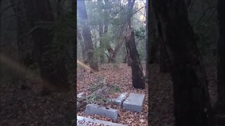
Checking Out the North/West Road Near the GC75BP8 GeoCache
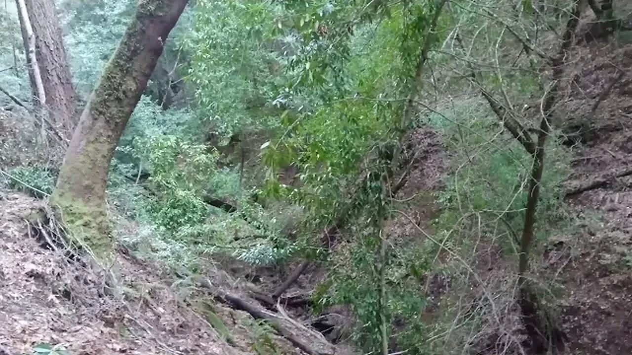
I had seen water running in the creek to the north side of the GC75BP8 GeoCache site. I had been down the side trail that drops down off the unnamed road last spring and thought that might be good for checking on potential waterfalls with the recent heavy rain.
Previous visits:
https://youtu.be/Ocaudd8inGE
https://youtu.be/MgX2TEbGFq8
The rains had softened the soil so footing was better than last spring so I was able to get across the steep side hill where the trail has mostly slid away. Unfortunately, I couldn't quite make it far enough to check out a potential waterfall just upstream. Likewise, while I could hear a likely waterfall farther down, the steep, brushy terrain prevented me from getting close enough to see that one either.
Still having video issues with the lighting conditions in this area. I tried turning off the auto flicker correction setting (no change) and also switched off auto exposure (sometimes helps but not always).
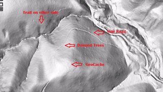
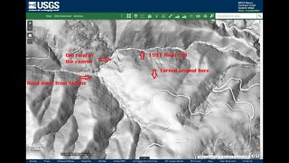
USGS National Map Viewer w/ Hill Shade layers:
https://apps.nationalmap.gov/viewer/
This whole area is part of a single 40 acre parcel of land that the Open Space district purchased around 2001, per the newspaper article. I haven't been able to find out about anything that was located here prior to district clearing the land shortly after acquisition. Here's a demolition project for an adjoining parcel of land, acquired from the same owner in 2013, that was cleared in 2014:
https://www.openspace.org/sites/default/files/CGI-BIN/agendas_minutes/2014.07.23_Lobner_AwardofContract_Demolition_r-14-97.pdf
More to come...
Subscribe for more content like this
Comment, rate, share & click the bell icon
And as always, thanks for watching
#USGS #HillShade
-
 7:33
7:33
4Crawler
3 years agoChecking Out the West Road Near the GC75BP8 GeoCache
45 -
 0:14
0:14
The 4Crawler Channel
2 years agoHalloween At GC75BP8 GeoCache
13 -
 9:26
9:26
4Crawler
2 years agoHalloween-eve at GC75BP8 GeoCache and beyond
22 -
 0:14
0:14
The 4Crawler Channel
2 years agoHalloween At GC75BP8 GeoCache, 2nd view
12 -
 1:01
1:01
KJRH
2 years agoChecking Tuesday afternoon road conditions in Tulsa
-
 2:02
2:02
WXYZ
2 years agoNorth, South, West Party at Blake's
6 -
 0:15
0:15
Broke Moe Howard UHF TV Channel 33
2 years agoChecking out Mount Wood in Wheeling West Virginia!
61 -
 6:08
6:08
4Crawler
3 years agoChecking out the Middle Road on the Grizzly Flat North Trail
12 -
 12:29
12:29
The Pascal Show
1 day ago $0.65 earnedLOCKED IN A DUNGEON?! Parents Arrested After 5 Children Found In 'Dungeon' At Home
9.96K3 -
 LIVE
LIVE
Lofi Girl
2 years agoSynthwave Radio 🌌 - beats to chill/game to
198 watching