MELTING ICE IN ANTARCTICA NOW REVEALS EVIDENCE OF MASSIVE ANCIENT CONTINENTAL ENGINEERING PROJECT(!)
Artificial Ice Bridge~ 70° 0'41.28"S 160°36'47.26"E
Disappearing Platform~ 69°39'51.67"S 160°24'55.99"E
Artificial Depression~ 70°16'37.54"S 162°18'43.61"E
Collapsing Structure~ 70°16'29.98"S 162° 9'4.52"E
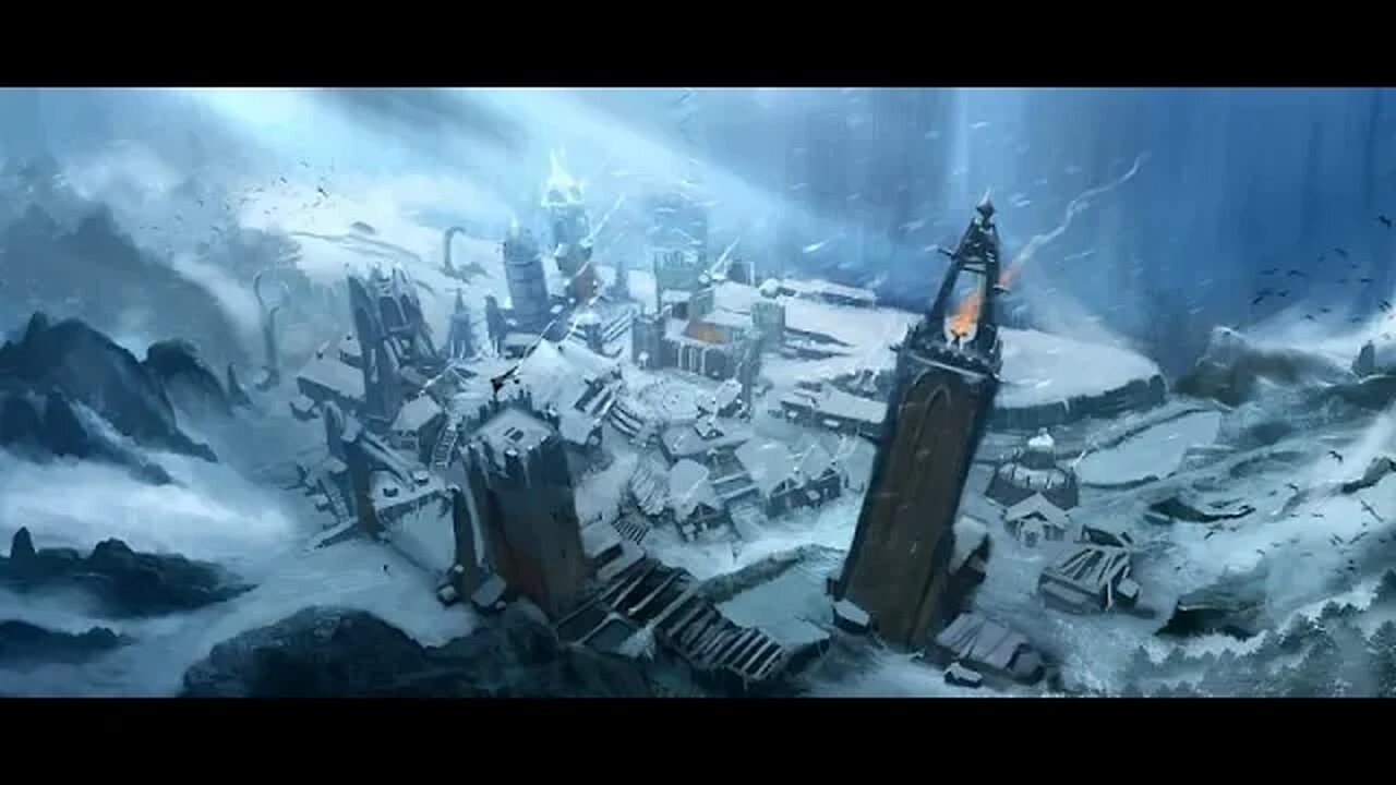
Vertical Glowing Columns~ 70°58'9.32"S 162°15'19.48"E
Exposed Subterannean Tunnel~ 70°43'30.63"S 162°22'3.36"E
Pool of Blood~ 70°37'43.42"S 163° 4'58.84"E
4 sided pyramid~ 70°37'18.15"S 162°24'46.17"E
Teal Glowing Marine Portal~ 70°36'6.68"S 166° 2'23.41"E
Unexplained Collapse Site~ 70°21'57.15"S 163°26'23.71"E
First Cable (1) Begins @~ 71° 7'7.62"S 167° 2'28.67"E
runs on a course near 270 deg true (perfect E-W)
First Cable Ends @~ 71° 6'52.86"S 164°11'47.86"E
PerpendicularCbl (2) WayPts @~ 70°58'44.30"S 164°14'57.07"E
70°46'29.08"S 164°21'40.22"E
70°44'56.88"S 164°21'59.87"E
Exact Start and End locations for this connector cable are extremely hard to pinpoint but the cable runs on a near 0-180 degree line ( perfect N-S ) and intercepts Cable 3 at the following heavily blurred out location:
70°40'4.80"S 164°22'22.15"E
...2012 layer reveals presence of artificial non natural items to confirm the junction.
Cable 3 Continues Westward from above intersection along these waypoints:
Cable Markers~ 70°39'48.93"S 163°46'48.88"E
70°39'47.77"S 163°40'14.16"E
70°39'46.23"S 163°28'29.72"E
Passing directly south of the Pool Of Blood:
70°37'43.42"S 163° 4'58.84"E
and ending at the Pyramid Complex Mentioned in the Video Here:
70°37'41.15"S 162°30'7.23"E
-
 9:33
9:33
The Art of Improvement
20 hours ago $1.50 earnedHow to Bounce Back from Hard Times
9.03K4 -
 4:53
4:53
The Official Steve Harvey
1 day ago $0.77 earnedNo Such Thing as Luck — Just God’s Grace
8.29K3 -
 6:16
6:16
GBGunsRumble
20 hours agoGBGuns @ Alabama Arsenal Czech Weapons CSV-9
7.49K -
 9:06
9:06
MattMorseTV
1 day ago $13.51 earnedTrump wants to END THE FED.
62K99 -
 2:05:18
MG Show
20 hours agoBreaking: Ukrainian Whistleblower Letter to DNI Gabbard Exposes Biden Corruption
23.5K19 -
 LIVE
LIVE
Biscotti-B23
3 hours ago $1.92 earned🔴 LIVE SEASON 12 🔥 TAMAKI AMAJIKI IS INSANE & NEW ENDEAVOR QUIRK SET 💥 MY HERO ULTRA RUMBLE
178 watching -

B2ZGaming
7 hours agoPlay All The Games?! | B2Z Gaming
10.9K -
 2:17:23
Side Scrollers Podcast
21 hours agoIronmouse/Vshojo SCANDAL, Stripe DE-BANKING “Wrong Think”, RIP Theo | Side Scrollers
36.2K1 -
 6:43:02
Outworldlive
8 hours agoGames, Nite Cap 106, more games!
6.6K1 -
 20:44
20:44
GritsGG
1 day agoThis Warzone Item is BROKEN!
26.2K5