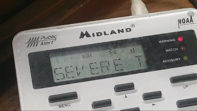
Severe Thunderstorm Warning NOAA Weather Radio Laporte Indiana Sunday June 20 2021
Northern Indiana Severe Weather Midland NOAA weather radio KJY-62 162.500 MHz La Porte June 20 2021
848
WUUS53 KIWX 202258
SVRIWX MIC021-027-202345-
/O.NEW.KIWX.SV.W.0021.210620T2258Z-210620T2345Z/
BULLETIN - EAS ACTIVATION REQUESTED
Severe Thunderstorm Warning
National Weather Service Northern Indiana
658 PM EDT Sun Jun 20 2021
The National Weather Service in Northern Indiana has issued a
* Severe Thunderstorm Warning for...
Northwestern Cass County in southwestern Michigan...
Eastern Berrien County in southwestern Michigan...
* Until 745 PM EDT.
* At 657 PM EDT, a severe thunderstorm was located over Berrien Springs, or 7 miles north of Niles, moving northeast at 40 mph.
This is a very dangerous storm.
HAZARD...Baseball size hail and 60 mph wind gusts.
SOURCE...Radar indicated.
IMPACT...People and animals outdoors will be severely injured. Expect shattered windows, extensive damage to roofs, siding, and vehicles.
* This severe thunderstorm will be near...
Dowagiac around 710 PM EDT.
Watervliet and Paw Paw Lake around 725 PM EDT.
Other locations impacted by this severe thunderstorm include Magician Lake,
Spinks Corners,
Dewey Lake,
Eau Claire,
Sumnerville,
Pokagon,
Indian Lake
and Sandy Beach.
This includes Interstate 94 in Michigan between mile markers 39 and 42.
PRECAUTIONARY/PREPAREDNESS ACTIONS... Prepare immediately for large hail and damaging winds. People outside should move immediately to shelter inside a strong building. Stay away from windows.
&&
LAT...LON 4207 8622 4207 8604 4182 8622 4189 8644 4224 8627 4224 8622
TIME...MOT...LOC 2257Z 203DEG 34KT 4193 8629
HAIL...2.75IN
WIND...60MPH
$$
JBALL
-----------------------------
164
WUUS53 KIWX 202307
SVRIWX
INC039-085-099-141-202330-
/O.NEW.KIWX.SV.W.0022.210620T2307Z-210620T2330Z/
BULLETIN - IMMEDIATE BROADCAST REQUESTED
Severe Thunderstorm Warning
National Weather Service Northern Indiana
707 PM EDT Sun Jun 20 2021
The National Weather Service in Northern Indiana has issued a
* Severe Thunderstorm Warning for...
Elkhart County in north central Indiana...
Southeastern St. Joseph County in north central Indiana...
Northwestern Kosciusko County in north central Indiana...
Northeastern Marshall County in north central Indiana...
* Until 730 PM EDT.
* At 706 PM EDT, severe thunderstorms were located along a line
extending from near Lakeville to near Bremen, moving northeast at
60 mph.
HAZARD...60 mph wind gusts and penny size hail.
SOURCE...Radar indicated.
IMPACT...Expect damage to roofs, siding, and trees.
* Locations impacted include...
Elkhart, Mishawaka, Goshen, Nappanee, Bremen, Syracuse, Dunlap,
Osceola, Wakarusa, Bristol, Milford, Lakeville, New Paris, Locke,
La Paz, Woodland, Jimtown, Southwest, Foraker and Gravelton.
This includes Interstate 80 in Indiana between mile markers 93 and
98.
PRECAUTIONARY/PREPAREDNESS ACTIONS...
For your protection move to an interior room on the lowest floor of a
building.
Torrential rainfall is occurring with these storms, and may lead to
flash flooding. Do not drive your vehicle through flooded roadways.
&&
LAT...LON 4176 8586 4167 8580 4143 8575 4137 8634
4146 8634 4154 8635 4176 8589
TIME...MOT...LOC 2306Z 239DEG 53KT 4152 8620 4150 8618 4145 8621
HAIL...0.75IN
WIND...60MPH
$$
Brown
---------------
523
WUUS53 KIWX 202319
SVRIWX
INC039-087-113-MIC149-210000-
/O.NEW.KIWX.SV.W.0023.210620T2319Z-210621T0000Z/
BULLETIN - IMMEDIATE BROADCAST REQUESTED
Severe Thunderstorm Warning
National Weather Service Northern Indiana
719 PM EDT Sun Jun 20 2021
The National Weather Service in Northern Indiana has issued a
* Severe Thunderstorm Warning for...
Eastern Elkhart County in north central Indiana...
Northern Noble County in northeastern Indiana...
Lagrange County in northeastern Indiana...
Southern St. Joseph County in southwestern Michigan...
* Until 800 PM EDT.
* At 719 PM EDT, severe thunderstorms were located along a line
extending from near Bristol to near Goshen to New Paris, moving
northeast at 40 mph.
HAZARD...60 mph wind gusts and quarter size hail.
SOURCE...Public reported wind damage and golf ball sized hail in
the greater Mishawaka area.
IMPACT...Hail damage to vehicles is expected. Expect wind damage
to roofs, siding, and trees.
* Locations impacted include...
Goshen, Sturgis, Kendallville, Ligonier, Syracuse, Lagrange,
Middlebury, Constantine, Bristol, White Pigeon, Rome City, Colon,
Topeka, Millersburg, New Paris, Benton, Scott, Fawn River,
Mottville and Wolcottville.
This includes Interstate 80 in Indiana between mile markers 98 and
132.
PRECAUTIONARY/PREPAREDNESS ACTIONS...
For your protection move to an interior room on the lowest floor of a
building.
&&
LAT...LON 4176 8529 4176 8520 4142 8519 4142 8565
4144 8565 4143 8583 4176 8587 4176 8579
4182 8576 4196 8529
TIME...MOT...LOC 2319Z 232DEG 36KT 4177 8581 4158 8578 4149 8583
-
 LIVE
LIVE
MYLUNCHBREAK CHANNEL PAGE
22 hours agoThe Gate of All Nations
2,036 watching -
 1:29:32
I_Came_With_Fire_Podcast
12 hours ago"UFOs, Nukes, & Secrecy: Bob Salas on the 1967 Malmstrom Incident, UAPs, & Disclosure"
92.6K19 -
 1:57:05
The Quartering
5 hours agoElon Musk To BUY MSNBC & Give Joe Rogan A Spot, MrBeast Responds Finally To Allegations & Much More
84.4K54 -
 3:01:18
EXPBLESS
6 hours agoFirst Time Playing Extraction Shooters | *LIVE* Arena BreakOut | #RumbleTakeOver
64.8K7 -
 1:26:18
LumpyPotatoX2
6 hours agoArena Breakout: Infinite - #RumbleGaming
46.4K1 -
 2:19:57
GamingWithHemp
6 hours agoCall of Duty BO6 Zombies episode #7
29.6K2 -
 39:47
39:47
Brewzle
1 day agoPennsylvania Wouldn’t Let Me Film…So I Went Bourbon Hunting in NY
82.3K11 -
 10:12
10:12
Space Ice
1 day agoBallistic: Ecks vs Sever - Underrated Masterpiece Or Incoherent Mess?
54.3K12 -
 2:43:07
RG_GerkClan
8 hours agoLIVE: Lets Get to 500 FOLLOWS! - Escape From Tarkov - Gerk Clan
45.7K4 -
 6:42:02
Vigilant News Network
23 hours agoHillary Clinton EXPOSED In Another Massive Hoax | The Daily Dose
85.3K68