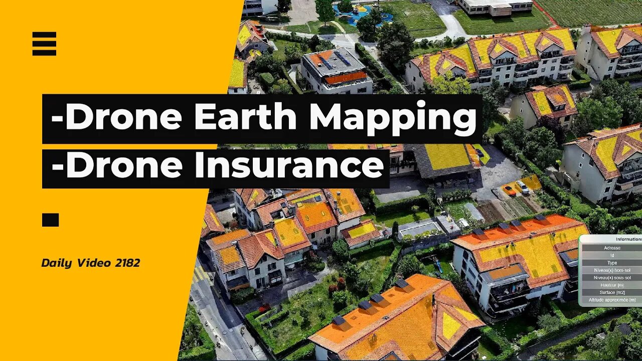
Google Earth Style Mapping With Drones Instead, Public Sector Drone Insurance
2 years ago
3
-Uzufly using aerial photography and videos from drones to create a better Google Earth type of mapping solution
India Assurance launching drone insurance for the public sector covering items such as property damage and injury.
-Squirrels and ducks
-Thermal video of snow and trees
-Drone video of snow and Christmas lights
0:00 Intro
0:17 Drone Mapping
2:35 Drone Insurance
4:20 Wildlife Thermal
5:15 Drone Video
#drone #3dmapping #droneinsurance
Vlog Entry 2182
Loading comments...
-
 2:11
2:11
Alan Yu
2 months ago $0.31 earnedGeese Parade Baby Goslings Guided to Pond
2.24K3 -

Sarah Westall
2 hours agoCan the World Be This Strange? The Nature of Our Reality w/ Darius J Wright
7K -
 LIVE
LIVE
megimu32
2 hours agoOn The Subject: Friends | 31 Years of the Sitcom That Defined a Generation
145 watching -
 30:00
30:00
BEK TV
1 day agoCounter Culture Mom
1.55K -
 1:24:54
Kim Iversen
5 hours agoTylenol vs Vaccines: Which One Is The REAL Cause Of Autism? The Truth Will Upset You
49.9K59 -
 LIVE
LIVE
GloryJean
3 hours ago2v2 Tuesday 🔥 Night Games w/ The Boys 🖱️ 6.7 K/D
16 watching -
 LIVE
LIVE
XxXAztecwarrior
5 hours agoNew Season/ War Ablaze
19 watching -
 LIVE
LIVE
Armadillofather
2 hours agoTime for some Borderlands Chaos! | Thank you for being here!
7 watching -
 1:03:39
TheCrucible
6 hours agoThe Extravaganza! EP: 41 (9/23/25)
275K18 -
 1:04:36
BonginoReport
6 hours agoSpineless Google Admits Caving To Biden Admin - Nightly Scroll w/ Hayley Caronia (Ep.140)
69.1K63