Gino Recchia NBC26 Weather Forecast
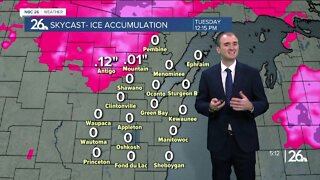
Winter storm watches are in effect for areas north of Highway 29 Wednesday morning through Thursday morning. Tonight, cloudy skies with temperatures in the upper 20s and lower 30s with light east winds at 5-10 mph. Tuesday, cloudy skies, temperatures in the mid to upper 30s with breezy east and southeast winds around 5- 15 mph. Tuesday night, precipitation moves into the area from the west and southwest. We will see some wintry mix move in, some snow, sleet, freezing rain, and rain are all on the table. Some ice accumulation is possible, especially north and northwest of the Fox Valley during the day Wednesday. Later at night into Thursday, we will see temperatures come down with a new area of precipitation ramping up. We should see widespread wintry mix or snow develop with snowfall accumulations in excess over six inches especially north of Highway 29. Several inches of snowfall likely will accumulate in the Fox Valley as well. Some wintry mix continues during the day Thursday with some snow showers or flurries on Friday.
-
 4:01
4:01
WGBA
1 year agoGino Recchia NBC26 Weather Forecast
-
 5:11
5:11
WGBA
4 years agoGino Recchia NBC26 Weather Forecast
25 -
 12:19
12:19
Great Lakes Weather
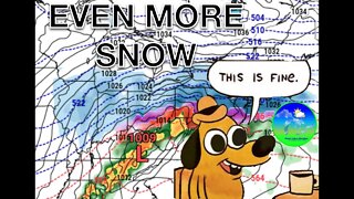
2 years agoMore Active Weather Ahead, Thunderstorms AND Snow in One Week -Great Lakes Weather
4 -
 15:40
15:40
Great Lakes Weather
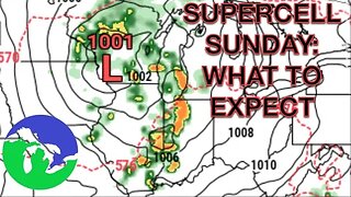
11 months agoSupercell Sunday: Severe Weather Potential for Michigan and Indiana -Great Lakes Weather
14 -
 17:45
17:45
Great Lakes Weather
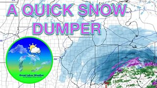
1 year agoWhat You Need To Know About Wednesday's Snowstorm -Great Lakes Weather
-
 9:13
9:13
TiffanysContent
5 months agoChicago Fog, Gulf Coast Flood, ThunderStorms, Freezing Rain, Snow, Atmospheric River
41 -
 8:36
8:36
TiffanysContent
5 months agoDaily Weather Update: Snowstorm, Tornadoes, Thunderstorms, LIGHTNING, Heavy Rainfall, Black Ice, FOG
38 -
 5:18
5:18
NCTV45
1 year agoNCTV45’S LAWRENCE COUNTY 45 WEATHER 2022 THUR FEB 16 2023 PLEASE SHARE
2 -
 6:53
6:53
NCTV45
2 years agoNCTV45’S LAWRENCE COUNTY 45 WEATHER FRIDAY MAY 20 2022 PLEASE SHARE
-
 9:45
9:45
Great Lakes Weather
9 months agoIsolated Severe Storms Possible Tomorrow, Cooler Weather Ahead -Great Lakes Weather
4