Lake Toba Drone View In (4K)
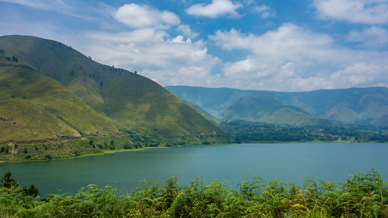
Lake Toba (Indonesian: Danau Toba) (Toba Batak: ᯖᯀᯬ ᯖᯬᯅ; romanized: Tao Toba) is a large natural lake in North Sumatra, Indonesia, occupying the caldera of a supervolcano. The lake is located in the middle of the northern part of the island of Sumatra, with a surface elevation of about 900 metres (2,953 ft), the lake stretches from 2.88°N 98.52°E to 2.35°N 99.1°E. The lake is about 100 kilometres (62 miles) long, 30 kilometres (19 mi) wide, and up to 505 metres (1,657 ft) deep. It is the largest lake in Indonesia and the largest volcanic lake in the world.[1] Toba Caldera is one of twenty Geoparks in Indonesia,[2] and was recognised in July 2020 as one of the UNESCO Global Geoparks.[3][4][5]
Lake Toba is the site of a supervolcanic eruption estimated at VEI 8 that occurred 69,000 to 77,000 years ago,[6][7][8] representing a climate-changing event. Recent advances in dating methods suggest a more accurate identification of 74,000 years ago as the date.[9] It is the largest-known explosive eruption on Earth in the last 25 million years. According to the Toba catastrophe theory, it had global consequences for human populations; it killed most humans living at that time and is believed to have created a population bottleneck in central east Africa and India, which affects the genetic make-up of the human worldwide population to the present.[10] More recent studies have cast doubt on this theory and found no evidence of substantial changes in global population.[11]
It has been accepted that the eruption of the Toba Caldera led to a volcanic winter with a worldwide decrease in temperature between 3 to 5 °C (5.4 to 9.0 °F), and up to 15 °C (27 °F) in higher latitudes. Additional studies in Lake Malawi in East Africa show significant amounts of ash being deposited from the Toba Caldera eruptions, even at that great distance, but little indication of a significant climatic effect in East Africa.[12]
-
 2:21:06
TheSaltyCracker
2 hours agoTrump Crosses Dem Red Line ReeEEEStream 05-21-25
66.2K128 -
 LIVE
LIVE
JdaDelete
3 hours ago $0.15 earnedBanjo-Kazooie | wedNESday | Part 3
257 watching -
 1:40:56
Glenn Greenwald
5 hours agoJD Vance: Does SCOTUS Have the Power to Reject the Majority's Will?; The Lingering Epstein Question: Did he Work with Foreign Intel Agencies?; Key Zelensky Opponent Murdered in Spain; And More | SYSTEM UPDATE #458
163K62 -
 LIVE
LIVE
Barry Cunningham
5 hours agoPRESIDENTIAL BEATDOWN UPDATE! | BIDEN TREASON NEWS | DEMS AND MEDIA IN DOOM SPIRAL!
10,175 watching -
 1:25:53
Sarah Westall
3 hours agoWolf of Wallstreet Targets Conservative Circles - Orchestrated IRA Gold Scams w/ Dale Whitaker
19.6K2 -
 16:33
16:33
From The Desk Of Anthony Pompliano
4 hours ago $4.75 earnedWhat I Got Wrong About The Trump Administration
41.5K7 -
 1:41:07
The Mike Schwartz Show
5 hours agoTHE MIKE SCHWARTZ SHOW with DR. MICHAEL J SCHWARTZ
23.8K3 -
 7:03:57
ZWOGs
8 hours ago🔴LIVE IN 1440p! - Star Wars Jedi: Fallen Order | DAY 3 | Then Fortnite Practice! - Come Hang Out!
5.17K -
 1:02:26
BonginoReport
5 hours agoWas Biden’s Drug Addicted Son His Chief Decision Maker?! - Nightly Scroll w/ Hayley Caronia (Ep.53)
143K110 -
 54:53
54:53
LFA TV
11 hours agoJim Comey Calls for Donald Trump’s Assassination | TRUMPET DAILY 5.21.25 7PM
28.2K5