Premium Only Content
This video is only available to Rumble Premium subscribers. Subscribe to
enjoy exclusive content and ad-free viewing.

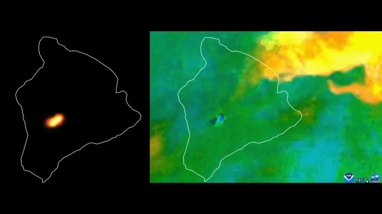
Satellite Imagery Captures Mauna Loa Eruption
1 year ago
969
Satellite Imagery Captures Mauna Loa Eruption
The Mauna Loa volcano in Hawaii began erupting just before midnight on Sunday, November 27, according to the USGS Volcanoes.
NOAA Satellites released this imagery and said it showed the heat signature and sulfur dioxide released when the volcano erupted.
The Hawaii Emergency Management Agency said that though there were reports of lava overflowing from the Mauna Loa caldera, there was no threat to populated areas on Monday and no evacuation orders were in place.
The National Weather Service issued an ash fall advisory for portions of the Big Island of Hawaii on Monday.
Loading comments...
-
 LIVE
LIVE
Matt Kohrs
11 hours agoBitcoin $100k Watch Party, Live Trading & Payday Friday || The MK Show
1,785 watching -
 40:24
40:24
BonginoReport
4 hours agoHow Biden is Quietly Sabotaging Trump’s Migration Mandate (Ep.91) - 11/22/24
63.3K102 -
 LIVE
LIVE
Wendy Bell Radio
5 hours agoMAYORKAS WANTS IMMUNITY
14,672 watching -
 LIVE
LIVE
Vigilant News Network
14 hours agoBill O’Reilly Drops METEOR News Story, Leaves Panel Speechless | The Daily Dose
2,115 watching -

Jeff Ahern
2 hours ago $1.36 earnedFriday Freak Out with Jeff Ahern (6am Pacific)
14.7K1 -
 1:25:27
Game On!
10 hours ago $8.38 earnedJameis Winston and the Browns UPSET the Steelers in a blizzard!
34K2 -
 12:59
12:59
Film Threat
16 hours agoGLADIATOR II EARLY REVIEW | Film Threat Reviews
47.1K7 -
 11:22
11:22
IsaacButterfield
1 day ago $4.28 earnedThe Shocking Truth About Fat Kids! (Ozempic For 6 year olds)
19.3K18 -
 1:02:48
PMG
1 day ago $8.80 earned"Missiles FIRED! Russia Hit By Ukraine!!! IS THIS WWIII?!"
26.4K2 -
 10:34
10:34
justintech
22 hours ago $17.35 earnedBest Gaming PC Under $1000! - In 2024
70.5K8