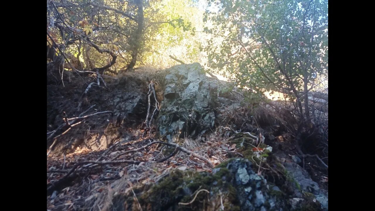
Rock Outcrop Along the Stevens Canyon Trail
An up close look at a bedrock outcrop on the North American side of the San Andreas fault and the Canyon Trail in Montebello Open Space Preserve.
Sorry about the video quality, my camera was having issues with the difficult lighting conditions.
The surface rocks along the stretch of the Canyon Trail where USGS shows the creek flowing are almost all angular. Aside from some minor rounding from decades of hoot, horse and bicycle travel, the rocks are all sharp and angular. This is in contrast to the well rounded rocks found in the bed of Stevens Creek. Also, many of the rocks in Waterwheel Creek proper are coated in Travertine from the minerals dissolved in that water.
Rock outcrop may be a Greenstone or similar type of metamorphosed basalt of the Franciscan Complex:
https://en.wikipedia.org/wiki/Franciscan_Complex
I was hoping to find a sedimentary rock to look at layering, but that type of rock is not as common on this side of the fault.
Geologic Analysis Of The Monte Bello Ridge Mountain Study Area paper:
https://fbdroch.com/book/environmental-geologic-analysis-of-the-monte-bello-ridge-mountain-study-area-santa-clara-county-california
From that paper:
"TECTONIC BLOCKS - Large angular to rounded, commonly elliptically shaped masses of relatively hard rocks surrounded by a clay-rich, sheared matrix. Occurs within shear zones and fault gouge. In the shear zones of the Franciscan rocks, these blocks range from "fist size" to masses more than one mile long."
USGS National Map Viewer w/ Hill Shade:
https://apps.nationalmap.gov/viewer/
About the USGS HTMC:
https://www.usgs.gov/programs/national-geospatial-program/historical-topographic-maps-preserving-past
View/download maps on the TopoView site:
https://ngmdb.usgs.gov/topoview/
Section of single track Canyon Trail built in 1990:
https://www.trailcenter.org/newsletter/2000/winter2000/winter2000-19f.htm
Future plan: I want to try to hike along the top of the ridge between the Canyon Trail and Stevens Creek between the Table Mtn. and Grizzly Flat trails. I'm hoping there might be some exposed sedimentary rock outcrops up there that might show if this block has been tilted in the past.
More to come...
Subscribe for more content like this
Comment, rate, share & click the bell icon
And as always, thanks for watching
#USGS #HillShade
-
 LIVE
LIVE
Price of Reason
7 hours agoCharlie Kirk Investigation Continues | Remembering 9-11 | Robert Downey Jr. Doctor Doom Look Reveal
14,587 watching -

Inverted World Live
3 hours agoManhunt for Suspect in Charlie Kirk's Assassination Continues, NASA Reveals "Life" on Mars | Ep. 107
150K22 -
 2:44:02
TimcastIRL
4 hours agoMedia Warns Of Civil War Following Charlie Kirk Assassination | Timcast IRL
349K273 -
 2:59:56
Laura Loomer
5 hours agoEP143: Remembering Charlie Kirk (1993–2025)
55.3K34 -
 58:04
58:04
Man in America
8 hours agoCharlie Kirk’s Assassination—An URGENT WARNING for America
31.9K42 -
 1:22:15
Glenn Greenwald
6 hours agoCharlie Kirk Assassination Fallout: U.S. Reps Call for Censorship; Do Graphic Videos Serve the Public Interest? Plus: WIRED Reporter on the Dark Side of Surrogacy | SYSTEM UPDATE #513
152K143 -
 1:48:36
Right Side Broadcasting Network
12 hours agoLIVE: President Trump Attends the Yankees Baseball Game - 9/11/25
129K24 -
 1:54:32
Badlands Media
6 hours agoBadlands Media Special Coverage - FBI Press Conference on Charlie Kirk's Assassination
105K17 -
 1:06:19
BonginoReport
7 hours agoManhunt Underway for Charlie Kirk’s Assassin - Nightly Scroll w/ Hayley Caronia (Ep.132)
254K190 -
 1:11:42
Flyover Conservatives
15 hours agoStructural Architect Destroys 9.11 Narrative... What Really Happened? - Richard Gage AIA | FOC Show
54.8K13