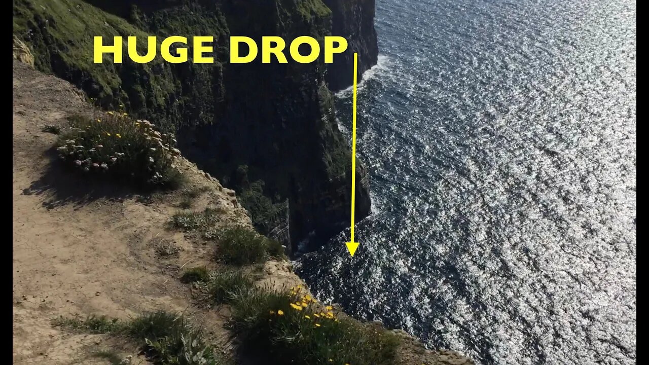
Walking on the Edge of the Cliffs of Moher
The Cliffs of Moher (/ˈmʌhər/; Irish: Aillte an Mhothair) are sea cliffs located at the southwestern edge of the Burren region in County Clare, Ireland. They run for about 14 kilometres (9 miles). At their southern end, they rise 120 metres (390 ft) above the Atlantic Ocean at Hag's Head, and, 8 kilometres (5 miles) to the north, they reach their maximum height of 214 metres (702 ft) just north of O'Brien's Tower, a round stone tower near the midpoint of the cliffs, built in 1835 by Sir Cornelius O'Brien, then continue at lower heights. The closest settlements are the villages of Liscannor 6 km (4 miles) to the south, and Doolin 7 km (4 miles) to the north.
From the cliffs, and from atop the tower, visitors can see the Aran Islands in Galway Bay, the Maumturks and Twelve Pins mountain ranges to the north in County Galway, and Loop Head to the south. The cliffs rank among the most visited tourist sites in Ireland, with around 1.5 million visits per year.
-
 2:13:33
Side Scrollers Podcast
17 hours agoAsmongold SUED for Emotional Distress + Hasan REJECTED+ INSANE Plane Crash + More | Side Scrollers
76.4K22 -
 21:39
21:39
Nikko Ortiz
4 days agoI Take A North Korean Shooting
62K9 -
 23:01
23:01
GritsGG
15 hours agoWarzone Solo Dubular! Last Night Time Solo???
4.38K -
 22:47
22:47
The Pascal Show
12 hours agoTHEY’RE HIDING EVIDENCE?! Candace Owens EXPOSES Foreign Connection In Charlie Kirk Shooting
9.06K9 -
 LIVE
LIVE
Lofi Girl
3 years agolofi hip hop radio 📚 - beats to relax/study to
133 watching -

FreshandFit
12 hours agoLas Vegas Takeover!
186K15 -
 2:19:29
Badlands Media
12 hours agoDevolution Power Hour Ep. 404
70.7K36 -
 6:02:58
Drew Hernandez
1 day agoGOP COOKED INTO DENIAL & 12 ISRAELI-LINKED PHONES DETECTED AT UVU DAY OF CK EXECUTION?
46.1K25 -
 2:46:08
TimcastIRL
8 hours agoFAA To STOP Flights Over Shutdown, May CLOSE Airspace, Thanksgiving Travel APOCALYPSE | Timcast IRL
193K114 -
 1:56:20
Tucker Carlson
8 hours agoIt’s Time to Decide: America First or Lindsey Graham’s Psychosexual Death Cult?
112K406