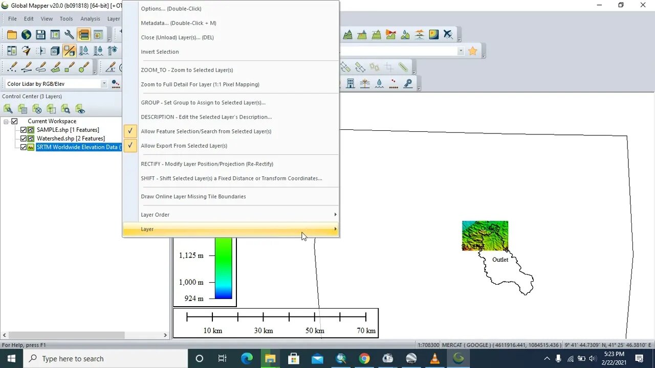
How to Georeference, mask with Dem & Export a watershed from Globalmapper to ArcGis
3 years ago
29
Watershed delineation is a process for creating an area from which runoff is collected and drained through common convergence point for a study area.
Simmerized Watershed Delineation Steps Using ArcGIS
Step 1: Fill DEM sinks
Step 2: Determining flow direction
Step 3: Flow Accumulation
Step 4: Snapping Pour point and
Step 5: Watershed Delineation
Factors Considered for Watershed Delineation
-Biophysical elements (Climate, Water, Drainage, Soil ,Vegetation, Slope, Status of erosion, LULC, Land capability classes etC.)
-Socio-economic elements (People, Farming system, Social set up, Economic activities, Vulnerability profile, Gender etc.)
-Softwares used for this tutorial are Global Mapper, ArcGIS, DEM, Google Earth
Loading comments...
-
 2:00:25
Steven Crowder
5 hours agoNo Influencer Safe: New X Update Exposed A Major Psyop
422K246 -
 17:38
17:38
Professor Nez
2 hours agoTHIS will HAUNT Jasmine Crockett for Years...
14.9K19 -
 56:36
56:36
The Rubin Report
4 hours agoTense Moment at Trump-Mamdani Meeting That No One Predicted
46.7K39 -
 9:34
9:34
The White House
4 hours agoFirst Lady Melania Trump Welcomes the Official 2025 White House Christmas Tree
35.2K15 -
 LIVE
LIVE
LFA TV
17 hours agoLIVE & BREAKING NEWS! | MONDAY 11/24/25
2,107 watching -
 1:01:32
VINCE
6 hours agoNew Info Blows the Lid Off The Butler Assassination Attempt | Episode 175 - 11/24/25 VINCE
267K227 -
 1:46:29
The Mel K Show
3 hours agoMORNINGS WITH MEL K - A Time to Choose: The People Must Reclaim Power 11-24-25
32.2K10 -
 1:23:10
The Shannon Joy Show
3 hours agoMarjorie Taylor Greene DUMPS Trump, Defects To ‘America First’ Setting Up NEW Paradigm For 2028 Presidential Election
21.6K14 -
 53:41
53:41
Grant Stinchfield
20 hours ago $2.92 earnedABC SETUP: Michael McCaul Falls for Martha Raddatz Trap on Live TV!
21.2K2 -
 2:00:33
Nikko Ortiz
4 hours agoWorst Military Events And War Crimes... | Rumble LIVE
25K1