Premium Only Content

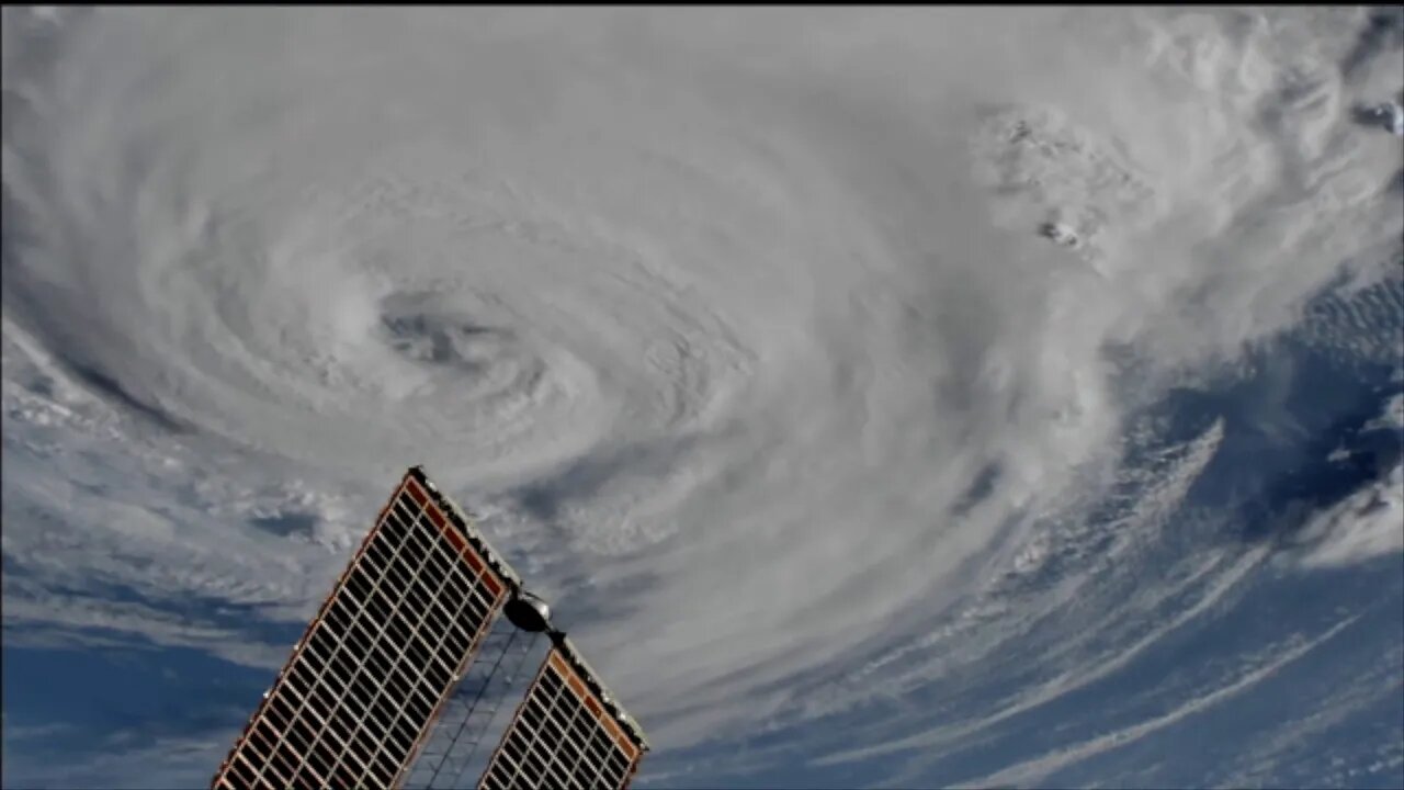
🔴👀🔴 Space Station Cameras View Dorian on Sept. 6
Cameras outside the International Space Station captured views at 8:10 a.m. Eastern time September 6 of a weakening Hurricane Dorian from 260 miles in altitude as it churned just off the outer banks of North Carolina. In its 8 a.m. EDT advisory, the National Hurricane Center said category 1 Hurricane Dorian is moving toward the northeast near 14 mph with maximum sustained winds of 90 miles an hour. The general motion of Dorian, with an increase in forward speed, is expected through Saturday. On the forecast track, the center of Dorian will move near or over the coast of North Carolina during the next several hours. The center should move to the southeast of extreme southeastern New England tonight and Saturday morning, and then across Nova Scotia late Saturday or Saturday night.
Dorian should remain a potent hurricane as it moves near or along the coast of North Carolina during the next several hours. Dorian is forecast to become a post-tropical cyclone with hurricane-force winds by Saturday night as it approaches Nova Scotia. Hurricane-force winds extend outward up to 45 miles from the center of the system and tropical-storm-force winds extend outward up to 220 miles.
TRT: xx:xx
Super: NASA
Center Contact: Rob Navias, 281-483-5111
HQ Contact: Joshua Finch, 202-358-1100
For more info: www.nasa.gov/station
Subscribe and hit the bell, video feeds from over 150 sources!
-
 6:34
6:34
Kurt's News
4 months agoBad Cop Harasses The WRONG Guy and INSTANTLY Regrets It
901 -
 26:35
26:35
Legends of Nerdvana - Boardgame Review
2 years agoSpace Station Phoenix Board Game Review
25 -
 42:38
42:38
Candace Show Podcast
3 hours agoIan Carroll Unleashed! | Private Equity, Big Pharma, and The Diddy Trial | Candace Ep 184
34.2K68 -
 14:55
14:55
The Gun Collective
7 hours agoWHOA! 26 New Guns Just Released!
3.67K2 -
 2:05:00
Darkhorse Podcast
6 hours agoReport from the Foxhole: The 276th Evolutionary Lens with Bret Weinstein and Heather Heying
71.9K24 -
 1:00:31
LFA TV
7 hours agoDID AOC JUST DROP ANOTHER THREAT? | BASED AMERICA 5.13.25 5PM
18.2K8 -
 49:28
49:28
Chrissy Clark
4 hours agoLawmakers Storm ICE Facilities, Hamas Releases Last American Hostage & MORE w/ Jennie Taer
23.9K4 -
 1:14:42
Untamed Nation
3 hours agoTRUMP AVOIDS GETTING POISONED IN SAUDI ARABIA ⚠ THEY ROLLED OUT THE PURPLE CARPET! Joe Oltmann and Matt Wallace | 12 May 2025
28.4K19 -
 1:17:51
Awaken With JP
7 hours agoTrump's Move on Big Pharma + Other Things That Piss Off Liberals - LIES Ep 91
245K47 -
 DVR
DVR
StoneMountain64
4 hours agoModern Warfare 2 Weapons NO ONE is using
29.1K1