Grizzly Flat / Peters Creek GeoCaching Ride
This ride was a week after the Mission Peak ride and it's really interesting comparing the two rides. Really goes to show you can't just compare distance and elevation gain between rides.
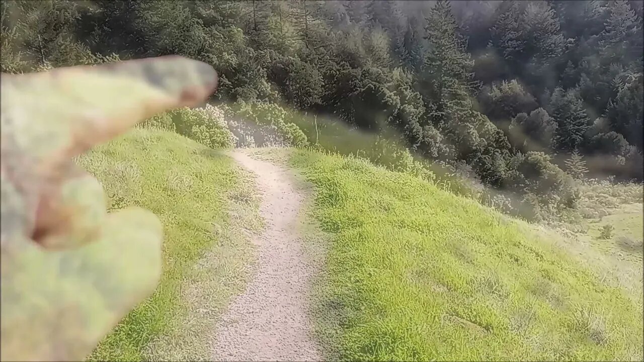
On this ride, the pavement ends at 15 miles and at that point, about 1000 ft. of elevation has been gained, mostly from riding up the canyon. In the first 10 miles, you gain 600ft. and in the last 5 miles, you gain 400ft. Then on dirt, you gain about 1300 ft. in 4 miles, but it's a mix of steep ramps followed by more moderate climbing. While the trails here are narrower and have rocks, sticks and other debris, they are fairly smooth.
On the Mission Peak ride, it's about 17 miles of pavement, almost all dead flat. At the end, you do gain about 500ft. to the start of the dirt/gravel. Then in 2 mi. you gain 1500ft. The dirt/gravel road climb hardly has any breaks and has ramps of 20% or steeper. Portions have deep, soft gravel that makes riding up very hard, if not impossible and the rest is a rough, dried clay surface, remnants of cow hoof prints during the wetter months.
Upper Stevens Creek County Park:
https://www.sccgov.org/sites/parks/parkfinder/Pages/StevensCreek.aspx
Long Ridge Open Space Preserve:
https://www.openspace.org/preserves/long-ridge
Ride Elevation Profile:
https://photos.app.goo.gl/c6gGhCpJ2gKvhENk7
Previous ride up Mission Peak:
https://youtu.be/3zoP5hw-xdU
This profile data is off the Garmin Connect web site where I upload my bike G data for each ride. I've used the data there to look at specific rides I've done in the past. But this is the first time I've used that data to compare two different rides to find out why they're so different. I knew there was a difference from riding both. But seeing the stark difference in the profiles really highlights the difference in the two rides.
GeoCaching web site:
https://www.geocaching.com/
Having the premium membership unlocks the off-line list feature in the app that allows for finding caches without a data connection. You do need to add these caches to your off-line list and then be sure to refresh that list in the app on your device while you have a data connection. I've been bitten by that one a few times, forgetting to download the off-line data before heading out, doh!
More to come...
Subscribe for more content like this
Comment, rate, share & click the bell icon
And as always, thanks for watching
#GeoCaching #GravelBike #MonsterCross #partypace
-
 1:20:39
Game On!
17 hours ago $1.68 earnedCommanders Are Built To WIN NOW! 2025 Preview!
26.4K2 -
 LIVE
LIVE
The Bubba Army
23 hours agoGhislaine Maxwell to Testify! - Bubba the Love Sponge® Show | 7/24/25
1,840 watching -
 16:50
16:50
Chris From The 740
2 hours ago $0.42 earnedI Didn’t Expect to Like This Fan So Much – Ogery F11 Review!
10.8K -
 8:11
8:11
Millionaire Mentor
16 hours agoJohn James SHUTS DOWN AOC With One BRUTAL Sentence
22K19 -
 31:34
31:34
Friday Beers
15 hours ago $3.55 earnedOur Horrifying Night Drunk Ghost Hunting the Manson Murders
52.5K7 -
 4:09
4:09
Blackstone Griddles
14 hours agoEndless Summer Smashburgers on the Blackstone Griddle
23.5K5 -
 7:02
7:02
China Uncensored
16 hours agoWell, I Guess Now We Know...
20.1K22 -
 46:10
46:10
Members Club
19 hours ago $1.35 earnedThe WNBA Has Demands, TSA Loosens Up, and NYC Has a Whale Whisperer - MC04
16.8K6 -
 1:35:15
Man in America
16 hours ago🚨 ALERT: Hospitals in the U.S. Are KILLING Patients… for Their Organs!
92.3K42 -
 8:00
8:00
DropItLikeItsScott
16 hours ago $1.20 earnedIs This The BEST SIG P365? SIG P365 FUSE
13.4K