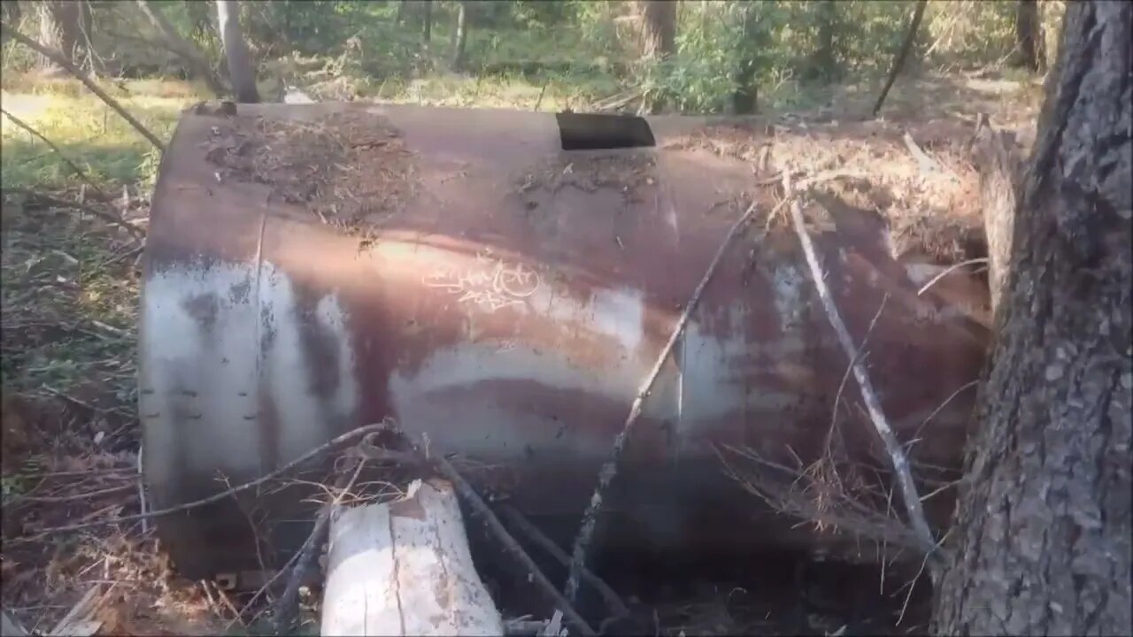
Grizzly Flat Trail, North/South Trail Junction
A short stop on a bike ride up the Grizzly Flat / North Trail in Upper Stevens Creek County Park. This area is at the location of the middle junction of the north and south trails. There's a short spur called the Grizzly Flat Cutoff Trail that joins the 2 trails here.
This is the only large, relatively flat area on this entire ridge. There's a large steel tank here, upon closer inspection, it appears to be around 6000 gallons. My DIY hill shade map is still off a bit, so will be trying to fix that before the next visit.
What do you think this area was used for?
About the USGS hill shade maps:
https://apps.nationalmap.gov/viewer/
More to come...
Subscribe for more content like this
Comment, rate, share & click the bell icon
And as always, thanks for watching
#USGS #HillShade
-
 LIVE
LIVE
Man in America
7 hours agoDr. Makis EXPOSES Big Pharma’s SICK Vaccine Scam—RFK Jr. Must Act NOW!
1,227 watching -
 1:28:21
Glenn Greenwald
5 hours agoRFK Jr. Hearing Reveals DC Pro-Pharma Consensus; Trump's Executive Order to Deport Student Protesters Criticizing Israel; Untangling DC Think Tank Funding & Influence | SYSTEM UPDATE #399
68.2K90 -
 1:23:44
Space Ice
6 hours agoSpace Ice & Redeye: Van Damme's The Quest: Pirates, Clowns, James Bond & Bloodsport
15.1K1 -
 59:57
59:57
The StoneZONE with Roger Stone
3 hours agoJ6 Martyr Enrique Tarrio Describes Inhumane Prison Conditions Ordered by Biden | The StoneZONE
15.1K -
 16:48
16:48
Tundra Tactical
3 hours ago $0.23 earnedAffordable Medical Gear From ACETAC SHOT Show 2025
9.47K1 -
 1:46:16
Redacted News
6 hours agoRFK CONFIRMATION: Kennedy goes to WAR with Big Pharma Democrats in Fiery Hearing | Redacted Live
156K322 -
 57:31
57:31
Candace Show Podcast
6 hours agoBREAKING! Taylor Swift Turns Against Blake Lively & Ryan Reynolds | Candace Ep 141
164K177 -
 1:04:59
Sarah Westall
3 hours agoRFK Jr Report, Constitution Suspended, War Time Procedures in Place, WHO Exit, DOD w/ Sasha Latypova
24.6K19 -
 1:56:37
Melonie Mac
7 hours agoGo Boom Live Ep 35!
35.8K11 -
 1:01:13
LFA TV
10 hours agoPRESIDENT TRUMP SIGNS LAKEN RILEY ACT | BASED AMERICA 1.29.25 6pm
49.5K6