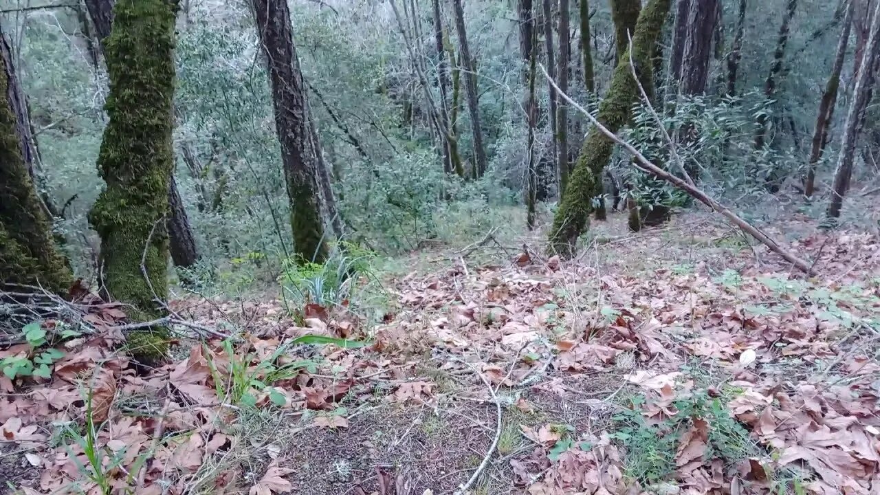
Scouting Access to the Old 1897 Stevens Canyon Road: Beyond Grizzly Flat Trail
The USGS Hill Shade map shows the old Stevens Canyon Road continuing beyond the location of where the 1897 historical topo map showed. Figuring out how to access that area is the topic of the next videos.
I had always seen what looked like an old road on the far side of the canyon when dropping down the stream crossing on the Grizzly Flat Trail. This road continues up past where I got to in this video. Three plans of attack are:
1. Climb over the downed trees that stopped me in the earlier video.
2. Climb down from the lower end of Grizzly Flat trail.
3. Then there's some old roads I've seen dropping down off higher up Grizzly Flat Trail that seem to be heading into the same canyon as this portion of the road is heading up.
It's hard to be certain of any of this as the old and new maps seem to be very inaccurate in this area. They show the Branch D canyon starting about 0.1 miles further upstream from this location. I think the modern maps make use of much of the topographic information on the older maps and thus if the old map was off, then new map is off as well.
In the next video, we'll drop down off the edge of the Grizzly Flat trail and see if there's a way down the side of the canyon as the hill shade map hints there might be.
About the USGS HTMC:
https://www.usgs.gov/programs/national-geospatial-program/historical-topographic-maps-preserving-past
View/download maps on the TopoView site:
https://ngmdb.usgs.gov/topoview/
I used the 1895 Palo Alto quadrangle or the 1900 historical topo as listed in GaiaG:
https://www.gaiagps.com/
More to come...
Subscribe for more content like this
Comment, rate, share & click the bell icon
And as always, thanks for watching
-
 LIVE
LIVE
JuicyJohns
1 hour ago $0.15 earned🟢#1 REBIRTH PLAYER 10.2+ KD🟢
37 watching -
 1:21:19
JULIE GREEN MINISTRIES
3 hours agoLIVE WITH JULIE
63.3K151 -
 LIVE
LIVE
GritsGG
1 hour agoWin Streaking! Most Wins 3485+ 🧠
21 watching -
 1:02:09
The Confessionals
21 hours agoThe Supernatural Proof You Can’t Ignore (When Angels and Demons Showed Up) | Lee Strobel
41.3K24 -
 15:24
15:24
Degenerate Jay
22 hours ago $1.10 earned5 Best Moments In Batman: Arkham Asylum
23.4K1 -
 12:24
12:24
The Shannon Joy Show
15 hours ago🔥From Flock Cameras to Palantir: America’s Expanding Digital Cage🔥
23.4K2 -
 2:03:45
BEK TV
1 day agoTrent Loos in the Morning - 8/27/2025
21.2K -
 LIVE
LIVE
The Bubba Army
23 hours agoTaylor Swift & Travis Kelce ENGAGED! - Bubba the Love Sponge® Show | 8/27/25
1,159 watching -
 40:14
40:14
Uncommon Sense In Current Times
18 hours ago $2.86 earnedThe Dating Crisis in America | J.P. De Gance on the Church’s Role in Restoring Family & Faith
54.1K6 -
 12:35
12:35
Red Pill MMA
20 hours agoNow We Know The Truth.. Hero Who Stopped Raja Jackson Speaks Out
22.6K8