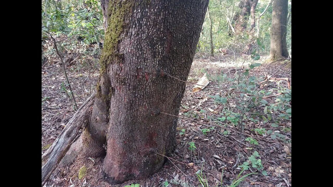
Grizzly Flat North Trail / What was this Middle Road built for?
Another stop on a bike ride to check out an old road I saw near the middle of the Grizzly Flat / North Trail in Upper Stevens Creek County Park. Following up on an earlier video to check out the barbed wire fence and also look for signs of old tree stumps or other signs of logging in the area. This road seems to have been built for decent sized trucks, judging by the large radius curves, but not sure of the purpose.
The first trip down here, I only noticed a few fence posts, but by this 4th trip, I saw fence posts and barbed wire all along the road. The fence seemed to only run along the downhill side of the road and not cut across between curves in the road as if it were following a straight property line.
I don't see any signs of logging in this area, at least for large Redwood trees that were commonly harvested in the western Santa Cruz Mountains. My guess is that with the drier climate on the east side of the mountains, coupled with the rugged topography, logging was not economically feasible. The density of large Redwood trees is fairly low and the cost of building lots of roads in the steep, slide prone canyon would be too high.
What do you think this road/fence was built for?
This road doesn't appear on any maps. It looks like it may been constructed around the same time as the Grizzly Flat road. Grizzly Flat North Road first appears on the 1961 USGS topo map.
There appear to be at least 3 roads that come together at the bottom of the Branch D canyon. 2 of them seem to be quite old based on their minimal construction. Then this road seems more modern in terms of wider radius turns and that it joins up to an existing road. But then the question is, what was this built road for? Were the 2 older roads in the canyon still in use when this road was built? If not, then why did this road go down to the same area that the 2 old roads seem to meet up in? Maybe this road was abandoned when the county acquired this land for the county park in 1965.
In the next video, we'll try to follow the road to the bottom of the canyon.
Oneal Ranch:
https://www.openspace.org/preserves/los-trancos#history
This is ~2 miles north on Montebello Ridge.
E Ranch:
https://www.paloaltoonline.com/news/2014/03/21/cover-story-a-gem-of-open-space
This is on the north side of the Branch D canyon.
About the USGS HTMC:
https://www.usgs.gov/programs/national-geospatial-program/historical-topographic-maps-preserving-past
View/download maps on the TopoView site:
https://ngmdb.usgs.gov/topoview/
I used the 1897 Palo Alto quadrangle or the 1900 historical topo as listed in GaiaG:
https://www.gaiagps.com/
More to come...
Subscribe for more content like this
Comment, rate, share & click the bell icon
And as always, thanks for watching
#USGS #HillShade
-
 LIVE
LIVE
Benny Johnson
31 minutes ago🚨Trump LIVE Right Now at Emergency Press Conference with FBI Director Kash Patel in Oval Office
4,580 watching -
 LIVE
LIVE
vivafrei
1 hour agoLiquid Death-Gate! Text Message-Gate! Ostrich-Gate! AND MORE!
5,167 watching -
 LIVE
LIVE
Right Side Broadcasting Network
6 hours agoLIVE: President Trump Hosts a Press Conference with FBI Director Kash Patel - 10/15/25
10,717 watching -
 1:26:01
The Quartering
2 hours agoYoung Republican Smear, Woke Sidewalks Washed Away, Major Changes To X & More
75.5K31 -
 LIVE
LIVE
Dr Disrespect
5 hours ago🔴LIVE - DR DISRESPECT - BATTLEFIELD 6 - THE PERFECT WEAPON
1,574 watching -
 LIVE
LIVE
Darkhorse Podcast
3 hours agoThe 296th Evolutionary Lens with Bret Weinstein and Heather Heying
284 watching -
 LIVE
LIVE
StoneMountain64
49 minutes agoI can't stop playing BATTLEFIELD 6
32 watching -
 LIVE
LIVE
Jeff Ahern
1 hour agoNever Woke Wednesday with Jeff Ahern
138 watching -
 1:24:59
Sean Unpaved
4 hours agoPrime Pulse: Yamamoto's Gem, Mendoza & Simpson's Title Quest, & NFL QB Rule Shift
23.3K1 -
 2:38:53
The Shannon Joy Show
5 hours agoCharlie Kirk Killing Exploited For Trump’s Everything War - Insurrection Against The Constitution
28.6K13