Water Wheel Creek: Waterfalls and More...
Checking out the top end of the waterfall canyon on Water Wheel Creek. This is located near the bottom of the switchbacks on the Grizzly Flat Trail where it drops down to cross Stevens Creek.
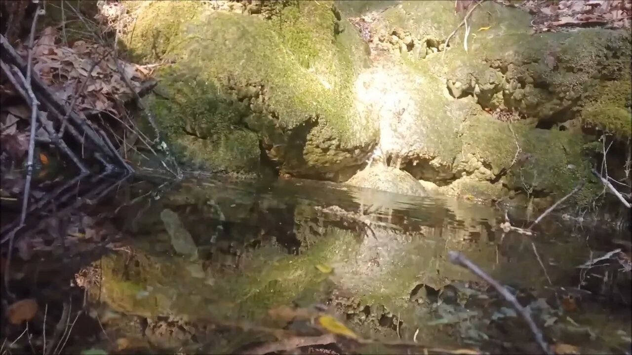
This is the upper most fall in the lower canyon. Water is pouring out down here even though the above ground channel is dry. Lots of flowstone in here with a couple of stalactites. Stay tuned to the end for a cool shot of an infinity pool fed by a waterfall!
This whole area seems to be part of a 1/2 mile long tectonic block that's been tilted by the San Andreas fault. It seems to have slid down the northern slope of the canyon and tilted noticeably as well as being displaced in the direction of the Pacific plate motion.
This would be an excellent area to study for a graduate student in geology. It should be possible to get some dating information from the abundant travertine deposits.
According to the USGS maps, there's no creek here. On the USGS maps, what I'm calling Waterwheel Creek flows down to the east from here, not to the west.
Normally, a Speleothem is in a cave (a.k.a. a Karst), but this Speleothem is flowing over a Karst. There's a large Speleothem along the paved portion of Stevens Canyon Road.
Speleothem:
https://en.wikipedia.org/wiki/Speleothem
Location:
https://www.google.com/maps/@37.2968397,-122.141266,17.17z
Another tidbit, the 1838 earthquake epicenter was located almost at this location:
https://en.wikipedia.org/wiki/1838_San_Andreas_earthquake
Magnitude estimated in the 6.8 - 7.2 range, surrounding areas saw over 5 ft/1.6 m displacement. Found this out with the Wikipedia layer in the OSMand mapping app.
More to come...
Subscribe for more content like this
Comment, rate, share & click the bell icon
And as always, thanks for watching
-
 LIVE
LIVE
The Daily Signal
42 minutes ago🚨 DEVELOPING: The Trump / Musk Feud and What It Means for YOU
1,137 watching -
 LIVE
LIVE
LumpyPotatoX2
1 hour agoRumble Creator Round-Table - June 2025
214 watching -
 53:26
53:26
Donald Trump Jr.
4 hours agoDem Destruction & Judicial Coup, Plus the Agro-Terror Threat Exposed | TRIGGERED Ep.247
67.7K57 -
 1:03:24
The Charlie Kirk Show
2 hours agoTHOUGHTCRIME Ep. 86 — Battle of the Bill(ionaires)
92.6K92 -
 1:04:01
BonginoReport
3 hours agoDiddy’s TDS Comes Back to BITE Him - Nightly Scroll w/ Hayley Caronia (Ep.63) - 06/05/2025
40.6K23 -
 52:08
52:08
Stephen Gardner
1 hour ago🔥Trump & Musk GO TO WAR as Obama gets BAD NEWS! Larry Elder GOES OFF!
16.6K14 -
 LIVE
LIVE
Robert Gouveia
2 hours agoSupreme Court Unloads! Straight Woman WINS! 2A Victory! Spitting Lib in MORE Trouble!
1,313 watching -
 LIVE
LIVE
LFA TV
22 hours agoLFA TV ALL DAY STREAM - THURSDAY 6/5/25
953 watching -
 LIVE
LIVE
Badlands Media
20 hours agoQuite Frankly Ep. 9: "The New Ouija Board & Musk CRASHES OUT" ft Rev. Bill Bean 6/6/25
904 watching -
 1:10:28
Kim Iversen
3 hours agoMusk Drops BOMB: "Trump Is In The Epstein Files"
73.3K152