South Of "Laurel Park": Scouting Hike
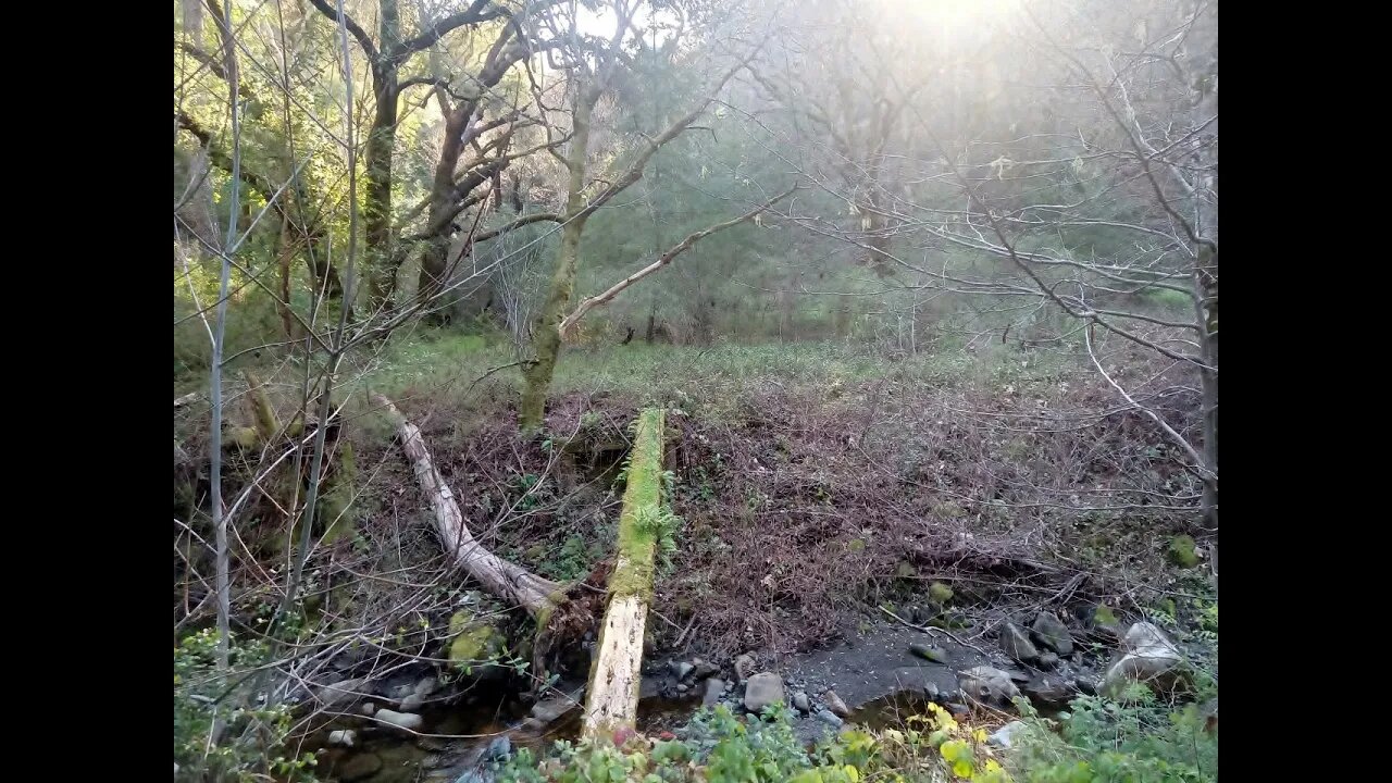
I had a bit of time left after the previous hike to do some exploring on the south side of Stevens Creek to look for a structure shown on the 1961 USGS topo map as well as to see if an old road from the 1895 topo map still remains.
Used the USGS National Map Viewer with the "hill shade" 3D shading overlay to see that traces of the old road are present:
https://apps.nationalmap.gov/viewer/
This tool is seriously cool, it's just like slapping a pair of those X-ray specs they used to advertise in the comic books back in the day.:
https://en.wikipedia.org/wiki/X-ray_specs
If anyone has any information on this area like who owned this 1961 structure or anything about the old road. feel free to post up in the comments:
https://www.google.com/maps/@37.2750562,-122.1051916,18z/data=!5m1!1e4
County bridge information, 37C0604 and 37C0605:
https://bridgereports.com/ca/santa-clara/
This area looks like it's worth a dedicated trip or two to check out the old structure site and also follow the old road up to see where it goes. Not sure when that'll happen but stay tuned and will add a link to that video in the end screen.
Subscribe for more content like this
Comment, rate, share & click the bell icon
And as always, thanks for watching
-
 2:04:04
DeVory Darkins
3 hours agoSchumer gets NIGHTMARE NEWS from Democrats
113K33 -
 2:10:12
Side Scrollers Podcast
4 hours agoMAJOR Hasan Allegations + Arc Raiders Review CONTROVERSY + Craig TRENDS on X + More | Side Scrollers
23.4K6 -
 5:43
5:43
Buddy Brown
4 hours ago $2.05 earnedThere's a List of WEF's "Post Trump" Predictions GOING VIRAL! | Buddy Brown
11.5K12 -
 1:02:24
Timcast
4 hours agoBerkeley Goes BALLISTIC Over TPUSA Event, Massive BRAWL ERUPTS
161K122 -
 LIVE
LIVE
StoneMountain64
2 hours agoBattlefield REDSEC $100k TOURNAMENT
129 watching -
 57:04
57:04
Daniel Davis Deep Dive
7 hours agoRussia's Doomsday Weapon /MIT Prof. Ted Postol
15.2K2 -
 2:12:10
Steven Crowder
6 hours ago🔴Is This Really MAGA: What the Hell Is Donald Trump Doing?
464K517 -
 1:03:36
The Rubin Report
4 hours agoCNN Panel Looks Angry as Republican Points Out How Dems Shutdown Backfired
50.8K51 -
 1:11:36
Sean Unpaved
4 hours agoBen Johnson Has Caleb Williams Playing Best Football Of His Career! | UNPAVED
22.7K1 -
 3:11:24
Right Side Broadcasting Network
7 hours agoLIVE REPLAY: President Trump’s Veterans Day Wreath Laying Ceremony and Address - 11/11/25
78.3K18