THE MYSTERIES SURROUNDING ANCIENT SAILOR MAPS CONTINUE TO THIS DAY
1 year ago
64
THE MYSTERIES SURROUNDING ANCIENT SAILOR MAPS CONTINUE TO THIS DAY
https://www.bitchute.com/video/4ngKif5AyoPI/
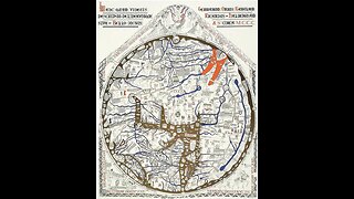
When and how were the first nautical charts constructed ? The earliest existent chart is the Carta Pisana (1275-1280). But researchers suspect a long tradition before that, and we know nothing about its development. Also, how were they updated with new geographical information ? These issues are particularly relevant for the medieval ones, but similar questions could be asked for the more recent, so-called, latitude charts of the Atlantic, which were developed by the Portuguese following the introduction of astronomical navigation. Where did the knowledge come from so to create these old maps remains a significant mystery.
Loading 1 comment...
-
 6:55
6:55
Ancient Mysteries
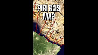
8 months ago $4.54 earnedThe 3 Mysterious Ancient Maps That Shouldn't Exist Could REWRITE History
7925 -
 0:45
0:45
The Ancient Enigma Files
6 months ago🌍 Discovering the Piri Reis Map Mystery: Uncharted Waters of History 🗺️
611 -
 2:40
2:40
RicardoY2
1 year agoMystery Japan Sea
14 -
 10:32
10:32
History
5 months agoDEEP SEA CHRONICLES ARCHAEOLOGICAL DISCOVERIES AND INCREDIBLE SHIPWRECKS
91 -
 2:21
2:21
B.C. Begley
3 months agoNeolithic boats that traversed the Mediterranean 7,000 years ago excavated near Rome
114 -
 3:48
3:48
TVNSyndicated
6 years ago9 Strange Ancient Places Around the world
545K -
 2:30
2:30
MKWPublishing
5 months agoOld World Maps and Islands
221 -
 17:31
17:31
History
6 months agoUnearthing The Mysteries Ancient Maps, Nephilim, and Interstellar Mysteries
260 -
 0:59
0:59
Third Eye Opener
10 months agoAncient Maps and the Mysterious Longitude | Graham Hancock on Joe Rogan Experience #1284
11 -
 0:53
0:53
Raps2020
6 months agoAncient Mysterious Relics From The Sea
6