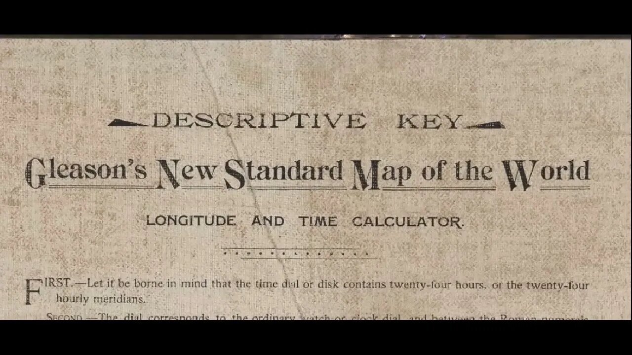
Descriptive Key 🗝️ Gleason´s New Standard Map of the World 🇺🇳
Extraordinarily rare 1892 flat Earth map by Alexander Gleason
https://bostonraremaps.com/inventory/alexander-gleason-flat-earth-1892.
Music: Dystopia – Luke Hall
At first look Gleason’s map is visually striking but otherwise innocuous: a north-polar azimuthal equidistant projection, enlivened by a bright-red horizon ring, with two rotating “indicator arms” to be used for determining the times at different locations. It all looks perfectly reasonable—the projection has a long and distinguished history, and the arms seem useful enough. Things get weird, though, with the “Descriptive Key” on the back of the map, which ends with the sentence “The demonstration has reference to either consideration [sic]: the earth a globe or a plane—take your choice.”
To make sense of all this one must refer to Gleason’s Is the Bible from Heaven? Is the Earth a Globe? (Buffalo: Buffalo Electrotype and Engraving Co., 1890, with an enlarged 2nd ed. in 1893). There he marshals Scripture, quirky interpretations of physical science, shoddy observation, and dollops of “common sense” to argue that the Earth is flat, stationary, and the center of the cosmos. Late in the work he announces and describes his new map:
“We have prepared A NEW MAP OF THE WORLD AS IT IS. The map is finely executed and printed in six colors. It contains all the continents and principal islands and rivers of the world, also, all the principal cities of the earth. The circle of the map is fourteen and one-fourth inches, having a time dial on which is marked in bold Roman numerals the twenty-four hours of the day and the minutes of the hour. The face of the map is provided with two detatched[sic] radiating arms from the center to the Circumference of the time dial, the arms are held together by friction, having a pivot socket at the center of the map. On the arms are stamped the degrees of latitude; by the operation or moving of these arms the relative time of day or night is quickly determined and read on the dial by the child or person who can read the multiplication table, or tell the time of day by the hands of a clock.” (p. 350)
Gleason received U.S. patent 497,917 for his map on May 23, 1893. Like the description above, the application makes no mention of his flat-earth views, and indeed at one point seems to contradict them:
“The extorsion of the map from that of a globe consists, mainly in the straightening out of the meridian lines allowing each to retain their original value from Greenwich, the equator to the two poles.”
I read this as Gleason unwittingly fessing up that his map is, like any other, a projection of a globe or section thereof onto a flat surface. In any event, he presumably chose not to mention his flat Earth views in the application, in order to avoid the risk of rejection by the Patent Office.
#Gleason #AzimuthalEquidistant #Map #ofthe #World #FE #Earth
-
 1:35:45
Tucker Carlson
6 hours agoTucker Puts Piers Morgan’s Views on Free Speech to the Ultimate Test
49.6K236 -
 2:06:16
TheSaltyCracker
7 hours agoMedia Justifies Attack on National Guard ReeEEStream 11-26-25
108K264 -
 3:54:35
Mally_Mouse
10 hours ago🎮 Let's Play!!: Stardew Valley pt. 34
48.6K2 -
 18:25
18:25
MetatronHistory
2 days agoThe REAL Origins of the Macedonians
48.3K4 -
 1:22:12
MattMorseTV
7 hours ago $163.12 earned🔴It’s MUCH WORSE than WE THOUGHT. 🔴
143K213 -
 7:22:09
Meisters of Madness
10 hours agoOmega Gaiden - Part 4
42.1K1 -
 2:51:18
Barry Cunningham
10 hours agoBREAKING NEWS: NATIONAL GUARD ATTACK PRESS CONFERENCE AND LIVE UPDATES!
88K52 -
 5:56:12
SilverFox
6 hours ago🔴LIVE - ARC AT NIGHT! COME THRU!
41.1K2 -
 2:46:09
Joker Effect
6 hours agoCLAVICULAR - What the hell is "Looks Maxing"? Asmond Gold is a Demon. KaceyTron. Steve Will do it.
44K4 -
 3:31:22
SlingerGames
5 hours agoLIVE - Wumble Wednesday - BIRTHDAY STREAM!
19.7K3