Fire map invalidation and satellite imaging of the "flood" north of Kyiv
3 years ago
4
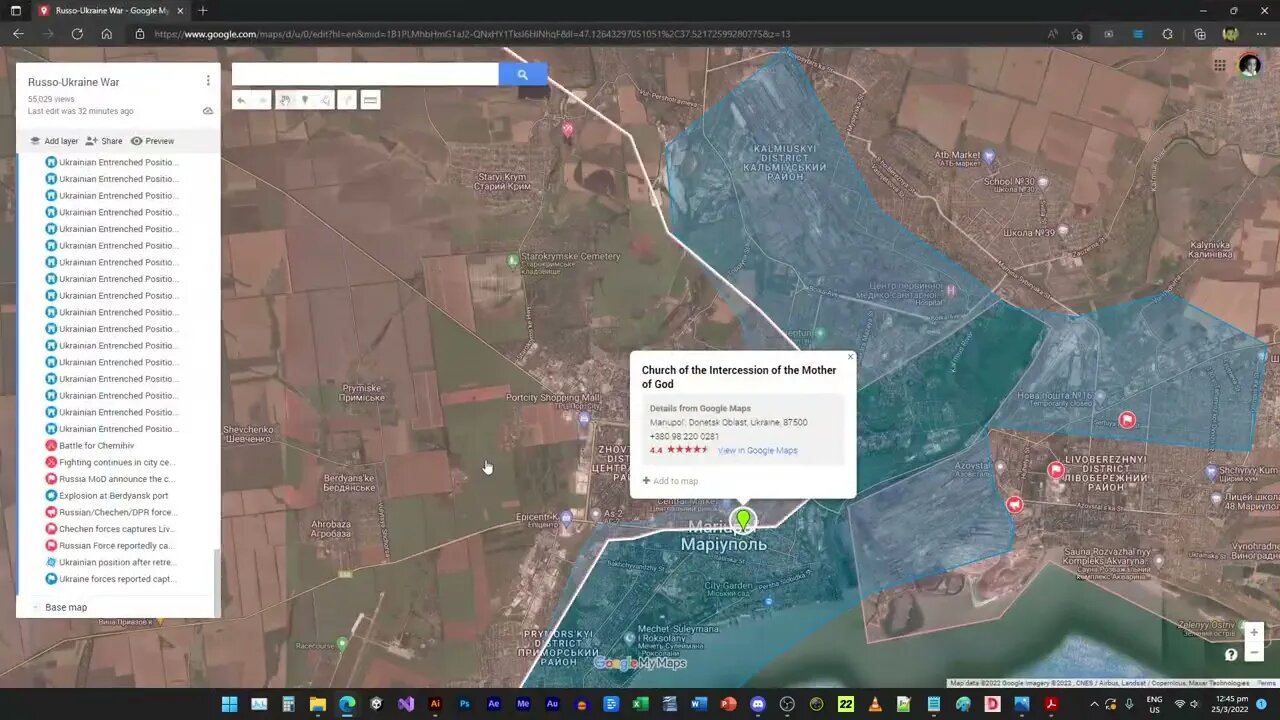
This is how I invalidated my own use of the fire map - as well as satellite imaging of how extensive is the alleged flood that was supposed to impeded the Russians.
You can find more information and the interactive map used in the video on http://defensepoliticsasia.com/Ukraine
Twitter: https://twitter.com/defensepolitics
Facebook: http://facebook.com/defensepolitics
Instagram: https://www.instagram.com/defensepoliticsasia/
Telegram: https://t.me/defensepoliticsasia
Discord: https://discord.gg/HG3Qmwjdbt
Be a DPA Insider!!!
Patreon: https://patreon.com/defensepoliticsasia/
Loading comments...
-
![[ Ukraine SITREP ] Now that Ukraine entered the fog.... Russia advances on other fronts...](https://1a-1791.com/video/fww1/bf/s8/1/s/a/o/a/saoaz.0kob-small--Ukraine-SITREP-Now-that-Uk.jpg) 30:00
30:00
Defense Politics Asia
4 days ago[ Ukraine SITREP ] Now that Ukraine entered the fog.... Russia advances on other fronts...
4211 -
 15:27
15:27
robbijan
1 day ago $2.40 earnedThe Emperor’s New Labubu & The Spiritual War Behind Everything
42.9K43 -
 LIVE
LIVE
GritsGG
18 hours ago36 Hour Stream! Most Wins 3420+ 🧠
755 watching -
 2:05:47
TimcastIRL
6 hours agoTrump FBI Raids John Bolton Amid Classified Docs Investigation | Timcast IRL
174K72 -
 2:15:23
TheSaltyCracker
6 hours agoFinally Someone Gets Raided ReEEeStream 8-22-25
81K213 -
 2:59:21
I_Came_With_Fire_Podcast
18 hours agoChina's New Ship Killers, EU Dead, Shooter HOAX, and The Missing Woman
16.1K2 -
 3:46:26
SynthTrax & DJ Cheezus Livestreams
15 hours agoFriday Night Synthwave 80s 90s Electronica and more DJ MIX Livestream OUTSIDERZ Edition
23.7K -
 3:39:16
VapinGamers
5 hours ago $0.07 earnedFortnite Friday with BrianZGame and Community! #1 Controller Scrub NA - !rumbot !music
9.83K -
 5:00:14
iCheapshot
6 hours ago $0.02 earnedTrying Out The Finals | Complete Newb
6.77K3 -
 1:59:06
HogansAlleyHero
8 hours ago💥2XP WEEKEND - BF6 REWARDS UNLOCK GRIND 💥
4.03K