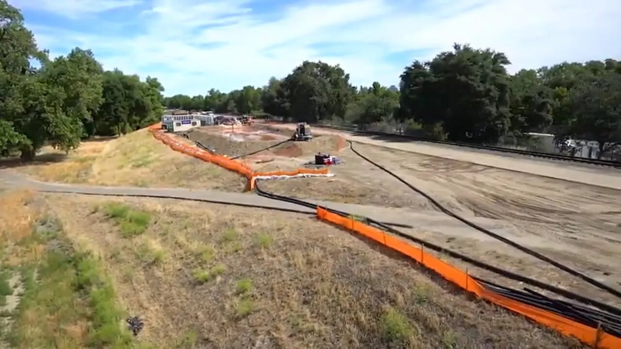
Sacramento & American Rivers Common Features Project
If you have been wondering why the bike trail along the Sacramento River is closed this video should explain it to you. Greater Sacramento, California, is often considered to be the most at-risk region in America for catastrophic flooding, relying on an aging system of levees, weirs and bypasses and Folsom Dam to reduce its flood risk. But that system, just like a chain, is only as strong as its weakest link. Together, the U.S. Army Corps of Engineers, California’s Central Valley Flood Protection Board, California Department of Water Resources, and the Sacramento Area Flood Control Agency have made tremendous progress in reducing the flood risk, but more work remains. Through the Bipartisan Budget Act, the Corps has received full upfront funding to modernize Sacramento's aging flood infrastructure. This allows us to more efficiently implement nearly $1.8 billion in upgrades to Sacramento's flood risk management system. The authorized work includes up to: 13 miles of seepage cutoff walls, 21 miles of bank protection, 5 miles of levee stabilization, 5 miles of levee raises and widening the Sacramento Weir and bypass.
YouTube said they are going to put ads on all channels, if a channel is not ads friendly why would they put ads on a channel but not monetize it? They may have to start monetizing all channels!!!
Subscribe now for more videos from over 280 sources plus my own videos!
Subscribe to my entertainment channel too or at least peek at my other channel !!! https://www.youtube.com/channel/UCiNFsoytAuun90UzU5AuxXg
https://www.patreon.com/user?u=26453564
https://twitter.com/KurtElliott8
https://parler.com/profile/Filegod/posts
https://www.bitchute.com/channel/YsJ0PYUWx5An/
-
 0:23
0:23
Kurt's News
24 days agoWarp-Speed Window Wash 2025-06-03
41 -
 10:55:10
LFA TV
22 hours agoLFA TV ALL DAY STREAM - FRIDAY 6/27/25
166K18 -
 1:10:58
Kim Iversen
4 hours agoThis Ex-Narc Will Teach You How To Beat A Drug Charge. Seriously.
84K24 -
 DVR
DVR
StoneMountain64
6 hours agoIt's Rocket League but with HUMANS. This should be a sport.
63.3K2 -
 1:31:30
Roseanne Barr
1 day ago"I'm Too Old Not To Fight" W\ Sage Steele | The Roseanne Barr Podcast #104
121K13 -
 1:37:47
Sarah Westall
2 hours agoSocrates: War to Expand Globally in 2026, Approx 0% Chance Ceasefire will Hold w/ Martin Armstrong
15.3K1 -

The Amber May Show
8 hours ago $0.19 earnedThe Story Of Tyler Grey | Forged In Chaos Shattered In Peace
3.43K1 -
 LIVE
LIVE
Wayne Allyn Root | The Root Reaction
2 hours agoThe Root Reaction LIVE | 27 JUNE 2025
46 watching -
 1:32:14
vivafrei
5 hours agoSCOTUS Rules on Nation-Wide Injunctions! Gavin Newsom SUES Fox! Fake News Gonna Fake & MORE!
152K32 -
 5:46:44
Barry Cunningham
7 hours agoPRESIDENT TRUMP LIVE PRESS CONFERENCE!
36.2K20