Approach to Long Rustic Bridge – Start of McKenzie River – Clear Lake – Central Oregon – 4K
My goal of these wilderness trail videos is to 1) show reverence for the beauty of the land, and 2) give YOU actionable trail information that can assist you in planning your own hike here.
This was a day-hike in Central Oregon, Willamette National Forest, Clear Lake Area, Circumnavigating the approximately 5 mile Shoreline Loop all the way around the lake. The hike starts at the Day Use Area of Clear Lake Resort and I recommend going counterclockwise south down to the southern edge of the Lake where you cross a bridge and see the start of McKenzie River as Clear Lake is the source of that river. The hike then goes by Coldwater Cove Campground and goes North up the East side of the Lake which is Volcanic Lava Fields and my favorite section of the hike. The NE corner has Great Springs, probably the most famous part of the hike. You then cross Fish Lake Creek and Ikenick Creek, both by bridge, before returning back to the trailhead to compete the loop The elevation is around 3100 ft and is a relatively flat area with some natural machinations in the Forest Trail of about 200 - 300 feet of elevation gain. The sky was dark grey clouds, mostly overcast, foggy misty and it hailed and rained a bit. This was hiked on 5/30/2022 and there were of NO Mosquitoes. As far as road conditions, it's highway and well paved roads until the parking lot, so it was a very easy and safe driving route. In my opinion, the road most definitely DOES NOT require 4-Wheel Drive, however do watch for road conditions, particularly snow/ice depending on the time of year.
-
 8:38
8:38
HikingViking
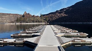
16 days agoLower Deschutes Day Use Area Boat Launch @ The Cove Palisades State Park! | Lake Billy Chinook | 4K
25 -
![6.5 Grendel vs. 6mm ARC vs. .224 Valkyrie [Which is Best?]](https://ak2.rmbl.ws/fw/s8/1/_/c/o/s/_cosr.Vkob-small-6.5-Grendel-vs.-6mm-ARC-vs..jpg) 5:17
5:17
Bear Creek Arsenal
20 hours ago6.5 Grendel vs. 6mm ARC vs. .224 Valkyrie [Which is Best?]
1521 -
 3:36
3:36
Michael Heaver
22 hours agoUK’s Block Triggers Unbelievable EU U-TURN
8708 -
 48:20
48:20
Crime Circus
1 day agoFlorida Man's Nightmare: The Shocking Interrogation & Wrongful Arrest
1.06K3 -
 19:32
19:32
Crypto Crew University
13 hours agoWARNING: BITCOIN IS ABOUT TO DO SOMETHING THAT CAUSED HUGE CRASH LAST TIME – CAN IT BE AVOIDED
1K -
 2:59:18
Fresh and Fit
7 hours agoFresh&Fit After Hours w/ Girls
101K113 -
 3:43:35
Alex Zedra
8 hours agoLIVE! Giving away an M249 SAW | PJ Party + Games
29.7K8 -
 29:23
29:23
Standpoint with Gabe Groisman
15 hours agoEp. 21. Can Israel "End Hamas"? IDF Brig. General Res. Amir Avivi, Founder of IDSF
40.8K41 -
 1:26:49
Glenn Greenwald
12 hours agoCampus Protest Propaganda Snowballs; Congress Moves to Criminalize Israel Critics | SYSTEM UPDATE #264
83.6K431 -
 1:25:44
The Anthony Rogers Show
16 hours agoEpisode 303 - Brock Bristow
50.1K2