Snowy Range Aug 2021
Snowy Range Aug 2021
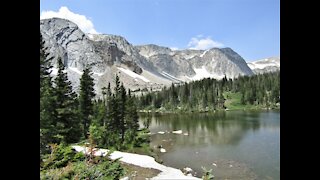
The Snowy Range area in the Medicine Bow National Forest is located in southeast Wyoming. The Laramie Ranger District, Brush Creek/Hayden Ranger District, and Parks Ranger District manage portions of the Snowy Range. Year-round recreation uses include hiking, fishing, hunting, snowmobiling, skiing, OHV riding, camping, and biking. Primary access across the Snowy Range is by Highway 130, known as the Snowy Range Scenic Byway.
SNOWY RANGE SCENIC BYWAY
The Snowy Range Scenic Byway (Hwy. 130) is located in southeastern Wyoming and is a spectacular “cut-across” for travelers. This scenic alternative to I-80 takes you through the majestic Snowy Range Mountains, past deep glacial lakes, pastoral meadows, rushing mountain streams, and awe-inspiring mountain peaks.
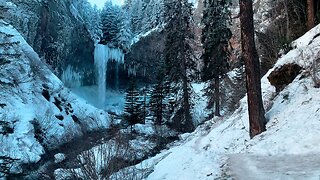
The Snowy Range Scenic Byway self-driving tour was originally a wagon road built in the 1870s and in the 1920s was widened and smoothed using horse-drawn equipment. The road was paved in the 1930s and designated as the nation’s second Scenic Byway in 1988. After six years of working on the road, it was completed and known as the “Great Skyroad.” The Scenic Byway over the Snowy Range is one of the shortest of Wyoming’s scenic byways, both in length and in the number of months it can be driven. The Byway is the second-highest mountain pass in Wyoming. Snow usually closes the highest section of the road about early to mid-November, and snowplows traditionally open the road in May, right around Memorial Day weekend.
The land known as the Medicine Bow-Routt National Forests has a long history dating back to 8,000 years ago when ancestors of the Plains Indians inhabited the area. The Northern Arapaho, Oglala Sioux, Northern Cheyenne, Eastern Shoshone, and the White River Utes all frequented the area. The region was used by these tribes, who took advantage of its wildlife bounty. They frequented the forest to gather the prime “lodge pole pine” wood they liked to use for teepee poles and firewood. The soothing mineral hot springs along the banks of the North Platte River provided a welcome place to “make medicine” to cure their ills and to hold ceremonial powwows.
Truly a “land of many uses,” the Snowy Range today supports an active timber harvesting industry in addition to providing traditional livestock forage, watershed, and outdoor recreation benefits. The Scenic Byway has numerous places to stop or pull off and take in the serenity of the Snowy Range. During your drive, remember to be cautious of wildlife on or near the road, especially during early morning and late evening hours.
Is Snowy Range Pass worth it?
This is a remarkable road trip through the majestic Snowy Range Mountains. Remember to bring your camera. It has numerous places to stop or pull off for visitors. The byway is a popular recreation attraction with many picnics, camping, observation, and interpretive facilities. Visitors will find many lakes along the byway and throughout the national forest. Anglers will want to spend some time fishing for trout. Others may want to lay down a blanket and enjoy a picnic. Campgrounds can also be found on the shores of several lakes. If you're interested in pitching a tent or parking your RV, you'll find several campgrounds from which to choose. During your drive, remember to be cautious of wildlife on or near the road, especially during early morning and late evening hours. The drive offers deep glacial lakes, pastoral meadows, rushing mountain streams, and awe-inspiring mountain peaks.
Is Snowy Range Pass open?
Set high in the Rocky Mountains, within the Medicine Bow-Routt National Forest, the road is not plowed during the winters: it closes for the season in mid-November and traditionally reopens with the help of snowplows before Memorial Day weekend. Snow usually lingers late into the spring and early summer near the pass.
How long is Snowy Range Pass?
The pass is 42.16 km (26.2 miles) long-running west-east from Ryan Park (in Carbon County) to Centennial (in Albany County).
Snowy Range Pass is one of the most beautiful drives in WY
Snowy Range Pass is a high mountain pass at an elevation of 3.310 m (10,859ft) above the sea level, located on the boundary of Albany and Carbon counties in the U.S. state of Wyoming. It's one of the highest roads in Wyoming.
Is the road to Snowy Range Pass paved?
Tucked away in southern Wyoming, the road to the summit is a two-lane paved road suitable for all vehicles. It’s called Snowy Range Scenic Byway (Wyoming Highway 130). The road is pretty steep. The road was built in the 1870s as a wagon road and was paved in the 1930s. It was originally called the “Great Skyroad”. The pass was named for the large amounts of snow that remain at high elevations during the summer months. It’s said to be Wyoming's second-highest pass.
#snowyrange
#medicinebownationalforest
#wyoming
#laramiewy
#saratogawy
#centennialwy
#jelmwy
#rv
#camping
#travel
-
 9:31
9:31
Manifestations of God's Creation: Nature Photography Videos
3 years ago $0.01 earnedSnowy Range Serenity
30 -
 0:37
0:37
HikingViking
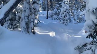
2 years agoEpic Snow Zone – Central Oregon – Swampy Lakes Sno-Park
22 -
 4:31
4:31
HikingViking
6 months agoAPPROACH & EXPLORING UP TO THE EDGE of Tamanawas Falls! | Mount Hood | 4K Winter Snow Hiking Oregon
572 -
 0:31
0:31
HikingViking
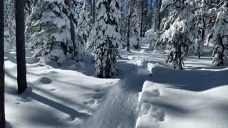
2 years agoAvoid Snowshoes if Logistically Possible & Safe – Central Oregon – Swampy Lakes Sno-Park – 4K
50 -
 0:40
0:40
HikingViking
2 years agoThick White Powdery Snow & Beautiful Blue Skies – Central Oregon – Swampy Lakes Sno-Park
29 -
 1:34
1:34
HikingViking
8 months agoAscending the PRISTINE High Alpine Tundra Zone of Mount Hood in NE Timberline Loop! | 4K | Oregon
48 -
 1:13
1:13
HikingViking
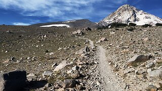
2 years agoOregon – Mount Hood – Forest Tundra Near the Summit
402 -
 0:39
0:39
HikingViking
2 years agoAlpine Snow – Central Oregon – Swampy Lakes Sno-Park – 4K
34 -
 0:54
0:54
HikingViking
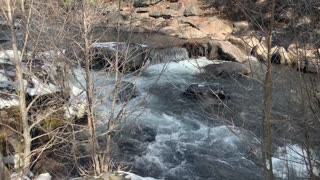
2 years agoSnow Hiking Beside Roaring Whychus Creek Canyon – Central Oregon
9 -
 0:30
0:30
HikingViking
2 years agoTruly Winter-rific – Central Oregon – Swampy Lakes Sno-Park – 4K
18