Gino Recchia NBC26 Weather Forecast
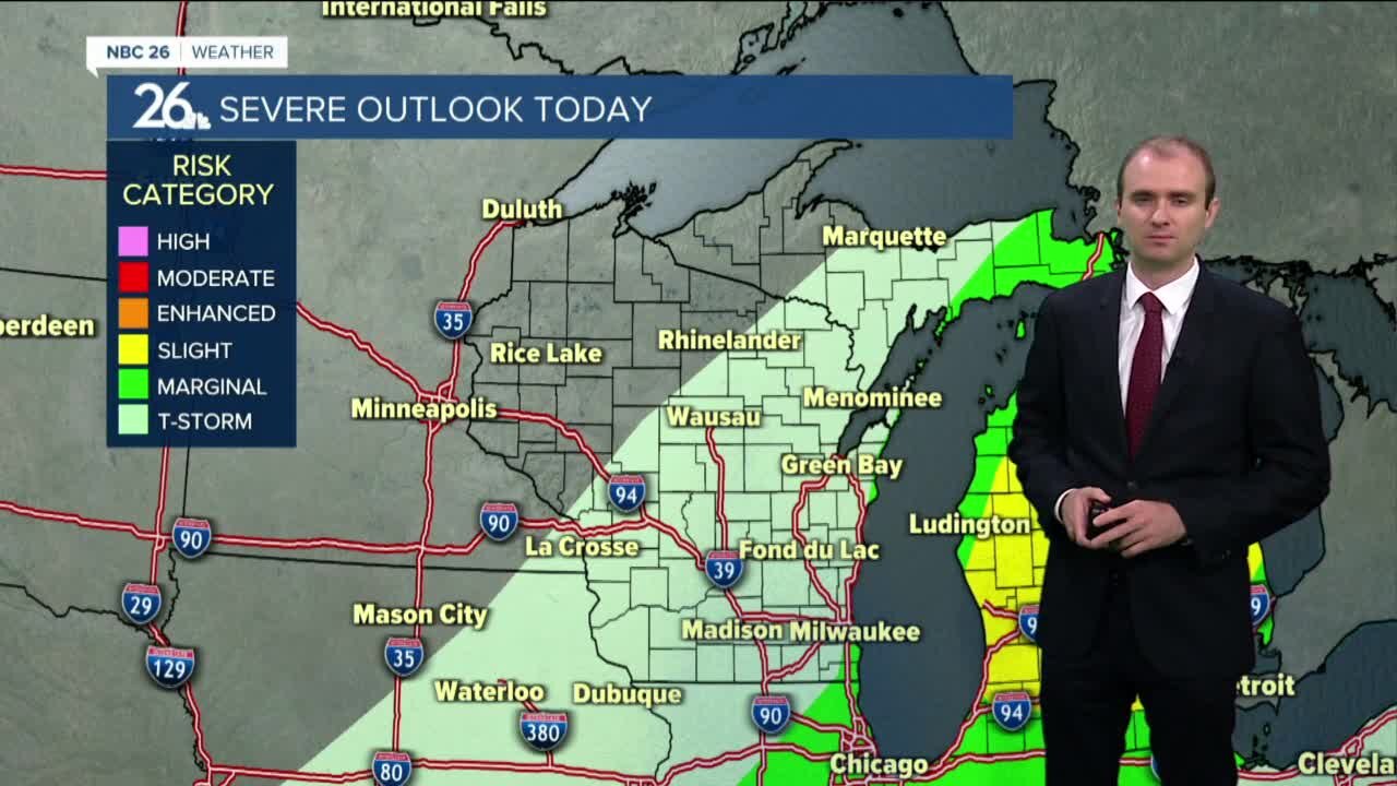
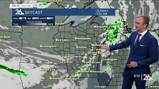
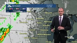
A cold front is moving through Northeast Wisconsin today bringing some showers and thunderstorms to the area. There will be a risk for strong to severe storms, but a much better chance will in the southern part of the state today. Highs will rise only into the upper 60s and lower 70s. Skies will clear this evening and then turn mostly clear tonight as temperatures fall into the upper 40s and lower 50s. The brief dry weather ends Saturday with another chance of showers returning to the area in the later half. You might encounter some light rain showers Sunday morning, otherwise expect a mostly cloudy day with highs in the upper 50s. Cool weather continues Monday and Tuesday with temperatures in the upper 50s to the lower 60s. We do see a rebound into the 70s by the end of the work week.
-
 3:36
3:36
WGBA
1 year agoWill it be necessary to have both the AC & the heat on during the same day??
3771 -
 3:08
3:08
WGBA
3 years agoGino Recchia NBC26 Weather Forecast
6 -
 2:36
2:36
WGBA
3 years agoGino Recchia NBC26 Weather Forecast
4 -
 1:56
1:56
WGBA
3 years agoGino Recchia NBC26 Weather Forecast
-
 4:00
4:00
WGBA
3 years agoGino Recchia NBC26 Weather Forecast
1 -
 3:44
3:44
WGBA
3 years agoGino Recchia NBC26 Weather Forecast
2 -
 4:06
4:06
WGBA
3 years agoGino Recchia NBC26 Weather Forecast
-
 4:03
4:03
WGBA
3 years agoGino Recchia NBC26 Weather Forecast
-
 3:32
3:32
WGBA
3 years agoGino Recchia NBC26 Weather Forecast
1 -
 3:40
3:40
WGBA
3 years agoGino Recchia NBC26 Weather Forecast
1