Hiking The End Section of Incredible West Metolius River Trail – Central Oregon – 4K
My goal of these wilderness trail videos is to 1) show reverence for the beauty of the land, and 2) give YOU actionable trail information that can assist you in planning your own hike here.
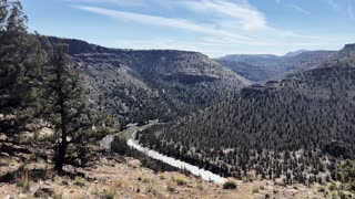
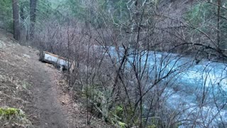
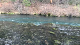
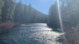
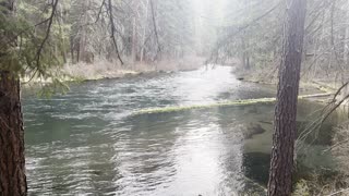
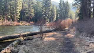
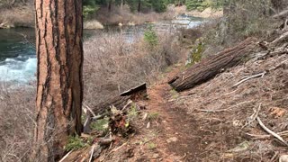
This was a day-hike in Central Oregon, Deschutes National Forest, Metolius River National Recreation Area, starting at Lower Bridge Campground Parking at Lower Bridge and exploring the East side of Metolius River to Pioneer Ford Campground for the first little part and the bulk of the hike was on West Metolius River Trail to Candle Creek Campground as a 3.2 miles Out and Back with miles of epic shoreline hiking and a minor amount of elevation gain making it mostly a flat hike. The elevation starts around 2800 ft and stays in a range of up to 3000 ft, at such low elevation it allows this hike to be done in the end of Winter as far as snow melt and road access. The sky was overcast and it sprinkled a little bit. This was hiked on 4/28/2022 and there were of course NO Mosquitoes. As far as road conditions, it's highway to the turn off for the Camp Sherman area which is a well paved road until the parking lot, so it was a very easy and safe driving route. In my opinion, the road most definitely DOES NOT require 4-Wheel Drive, however do watch for road conditions, particularly snow/ice depending on the time of year.
-
 7:21
7:21
HikingViking
16 days agoHigh Desert Wonderland Ascension to Chimney Rock! | Lower Crooked River BLM | Prineville Oregon | 4K
67 -
 5:24
5:24
HikingViking
2 years agoHiking Incredible Wilderness Trail Overlooking Metolius River – Central Oregon – 4K
5 -
 1:47
1:47
HikingViking
2 years agoIncredible Section of Roaring Metolius River – Central Oregon
6 -
 1:30
1:30
HikingViking
2 years agoHiking Metolius River – Central Oregon
10 -
 0:59
0:59
HikingViking
2 years agoWilderness Hiking Beautiful Section of Metolius River – Central Oregon
10 -
 4:10
4:10
HikingViking
2 years agoHiking Shoreline of Incredible Metolius River – Central Oregon
29 -
 1:00
1:00
HikingViking
2 years agoHiking Along an Incredible Wilderness Trail – Metolius River – Central Oregon – 4K
13 -
 0:39
0:39
HikingViking
2 years agoIncredible Metolius River Wonderland – Central Oregon
10 -
 2:13
2:13
HikingViking
2 years agoWonderful Wilderness Hiking on West Metolius River Trail – Central Oregon – 4K
1 -
 1:39
1:39
HikingViking
2 years agoThe Incredible Metolius River – Central Oregon
252