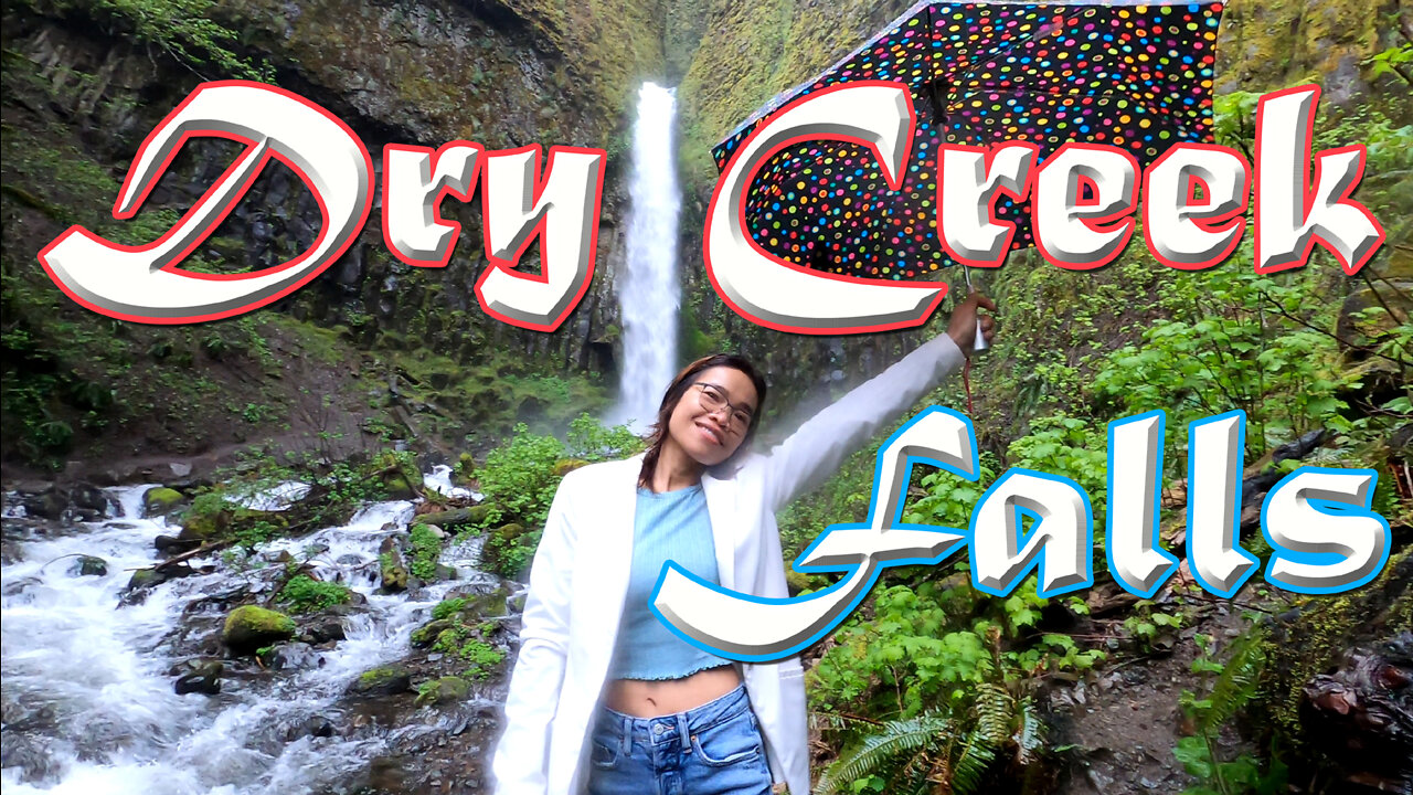
Hiking to Dry Creek Falls - Oregon
Daniel and Sunisa take us on a lovely hike through the lush woods of northern Oregon, to Dry Creek Falls near Cascade Locks, Oregon.
Trail head:
45.661385, -121.871248
Hike Description
Dry Creek Falls plunges 74 feet over a basalt wall in a secluded amphitheater near Cascade Locks. It is easily reached via the Pacific Crest Trail and is a popular destination for those interested in a short, woodsy hike with plenty of Gorge ambience. At the base of the falls are the remains of a water diversion works. In the 1930s, the rapidly expanding town of Cascade Locks got its water supply from this location during the construction of the Bonneville Dam. The creek was channeled into a tunnel and thus ran "dry" on its original bed. Almost the entire area of this hike was affected by the 2017 Eagle Creek Fire. You'll see blackened tree trunks and a recovering understory, but most of the canopy is still intact.
This hike starts you at the Bridge of the Gods Trailhead. From the trailhead, cross the road and head up the Pacific Crest Trail parallel to I-84. There's an old safety fence on your right. Soon, you'll come to Moody Street as it crosses under the freeway. Walk the road uphill to the right, passing under the freeway. When the road angles left, keep right on a gravel road a short distance to a couple of parking pullouts. Altogether the road walking here is about 100 yards. The trail to the right is the Gorge Trail headed toward the Ruckel Creek Trail and the Eagle Creek Campground. You'll take the Pacific Crest Trail to the left, which also doubles as the Gorge Trail #400 heading east from here.
The Crest Trail heads gradually uphill, never too steep, through a pretty, dappled sun kind of forest dominated by Douglas-firs and big-leaf maples, the latter providing a colorful display in the fall. In the spring, forest wildflowers including columbines are common here. Almost immediately, you'll see evidence of the 2017 Eagle Creek Fire. The trail swings right and then loops back along a slope of larger Douglas-firs and hemlocks. About one mile in, you'll come to a powerline access road. Turn right here and follow the road a short distance under the powerlines to the resumption of the trail in the woods. Pass an impressive Douglas-fir on the left side of the trail. Soon after the powerline road, you'll make a traverse along a very steep slope. Then the trail begins a gradual descent to Dry Creek. This section of trail heads gradually downward through an interesting area of large lava boulders and trees for almost another mile.
At Dry Creek, the trail comes to another dirt road (Ten yards before this road is the almost invisible junction with the abandoned Rudolph Spur Trail). Across the road, you'll see the Pacific Crest Trail crossing Dry Creek on a wooden footbridge. To get to Dry Creek Falls, instead of crossing the bridge, turn right here and head up the rough track about 2/10 of a mile to the falls. Trees at the top of the falls were more heavily damaged by the Eagle Creek Fire than those below. Dry Creek hasn't run dry since the diversion apparatus was decommissioned, and the falls put on a pretty display throughout the year, although with much greater volume in the wet months. After enjoying the spray of the falls in the quietude of this little amphitheater, return the way you came in.
___________________________________________________
This video footage comes from the Dry Creek Falls, Oregon. ~ Daniel F Mitchell – AOWS Editor
Contact AOWS at: danielfmitchell@hotmail.com
Subscribe to us on Rumble: https://rumble.com/c/c-1143951
Subscribe to us on Odysee: https://odysee.com/@AOWS:a
Subscribe to us on TikTok: https://www.tiktok.com/@A.O.W.S
Subscribe to us on Youtube: https://www.youtube.com/c/AnythingOutdoorswithSteve
____________________________________________________
#waterfalls #oregon #hiking
-
 2:16
2:16
Anything Outdoors with Steve
8 months agoHammers and Nails
321 -
 2:06:07
TimcastIRL
9 hours agoDemocrats LOSE IT Over SECOND Liberal Judge ARRESTED By Trump Admin | Timcast IRL
210K183 -
 1:26:16
Man in America
1 day agoEXPOSED: Trump's COVERT War Against the European Banking Cartel w/ Tom Luongo
97.7K45 -
 1:45:48
Glenn Greenwald
13 hours agoGlenn Reacts to News of the Week; Plus: Audience Q&A | SYSTEM UPDATE #443
112K80 -
 11:05:38
Dr Disrespect
18 hours ago🔴LIVE - DR DISRESPECT - PUBG - 5 CHICKEN DINNERS CHALLENGE
229K21 -
 3:23:12
I_Came_With_Fire_Podcast
17 hours agoSHALL NOT BE INFRINGED| THE TYRANNY OF UNELECTED BUREAUCRATS | XI BOWS
51.8K9 -
 4:19:36
SynthTrax & DJ Cheezus Livestreams
19 hours agoFriday Night Synthwave 80s 90s Electronica and more DJ MIX Livestream THE GREAT EDO WARS OF 2067 Edition
85.3K10 -
 4:45:15
RalliedLIVE
9 hours ago $1.76 earnedWarzone Domination w/ Ral
60.8K -
 1:10:17
Sarah Westall
11 hours agoWorld Leaders Increasingly Display Panic Behavior as Economic Change Accelerates w/ Andy Schectman
90.2K17 -
 59:54
59:54
Motherland Casino
8 hours ago $1.96 earnedScar x Ayanna
38.9K7