Premium Only Content

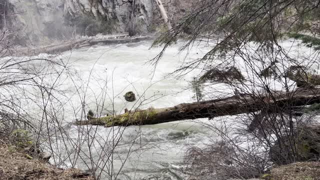
Benham Falls Area – Deschutes River Trail – Central Oregon – 4K
My goal of these wilderness trail videos is to 1) show reverence for the beauty of the land, and 2) give YOU actionable trail information that can assist you in planning your own hike here.
This was a day-hike in Central Oregon, Deschutes National Forest, starting at Sun Lava Path Trailhead and hiking to Benham Falls and then Dillon Falls along the Shoreline of Deschutes River as an Out and Back hiking approximately 8 miles with only a couple hundred feet elevation gain. I call this the "Southern Half" of Deschutes River Hiking (the "Northern Half" starts at Meadow Day Use Picnic Area and also goes to Dillon falls, approximately 8 miles). The temperature was 29 when I started and raised to over freezing. On my way Back to the Trailhead there was a FREAK HAIL STORM that created some ice on the trail requiring more careful footing on the way Back than the original way Out. This was hiked on 4/22/2022 and there were of course NO Mosquitoes. As far as road conditions, it's highway and then a relatively well maintained road to the parking lot. In my opinion, the road most definitely DOES NOT require 4-Wheel Drive, however do watch for road conditions, particularly snow/ice depending on the time of year.
-
 8:11
8:11
HikingViking
1 month ago(4K UHD) SILENT PERSPECTIVES @ North Cascades National Park | Diablo Lake Colonial Creek Campgrounds
771 -
 LIVE
LIVE
Jokeuhl Gaming and Chat
7 hours agoDARKTIDE - Warhammer 40k w/ Nubes and AoA
116 watching -
 2:19:56
Nerdrotic
14 hours ago $2.68 earnedNerdrotic Nooner 513
28.4K2 -

BigTallRedneck
3 hours agoRANKED FINALS W OMEGA
3.71K -
 LIVE
LIVE
Eternal_Spartan
10 hours ago🟢 Eternal Spartan Plays Final Fantasy 7 Rebirth Ep. 3 | USMC Vet | Join the Best Chat on Rumble
65 watching -

megimu32
2 hours agoOTS: Ace Ventura & The Death of 90s Comedy
7.32K8 -
 1:14:30
We Like Shooting
15 hours ago $0.74 earnedDouble Tap 426 (Gun Podcast)
6.02K1 -
 4:32:32
Meisters of Madness
5 hours agoWuchang Returns with Madness & Ranked Finals
2.27K -

Illyes Jr Gaming
2 hours agoBlack Ops 6 Action Reppin @Mystivis
1.36K -
 LIVE
LIVE
a12cat34dog
2 hours agoCRAZY NEW HORROR GAME :: Cronos: The New Dawn :: SPOOKY SEASON CAME EARLY {18+}
52 watching