

Cover Savage Garden To The Moon And Back
Savage Garden To The Moon And Back Singing With Guitar
346
views
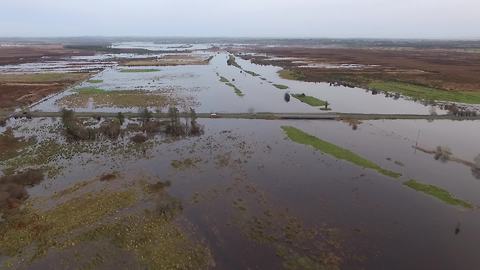
Drone captures magnitude of destruction left by Storm Desmond
This drone footage shows the damage left by Storm Desmond as it lashes out across the city of Galway in Ireland. The banks of the Clare River are breached, leading to massive flooding in the area. This fierce Atlantic storm has soaked parts of England, Scotland, Northern Ireland and Ireland with flooding rain, storm surge flooding and winds reaching over 100 mph.
28.5K
views
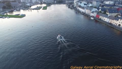
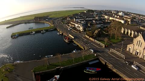
Air view of the Galway docks and claddagh
Air view of the Galway docks and claddagh in beautiful Ireland.
807
views
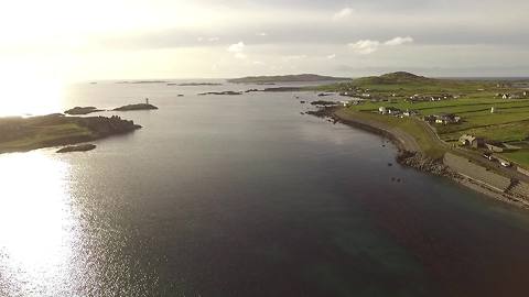
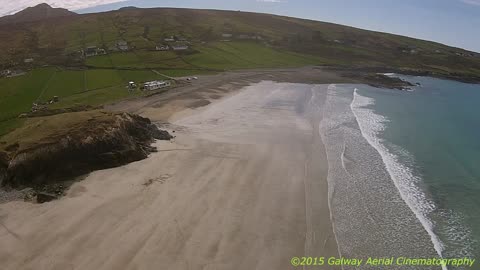
Aerial view unveils Irish hidden jewel
This beautiful drone footage captures the magnificent beauty of Inishbofin, a small island off the coast of Ireland. Known as a popular tourist destination, this stunning landscape is truly one of Ireland's most beautiful places.
53.6K
views
1
comment
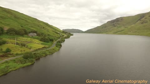
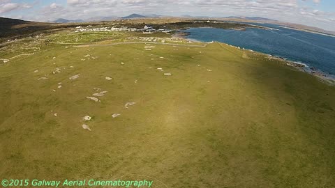
Drone footage of the unforgettable Connemara
Where land and sea collide. Where untamed beauty abounds. Welcome to unforgettable Connemara, a district in the west of Ireland.
1.3K
views

Aerial View A family Bringing Home The Turf From an Irish Peat Bog
For years the people of ireland have lite there fires with turf.
This video captures a family bringing home the turf for the winter
76
views
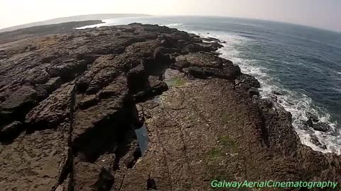
Beautiful drone footage of The Burren in Ireland
The Burren is the last most natural, beautiful and unspoiled landscape in Ireland. Check out this amazing aerial footage as it explores this national park with all of its stunning beauty.
1.85K
views

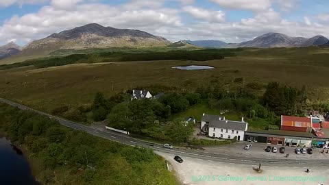
Aerial View Through Connemara Ireland
Traveling by drone through Connemara ireland. Taking in Maam cross,Recess,Inagh Valley,and much more, Ending at beach past letterfrack
374
views
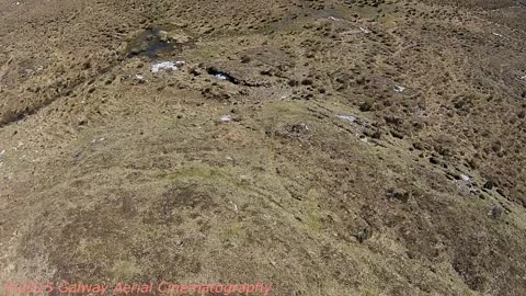
Aerial View Where Alcock & Brown had Landed In Connemara On A Irish Bog
The first transatlantic flight was achieved in 1919 with the arrival of a Vickers-Vimy biplane behind the Marconi wireless station at Derrigimlagh, 4 kilometres south of Clifden. On-board were two British airmen, Captain John Alcock (pilot), and Lieutenant Arthur Whitten Brown (navigator). The aeroplane had taken off from Lester’s Field in St John’s, Newfoundland at 4:12 p.m. GMT the previous day and arrived at Derrigimlagh, Clifden, County Galway at 8:40 a.m. GMT on Sunday 15th June. The distance covered was a little less than 1,900 miles. The flight time was 16 hours 28 minutes.
The successful flight had won the two fliers a £10,000 prize and a place in aviation history. Competition for the prize was intense and several aircrafts had gathered at St John’s in preparation for the challenge; one attempt had already failed. The average speed during the Atlantic crossing was 120 miles per hour. On takeoff, the Vickers-Vimy carried 865 gallons of petrol and 40 gallons of oil. On arrival at Derrigimlagh, she still carried sufficient fuel for a further ten hours flight. The flyers wore electrically heated clothing, Burberry overalls, fur gloves and fur-lined helmets. The battery for heating their clothing sat between them in the cockpit. They carried with them 300 private letters, the first transatlantic airmail in history.
Crossing the Irish coast, Alcock and Brown spotted the tall masts of the Marconi wireless station at Derrigimlagh. Recognizing their location, Alcock decided not to go any further. Switching off his engines, he glided towards what he thought to be a level stretch of ground behind the station. The wheels touched down and ran on a short distance, before coming to a stop as they sank into the bog. The nose dipped and the tail lifted, and fuel began leaking into the cockpit. The airmen scrambled to safety, stepping onto Irish soil.
41
views
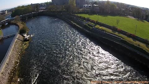
Drone footage of River Corrib and Salmon Weir
Check out this awesome aerial view of the Corrib River, leading to Galway's famous Salmon Weir in Ireland. Would you like to visit here? Credit to 'galwaycinematography'.
150
views
Cool drone footage of Irish city
Check out this incredible aerial view of the Galway City in Ireland, leading to the Connemara district. What a hidden beauty! Credit to 'galwaycinematography'.
3.43K
views
Incredible aerial view of Irish coast
Check out this stunning drone footage of Connemara, a district in the west of Ireland. This remote are packs some amazing beauty and history. Would you like to visit here? Credit to 'galwaycinematography'.
1.98K
views
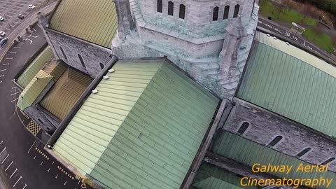
Amazing drone footage of Irish Cathedral
The Cathedral of Our Lady Assumed Into Heaven and St. Nicholas, commonly known as Galway Cathedral, is a Roman Catholic cathedral in Galway, Ireland, and is one of the largest and most impressive buildings in the city. Construction began in 1958 on the site of the old city prison, and in 1965 it was dedicated, jointly, to Our Lady Assumed into Heaven and to St. Nicholas. Credit to 'galwaycinematography'.
4.93K
views
1
comment
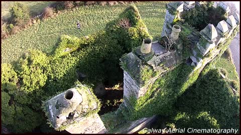
Amazing drone footage of Medieval castle
The Menlo Castle in Ireland was built in 1569 but was destroyed by an accidental fire in 1910. The inside was completely gutted and only the walls were left standing. The Menlo Castle is a very well known local landmark and this magnificent ivy covered ruin sits in a beautiful location on the banks of the River Corrib. Credit to 'galwaycinematograph'.
135K
views
4
comments
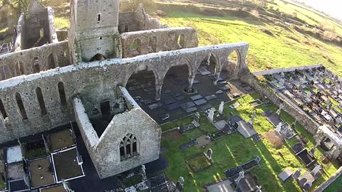
1st Drone View Of Medieval Franciscan abbey ireland
History
The monastery was commissioned in about 1252 by John de Cogan, a Norman knight who took possession of the area following the Norman conquest of Connacht.
The Franciscan community at the abbey lived under the patronage of the de Cogan clan until 1327, when John Magnus de Cogan gave them the building and surrounding lands. In return for this favour, the monks were asked to present a rose to de Cogan and his descendants on the annual feast day of St. John the Baptist (June 24).
The community flourished until the mid-16th century, when the English Reformation disrupted the Catholic establishment in Ireland. From that time on, the monks of Claregalway struggled to keep the abbey viable against political and economic forces.
The cloister within the abbey ruins
On July 11, 1538, forces under the command of Lord Leonard Gray ransacked and looted the abbey while on march to Galway. In 1570, Queen Elizabeth I granted possession of the monastery to Sir Richard de Burgo. In 1589, the monastery buildings were turned into a barracks under the administration of the English provincial governor, Sir Richard Bingham.
During the reign of King James, the property was given to the Earl of Clanrickarde. By 1641, the Franciscans had reoccupied the abbey, but the building was in poor repair and the community lacked the ability to renovate it.
In 1731, Edward Synge, Anglican archbishop of Tuam recorded that “there is a friary in Claregalway, where three at least are always resident.” The High Sheriff of the county, Stratford Eyre, reported in 1732 that the monks "lived close" to the abbey.
The bell tower
Church records indicate that the community numbered about 220 religious in 1766, but this number had declined to about 150 by 1782. French diplomat Coquebert de Montbret wrote in 1791 that “the monks are settling down among the ruins.”
The remains of the friary's living quarters
The size of the community continued to dwindle. By 1838, it was down to only two members. Archives of the Galway Vindicator, a local newspaper, indicate that the community's last two monks departed for a larger community in Galway in November 1847. For some years after the monastery closed, members of the Galway friary continued to travel to the site on feast days to celebrate Mass and hear confession, but these activities had ceased by 1860.
In 1892, a Lord Clanmorris donated the property to the Commissioner of Public Works under the provisions of the Ancient Monuments Act of 1882.
Today, the abbey buildings and grounds are open to the public free of charge. The burial grounds surrounding the building are maintained and still in use.
57
views
2
comments
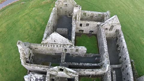
1st Drone View Of Medieval Franciscan Friary West Coast Ireland
The Ross Errilly Friary
Abandonment and neglect
The abbey ruins as depicted in William Wilde's 1867 book, Lough Corrib, Its Shores and Islands.
In the meantime, the long-abandoned friary continued its descent into ruin. In 1835, English tourist John Barrow described the abbey as "a remarkably fine old ruin...in a disgracefully neglected state." In particular, Barrow was astonished by the large amount of unburied human remains at the site, which included "moss-grown skulls and human thigh and leg-bones strewed about so plentifully that not a step can be taken without encountering them."[7] Geographer Samuel Lewis noted the continued decay in 1837, writing that the abbey was "partially covered in ivy" and that the roof had collapsed in 1812. Despite the neglect, Lewis was able to report that "one of the windows is still perfect."[8]
William Wilde visited the abbey ruins in July 1866. Like Barrow, he described "heaps of skulls and bones" in the church and claimed that the site had become notorious for its unburied remains. Wilde noted with dismay that further "desecration" was being effected by sheep and cattle, which roamed freely through the ruins. He also credited a nearby resident, Oliver Burke, with some early efforts to preserve the site by "removing obstructions from between the mullions of the beautiful windows" and making "repairs to the tower, thereby rendering it accessible to the top."[9] In 1868, Burke, a barrister by profession, wrote his own account of the friary's history.
Today
Today, the ruin of Ross Errilly is maintained by the Office of Public Works and is open to the public free of charge. It has been used as a filming location for Bad Karma, The Suicide Club and Moving Target.
372
views
6
comments