

USA NOW! Snowstorm Havoc: Northeast Nightmare - Road Chaos, Flight Groundings, and Fatalities
The storm swept through the Central Atlantic and New England, causing chaos on roads and widespread school closures. According to the National Weather Service, snowfall varied from a few inches to a colossal 15.5 inches in Farmington, Connecticut.
In New York, nearly 7 inches of snow fell on Coney Island, while Central Park received about 3.3 inches. Snowplows were deployed in the city for the first time since January 2022, marking the largest snowfall in the past 2 years, as stated by New York City's Emergency Management Commissioner, Zachary Iscol.
The storm disrupted air travel in the Northeast, with over 1100 flights canceled, mainly at major airports in New York, Boston, and New Jersey, according to FlightAware.
Tragically, in Newberry, Pennsylvania, a man on a snowmobile died after colliding with a downed power line during the storm. Police noted numerous weather-related issues in the area, including fallen trees and power line disruptions.
Governor Phil Murphy closed all state offices in New Jersey, and New York City public schools switched to remote learning. The heavy, wet snow weighed down branches across the region, exacerbated by gusty winds. More than 135,000 customers in Pennsylvania were left without electricity, affecting New Jersey, New York, Connecticut, Maryland, Rhode Island, Massachusetts, and Virginia.
Road conditions were extremely challenging, leading to over 250 car accidents in New Jersey, according to Governor Phil Murphy, who highlighted the difficulties of morning commutes.
Rescue and utility services are working tirelessly to restore normalcy in cities after the widespread snowfall.
Moving north, the storm continued to wreak havoc in Atlantic Canada, causing rapidly deteriorating road conditions, flight delays, and school closures in Nova Scotia and Newfoundland.
In light of the recent snowstorm, it's noteworthy that eight counties in the state of New York have been listed among the "snowiest counties" in America. These rankings are based on historical data of snowfall, average annual temperature, and the number of days with temperatures below freezing.
One of the counties in New York has emerged as the snowiest county in the United States. This is surprising considering that four out of the five snowiest counties are located in Alaska, where residents are accustomed to heavy snowfall.
The snowfall data in New York underscores the significant and hazardous changes in the climate. We are increasingly witnessing abnormal climate events that are uncommon for the regions we inhabit.
For more information on the dangers posed by the climate in the coming years and how to protect yourself and your loved ones from the onslaught of natural disasters, you can find here: "Global Crisis. Responsibility."
34
views

2024 Winter Chaos in Europe
From January 17 to 18, Europe faced a tough time with lots of snow and freezing rain. This bad weather caused a lot of problems, like messing up flights and trains, closing schools, and making roads super slippery.
In Germany, the weather people warned everyone about really heavy snow in the central and southern areas. Frankfurt Airport, which is super busy, had to cancel about 700 flights because of the bad weather. They were worried that planes might get icy when they were landing. Roads in western and southern Germany got really icy, causing lots of car crashes. To be safe, many schools and places for kids to stay during the day were closed. Some people even got to work from home.
Train rides in Germany weren’t smooth either. The main train company, Deutsche Bahn, had to slow down their fast trains from 300 kilometers per hour to 200, and there were a bunch of delays and cancellations.
Over in Denmark, the snow and strong winds made driving dangerous, and there were some accidents. The police told people to stay home if they could and to move their meetings.
In Oslo, Norway’s capital, they had to stop the buses because of too much snow and not being able to see well. This left a lot of people stuck. Roads and trains in southern Norway also had problems because of the weather.
Airports in the city had to close for a while because the pilots couldn’t see through all the snow. “It’s really rare that we get so much snow the pilots can’t see the ground lights, so we’ve stopped all planes from coming in or going out,” said someone from Avinor, the airport folks in Norway.
All trains in eastern Norway got canceled, and there were lots of delays and cancellations for buses, trams, metros, and ferries.
In Sweden, at the Gothenburg airport, a plane slid off the path where planes drive and got stuck in the snow one morning. The main train company in Sweden, SJ, had to cancel many trains until early March because of all the snow and really cold weather.
In the northeast of France, in Lorraine, they put out an orange warning for icy rain and snow. There were a lot of problems on the roads, and public transport got messed up. The weather service in France said there would be more snow and rain in most of the northeast.
Southern parts of Belgium and Luxembourg were also on high alert because the freezing rain was making it hard to drive.
This extreme weather is happening one after the other, not giving people much time to get ready. It’s causing chaos in our daily lives, messing up our homes and cities, and sometimes it even takes lives.
What’s going on with our planet? Why are these natural disasters happening more and more? Why haven’t our efforts to stop climate change worked yet? You can find answers at the “Global Crisis. The Responsibility” event.
37
views
1
comment

USA Underwater: The Worst Flash Flood! Cities Without Electricity! Cars Sinking in Water
A winter storm on the East Coast of the United States is leaving behind power outages and widespread flooding. The East Coast remained under the threat of adverse weather on Wednesday as a powerful winter storm loomed over the region.
According to the National Weather Service (NWS), on January 10, more than 50 million people from eastern Ohio to the Mid-Atlantic and the Northeast were at risk of strong winds and flooding. The storm caused delays or cancellations of over 1,200 flights on Wednesday, including more than 270 flights to and from Chicago.
In several Pennsylvania communities, over 3.9 inches of rain fell. Trees were toppled, leaving thousands of homes without power. Several rivers in eastern Pennsylvania experienced flooding, during which rescuers evacuated some drivers from stranded vehicles.
Flooding inundated several coastal towns in New England, including Hampton Beach, New Hampshire. Streets, homes, and vehicles were submerged, leading to a state of emergency declaration. Local residents were recommended to leave the area and move to higher ground.
A dam breach in Connecticut led to evacuation orders along the Yantic River in Norwich. Later, another dam in Connecticut – the Pameacha Pond Dam in Middletown – partially breached due to flooding on January 9.
In Maine, on Isle au Haut island, wind gusts reached 95 miles per hour. As a result, an empty passenger plane collided with a jet bridge at the state's largest airport. Fortunately, no one was injured.
Maine Governor Janet Mills urged residents to stay away from roads amid flash flood warnings.
In New Jersey, a state of emergency was declared ahead of the storm. In some areas, 2.99 inches of precipitation fell, leading to flooding of streets, roads, and rising water levels in rivers.
In Burlington, the water level reached 11.99 feet, surpassing the previous record. On January 10, 2024, floodwaters submerged homes, businesses, streets, vehicles, and parks along the Saddle River in Lodi, New Jersey.
Strong winds caused storm surge that hit several coastal areas of the Mid-Atlantic and the Northeast, triggering historic flooding. On the Delaware River near Philadelphia, the highest storm surge since 1900 was recorded.
High tides flooded cities along the southern coast of Long Island early Wednesday after overnight rain and storm.
In Nassau County, New York, cars were floating in floodwaters. Several schools on Long Island canceled or postponed classes due to the storm.
Recently, meteorologists' forecasts are becoming increasingly inaccurate because old forecasting models no longer work in new climate realities. Now, what has never happened in the history of our humanity is happening – our planet is entering a cycle of climate catastrophes. In the next five years, an increase in the strength and number of catastrophes is expected, putting millions of human lives at risk and causing the relocation of billions of people.
What needs to be done and how to ensure the safety of yourself and your family in the future, see here: Global Crisis. The Responsibility
53
views
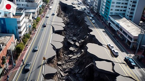
Japan now! Earthquakes struck Japan on New Year's Day! Live Video
January 1, 2024, at 16:10 local time, a devastating earthquake with a magnitude of 7.6 struck the Noto region in Ishikawa Prefecture, Japan. Following the main tremor, more than 60 powerful aftershocks ranging from magnitudes 3 to 6.1 occurred.
As a result, buildings were destroyed, electricity was cut off in tens of thousands of homes, and residents in some coastal areas were forced to flee to higher ground.
The Japan Meteorological Agency issued a tsunami warning for the coastal prefectures of Ishikawa, Niigata, and Toyama. This strong tsunami warning became the first since the destructive earthquake and tsunami in March 2011. Russia and North Korea also issued tsunami warnings.
The wave heights along the coast of the Sea of Japan reached 3 meters and in some areas up to 5 meters.
The earthquake disrupted air and railway transportation. Transport authorities reported that due to the earthquake, forty train lines and two high-speed trains in the affected area ceased operations. Additionally, six expressways were closed, and one of Ishikawa's airports had to close temporarily due to a crack on the runway.
Japan Airlines canceled most of its flights scheduled for the Niigata and Ishikawa regions.
The city of Wajima on the Noto Peninsula, close to the epicenter, suffered severe damage. The earthquake triggered a major fire, buildings collapsed, and extensive cracks emerged on roads.
Japanese telecommunication companies warned customers that there might be communication disruptions in some areas, and emergency services might be unavailable.
Officials from the Japan Meteorological Agency, including spokesperson Toshihiro Shimoyma, stated that there might be stronger earthquakes in this region in the coming days, where seismic activity has been persistent for over three years.
Prime Minister of Japan Fumio Kishida urged residents to prepare for potential further disasters: "Residents should be prepared for possible further earthquakes, and I urge people in tsunami-affected areas to evacuate as soon as possible."
In recent years, the number and intensity of destructive earthquakes have been rapidly increasing. According to USGS data, before the 2000s, there used to be one to two earthquakes above a magnitude of 6 per year. Currently, there are eight times more occurrences.
What is happening to our planet at present? How can we ensure safety for ourselves and our loved ones? Seek answers and solutions here: Global Crisis. The Responsibility.
43
views

San Diego Flood 2024. Aftermath Of 'Thousand-Year Storm'
On January 22nd, 2024, an unprecedented weather event unfolded in sunny San Diego, California, which left the city grappling with the aftermath of heavy rains and severe flooding. Join us as we delve deeper into the details of this extraordinary event, its impact on the community, and the pressing issue of climate change.
The National Weather Service reported that January 22nd marked a historic moment in San Diego's weather records. A staggering 2.75 inches of rainfall was recorded in just one day, far exceeding the usual January average of slightly over 2 inches for the entire month. It was, without a doubt, the rainiest January day ever recorded in the city.
The surprising aspect of this event was that San Diego is not known for its winter storms. In fact, it's relatively dry compared to other parts of the United States. While rain was expected, the scale and intensity of this downpour caught everyone off guard. Meteorologists had predicted rain, but they couldn't foresee the sheer impact of this winter storm.
The consequences were immediate. A state of emergency was declared in the city, as residents struggled to cope with the rapidly rising floodwaters. The visuals from social media were both astonishing and heartbreaking, as water streams turned into raging rivers and cars were swept away on roads that had become treacherous waterways. It was a challenging time for the community, particularly for those in the Southcrest area, where firefighters had to perform daring rescues as the water flooded residential complexes. Even homeless shelters were not spared, forcing city services to relocate affected individuals to state sports halls.
PowerOutage.us reported that around 14,500 households in San Diego were without gas and electricity. Approximately 100 houses were damaged, leaving many residents in dire situations. To provide immediate relief, a middle school was transformed into a temporary shelter for those affected.
In Coronado, a picturesque resort city across the bay from San Diego, 22,000 residents received an unusual request on Monday evening: to limit their water usage for household needs. The local sewage system had become overloaded due to the excessive rainfall and required a full 24 hours to recover.
During a press conference held by Mayor Todd Gloria, the gravity of the situation became even more apparent. Mayor Gloria had recently returned from a conference of U.S. mayors in Washington, where participants unanimously agreed that extreme weather events, driven by climate change, have become the new norm. He emphasized, 'We are used to snow, but not to such a quantity of snow. We are used to rain, but not to such a quantity of rain.' These unusual weather conditions truly exceed ordinary human experience.
This catastrophic event serves as a stark reminder that the climate is changing, and this is an undeniable fact. The old forecasting models, designed for a different era, no longer seem sufficient to predict and prepare for these increasingly extreme weather events. The measures taken to combat the climate crisis, while essential, don't seem to be yielding the desired results. This raises a critical question: does humanity truly understand the underlying reasons behind these escalating climate catastrophes?
To explore this question further and gain insight into how we can safeguard humanity from impending large-scale crises, we invite you to watch the international forum titled 'Global Crisis. Responsibility.' This forum brings together experts and thought leaders to delve into the complex issues surrounding climate change and our collective responsibility.
In conclusion, the events that unfolded in San Diego on January 22nd serve as a poignant reminder of the urgent need to address climate change. The impact of extreme weather events, like the one witnessed in San Diego, extends far beyond the immediate damage. It affects communities, livelihoods, and the very future of our planet. As Mayor Todd Gloria stated, 'No matter which part of the country you're a mayor from, you see people going through exactly the same experience.' It's a shared challenge that calls for collective action and a renewed commitment to understanding and mitigating the effects of climate change.
528
views

Norway now! Record snowfalls! Blizzard buries towns in Norway under meters of snow
The snowstorm buried cities in Norway under a meter of snow.
A snowstorm paralyzed the southern part of Norway in early January 2024, leaving thousands without electricity and burying the cities of Risør, Grimstad, and Arendal under a 100-centimeter layer of snow.
In Risør, 102 cm of snow fell in the last three days. The height of the snowdrifts reached 120 cm, setting a record for the entire observation history since 1985.
Continuous snowfall led to the suspension of local railway lines, traffic jams, and power outages. Schools along the coast announced closures.
Problems also occurred in the capital, Oslo: bus services were hindered, and the E6 highway was closed after a serious accident.
Public transport in the Oslo area faced difficulties, and the state agency Ruter considered the possibility of a complete suspension of bus services due to the heavy snowfall.
The snowfall paralyzed mail delivery and interrupted waste removal services in the city.
Officials urged motorists to stock up on warm clothing, food, and shovels, emphasizing the unpredictability of the blizzard.
Residents of Southern Norway were advised to work from home due to dangerous weather conditions and to drive only when necessary.
After several days of heavy snowfall, the sky cleared, and abnormally strong frosts set in. The lowest temperature was recorded in the northern province of Finnmark, where thermometers dropped below -40°C. Similar temperatures were observed in central and inland parts of Norway, including the cities of Folladal and Røros.
It was so cold that Oslo's central railway station offered shelter to the homeless. City shelters and the Salvation Army also expanded the number of places for people seeking refuge from the cold.
Due to the abnormal cold, ski resorts, including Hemsedal and Strandafjellet in the Sunnmøre Alps, closed chairlifts. "It's too cold to operate them, and it's unsafe for our guests," said NRK's Mari Rikshaim from Strandafjellet.
Schools also remained closed for a week in the southern coastal area.
The inclement weather also affected neighboring countries. Drivers in southern Sweden got stranded in their cars overnight because it was impossible to pass on the main road due to deep snow. The Swedish armed forces delivered food and water to nearly 1000 cars stuck in heavy snowfall for almost 24 hours.
The ferry, operating between the capitals of Norway and Denmark, couldn't dock in Copenhagen due to bad weather. About 900 passengers were forced to spend the night on board the ship, parked in the Øresund strait between Denmark and southern Sweden.
In Swedish Lapland, in Kvikjokk-Orrerjaurke, a temperature of -43.6°C was recorded. This data sets a new absolute record for the meteorological station since 1901.
Record precipitation, sharp temperature fluctuations, abnormal cold and heat, hurricane winds - all these phenomena are rapidly intensifying. How climate events will develop further and whether we can protect ourselves and our loved ones from natural disasters? Find the answers here. Global Crisis. The Responsibility
37
views
3
comments
Huge Snow Storm in USA now! Massive snow storm hit New York, Boston, and Philadelphia
From January 8 to 10, 2024, a powerful winter storm brought severe weather conditions, floods, blizzards, and power outages to the central and eastern regions of the United States. The fast-moving storm covered a distance of over 1800 miles in just 72 hours. By the evening of January 8, heavy snowfall and strong winds spread from the Texas Panhandle to Nebraska.
In Kansas, due to a snowstorm, visibility was so low that authorities faced difficulties conducting rescue operations. "Please stay home," wrote one highway patrol officer on social media. "We won't be able to save you if you get stranded because it's challenging for us to move around."
According to the National Weather Service in Des Moines, Iowa, a new snowfall record of 8.3 inches was set on January 9.
On Wednesday, January 10, thousands of residents from New Jersey to Maine experienced strong winds and precipitation. Along the coast, hurricane-force winds exceeding 60 miles per hour blew. Coastal towns and areas in Maine received 1 to 4 inches of snow overnight.
Hundreds of people were forced to leave their homes after a dam in southeast Connecticut was partially damaged, leading to a mandatory evacuation order.
The weather in this winter season has been described as "very unusual" by a resident of one of the coastal towns. He cannot recall a time when extreme weather conditions hit the region with such frequency.
According to FlightAware, more than 500 flights were delayed, and over 60 were canceled by noon on Wednesday. Due to the storm's aftermath, Amtrak canceled dozens of trains on Wednesday in the Mid-Atlantic region and through Maine to the Northeast. Canceled trains affected major cities, including New York, Boston, and Philadelphia.
Storms left about 811,000 homes and businesses without power in 12 states.
The snowstorm parade was just a precursor of what lies ahead. By Friday, cold air comparable to true Arctic air is expected to reach the central part of the U.S., and by Sunday, temperatures in many areas will not exceed zero degrees Fahrenheit.
Climate catastrophes are intensifying and pose a serious threat to people. To understand what is happening on the planet and how to stop it, see here: Global Crisis. The Responsibility
28
views

California NOW: Battling the Wrath of Atmospheric Rivers
California has been hit by a storm caused by a massive atmospheric river. This storm marks the second to strike California within a week. The storm system unleashed on Sunday resulted in destructive wind gusts in northern California and along the central coast, bringing torrents of rain and snow. Consequently, the National Weather Service issued a rare hurricane-force wind warning.
In the San Francisco Bay Area, wind speeds exceeded 60 miles per hour, while mountainous areas experienced gusts surpassing 80 miles per hour. Heavy rain flooded streets, and the wind toppled trees and power lines.
Eight counties in California, including Los Angeles and San Diego, declared a state of emergency. According to poweroutage.us, powerful wind gusts damaged power lines, leaving around 550,000 out of 15 million registered electricity consumers in the state without power early Monday morning on February 6.
As the storm moved south, officials warned of potentially devastating floods and ordered evacuations in canyons that had recently suffered from wildfires, posing a high risk of mudslides and debris flows. Evacuation orders and warnings were in effect in mountainous areas and canyons in the counties of Monterey, Santa Barbara, Ventura, and Los Angeles.
"All the highways are flooded here," reported Ventura County resident Alexis Herrera, who found herself in a flood. "I don't know how I'm going to move my car."
In Santa Barbara, schools were closed on Monday, and the airport was also closed due to flooding. Sepulveda Canyon in the Santa Monica Mountains received 9.95 inches of rain. In downtown Los Angeles, 5.96 inches of rain fell since Sunday, significantly more than the usual amount for the entire month of February.
The rains caused "significant" road flooding in Malibu canyon roads, leading to road closures. The city is also preparing for "significant" beach erosion. Early Monday morning, a mudslide affected several homes in Encino, northwest of Los Angeles.
"We're not used to this much rain; we're used to perfect weather," said the mayor of San Diego, preparing for the storm's impact. "These atmospheric rivers are something that probably many of us didn't even know about as kids, but now they seem to be almost constantly present in our lives."
A powerful atmospheric river is moving at an agonizingly slow pace across Southern California. Normally, storms move across the United States from west to east at a constant speed, but this time, an atmospheric feature high above the surface is causing the storm to stall over Southern California. This is very bad news for the region, as the longer the rain persists, the more severe the flooding will become.
While rain is pouring over Southern California, heavy snowfall is blanketing some mountainous areas of the state. Winter storm warnings are in effect until noon on Tuesday in some parts of the Sierra Nevada and Southern California mountain ranges.
This week, some parts of the Sierra have already received more than two feet of snow, with several more inches expected on Tuesday.
California, which recently recovered from a historic mega-drought leading to water use restrictions, is now facing heavy rains and snowstorms this winter. These abrupt fluctuations between extreme drought and abundant precipitation, known as weather whiplash, are another phenomenon that scientists warn will occur more frequently in the coming years. The forum "Global Crisis. Responsibility" explained why such weather "swings" occur and what the United States and other countries can expect in the next 5-7 years. Everyone should know this.
244
views
1
comment
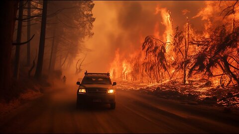
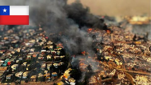
Chile now! Chile's State of Emergency: Battle Against Wildfires Devastating Central Regions
In Chile, a state of emergency has been declared in response to the battle against wildfires spreading across the central regions of the country. At least 19 people have become victims of this calamity.
The Minister of the Interior, Carolina Toha, presented an overview of the fires that have impacted the country. Monitoring data reveals that there are currently 92 active fires in the country, with 40 of them under control. The minister also noted that on the same date in the previous year, 2023, the area affected by fires was 360 thousand hectares, while this year it has already reached 440 thousand hectares.
President Gabriel Borich stated that all efforts are focused on extinguishing the fires. A particular priority in firefighting is given to the Valparaiso region due to its proximity to urban areas. Since the ignition on Friday, thousands of hectares of forest have been destroyed by fire, with two fires, "Complejo Las Tablas" in the Viña-del-Mar commune and "Lo Moscoso" in the Quilpue commune, causing the greatest concern.
According to CONAF, the National Forestry Corporation of Chile, which classified the fires as "extreme," approximately 7,000 hectares have already burned in Valparaiso alone.
Coastal areas are engulfed in thick smoke, prompting local residents to evacuate their homes. Authorities have closed the road between Valparaiso and Santiago due to the dense smoke, reducing visibility. From 8:00 to 12:00 this Saturday, curfews were imposed in the communes of Viña-del-Mar, Quilpue, Villa Alemana, and Limache due to the fires. Corridors dedicated solely to the work of security services and evacuation have been established in these areas.
Social media is flooded with images of blazing mountains, captured by drivers facing flames on Highway 68, the main route leading to the beaches of the Pacific coast. The rapid spread of the fire has been facilitated by strong winds reaching speeds of 31 mph, carrying burning tree fragments and creating new fire outbreaks.
Valparaiso's representative, Sofia Gonzalez, confirmed that at least a thousand homes have already been affected by the fires. The heatwave sweeping through Chile, leading to powerful fires, also threatens to affect Argentina, Paraguay, and Brazil in the coming days.
In recent years, wildfires have acquired highly dangerous characteristics, often accompanied by hurricane-force winds, rapidly spreading across vast areas. The fires are fueled not only by extreme heat and drought, occurring more frequently, causing vegetation to dry out and become ideal fuel for the fires, but also by their nearly impossible extinguishing, as highlighted in a segment of the international forum "Global Crisis. The Responsibility."
354
views
1
comment

Australia NOW! Apocalyptic Storms Hit Victoria: Chaos, Destruction, and a State in Shock
On Tuesday, February 13, 2024, wild storms hit the state of Victoria in Australia, bringing heavy rains, flooding, and hurricane-force winds. This led to a sharp drop in temperature: after reaching a maximum of 41 degrees, it quickly plummeted to 26 degrees within minutes.
Emergency Commissioner Rick Nugent reported a fatality in Gippsland where a man was killed after being struck by a roof torn off a shed by the wind while he was transporting livestock on a quad bike. "These storms were the most destructive in years," said Newgent. He mentioned wind gust speeds reaching 157 km/h (98 mph) and highlighted the eastern suburbs of Melbourne up to the Mornington Peninsula and east to Bairnsdale as the hardest-hit areas.
Numerous schools and childcare centers closed on Wednesday due to the weather. Many trains in the capital were also halted. Media reports and social media images showed roofs ripped off and trees uprooted by the wind.
The State Emergency Service received 4600 requests for assistance from Tuesday 9:00 am to Wednesday 10:30 am, all related to the hurricane. The Department of Energy, Environment, and Climate Change reported the collapse of six power line poles and the toppling of an entire power station in Gippsland due to the storms.
"This was one of the largest power outages in the state's history," said Victoria's Energy Minister Lily D'Ambrosio. 530,000 homes and businesses in the state were left without electricity.
The coastal town of Corinella in Bass was completely powerless, and telecommunication services there were severely limited. Local resident Paul Tapscott shared his experience of isolation due to the lack of electricity, having to heat water on a barbecue to make tea for himself and his neighbor.
By the evening of the following day, February 14, over 250,000 electricity customers were still disconnected, with nearly 5000 unable to make or receive calls on landlines. Winds and lightning during the storms also sparked forest fires.
In a 12-hour period on Tuesday, the state experienced 544,000 lightning strikes within a 600 km radius of Melbourne. The Grampians region suffered the most damage, with reports indicating around 20 homes lost.
Premier Jacinta Allan remarked on the impacts of climate change on Victoria's energy and transportation networks. She stated, "Yesterday, the first occurrence was in the western part of the state, and the damage from the hurricane occurred across the state. There is no doubt that we are witnessing not only a shift in the timing of these extreme weather events but also their severity."
Emma Germano, President of the Victorian Farmers Federation, criticized the government for its "complete lack of planning" ahead of the catastrophic weather. She stated, "The impact on our industry and regional communities is immense and once again have been left to pick up the pieces."
Unfortunately, it is becoming evident in practice that climate disasters have reached such scale and frequency that no single country will soon be able to cope with their consequences alone. At the "Global Crisis. The Responsibility" forum, specialists presented a solution to prevent the development of this catastrophic scenario. It is vital for everyone to hear this message!
64
views

Türkiye NOW! Catastrophic Floods Paralyze City as Infrastructure Buckles
Heavy downpours resulted in widespread flooding in the Mediterranean province of Antalya, Turkey on February 12, 2024.
According to the data from the 4th Regional Meteorology Directorate, Konaklı received 129 mm of precipitation in a day, Muratpaşa nearly 234 mm, and Kepez almost 305 mm. The average precipitation for February for the entire month is only 112.7 mm.
Residents and visitors of Antalya faced an unexpected turn of events as the city's infrastructure couldn't cope with such a volume of rain.
Streets were flooded, and many residents found themselves in difficult situations. Videos of submerged cars and roads turning into raging rivers are circulating on social media, reflecting the severity of the situation.
In the city center, water accumulated in several underground passages, disrupting transportation.
Amidst the chaos, a tragedy occurred: a lifeless body was discovered in a submerged vehicle in one of the underground passages.
Apartments on the lower floors of some residential complexes in the Günışığı district were also flooded. One resident, whose house was flooded, mentioned that there was about a meter of water inside his home. Those trapped in their homes were evacuated by rescuers using boats.
The Antalya governorate issued an "orange warning," signaling severe weather conditions, prompting authorities to suspend classes in schools and close kindergartens in five central districts.
Courier services are also suspended in these areas. Many people stranded at work and in vehicles due to the rain have been evacuated. Work in the region continues.
As the ocean temperature rises, evaporation intensifies, leading to increased atmospheric moisture. As a result, precipitation becomes very intense and falls within a short period, as seen in Antalya. The cities' infrastructure is no longer able to handle such downpours. Water supply systems and storm drainage fail, leading people to become trapped in water on the city streets, and underground passages and basements become life-threatening.
Such unpredictable floods are becoming more common. The world is gradually descending into climate chaos, which will significantly escalate by the end of 2024 as the planet enters a cycle of climate catastrophes. This will result in increased volcanic activity, floods, fires, droughts, storms, and other natural disasters. For more details on the cycle of climate catastrophes and what to be prepared for, you can see here.
21
views

UAE NOW! UAE Weather Alert: Devastating Floods and Hailstorms Hit the Emirates!
Early in the morning on February 12, heavy rains accompanied by thunder and lightning hit the United Arab Emirates. Intense showers occurred in Abu Dhabi, Dubai, Ras Al Khaimah, and Fujairah.
A country whose infrastructure is designed to combat sandstorms faced an unprecedented challenge due to the floods. Dubai authorities issued an emergency alert to mobile phones shortly after 6 am, warning of "weather fluctuations" throughout the emirate. They urged the public to stay away from beaches, "avoid valleys," and exercise caution while driving.
Government educational institutions and establishments switched to remote work. Dubai's private schools, nurseries, and universities were urged to follow suit, and private sector companies were advised to apply "flexible working models" for employees.
Heavy rains caused flooding and blocked streets in some areas of Dubai. Vehicles got stuck in standing water as drainage systems couldn't cope with the downpour. The Dubai Roads and Transport Authority offered alternative routes to bypass waterlogged roads leading to Dubai International Airport.
Sharjah Police reported the closure of the ring road in the city of Kalba due to flooding caused by heavy rain. Officials at Sharjah International Airport urged passengers to arrive at least three hours before departure and check the status of their flights before heading to the airport.
The meteorological bureau posted a series of videos on social media depicting the severe weather, including thunder, lightning, and a hailstorm in the Northern Emirates.
In the city of Al Ain (in the Emirate of Abu Dhabi), unprecedentedly large and intense hail fell amid a sharp drop in temperature. Residents considered this event historical as the scorching sands were covered with a layer of hail. Many cars were flooded due to the flooding.
Hail and flooding in the desert are not the first signs of events that are making waves on the internet. On the international online forum "Global Crisis. Responsibility," information was presented about the true causes of climate change on the planet, as well as a model of events for the next 7 years. You can familiarize yourself with the information in full here!
138
views

First EVER Wisconsin tornadoes in February: It’s an absolute shock
Guess what happened in Wisconsin on February 8th? For the first time EVER in February, two tornadoes decided to visit! That's right, tornadoes in the cold month of February, which is pretty unusual. And you won't believe it, but it was super warm that day, hitting a record 59 degrees Fahrenheit. It felt more like spring than winter!
The first tornado, which we'll call Tornado Number One, was pretty strong, with winds whipping up to 110 miles per hour. It danced around near Albany for about 14 minutes. But then, Tornado Number Two showed up and said, "Hold my water vapor!" It was even stronger, with winds at 135 miles per hour, and it traveled across the land for 36 minutes, covering a whopping 24.5 miles!
These tornadoes were so powerful they ripped roofs off houses, knocked down power lines, and even flipped tractors. Imagine seeing a tractor flying through the air! Debris was scattered everywhere, making it look like a giant had a tantrum.
Despite all this chaos, everyone was super brave and smart. They listened to the tornado warnings and found safe spots, which is why, thankfully, no one was seriously hurt. Just a few scratches and one person had a bit of an adventure in their car during the tornado.
The experts say this is all pretty strange for Wisconsin, especially in February. It's a big reminder that our planet's weather is full of surprises, and we need to be ready for anything, any time of the year.
So, what do you think made these tornadoes pop up in winter? Some say it's because of changes in our climate, which might mean we see more surprises like this in the future. Stay tuned, stay safe, and remember, when it comes to weather, always expect the unexpected!
Let's chat in the comments about your thoughts on these wintery tornadoes and how we can all stay prepared for wild weather! Don't forget to like and subscribe for more amazing weather stories and science facts! See you in the next video!
12
views

Philippines NOW! Devastation in Mako: Philippines Landslide Tragedy Unfolds
On February 6, 2024, around 19:40 local time in the municipality of Mako, Davao de Oro province in the Philippines, a massive landslide occurred. A part of the slope collapsed, covering two buses and several houses.
The incident happened near a mining facility that operates 24/7 in three shifts. Among the affected were several workers returning home on the two buses.
According to the National Disaster Risk Reduction and Management Council, the cause of the tragedy was heavy rains in the Mindanao region for several days.
In the three districts of the Mako municipality affected by the landslide, 430 families or approximately 1590 people resided. The affected individuals were relocated to five evacuation centers. 62 households were reported as completely destroyed.
The search for the affected has been ongoing for the third day, but is complicated by the extensive area covered by tons of soil and rocks.
By Friday, February 9, the death toll from the landslide reached 27 people, with 89 still missing.
In an updated statement, the municipal government of Mako reported that 32 people were rescued from the debris. Rescuers found a young girl after losing hope of finding survivors, and the rescue of a child on Friday, almost 60 hours into the search, was called a "miracle."
The global climate situation is rapidly deteriorating, and by the end of 2024, it will become catastrophic. These negative changes are associated with cyclic processes on the planet occurring once every 12,000 years. The year 2024 marks the beginning of such a cycle for Earth and the entire Solar System.
To learn more about what will happen to the planet in the coming years and what countries will be the first to suffer from climate change, see Global Crisis.
25
views
1
comment

Wisconsin NOW! Extraordinary February Tornado Outbreak - Unprecedented Weather Events
The US National Weather Service has confirmed that two tornadoes hit Wisconsin on February 8th. These were the first tornadoes ever recorded in Wisconsin during the typically cold month of February. On that day, the temperature reached a record-breaking 59 degrees Fahrenheit (15 degrees Celsius), creating an ideal scenario for severe weather usually observed in late spring and summer.
The first tornado was classified as an EF1 and struck near Albany with a maximum wind speed of 110 miles per hour and was on the ground for 14 minutes.
The second, more powerful tornado, was classified as a high-end EF2 and passed east of Evansville with a maximum speed of 135 miles per hour. It remained on the ground for 36 minutes, covering a distance of 24.5 miles. Meteorologists warn that, after further analysis and consultations with experts, it may be upgraded to an EF3.
The tornadoes tore roofs off homes and barns, toppled power lines and trees, and overturned tractors and other agricultural equipment in the fields. Twisted metal sheets, pieces of lumber, and other debris were scattered across farms and roads. Several roads in the area remained closed on Friday.
Reports from the Rock County Sheriff's Office indicate serious damage to 20 homes. Miraculously, despite the destruction, no one was seriously injured. However, a few people suffered minor injuries, and one person was hospitalized after being in a car during the tornado.
Most citizens apparently heeded tornado warnings when they were issued, taking shelter in time. As the storm moved east of Evansville, the weather service issued a warning for a "significant" tornado, the second-highest of three severity levels, as meteorologists observed debris rising to heights of up to 15 feet.
Authorities urge the public to avoid the affected areas while rescue teams and utility services restore order.
During the Friday press conference, Tim Halbach, the Warning Coordination Meteorologist at the National Weather Service, confirmed that tornadoes in February are abnormal. "For the first time, we got any tornado warnings for our office in February, let alone the first tornado in the state," said Halbach. He emphasized the importance of listening to sirens and tornado warnings year-round, reminding that climate change can lead to unexpected events requiring active attention and preparedness.
Tornadoes are most common in Wisconsin during the summer months from May to August. According to meteorological records from 1948 to 2024, fewer than a dozen tornadoes were recorded from November to February. And in February, a tornado had never happened in the state before.
The concept of a tornado season is practically disappearing in the US. Not only is the number of tornadoes increasing, but their characteristics are becoming more anomalous, with longer and wider destructive paths. Tornadoes are now appearing in places where they were previously rare.
This trend is not limited to the US but is occurring worldwide, including countries such as Poland, Ukraine, the Czech Republic, India, and others.
The reasons behind these significant climate shifts globally, the destructive force of tornadoes, and their connection to the Earth's core are essential questions. What should we prepare for in the next five years? Clear and comprehensive answers can be found here.
168
views

Iceland's Volcanic Emergency: Evacuations and Looming Danger as Lava Threatens Power Station
In Iceland, on the Reykjanes Peninsula, a volcano erupted on the morning of February 8. The volcano spewed lava up to 262.5 feet high from a fissure. This is the second eruption this year and the third since December of the previous year.
The events unfolded rapidly: seismic activity began in the area at 5:30 a.m., with strong earthquakes, and the eruption occurred within 30 minutes.
"Flames and smoke plumes from the 1.86 miles-long fissure can be seen from Reykjavik," writes the Swedish national radio station SVT, quoting Benedikt Ofeigsson, a geophysicist from the Icelandic Meteorological Agency.
The lava flow affected the geothermal pipelines south of the capital Reykjavik, disrupting the hot water supply for more than 20,000 people. The Civil Protection Agency raised the alert level to an emergency. The agency also urged households and businesses to conserve electricity. According to experts, restoring hot water supply through an emergency pipeline may take several days.
The Blue Lagoon, one of Iceland's most popular tourist attractions, has also been evacuated.
Volcanic eruptions on the Reykjanes Peninsula involve fissure eruptions that typically do not entail major explosions and ash dispersal into the stratosphere. However, such eruptions can last for years.
Therefore, Icelandic authorities have initiated the construction of dams to divert lava flows from residential areas and critical infrastructure. The lava flow is already within 0.6 miles of the Svartsengi geothermal power station. Workers are trying to fill small gaps in the dam along the road to prevent the lava from reaching the power station.
The eruption occurred near Grindavik, a fishing town that was severely affected by the previous volcano eruption starting on January 14 of this year, lasting for two days. Almost 4,000 residents were evacuated from the town. Lava flows damaged the city's infrastructure and destroyed several houses.
Authorities warn that eruptions will continue, as the land in this area continues to rise due to the accumulation of magma underground. According to the Icelandic Meteorological Office, around nine million cubic meters of magma have accumulated beneath the crater since the eruption in January.
This is the sixth volcano eruption on the Reykjanes Peninsula since 2021, but before that, the peninsula had not erupted for 800 years.
Iceland is a country of active volcanoes, and locals are accustomed to earthquakes and volcanic eruptions. However, what is happening now is unprecedented in human history.
The planet has entered a period where active mobile hot magma is rising from the depths to the Earth's surface.
On the Earth's surface, magma activity primarily manifests as a change in the eruption patterns of volcanoes, and this is only the preparatory stage.
Volcanologists note changes in various parameters during volcanic eruptions, particularly the chemical composition of lava, indicating a deeper origin of the magma. Deep magma, being hotter and more gas-saturated, becomes more aggressive toward the Earth's crust.
Now, magma has enough energy to rise from the deep layers and directly reach the surface.
During the eruption of the Fagradalsfjall volcano in Iceland in March 2021, the chemical composition of its lava changed more than a thousand times faster than usual. This indicates a new era of volcanic activity in Iceland.
The most significant danger in the coming years, not only for Iceland but for the entire world, is volcanic eruptions and supervolcanoes.
To understand what makes magma so active and how this process can be stopped, see the forum "Global Crisis. The Responsibility."
66
views

Powerful storm AGAIN slams San Diego with rain, snow, thunderstorms
In January and February of 2024, an unprecedented weather event unfolded in sunny San Diego, California, which left the city grappling with the aftermath of heavy rains and severe flooding. Join us as we delve deeper into the details of this extraordinary event, its impact on the community, and the pressing issue of climate change.
The National Weather Service reported that January 22nd marked a historic moment in San Diego's weather records. A staggering 2.75 inches of rainfall was recorded in just one day, far exceeding the usual January average of slightly over 2 inches for the entire month. It was, without a doubt, the rainiest January day ever recorded in the city.
The surprising aspect of this event was that San Diego is not known for its winter storms. In fact, it's relatively dry compared to other parts of the United States. While rain was expected, the scale and intensity of this downpour caught everyone off guard. Meteorologists had predicted rain, but they couldn't foresee the sheer impact of this winter storm.
The consequences were immediate. A state of emergency was declared in the city, as residents struggled to cope with the rapidly rising floodwaters. The visuals from social media were both astonishing and heartbreaking, as water streams turned into raging rivers and cars were swept away on roads that had become treacherous waterways. It was a challenging time for the community, particularly for those in the Southcrest area, where firefighters had to perform daring rescues as the water flooded residential complexes. Even homeless shelters were not spared, forcing city services to relocate affected individuals to state sports halls.
PowerOutage.us reported that around 14,500 households in San Diego were without gas and electricity. Approximately 100 houses were damaged, leaving many residents in dire situations. To provide immediate relief, a middle school was transformed into a temporary shelter for those affected.
In Coronado, a picturesque resort city across the bay from San Diego, 22,000 residents received an unusual request on Monday evening: to limit their water usage for household needs. The local sewage system had become overloaded due to the excessive rainfall and required a full 24 hours to recover.
During a press conference held by Mayor Todd Gloria, the gravity of the situation became even more apparent. Mayor Gloria had recently returned from a conference of U.S. mayors in Washington, where participants unanimously agreed that extreme weather events, driven by climate change, have become the new norm. He emphasized, 'We are used to snow, but not to such a quantity of snow. We are used to rain, but not to such a quantity of rain.' These unusual weather conditions truly exceed ordinary human experience.
This catastrophic event serves as a stark reminder that the climate is changing, and this is an undeniable fact. The old forecasting models, designed for a different era, no longer seem sufficient to predict and prepare for these increasingly extreme weather events. The measures taken to combat the climate crisis, while essential, don't seem to be yielding the desired results. This raises a critical question: does humanity truly understand the underlying reasons behind these escalating climate catastrophes?
To explore this question further and gain insight into how we can safeguard humanity from impending large-scale crises, we invite you to watch the international forum titled 'Global Crisis. Responsibility.' This forum brings together experts and thought leaders to delve into the complex issues surrounding climate change and our collective responsibility.
In conclusion, the events that unfolded in San Diego on January 22nd serve as a poignant reminder of the urgent need to address climate change. The impact of extreme weather events, like the one witnessed in San Diego, extends far beyond the immediate damage. It affects communities, livelihoods, and the very future of our planet. As Mayor Todd Gloria stated, 'No matter which part of the country you're a mayor from, you see people going through exactly the same experience.' It's a shared challenge that calls for collective action and a renewed commitment to understanding and mitigating the effects of climate change.
713
views

Chaos and floods. Tropical Cyclone Belal Hits French Island of Reunion
On December 15 and 16, 2024, a huge storm named Tropical Cyclone Belal hit two islands in the Indian Ocean: Reunion and Mauritius.
First, let’s talk about Reunion. This island is home to about 860,000 people. As the storm came close, everyone was told to stay in their homes for safety. The weather was so bad that even the police and rescue teams had to stay inside. The storm was really strong, but thankfully, the middle part of the storm didn’t hit the island directly. Still, many people didn’t have electricity or water at home.
Next, the storm moved to Mauritius. People there had to stay inside from Monday evening until Tuesday noon. Airports and many places like government offices and stores were closed. The storm brought a lot of rain and caused a lot of damage. Roads in the capital city, Port Louis, were flooded, and some cars were even washed away. One person said their car was carried by the water for a long way, and they had never seen anything like it.
Sadly, two people died because of the storm, and about 100,000 people were affected. More than 1,000 people had to leave their homes.
Did you know that tropical cyclones happen more often from January to March in the southern part of the world? It’s because it’s summer there, and the ocean water is really warm. Warm water makes these storms stronger. Scientists have noticed that the oceans are getting warmer, and this makes more and bigger storms. They found out that hot liquid rock from deep inside the Earth is making the ocean water warm.
Why is this happening? What will happen next? Are we ready for more storms like this? You can learn more about this from the “Global Crisis. Responsibility” forum. Let’s watch a part of the forum now.
11
views

Norway's worst storm in 30 years with 155mph gusts leaves trail of devastating destruction
On January 31, 2024, a super strong storm named Ingunn hit Central and Northern Norway really hard. This wasn't just any storm; it was the biggest one in 30 years! People called it a "weather bomb" because it got super strong super fast, with the pressure inside the storm dropping a whole bunch in just one day.
Before hitting Norway, Ingunn swung by the Faroe Islands with winds howling at 155 miles per hour—that's insanely fast!
In Norway, things got so serious that the police used a special system to warn everyone, something they hardly ever do. Nordland County was put on the highest alert with a red warning, telling people to hunker down and get ready for possibly losing power for a while.
In Bodø, the wind was so wild it blew out windows high up in a hotel! The police had to close down the city center to keep everyone safe.
Sømna saw winds nearly as strong as a hurricane, and another place had winds as powerful as a big tropical hurricane. Imagine that!
Over in Trøndelag County, 13,000 homes lost electricity. Even firefighters had to wait to help out because it was too dangerous with stuff flying everywhere.
A bus with 14 people got blown right off the road because of the wind, and planes and ferries had to cancel their trips. Schools shut down in some places too.
And just when you thought it couldn't get crazier, this storm hit just days after another big storm had already caused a lot of trouble in the same areas.
Ingunn (another way people spelled the storm's name) didn't stop in Norway; it also went over to the United Kingdom with super strong winds, leading to warnings about tornadoes in Scotland. Trains got canceled, ferries stopped running, and even some big tourist spots had to close down.
The storm even brought record winds to Sweden, making it a storm to remember across the Atlantic.
With storms like Ingunn getting more common and more intense, it's a big reminder that our planet is facing some serious weather changes. These storms can be really dangerous and cause a lot of damage. It makes you wonder, what's going on with our world? How can we keep ourselves and the people we care about safe when nature goes wild?
If these questions trouble you seek your answers at Global Crisis Responsibility.
16
views

Ultimate USA Tornado Compilation 2023 - 2024 Tornadoes
In 2023, the United States had more tornadoes than usual. Usually, from 1991 to 2020, there were about 1197 tornadoes a year. But in 2023, there were even more, and some from October to December still need to be counted.
These tornadoes were not just more in number. They were also stronger and caused more damage. They had longer and wider paths of destruction. Usually, tornadoes happen mostly from April to October. But in 2023, many tornadoes happened even outside this time. For example, in January alone, there were 128 tornadoes, which is a lot more than the usual 35.
On January 12, big storms and tornadoes hit the Midwest and Southeast. The National Weather Service said there were 69 tornadoes, including two really strong ones (EF-3). One of these traveled 76 miles in Alabama and caused seven deaths and many injuries in just one county. Another strong tornado hit Selma and caused a lot of damage. A third one went through Griffin, Georgia, destroying things like buildings and power lines.
In March, there were 206 tornadoes, much more than the usual 80. Now, tornadoes are happening more in the east of the U.S., in states like Iowa, Illinois, Arkansas, and the Southeast. Before, they were more common in Texas, Oklahoma, Kansas, and Nebraska.
On March 22, a strong tornado (EF-1) hit Montebello in Los Angeles, the strongest there since 1983. March was a dangerous month. There were many tornadoes that killed at least 47 people, which is more than all the tornado deaths in 2022. The worst was on March 24 in Mississippi, where a really strong tornado (EF-4) killed 16 people. Another big tornado hit the Alabama-Georgia border, killing at least 21 people.
The biggest tornado outbreak of 2023 was on March 31. Over 160 tornadoes hit many states. The strongest one hit Keota, Iowa (EF-4), causing a lot of damage in Little Rock, Arkansas. More than 20 people died and over 200 were hurt.
On April 1, 13 tornadoes hit areas in New Jersey, Delaware, Pennsylvania, and Maryland. The strongest was an EF-3 in Delaware, and it was very damaging. New Jersey had its largest tornado outbreak since 1950.
June had 234 tornadoes, the most in any month of 2023. Over 70 tornadoes hit in mid-June, causing damage in states like Oklahoma, Texas, Mississippi, Georgia, Florida, Arkansas, and Ohio. A tornado in Texas killed four people, the most in a month since December 2015. More tornadoes at the end of June caused deaths and damage in states like Wyoming, Colorado, Minnesota, Indiana, Kentucky, and Arkansas.
In August, there were 123 tornadoes, more than the usual 83. An outbreak from August 5-8 caused damage in many states. A strong tornado (EF-3) in New York was the strongest there since 1950. Another tornado in Michigan on August 24-25 killed five people.
Overall, the number and strength of tornadoes are increasing. This is worrying because it means more destruction and danger. A forum called “Global Crisis. The Responsibility” said this is because of a big change in the Earth’s climate. They think tornadoes will keep happening in new places and all year round. They talked about ways to deal with this problem.
189
views
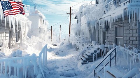
'Pandemic of snow' in Alaska. Anchorage sees historic 100 inches of snow.
Imagine this: In just three days, from January 28th to 30th, Anchorage, Alaska, was buried under 16 inches of snow! That's a lot of snow, but guess what? This winter, they've already had over 100 inches of snow. Even for Alaska, that's a ton of snow! It's only the second time ever that Anchorage has seen this much snow two years in a row. And it's the first time so much snow has piled up by the end of January.
People in Anchorage are used to cold and snow, but this is something else. They're working super hard to clear snow from roads and sidewalks. Schools are even having classes online because it's just too snowy to go outside. The snow is so heavy that it made the roofs of three big buildings collapse!
The city's leaders are telling everyone to clear the snow off their roofs because it's getting really heavy. Imagine 45,000 pounds of snow sitting on a house - that's like having eight big pickup trucks on your roof!
But Anchorage isn't alone. Other places in Alaska are getting buried in snow too. In Juneau, they got 69.5 inches of snow this month. And in Fairbanks, it got colder than -50°F!
Some people think it's too cold for snow to fall when it gets really cold, but that's not true. In Anchorage, it snowed over an inch when it was only 2°F. The last time that happened was way back in 1916!
Why does it snow even when it's super cold? Snow needs two things: cold air and moisture. The oceans are getting warmer and putting more moisture into the air. This means more rain, snow, and hail. The big question is, why are the oceans getting warmer? This is something everyone needs to think about because it affects our planet and our future. If you are ready for an answer see Global Crisis Responsibility.
34
views

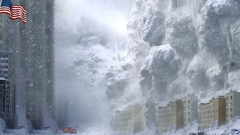
Canada NOW! Snowpocalypse: Canada's Epic Storm Shuts Down Cities and Sparks Survival Mode
Part of Canada is paralyzed by a "historic" snowstorm. Authorities had to seek help from the military.
Blocked houses, cars buried in snow... Images and videos posted on social media are impressive and shocking. This Monday, February 5, a part of Canada was paralyzed by an unprecedented snowstorm, according to experts, it's a "historic" storm.
A massive amount of snow fell in Nova Scotia. In Cape Breton, the snowfall was one of the strongest in the last 20 years, with some parts of the region receiving up to 2.62 feet of snow. As a result, the regional municipality declared a state of emergency. Residents were instructed to take shelter in their homes and clear snow from entrances, walkways, and driveways to facilitate access to homes.
Over 2.95 feet of snow fell at Sydney Airport, and in downtown Sydney, it was 4,92 feet of snow.
As of Sunday morning, more than 4,400 Nova Scotia Power customers were without electricity. This is likely to fluctuate throughout the storm.
Canada Post issued warnings to delivery services. Prince Edward Island and Nova Scotia are under a red alert, meaning that deliveries for the day are suspended. New Brunswick has a yellow alert, indicating potential delays in postal service. Due to the snowstorm, many schools, universities, and government offices were closed.
Many flights at Halifax International Airport were delayed or canceled, and city public transportation was suspended. "With such a large amount of heavy and sticky snow that we received, snow removal is difficult and will take time," warned Nova Scotia Premier Tim Houston.
Local residents shared their experiences of the snow collapse in the region. A 72-year-old man said he had seen a lot of snow in his time but nothing like this. He is also concerned about the snow on the roof of his house, part of which fell this weekend. Marilyn Exworth said that about a meter of snow had accumulated at her front door, and she felt trapped. "I felt like I was suffocating in the house, as if I had no way out."
In Michael Ladlow's house in Brotone, Cape Breton, the roof of one of his barns collapsed due to a huge amount of snow. According to his estimates, there were two meters of snow on the steel roof.
When windows began to break from the pressure of the snow, residents of the apartments joined forces, clearing the areas on the ground floors and boarding up the broken windows with plywood.
Buddy Singh was in his apartment in Sydney, North Carolina, early Sunday morning when he heard the windows in his apartment begin to break.
Due to the snow accumulated outside his ground-floor apartment and snow falling from the building's roof, the pressure on the windows in his apartment was so strong that they began to crack.
Singh said the snow almost reached the apartments on the second floor of his building. He gathered about a dozen residents of Rotary Drive building, and they went outside to clear the snow in front of other ground-floor apartments to prevent window breakage.
"Just all the people who lived there helped each other out, as in Cape Breton," he said.
This is just a small example proving that only by uniting can people cope with the consequences of climate catastrophes, which are already gaining momentum but will reach maximum destructive levels by the end of 2024! If all people on the planet unite and direct all scientific and financial potential to solve climate problems, humanity can overcome the climate threat. Moreover, the implementation of the solution to this problem should be under direct public control; people can participate in the process using their gadgets, as such a control method will eliminate many problems—corruption, abuse of power, irresponsibility, and many other negative manifestations of the modern form of societal governance.
The full report on climate change and what actually influences the climate of our planet can be found here, as well as the answer to the most crucial question: What to do?
49
views

California's Climate Crisis: Battling the Wrath of Atmospheric Rivers
An intense and prolonged atmospheric river is moving through California, causing snowstorms, torrential rains, dangerous floods, and landslides. At least two people have already died as a result of the storm.
This powerful type of atmospheric river, known as the Pineapple Express, is a long and narrow band of moisture that carries saturated air for thousands of miles before releasing it, resembling a fire hose. According to the National Oceanic and Atmospheric Administration, it carries a concentration of moisture from the Pacific Ocean near the Hawaiian Islands and unleashes it on the western coast of the United States and Canada in the form of heavy rain and snow.
The atmospheric river that hit California this week followed another recent storm that inundated much of the state, including Los Angeles, with record-breaking precipitation. Residents in the western and central parts of Los Angeles County received emergency flood warnings on their phones on Sunday evening, covering more than 2.5 million people. Later that day, all lanes of Interstate 5 were flooded in San Fernando in Los Angeles County.
Nearly a foot of rain fell in Bel Air, flooding the upscale Bel Air neighborhood in Los Angeles, with over 11 inches of precipitation recorded since noon on Sunday, February 4.
Los Angeles experienced a historic downpour, with an incredible amount of rain – 6.65 inches – falling in the downtown area over two days. This is significantly more than the average February rainfall of 3.64 inches in Los Angeles.
According to the fire department, two homes in the Studio City area were damaged, and another nine were evacuated due to mudslides in that area. In the Encino area, three homes were affected by mudslides, and several people were evacuated, as reported by the department. Heavy downpours triggered over 120 landslides, damaging around 25 structures.
Due to strong winds and rain, nearly 300,000 customers in California, especially along the coast, were left without power, according to PowerOutage.us. Most outages occurred in the northern half of the state, where wind gusts reached 100 miles per hour in the last day.
Los Angeles Mayor Karen Bass signed a local state of emergency declaration on Monday. At a press conference on Monday, the mayor addressed the city's residents: "We ask that when you are notified to evacuate, please do so to avoid the need for rescue."
Evacuation warnings were issued in low-lying and flood-prone areas in San Diego.
All schools in Malibu were closed on Monday, February 5. Due to road closures, some staff could not reach the schools. Severe weather also led to class cancellations in Santa Barbara.
The storm disrupted flight schedules at several major airports in California. Since Sunday, more than 1,000 flights to and from Los Angeles International Airport were delayed, with over 200 cancellations and more than 800 delays reported at San Francisco International Airport during the same period. Airports in San Diego, Oakland, and Sacramento also experienced disruptions.
According to the Las Vegas Police Department, the same storm system triggered avalanches in the Lee Canyon and Charleston Mountain areas, northwest of Las Vegas. About a foot of snow fell in Lee Canyon in 24 hours. After the incident, several people were reported missing but were later found.
Scientists attribute the record-breaking amount of precipitation and the destructive force of the storm hitting California to the escalating climate crisis and El Niño. However, little is said about the main cause of catastrophic climate changes in our time.
What causes serious catastrophes worldwide, why the climate has gone haywire, and how it is all connected to the Earth's core are questions that can be fully explored here.
150
views
Chile wildfires: Hundreds missing as thousands of homes on fire
Chile is facing a huge crisis with wildfires tearing through its central areas, and it's gotten so bad that the government had to declare a state of emergency. Sadly, 19 people have lost their lives because of these fires.
The Interior Minister, Carolina Toha, shared some scary numbers: right now, there are 92 fires burning across Chile. They've managed to get a handle on 40 of them, but think about this—last year, fires had burned up 360 thousand hectares of land by this time, and this year, it's already up to 440 thousand hectares. That's a lot of land!
President Gabriel Borich has said they're putting everything they've got into fighting these fires, especially around Valparaiso, because it's so close to where people live. Two big fires are causing a lot of worries. One is called "Complejo Las Tablas" in the Viña-del-Mar area, and the other is "Lo Moscoso" in Quilpue. Together, they've already burned through thousands of hectares of forest.
The smoke from these fires is so thick it's covering coastal areas, forcing people to leave their homes. They even had to close the main road between Valparaiso and Santiago and set a curfew in some places to keep roads clear for emergency workers and evacuations.
People driving to the Pacific coast beaches saw mountains on fire right from the highway. The fire is spreading super fast, helped along by strong winds that carry bits of burning trees to start new fires.
At least a thousand homes have been hit by the fires. And it's not just Chile that's feeling the heat; the same conditions are threatening to spread to Argentina, Paraguay, and Brazil.
Wildfires nowadays are becoming more intense and harder to control. They're fueled by extreme heat, droughts, and winds that make them spread faster and further. This is making it really tough to put them out, and it's a big topic at international forums Global Crisis Responsibility where people are talking about what's happening to our planet.
816
views
5
comments