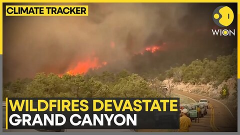
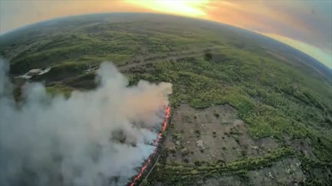
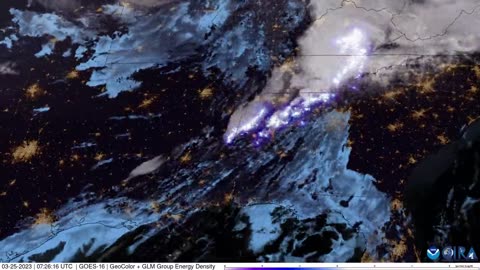
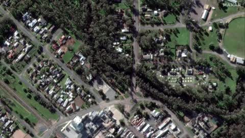
2 years agoQuebec, Canada Fires | Why Does June 2nd 2023 Satellite Imagery from College of DuPage Meteorology Department Show Dozens of Fires in Quebec Starting Up at Almost the Exact Same Time?Thrivetime Show: The ReAwakening versus The Great ResetVerified
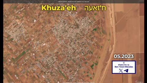
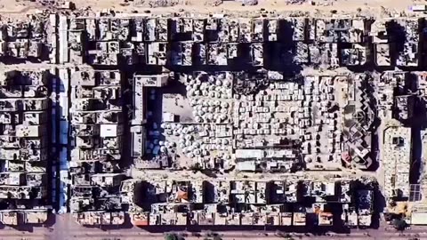
1 month ago“Satellite imagery shows the massive destruction in the town of Khuza'a, southern Gaza, after 19 months of ongoing Israeli genocide.”palmernpVerified
8 months agoAmerican Voters: Did you know Democrats have been using satellite imagery to raid American Farms?Question EverythingVerified
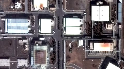
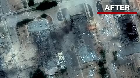
24 days agoNatanz, Iran Nuclear Facility Aftermath: Satellite Imagery Shows Israeli Strike DamageLinking Atlas
4 years agoNephilim Giant caught on satellite imagery of the Patagonian MountainsUfomania - the truth is out there
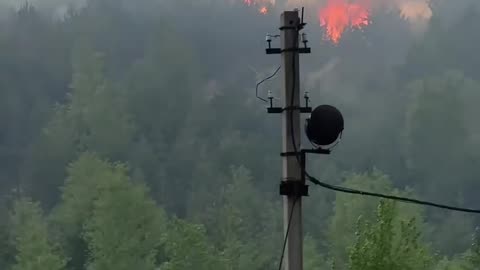
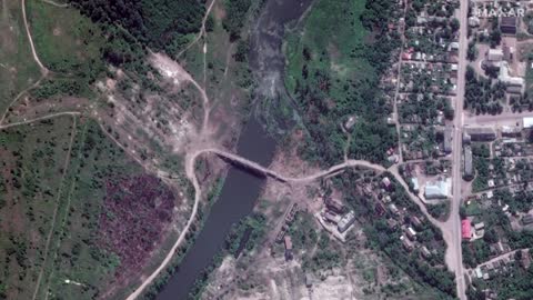
1 month ago🔥 NASA satellite imagery shows a large-scale fire burning at the site of the 304th Ammunition DepotWar in UkraineVerified
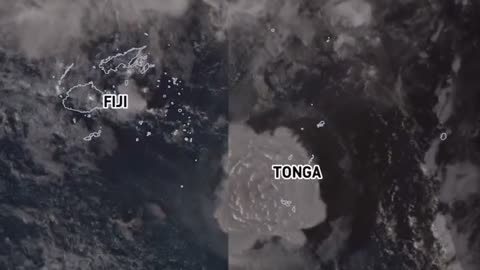
3 years agoSatellite imagery shows shockwave as Tonga's Hunga volcano erupts, causing tsunamiEarth Wind and FireVerified
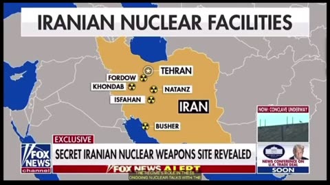
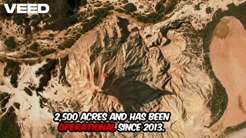
1 month agoSatellite imagery reveals a previously UNKOWN nuclear facility in Iran that spans 2500 acresGHardJoe
1 month ago🔥 NASA satellite imagery shows a large-scale fire burning at the site of the 304th Ammunition DepotWar in UkraineVerified
2 years agoSatellite imagery reveals damage by Sudanese military factions at airports and government buildingsJTN2020Verified
24 days agoGaza Before & After: Satellite Imagery Reveals Scale of Devastation & Tent Cities (2023-2024 Update)Linking Atlas
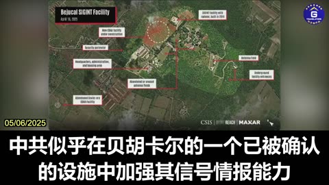
2 months agoDr. Ryan Berg Presents New Satellite Imagery of Potential CCP Surveillance Facilities in CubaGloryMifan
24 days agoDid Iran move its Uranium? Satellite imagery reveal trucks outside Fordow before US strikeWorld News
1 year agoBREAKING! PROOF CHINA SATELLITES OVER MAUI AT FIRE STARTS! | The Prather Brief Ep. 92PATRIOT.TVVerified
25 days agoAftermath: Satellite Images Show US Bunker Buster Damage at Iran's Fordow Nuclear SiteLinking Atlas