2 years agoHow to create a persistent Login script on Python that allows a user to keep trying to login #pythonPro Geomatics
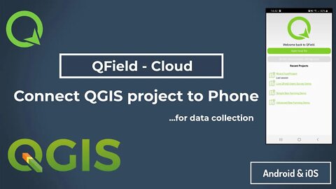
1 year agoQField Cloud for #android. Connect your QGIS project to your phone for data collection #qfield #gisPro Geomatics
2 years agoExploring data on shapefiles using attribute table. #qgis #gis #attribute #table #shapefile #dataPro Geomatics
1 year agoLevel Survey PART 1: Why we need DATUMS for level surveys #survey #landsurveying #engineeringPro Geomatics
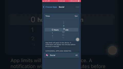
1 year agoHow to stay reduce phone distractions while #working. Make use of your #iPhone #app limitq today.Pro Geomatics
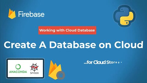
2 years agoCreate a Cloud Database on Firestore for cloud storage #firestore #database #cloudstorage #realtimePro Geomatics
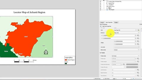
2 years agoSimple way to create locator / Inset Map on QGIS for your research site #qgis #locatormap #insetPro Geomatics
2 years agoHow to Setup QGIS environment on your PC & create a proper working directory #qgis #gis #geomaticsPro Geomatics
1 year agoLevel Survey Part 2: How to Conduct a Level Survey and Record Field Readings #engineering #surveyPro Geomatics
1 year agoLevel Survey Part 4: How to conduct a level survey - from benchmark 1-2 #engineering #surveyPro Geomatics
1 year agoLevel Survey Part 5: Rise and Fall method of reducing Level Data into Elevations/SpotheightsPro Geomatics
1 year agoLevel Survey Part 3: How to set up and read Automatic Level on site #engineering #survey #sitePro Geomatics