2 months agoTHE AMERICAN JOURNAL [3 of 3] Friday 4/18/25 • PRESTON BATES - TOMMY ROBINSON UPDATE, News, AnalysisRon Gibson Channel - Infowars PartnerVerified
2 months agoTHE AMERICAN JOURNAL [2 of 3] Friday 4/18/25 • News, Calls, Reports & Analysis • InfowarsRon Gibson Channel - Infowars PartnerVerified
2 months agoTHE AMERICAN JOURNAL [1 of 3] Friday 4/18/25 • DAILY DISPATCH - News, Reports & Analysis • InfowarsRon Gibson Channel - Infowars PartnerVerified
2 years ago20 Jumpgate Missions to Mars & Corroborating NASA Images of Martian LifeExopolitics Today with Dr. Michael SallaVerified
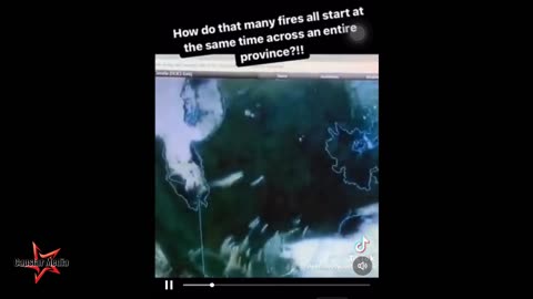
2 years agoCanadian "Wildfires" Are Not Naturally Occurring - Image Shows Simultaneous CombustionCapstar Media
1 year agoSpraying chemtrails over Sandy Hook school shooting hoax blocking evidence Through satellite imageryGlobal_communist_takeover1
2 years agoA fortunate accident and lesson learned from joining the military #shorts #militaryThe NDS Show Podcast
4 years agoGeoreferencing SBuilderX Satellite Imagery with Global Mapper | MSFS Scenery TutorialRotornut44
15 days agoPutin Boosts Russia_s Military Footprint In Africa With Arms_ Artillery _ Firstpost Africa _ N18GFirstpost
7 months ago"THE LM AGS COMPUTER/SHUTTLE O-RING FAILURE/EM ENGINES/CARTOON PHYSICS" PART 102TheApolloDetectives
7 months agoTHE APOLLO DISCUSSIONS "5,771 PHOTOS TAKEN BY 12 ASTRONAUTS? REALLY!" PART 47TheApolloDetectives
2 years ago!~*GHOST👻ALERT*~!STRANGE ALIEN CREATURE & BLACK PHANTASM NOW CAPTURED BY HI RES ANTARTICA SATELLITE!FLAMaquis
2 years agoGoogle map has updated its satellite imagery for the Ukrainian city of mariupol360infotoyou
1 year agoSatellite Footage of Harp Activating Over Texas? Film got cut short but it's still okay.Real Fishing Life
1 year agoWhat Does the Sun Look Like? NOAA Satellite Captures Full Rotation of the Sun!NASA Now Official
1 year agoI Found This Ancient HillTop Ruin Using Satellite Imagery - 4 Wheeled and Hiked To It! #FullTourOff-Grid Backcountry Adventures

![THE AMERICAN JOURNAL [3 of 3] Friday 4/18/25 • PRESTON BATES - TOMMY ROBINSON UPDATE, News, Analysis](https://1a-1791.com/video/fww1/43/s8/1/X/t/d/D/XtdDy.oq1b.2-small-THE-AMERICAN-JOURNAL-3-of-3.jpg)
![THE AMERICAN JOURNAL [2 of 3] Friday 4/18/25 • News, Calls, Reports & Analysis • Infowars](https://1a-1791.com/video/fww1/29/s8/1/b/t/c/D/btcDy.oq1b.2-small-THE-AMERICAN-JOURNAL-2-of-3.jpg)
![THE AMERICAN JOURNAL [1 of 3] Friday 4/18/25 • DAILY DISPATCH - News, Reports & Analysis • Infowars](https://1a-1791.com/video/fww1/8e/s8/1/n/L/b/D/nLbDy.oq1b.2-small-THE-AMERICAN-JOURNAL-1-of-3.jpg)