-
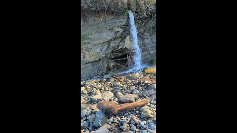
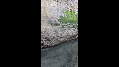
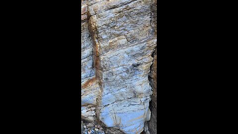
Beautiful Blues at Beverly Beach!
HumbleConservativeThese rocks appear to be a type of sedimentary rock, likely a sandstone or shale, with some interesting features. The blue-gray coloration and the layered, striated texture suggest it could be a mudstone or siltstone that has undergone some degree of alteration, possibly due to mineral content or weathering processes. The presence of yellowish-brown veins or streaks might indicate iron oxide or other mineral deposits, which are common in coastal sedimentary rocks exposed to the elements. Given the context of Beverly Beach, Oregon, this rock could be part of the geological formations found along the Oregon Coast, where sedimentary layers from ancient marine environments are often exposed. These layers can contain fossils or impressions, as the area is known for fossil hunting. The blue hue might also hint at the presence of reduced iron or other minerals, which can give rocks unusual colors when exposed to air and water over time. Without a closer analysis (like a sample test or expert fieldwork), it’s hard to be definitive, but this looks like a weathered sedimentary rock, possibly a siltstone or mudstone with mineral staining.26 views -
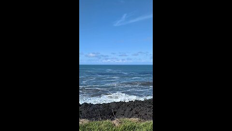
Big Blue Pacific!
HumbleConservativeMoolack Beach is a rugged, beautiful stretch of the central Oregon Coast, just south of Wade Creek Beach and about 4 miles north of Newport in Lincoln County. It’s part of the same continuous sandy shoreline as Beverly Beach to the north, but Moolack stands out with its mix of soft sand, rocky outcrops, and dramatic cliffs. It’s less touristy than spots like Cannon Beach, offering a wilder, more laid-back vibe perfect for beachcombers, rockhounds, and anyone who loves untamed coastal scenery. You can access Moolack Beach from a few points off Highway 101. The main one is a gravel pull-out near milepost 135, marked by a small “Moolack Beach” sign—room for about 10-15 cars. From there, a short, easy trail (about 0.1 miles) winds through a grassy dune area down to the sand. Another access is via Beverly Beach State Park to the north, where you can walk south along the shore for roughly a mile to reach Moolack. At low tide, the beach stretches wide, revealing tide pools and rocky patches; at high tide, it narrows, so timing matters. What sets Moolack apart is its geology. The cliffs—up to 100 feet high—are layered sandstone and siltstone, packed with fossils from millions of years ago (think clams and snails). Erosion exposes these, and winter storms often wash agates, jasper, and petrified wood onto the shore—prime hunting grounds for rock enthusiasts. The beach also has scattered sea stacks and boulders, remnants of ancient coastal erosion. To the south, you’ll spot Yaquina Head Lighthouse, a scenic backdrop about 2 miles away. It’s a great place to explore. Tide pools near the rocks host sea stars, anemones, and crabs, though they’re not as dense as at Devils Punchbowl. The sand is soft and walkable, stretching over 2 miles, with Wade Creek to the north as a loose boundary. Surfers occasionally hit the waves, and kite flyers take advantage of the steady breeze. Whales pass by during migration (December-January and March-April), visible from the cliffs or beach if you’re lucky. There’s no real infrastructure—no restrooms or picnic tables—so it’s raw and natural, with Highway 101’s hum in the background. The name “Moolack” might come from a Native term, possibly meaning “elk” or “place of elk,” though exact origins are murky. It’s close enough to your earlier spots—5 minutes from Wade Creek, 10 from Devils Punchbowl—for a multi-beach day.67 views -
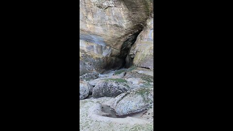
Near the Punchbowl!
HumbleConservativeDevil's Punchbowl State Natural Area is a stunning spot on the central Oregon Coast, located in Otter Rock, about 5 miles south of Depoe Bay and 8 miles north of Newport. It’s a day-use state park centered around a massive, bowl-shaped rock formation carved into a headland, partially open to the Pacific Ocean. This "punchbowl" was likely formed when the roofs of two sea caves collapsed, and over time, relentless waves sculpted it into the dramatic feature you see today. During high tide, especially in stormy weather, waves crash in with a thundering roar, churning and foaming inside the bowl—pretty wild to watch from above. At low tide, you can actually hike down to explore the interior, though you’ve got to time it right and stay cautious, as the ocean can be unpredictable. The park itself offers more than just the punchbowl. There’s a scenic overlook right near the parking lot where you can take in the view, plus picnic tables with ocean vistas—perfect for a coastal lunch. Trails lead down to the beach, where you can check out tidepools teeming with starfish, anemones, and crabs, especially on the north side. Surfers love the waves near Gull Rock, a big offshore pinnacle about half a mile out, and the area’s part of the Oregon Islands National Wildlife Refuge, so you might spot seabirds, seals, or even whales if you’re there during migration season (spring or late winter). Heads up, though: the stairs to the beach are set to be closed for repairs from April 15th to May 15th, 2025—so right now, on April 4th, 2025, they’re still open, but plan accordingly if you’re visiting later this month. If the stairs are out, the next beach access is south at Beverly Beach State Park. Parking can get tight, especially in summer, but it’s free, and the vibe’s laid-back with a coffee shop and small shops nearby in Otter Rock. It’s a classic Oregon Coast stop—raw, rugged, and worth the detour off Highway 101.27 views -
Beverly Beach!
HumbleConservativeBeverly Beach, Oregon, is a beautiful spot along the Oregon Coast, known for its stunning sandy beaches and natural charm. It’s an unincorporated community in Lincoln County, located on U.S. Route 101, just north of Yaquina Head and south of Beverly Beach State Park.29 views -
Beverly Beach Oregon!
HumbleConservativeBeverly Beach, Oregon, is a beautiful spot along the Oregon Coast, known for its stunning sandy beaches and natural charm. It’s an unincorporated community in Lincoln County, located on U.S. Route 101, just north of Yaquina Head and south of Beverly Beach State Park.31 views -
Path to the Punchbowl!
HumbleConservativeDevil's Punchbowl State Natural Area is a stunning spot on the central Oregon Coast, located in Otter Rock, about 5 miles south of Depoe Bay and 8 miles north of Newport. It’s a day-use state park centered around a massive, bowl-shaped rock formation carved into a headland, partially open to the Pacific Ocean. This "punchbowl" was likely formed when the roofs of two sea caves collapsed, and over time, relentless waves sculpted it into the dramatic feature you see today. During high tide, especially in stormy weather, waves crash in with a thundering roar, churning and foaming inside the bowl—pretty wild to watch from above. At low tide, you can actually hike down to explore the interior, though you’ve got to time it right and stay cautious, as the ocean can be unpredictable. The park itself offers more than just the punchbowl. There’s a scenic overlook right near the parking lot where you can take in the view, plus picnic tables with ocean vistas—perfect for a coastal lunch. Trails lead down to the beach, where you can check out tidepools teeming with starfish, anemones, and crabs, especially on the north side. Surfers love the waves near Gull Rock, a big offshore pinnacle about half a mile out, and the area’s part of the Oregon Islands National Wildlife Refuge, so you might spot seabirds, seals, or even whales if you’re there during migration season (spring or late winter). Heads up, though: the stairs to the beach are set to be closed for repairs from April 15th to May 15th, 2025—so right now, on April 4th, 2025, they’re still open, but plan accordingly if you’re visiting later this month. If the stairs are out, the next beach access is south at Beverly Beach State Park. Parking can get tight, especially in summer, but it’s free, and the vibe’s laid-back with a coffee shop and small shops nearby in Otter Rock. It’s a classic Oregon Coast stop—raw, rugged, and worth the detour off Highway 101.30 views -
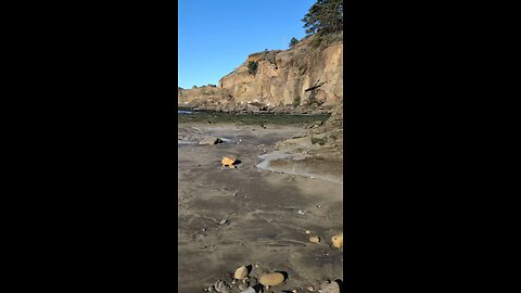
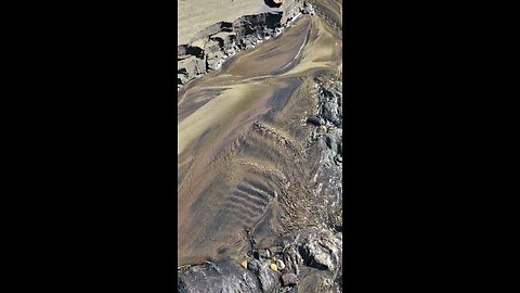
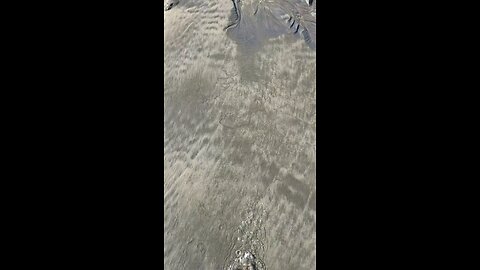
Beautiful Beverly Beach Sand Art!
HumbleConservativeBeverly Beach, Oregon, is a beautiful spot along the Oregon Coast, known for its stunning sandy beaches and natural charm. It’s an unincorporated community in Lincoln County, located on U.S. Route 101, just north of Yaquina Head and south of Beverly Beach State Park.31 views -
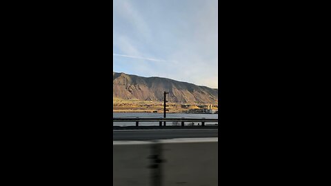
Heading home along the Columbia River!
HumbleConservativeThe Columbia River Gorge is a stunning canyon of the Columbia River in the Pacific Northwest of the United States. It stretches over 80 miles (130 kilometers) where the river cuts through the Cascade Range, forming part of the border between Washington and Oregon.30 views -
John Day Dam!
HumbleConservativeThe John Day Dam is a major structure on the Columbia River, located at river mile 215.6, about 28 miles (45 km) east of The Dalles, Oregon, and just below the mouth of the John Day River. It spans the river between Sherman County, Oregon, and Klickitat County, Washington. Operated by the U.S. Army Corps of Engineers, this concrete gravity run-of-the-river dam was completed in 1971 after construction began in 1958, at a cost of $511 million. It’s part of the Columbia River Basin dam system, designed primarily for hydroelectric power and navigation. Here’s what stands out about it: Power Generation: It has 16 turbine units with a nameplate capacity of 2,160 megawatts and an overload capacity of 2,485 megawatts—enough to power roughly two cities the size of Seattle. Skeleton units for four more generators were built in, hinting at potential expansion. Navigation Lock: The John Day Lock boasts the highest lift of any U.S. lock at 110 feet (34 meters), allowing barges and ships to navigate the river’s elevation changes. Reservoir: The dam forms Lake Umatilla, stretching 76.4 miles (123 km) upstream to the McNary Dam. The reservoir’s full pool elevation is 268 feet (82 meters), with a usable storage capacity of 534,000 acre-feet between 257 and 268 feet. Fish Passage: It includes fish ladders on both sides to aid salmon and steelhead migration, though the 76-mile reservoir has been noted as a tough stretch for young salmon, with high mortality rates reported in studies from the mid-2000s. The dam’s not open to the public for tours, but you can get a good view from Giles French Park downstream. It’s a powerhouse—literally and figuratively—but its impact on the river’s ecology, especially salmon runs, has long been debated.47 views 2 comments -
Beautiful Beverly Beach Sand Art!
HumbleConservativeBeverly Beach, Oregon, is a beautiful spot along the Oregon Coast, known for its stunning sandy beaches and natural charm. It’s an unincorporated community in Lincoln County, located on U.S. Route 101, just north of Yaquina Head and south of Beverly Beach State Park. The area got its name in the early 1930s from Curtis and Florence May Christy, who owned the land and asked their young daughter, Florence Daneene Christy, to name it. She chose "Beverly" after her favorite doll, and the name stuck. The main draw here is Beverly Beach State Park, a popular destination for visitors. It features a large, forest-sheltered campground along Spencer Creek, with giant, wind-sculpted trees and easy access to miles of beach stretching from Yaquina Head (where you can spot the lighthouse) to Otter Rock. The park offers something for everyone: 53 full-hookup RV sites, 76 electrical sites with water, 128 tent sites, and 21 yurts (some pet-friendly), plus group camping areas and a hiker/biker camp. A short walkway under Highway 101 takes you straight to the beach, perfect for kite flying, sandcastle building, surfing, fossil hunting, or just relaxing. The park also has amenities like hot showers, flush toilets, a playground, and a visitor center. The beach itself is wide and flat, great for long walks, and on clear days, you can see from Cape Foulweather down to Yaquina Head. It’s a hotspot for surfers (especially in winter) and fossil enthusiasts, with ancient shells and marine life impressions visible in the cliffs. Nearby attractions like the Oregon Coast Aquarium, Yaquina Head Lighthouse, and Newport’s shops and restaurants are just a short drive away, making it a convenient base for exploring the central coast. It’s a busy place, especially in summer, with the campground being one of Oregon’s largest and most popular, hosting nearly 170,000 campers a year. If you’re after peace and quiet, head north or south along the beach to escape the crowds. Whether you’re camping or just stopping by for the day, Beverly Beach offers a classic Oregon Coast experience—raw, rugged, and unforgettable.26 views