
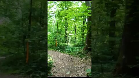
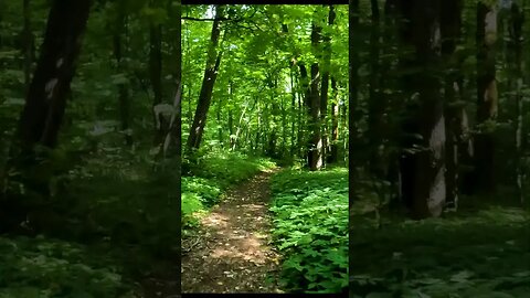
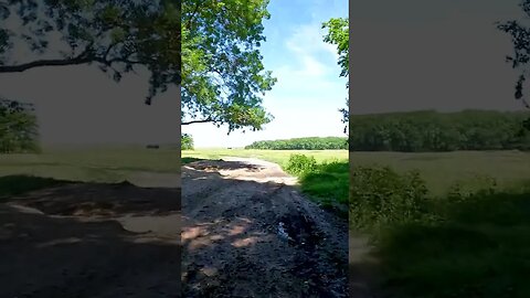
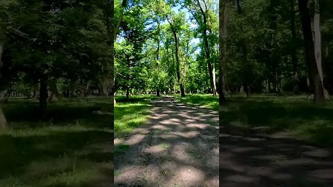
BANEASA Forest - Trailer, Bucharest - Ilfov | 4k Virtual Tour | #shorts
This video features the trailer from the coming episode, a 4k virtual tour of the Baneasa Forest, located next to Bucharest and reaching Ilfov county. Codrii Vlasiei was the forest that once covered parts of southern Romania, including the territory of today's Bucharest and the surrounding Ilfov County and Baneasa Forest is a part of that original forest. Closed Captions [CC] which include historical facts and descriptions are available in all languages.
#virtualtour #bikeride #mtblife #shortsfeed #shortsyoutube #shortsvideo #shortfeed #shortvideo #cyclingworkout #indoorcycling #4kride #romania #shortsfeed #shortsbeta #shortfeed
===============================================================================
🌎Complete Playlist of Virtual Tours: https://www.youtube.com/playlist?list=PLdyvAxFyPXo89pj1Q1oPwDmmVURBP1l8h 🌎
🏔️ Mountain road descents : https://www.youtube.com/playlist?list=PLdyvAxFyPXo8XTKj8xega-31flwsiEaV_ 🏔️
🏞️ Park rides : https://www.youtube.com/playlist?list=PLdyvAxFyPXo-aF6HRtKwq17l1m1LKvf5b 🏞️
🏨 Urban rides : https://www.youtube.com/playlist?list=PLdyvAxFyPXo8uQ-gTaZ3b38SmrEC13pwq 🏨
🌳 Forest rides : https://www.youtube.com/playlist?list=PLdyvAxFyPXo8-7xZMAHzDJmQRP4Dx7ffy 🌳
📢 𝗣𝗹𝗲𝗮𝘀𝗲 𝗦𝘂𝗯𝘀𝗰𝗿𝗶𝗯𝗲! 📢 - youtube.com/channel/UCib-JDIHF_Btivu010jNd5g?sub_confirmation=1
===============================================================================
✔️JOIN US:✔️
➤TikTok: https://www.tiktok.com/@snailsonwheelz?lang=en
➤Instagram: https://www.instagram.com/snails_on_wh33ls/?hl=ro
➤Facebook: https://www.facebook.com/snailsonwheels
===============================================================================
INFO :
Baneasa Forest (Padurea Baneasa in Romanian) is a wood in the north of Bucharest, Romania. Covering 800 hectares (2,000 acres), the ground is located in proximity to Baneasa neighborhood and Baneasa Airport. On its southern edge, there is the Zoo Baneasa zoological garden.
Baneasa Forest is assigned a central presence in Noaptea de Sânziene, a novel written after 1949 by Romanian author and researcher Mircea Eliade. Referred to as the "forbidden forest" in the English version of the book, it is a paranormal site, where the protagonist Ștefan finds escape from the suffering of the modern world. Andy Irvine has written a song "Baneasa's Green Glade", which he recorded in 1974 with Planxty on the album Cold Blow and the Rainy Night.
Codrii Vlasiei was the forest that once covered parts of southern Romania, including the territory of today's Bucharest and the surrounding Ilfov County.
The thick forests were used by Romanians as a retreat during the age of migrations because they were not easy to cross on horseback. In fact, the name of the forest means "the Forests of Wallachia". Codrii means "forests" in the Romanian language, while Vlasiei is the genitive form of Vlasia, the Slavic denomination for Wallachia.
Most of the forest was intact until the 19th century, when commerce involving cereals and wood began to develop in Wallachia and the forest was razed for the land to be used in agriculture. Of the old forests only a few small areas remain, mostly north of Bucharest, in localities such as Snagov, Pustnicul, Cernica, Romaneşti and Comana. The surface of forests is currently just about. 3500 ha.
Source : https://en.wikipedia.org/wiki/B%C4%83neasa_Forest
https://en.wikipedia.org/wiki/Codrii_Vl%C4%83siei
3
views
BANEASA Forest - Trailer, Bucharest - Ilfov | 4k Virtual Tour | #shorts
This video features the trailer from the coming episode, a 4k virtual tour of the Baneasa Forest, located next to Bucharest and reaching Ilfov county. Codrii Vlasiei was the forest that once covered parts of southern Romania, including the territory of today's Bucharest and the surrounding Ilfov County and Baneasa Forest is a part of that original forest. Closed Captions [CC] which include historical facts and descriptions are available in all languages.
#virtualtour #bikeride #mtblife #shortsfeed #shortsyoutube #shortsvideo #shortfeed #shortvideo #cyclingworkout #indoorcycling #4kride #romania #shortsfeed #shortsbeta #shortfeed
===============================================================================
🌎Complete Playlist of Virtual Tours: https://www.youtube.com/playlist?list=PLdyvAxFyPXo89pj1Q1oPwDmmVURBP1l8h 🌎
🏔️ Mountain road descents : https://www.youtube.com/playlist?list=PLdyvAxFyPXo8XTKj8xega-31flwsiEaV_ 🏔️
🏞️ Park rides : https://www.youtube.com/playlist?list=PLdyvAxFyPXo-aF6HRtKwq17l1m1LKvf5b 🏞️
🏨 Urban rides : https://www.youtube.com/playlist?list=PLdyvAxFyPXo8uQ-gTaZ3b38SmrEC13pwq 🏨
🌳 Forest rides : https://www.youtube.com/playlist?list=PLdyvAxFyPXo8-7xZMAHzDJmQRP4Dx7ffy 🌳
📢 𝗣𝗹𝗲𝗮𝘀𝗲 𝗦𝘂𝗯𝘀𝗰𝗿𝗶𝗯𝗲! 📢 - youtube.com/channel/UCib-JDIHF_Btivu010jNd5g?sub_confirmation=1
===============================================================================
✔️JOIN US:✔️
➤TikTok: https://www.tiktok.com/@snailsonwheelz?lang=en
➤Instagram: https://www.instagram.com/snails_on_wh33ls/?hl=ro
➤Facebook: https://www.facebook.com/snailsonwheels
===============================================================================
INFO :
Baneasa Forest (Padurea Baneasa in Romanian) is a wood in the north of Bucharest, Romania. Covering 800 hectares (2,000 acres), the ground is located in proximity to Baneasa neighborhood and Baneasa Airport. On its southern edge, there is the Zoo Baneasa zoological garden.
Baneasa Forest is assigned a central presence in Noaptea de Sânziene, a novel written after 1949 by Romanian author and researcher Mircea Eliade. Referred to as the "forbidden forest" in the English version of the book, it is a paranormal site, where the protagonist Ștefan finds escape from the suffering of the modern world. Andy Irvine has written a song "Baneasa's Green Glade", which he recorded in 1974 with Planxty on the album Cold Blow and the Rainy Night.
Codrii Vlasiei was the forest that once covered parts of southern Romania, including the territory of today's Bucharest and the surrounding Ilfov County.
The thick forests were used by Romanians as a retreat during the age of migrations because they were not easy to cross on horseback. In fact, the name of the forest means "the Forests of Wallachia". Codrii means "forests" in the Romanian language, while Vlasiei is the genitive form of Vlasia, the Slavic denomination for Wallachia.
Most of the forest was intact until the 19th century, when commerce involving cereals and wood began to develop in Wallachia and the forest was razed for the land to be used in agriculture. Of the old forests only a few small areas remain, mostly north of Bucharest, in localities such as Snagov, Pustnicul, Cernica, Romaneşti and Comana. The surface of forests is currently just about. 3500 ha.
Source : https://en.wikipedia.org/wiki/B%C4%83neasa_Forest
https://en.wikipedia.org/wiki/Codrii_Vl%C4%83siei
9
views
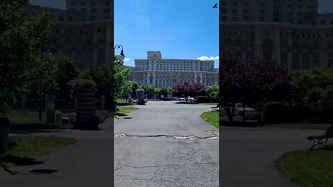
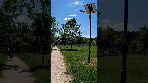
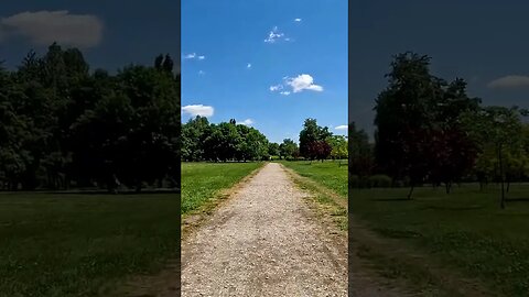
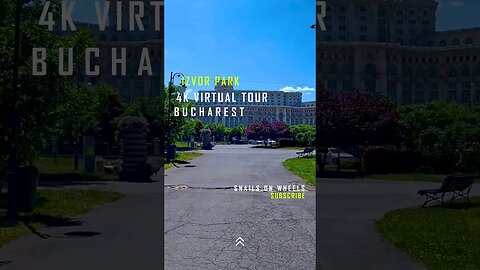
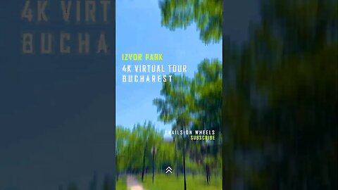
Discover the Secret Oasis Hidden in the Heart of Bucharest! Izvor Park #Shorts
This video features a short from a 4k virtual tour of the Izvor Park located in center Bucharest next to Dambovita River and the Palace of Parliament. Closed Captions [CC] which include historical facts and descriptions are available in all languages.
#romaniatravel #bucharest #bucuresti #romania #touristplace #discoverromania #short #shortsfeed #shortsvideo #shortsyoutube #shortsbeta #shortsvideos #shorts_video #shortvideo #shortfeed
===============================================================================
🌎Complete Playlist of Virtual Tours: https://www.youtube.com/playlist?list=PLdyvAxFyPXo89pj1Q1oPwDmmVURBP1l8h 🌎
🏔️ Mountain road descents : https://www.youtube.com/playlist?list=PLdyvAxFyPXo8XTKj8xega-31flwsiEaV_ 🏔️
🏞️ Park rides : https://www.youtube.com/playlist?list=PLdyvAxFyPXo-aF6HRtKwq17l1m1LKvf5b 🏞️
🏨 Urban rides : https://www.youtube.com/playlist?list=PLdyvAxFyPXo8uQ-gTaZ3b38SmrEC13pwq 🏨
🌳 Forest rides : https://www.youtube.com/playlist?list=PLdyvAxFyPXo8-7xZMAHzDJmQRP4Dx7ffy 🌳
📢 𝗣𝗹𝗲𝗮𝘀𝗲 𝗦𝘂𝗯𝘀𝗰𝗿𝗶𝗯𝗲! 📢 - youtube.com/channel/UCib-JDIHF_Btivu010jNd5g?sub_confirmation=1
===============================================================================
✔️JOIN US:✔️
➤TikTok: https://www.tiktok.com/@snailsonwheelz?lang=en
➤Instagram: https://www.instagram.com/snails_on_wh33ls/?hl=ro
➤Facebook: https://www.facebook.com/snailsonwheels
===============================================================================
INFO :
On the site of the current park, before 1984-1985, there was the Mihai-Vodă hill, on which the Mihai Vodă Monastery stood. Through the plan to modernize Bucharest and build the Civic Center, the hill was leveled and the cells of the monastery were demolished. Mihai-Vodă Church, together with the bell tower, was saved, in 1985, being translated to the east, on the slope, over a distance of 289 m and lowered vertically by 6.2 m[1], to the bank of Dâmbovița, where it was hidden from view, after some blocks, on Sapienței street. The rest of the buildings on the hill were demolished, including the Palace of State Archives, rebuilt in the years 1900-1916, according to the plans of the architects Petre Antonescu and Cristofi Cerchez, and the archaeological site with vestiges from the Bronze Age, located in the courtyard of the monastery, was also destroyed. Next to the monastery were the remains of the New Court (also called Curtea Arsă, after the fire of 1812), erected by the Phanariot Alexandru Ipsilanti, which were also irreparably destroyed.
In the corner from the Hasdeu bridge of the current Izvor park, located at the intersection between Splaiul Independentiei and Str. Bogdan Petriceicu Hasdeu, across the street from the Faculty of Biology of the University of Bucharest, there was, since 1925, the Institute of Theoretical Chemistry within the University of Bucharest. The L-shaped, 3-story building collapsed in the earthquake of March 4, 1977. The remains of the faculty were demolished and the building was never rebuilt.[2]
In that level place it was desired to build a large conference and reception hall. After the Romanian Revolution of 1989, the project was no longer started and the location remained at the "maidan" stage.
In the 90s, the City Hall laid out alleys, planted trees and gave the place the name Parkul Izvor. The park has the shape of a rectangle, with an area of 17 hectares, and is bounded by Naçionile Unite boulevard, Libertății boulevard, B. P. Hasdeu street and Splaiul Independţei, where the Izvor metro station is also located. Of the 170,000 square meters occupied by Izvor Park, 28,902 square meters are walkways and 141,098 square meters are covered with grass. The 4 main paths, which add up to about 3.2 km, are ideal routes for those who practice running or jogging.
Source : https://ro.wikipedia.org/wiki/Parcul_Izvor
11
views
Discover the secret oasis tucked away in IZVOR Park #shorts
This video features a short from a 4k virtual tour of the Izvor Park located in center Bucharest next to Dambovita River and the Palace of Parliament. Closed Captions [CC] which include historical facts and descriptions are available in all languages.
#shortsfeed #shortsyoutube #shortsvideo #shortfeed #shortvideo #shortsfeed #shortsbeta #shortfeed
===============================================================================
🌎Complete Playlist of Virtual Tours: https://www.youtube.com/playlist?list=PLdyvAxFyPXo89pj1Q1oPwDmmVURBP1l8h 🌎
🏔️ Mountain road descents : https://www.youtube.com/playlist?list=PLdyvAxFyPXo8XTKj8xega-31flwsiEaV_ 🏔️
🏞️ Park rides : https://www.youtube.com/playlist?list=PLdyvAxFyPXo-aF6HRtKwq17l1m1LKvf5b 🏞️
🏨 Urban rides : https://www.youtube.com/playlist?list=PLdyvAxFyPXo8uQ-gTaZ3b38SmrEC13pwq 🏨
🌳 Forest rides : https://www.youtube.com/playlist?list=PLdyvAxFyPXo8-7xZMAHzDJmQRP4Dx7ffy 🌳
📢 𝗣𝗹𝗲𝗮𝘀𝗲 𝗦𝘂𝗯𝘀𝗰𝗿𝗶𝗯𝗲! 📢 - youtube.com/channel/UCib-JDIHF_Btivu010jNd5g?sub_confirmation=1
===============================================================================
✔️JOIN US:✔️
➤TikTok: https://www.tiktok.com/@snailsonwheelz?lang=en
➤Instagram: https://www.instagram.com/snails_on_wh33ls/?hl=ro
➤Facebook: https://www.facebook.com/snailsonwheels
===============================================================================
INFO :
On the site of the current park, before 1984-1985, there was the Mihai-Vodă hill, on which the Mihai Vodă Monastery stood. Through the plan to modernize Bucharest and build the Civic Center, the hill was leveled and the cells of the monastery were demolished. Mihai-Vodă Church, together with the bell tower, was saved, in 1985, being translated to the east, on the slope, over a distance of 289 m and lowered vertically by 6.2 m[1], to the bank of Dâmbovița, where it was hidden from view, after some blocks, on Sapienței street. The rest of the buildings on the hill were demolished, including the Palace of State Archives, rebuilt in the years 1900-1916, according to the plans of the architects Petre Antonescu and Cristofi Cerchez, and the archaeological site with vestiges from the Bronze Age, located in the courtyard of the monastery, was also destroyed. Next to the monastery were the remains of the New Court (also called Curtea Arsă, after the fire of 1812), erected by the Phanariot Alexandru Ipsilanti, which were also irreparably destroyed.
In the corner from the Hasdeu bridge of the current Izvor park, located at the intersection between Splaiul Independentiei and Str. Bogdan Petriceicu Hasdeu, across the street from the Faculty of Biology of the University of Bucharest, there was, since 1925, the Institute of Theoretical Chemistry within the University of Bucharest. The L-shaped, 3-story building collapsed in the earthquake of March 4, 1977. The remains of the faculty were demolished and the building was never rebuilt.[2]
In that level place it was desired to build a large conference and reception hall. After the Romanian Revolution of 1989, the project was no longer started and the location remained at the "maidan" stage.
In the 90s, the City Hall laid out alleys, planted trees and gave the place the name Parkul Izvor. The park has the shape of a rectangle, with an area of 17 hectares, and is bounded by Naçionile Unite boulevard, Libertății boulevard, B. P. Hasdeu street and Splaiul Independţei, where the Izvor metro station is also located. Of the 170,000 square meters occupied by Izvor Park, 28,902 square meters are walkways and 141,098 square meters are covered with grass. The 4 main paths, which add up to about 3.2 km, are ideal routes for those who practice running or jogging.
Source : https://ro.wikipedia.org/wiki/Parcul_Izvor
5
views
IZVOR Park: A hidden gem in Bucharest you need to see! #shorts
This video features a short from a 4k virtual tour of the Izvor Park located in center Bucharest next to Dambovita River and the Palace of Parliament. Closed Captions [CC] which include historical facts and descriptions are available in all languages.
#shortsfeed #shortsyoutube #shortsvideo #shortfeed #shortvideo #shortsfeed #shortsbeta #shortfeed
===============================================================================
🌎Complete Playlist of Virtual Tours: https://www.youtube.com/playlist?list=PLdyvAxFyPXo89pj1Q1oPwDmmVURBP1l8h 🌎
🏔️ Mountain road descents : https://www.youtube.com/playlist?list=PLdyvAxFyPXo8XTKj8xega-31flwsiEaV_ 🏔️
🏞️ Park rides : https://www.youtube.com/playlist?list=PLdyvAxFyPXo-aF6HRtKwq17l1m1LKvf5b 🏞️
🏨 Urban rides : https://www.youtube.com/playlist?list=PLdyvAxFyPXo8uQ-gTaZ3b38SmrEC13pwq 🏨
🌳 Forest rides : https://www.youtube.com/playlist?list=PLdyvAxFyPXo8-7xZMAHzDJmQRP4Dx7ffy 🌳
📢 𝗣𝗹𝗲𝗮𝘀𝗲 𝗦𝘂𝗯𝘀𝗰𝗿𝗶𝗯𝗲! 📢 - youtube.com/channel/UCib-JDIHF_Btivu010jNd5g?sub_confirmation=1
===============================================================================
✔️JOIN US:✔️
➤TikTok: https://www.tiktok.com/@snailsonwheelz?lang=en
➤Instagram: https://www.instagram.com/snails_on_wh33ls/?hl=ro
➤Facebook: https://www.facebook.com/snailsonwheels
===============================================================================
INFO :
On the site of the current park, before 1984-1985, there was the Mihai-Vodă hill, on which the Mihai Vodă Monastery stood. Through the plan to modernize Bucharest and build the Civic Center, the hill was leveled and the cells of the monastery were demolished. Mihai-Vodă Church, together with the bell tower, was saved, in 1985, being translated to the east, on the slope, over a distance of 289 m and lowered vertically by 6.2 m[1], to the bank of Dâmbovița, where it was hidden from view, after some blocks, on Sapienței street. The rest of the buildings on the hill were demolished, including the Palace of State Archives, rebuilt in the years 1900-1916, according to the plans of the architects Petre Antonescu and Cristofi Cerchez, and the archaeological site with vestiges from the Bronze Age, located in the courtyard of the monastery, was also destroyed. Next to the monastery were the remains of the New Court (also called Curtea Arsă, after the fire of 1812), erected by the Phanariot Alexandru Ipsilanti, which were also irreparably destroyed.
In the corner from the Hasdeu bridge of the current Izvor park, located at the intersection between Splaiul Independentiei and Str. Bogdan Petriceicu Hasdeu, across the street from the Faculty of Biology of the University of Bucharest, there was, since 1925, the Institute of Theoretical Chemistry within the University of Bucharest. The L-shaped, 3-story building collapsed in the earthquake of March 4, 1977. The remains of the faculty were demolished and the building was never rebuilt.[2]
In that level place it was desired to build a large conference and reception hall. After the Romanian Revolution of 1989, the project was no longer started and the location remained at the "maidan" stage.
In the 90s, the City Hall laid out alleys, planted trees and gave the place the name Parkul Izvor. The park has the shape of a rectangle, with an area of 17 hectares, and is bounded by Naçionile Unite boulevard, Libertății boulevard, B. P. Hasdeu street and Splaiul Independţei, where the Izvor metro station is also located. Of the 170,000 square meters occupied by Izvor Park, 28,902 square meters are walkways and 141,098 square meters are covered with grass. The 4 main paths, which add up to about 3.2 km, are ideal routes for those who practice running or jogging.
Source : https://ro.wikipedia.org/wiki/Parcul_Izvor
4
views
The Mysterious IZVOR Park Hiding in Plain Sight #shorts
This video features a short from a 4k virtual tour of the Izvor Park located in center Bucharest next to Dambovita River and the Palace of Parliament. Closed Captions [CC] which include historical facts and descriptions are available in all languages.
#shortsfeed #shortsyoutube #shortsvideo #shortfeed #shortvideo #shortsfeed #shortsbeta #shortfeed
===============================================================================
🌎Complete Playlist of Virtual Tours: https://www.youtube.com/playlist?list=PLdyvAxFyPXo89pj1Q1oPwDmmVURBP1l8h 🌎
🏔️ Mountain road descents : https://www.youtube.com/playlist?list=PLdyvAxFyPXo8XTKj8xega-31flwsiEaV_ 🏔️
🏞️ Park rides : https://www.youtube.com/playlist?list=PLdyvAxFyPXo-aF6HRtKwq17l1m1LKvf5b 🏞️
🏨 Urban rides : https://www.youtube.com/playlist?list=PLdyvAxFyPXo8uQ-gTaZ3b38SmrEC13pwq 🏨
🌳 Forest rides : https://www.youtube.com/playlist?list=PLdyvAxFyPXo8-7xZMAHzDJmQRP4Dx7ffy 🌳
📢 𝗣𝗹𝗲𝗮𝘀𝗲 𝗦𝘂𝗯𝘀𝗰𝗿𝗶𝗯𝗲! 📢 - youtube.com/channel/UCib-JDIHF_Btivu010jNd5g?sub_confirmation=1
===============================================================================
✔️JOIN US:✔️
➤TikTok: https://www.tiktok.com/@snailsonwheelz?lang=en
➤Instagram: https://www.instagram.com/snails_on_wh33ls/?hl=ro
➤Facebook: https://www.facebook.com/snailsonwheels
===============================================================================
INFO :
On the site of the current park, before 1984-1985, there was the Mihai-Vodă hill, on which the Mihai Vodă Monastery stood. Through the plan to modernize Bucharest and build the Civic Center, the hill was leveled and the cells of the monastery were demolished. Mihai-Vodă Church, together with the bell tower, was saved, in 1985, being translated to the east, on the slope, over a distance of 289 m and lowered vertically by 6.2 m[1], to the bank of Dâmbovița, where it was hidden from view, after some blocks, on Sapienței street. The rest of the buildings on the hill were demolished, including the Palace of State Archives, rebuilt in the years 1900-1916, according to the plans of the architects Petre Antonescu and Cristofi Cerchez, and the archaeological site with vestiges from the Bronze Age, located in the courtyard of the monastery, was also destroyed. Next to the monastery were the remains of the New Court (also called Curtea Arsă, after the fire of 1812), erected by the Phanariot Alexandru Ipsilanti, which were also irreparably destroyed.
In the corner from the Hasdeu bridge of the current Izvor park, located at the intersection between Splaiul Independentiei and Str. Bogdan Petriceicu Hasdeu, across the street from the Faculty of Biology of the University of Bucharest, there was, since 1925, the Institute of Theoretical Chemistry within the University of Bucharest. The L-shaped, 3-story building collapsed in the earthquake of March 4, 1977. The remains of the faculty were demolished and the building was never rebuilt.[2]
In that level place it was desired to build a large conference and reception hall. After the Romanian Revolution of 1989, the project was no longer started and the location remained at the "maidan" stage.
In the 90s, the City Hall laid out alleys, planted trees and gave the place the name Parkul Izvor. The park has the shape of a rectangle, with an area of 17 hectares, and is bounded by Naçionile Unite boulevard, Libertății boulevard, B. P. Hasdeu street and Splaiul Independţei, where the Izvor metro station is also located. Of the 170,000 square meters occupied by Izvor Park, 28,902 square meters are walkways and 141,098 square meters are covered with grass. The 4 main paths, which add up to about 3.2 km, are ideal routes for those who practice running or jogging.
Source : https://ro.wikipedia.org/wiki/Parcul_Izvor
12
views
Secrets uncovered: the hidden history of BUCHAREST's Center #shorts
This video features a 4k virtual tour of the Izvor Park located in center Bucharest next to Dambovita River and the Palace of Parliament. Closed Captions [CC] which include historical facts and descriptions are available in all languages.
#virtualtour #bikeride #mtblife #shortsfeed #shortsyoutube #shortsvideo #shortfeed #shortvideo #cyclingworkout #indoorcycling #4kride #romania #shortsfeed #shortsbeta #shortfeed
===============================================================================
🌎Complete Playlist of Virtual Tours: https://www.youtube.com/playlist?list=PLdyvAxFyPXo89pj1Q1oPwDmmVURBP1l8h 🌎
🏔️ Mountain road descents : https://www.youtube.com/playlist?list=PLdyvAxFyPXo8XTKj8xega-31flwsiEaV_ 🏔️
🏞️ Park rides : https://www.youtube.com/playlist?list=PLdyvAxFyPXo-aF6HRtKwq17l1m1LKvf5b 🏞️
🏨 Urban rides : https://www.youtube.com/playlist?list=PLdyvAxFyPXo8uQ-gTaZ3b38SmrEC13pwq 🏨
🌳 Forest rides : https://www.youtube.com/playlist?list=PLdyvAxFyPXo8-7xZMAHzDJmQRP4Dx7ffy 🌳
📢 𝗣𝗹𝗲𝗮𝘀𝗲 𝗦𝘂𝗯𝘀𝗰𝗿𝗶𝗯𝗲! 📢 - youtube.com/channel/UCib-JDIHF_Btivu010jNd5g?sub_confirmation=1
===============================================================================
✔️JOIN US:✔️
➤TikTok: https://www.tiktok.com/@snailsonwheelz?lang=en
➤Instagram: https://www.instagram.com/snails_on_wh33ls/?hl=ro
➤Facebook: https://www.facebook.com/snailsonwheels
===============================================================================
INFO :
On the site of the current park, before 1984-1985, there was the Mihai-Vodă hill, on which the Mihai Vodă Monastery stood. Through the plan to modernize Bucharest and build the Civic Center, the hill was leveled and the cells of the monastery were demolished. Mihai-Vodă Church, together with the bell tower, was saved, in 1985, being translated to the east, on the slope, over a distance of 289 m and lowered vertically by 6.2 m[1], to the bank of Dâmbovița, where it was hidden from view, after some blocks, on Sapienței street. The rest of the buildings on the hill were demolished, including the Palace of State Archives, rebuilt in the years 1900-1916, according to the plans of the architects Petre Antonescu and Cristofi Cerchez, and the archaeological site with vestiges from the Bronze Age, located in the courtyard of the monastery, was also destroyed. Next to the monastery were the remains of the New Court (also called Curtea Arsă, after the fire of 1812), erected by the Phanariot Alexandru Ipsilanti, which were also irreparably destroyed.
In the corner from the Hasdeu bridge of the current Izvor park, located at the intersection between Splaiul Independentiei and Str. Bogdan Petriceicu Hasdeu, across the street from the Faculty of Biology of the University of Bucharest, there was, since 1925, the Institute of Theoretical Chemistry within the University of Bucharest. The L-shaped, 3-story building collapsed in the earthquake of March 4, 1977. The remains of the faculty were demolished and the building was never rebuilt.[2]
In that level place it was desired to build a large conference and reception hall. After the Romanian Revolution of 1989, the project was no longer started and the location remained at the "maidan" stage.
In the 90s, the City Hall laid out alleys, planted trees and gave the place the name Parkul Izvor. The park has the shape of a rectangle, with an area of 17 hectares, and is bounded by Naçionile Unite boulevard, Libertății boulevard, B. P. Hasdeu street and Splaiul Independţei, where the Izvor metro station is also located. Of the 170,000 square meters occupied by Izvor Park, 28,902 square meters are walkways and 141,098 square meters are covered with grass. The 4 main paths, which add up to about 3.2 km, are ideal routes for those who practice running or jogging.
Source : https://ro.wikipedia.org/wiki/Parcul_Izvor
6
views
Take a virtual tour of this stunning park in Bucharest! #shorts
This video features a 4k virtual tour of the Izvor Park located in center Bucharest next to Dambovita River and the Palace of Parliament. Closed Captions [CC] which include historical facts and descriptions are available in all languages.
#virtualtour #bikeride #mtblife #shortsfeed #shortsyoutube #shortsvideo #shortfeed #shortvideo #cyclingworkout #indoorcycling #4kride #romania #shortsfeed #shortsbeta #shortfeed
===============================================================================
🌎Complete Playlist of Virtual Tours: https://www.youtube.com/playlist?list=PLdyvAxFyPXo89pj1Q1oPwDmmVURBP1l8h 🌎
🏔️ Mountain road descents : https://www.youtube.com/playlist?list=PLdyvAxFyPXo8XTKj8xega-31flwsiEaV_ 🏔️
🏞️ Park rides : https://www.youtube.com/playlist?list=PLdyvAxFyPXo-aF6HRtKwq17l1m1LKvf5b 🏞️
🏨 Urban rides : https://www.youtube.com/playlist?list=PLdyvAxFyPXo8uQ-gTaZ3b38SmrEC13pwq 🏨
🌳 Forest rides : https://www.youtube.com/playlist?list=PLdyvAxFyPXo8-7xZMAHzDJmQRP4Dx7ffy 🌳
📢 𝗣𝗹𝗲𝗮𝘀𝗲 𝗦𝘂𝗯𝘀𝗰𝗿𝗶𝗯𝗲! 📢 - youtube.com/channel/UCib-JDIHF_Btivu010jNd5g?sub_confirmation=1
===============================================================================
✔️JOIN US:✔️
➤TikTok: https://www.tiktok.com/@snailsonwheelz?lang=en
➤Instagram: https://www.instagram.com/snails_on_wh33ls/?hl=ro
➤Facebook: https://www.facebook.com/snailsonwheels
===============================================================================
INFO :
On the site of the current park, before 1984-1985, there was the Mihai-Vodă hill, on which the Mihai Vodă Monastery stood. Through the plan to modernize Bucharest and build the Civic Center, the hill was leveled and the cells of the monastery were demolished. Mihai-Vodă Church, together with the bell tower, was saved, in 1985, being translated to the east, on the slope, over a distance of 289 m and lowered vertically by 6.2 m[1], to the bank of Dâmbovița, where it was hidden from view, after some blocks, on Sapienței street. The rest of the buildings on the hill were demolished, including the Palace of State Archives, rebuilt in the years 1900-1916, according to the plans of the architects Petre Antonescu and Cristofi Cerchez, and the archaeological site with vestiges from the Bronze Age, located in the courtyard of the monastery, was also destroyed. Next to the monastery were the remains of the New Court (also called Curtea Arsă, after the fire of 1812), erected by the Phanariot Alexandru Ipsilanti, which were also irreparably destroyed.
In the corner from the Hasdeu bridge of the current Izvor park, located at the intersection between Splaiul Independentiei and Str. Bogdan Petriceicu Hasdeu, across the street from the Faculty of Biology of the University of Bucharest, there was, since 1925, the Institute of Theoretical Chemistry within the University of Bucharest. The L-shaped, 3-story building collapsed in the earthquake of March 4, 1977. The remains of the faculty were demolished and the building was never rebuilt.[2]
In that level place it was desired to build a large conference and reception hall. After the Romanian Revolution of 1989, the project was no longer started and the location remained at the "maidan" stage.
In the 90s, the City Hall laid out alleys, planted trees and gave the place the name Parkul Izvor. The park has the shape of a rectangle, with an area of 17 hectares, and is bounded by Naçionile Unite boulevard, Libertății boulevard, B. P. Hasdeu street and Splaiul Independţei, where the Izvor metro station is also located. Of the 170,000 square meters occupied by Izvor Park, 28,902 square meters are walkways and 141,098 square meters are covered with grass. The 4 main paths, which add up to about 3.2 km, are ideal routes for those who practice running or jogging.
Source : https://ro.wikipedia.org/wiki/Parcul_Izvor
8
views
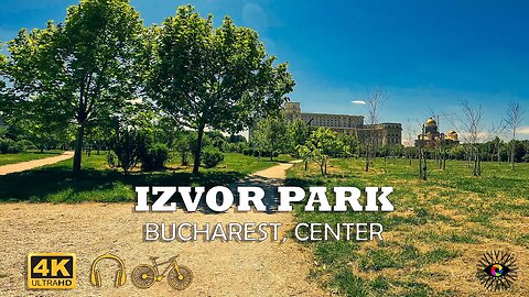
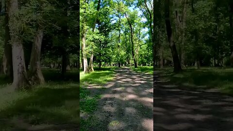
IZVOR Park, BUCHAREST, Center | 4k Virtual Tour | 🇷🇴
This video features a 4k virtual tour of the Izvor Park located in center Bucharest next to Dambovita River and the Palace of Parliament. Closed Captions [CC] which include historical facts and descriptions are available in all languages.
===============================================================================
🌎Complete Playlist of Virtual Tours: https://www.youtube.com/playlist?list=PLdyvAxFyPXo89pj1Q1oPwDmmVURBP1l8h 🌎
🏔️ Mountain road descents : https://www.youtube.com/playlist?list=PLdyvAxFyPXo8XTKj8xega-31flwsiEaV_ 🏔️
🏞️ Park rides : https://www.youtube.com/playlist?list=PLdyvAxFyPXo-aF6HRtKwq17l1m1LKvf5b 🏞️
🏨 Urban rides : https://www.youtube.com/playlist?list=PLdyvAxFyPXo8uQ-gTaZ3b38SmrEC13pwq 🏨
🌳 Forest rides : https://www.youtube.com/playlist?list=PLdyvAxFyPXo8-7xZMAHzDJmQRP4Dx7ffy 🌳
📢 𝗣𝗹𝗲𝗮𝘀𝗲 𝗦𝘂𝗯𝘀𝗰𝗿𝗶𝗯𝗲! 📢 - youtube.com/channel/UCib-JDIHF_Btivu010jNd5g?sub_confirmation=1
===============================================================================
✔️JOIN US:✔️
➤TikTok: https://www.tiktok.com/@snailsonwheelz?lang=en
➤Instagram: https://www.instagram.com/snails_on_wh33ls/?hl=ro
➤Facebook: https://www.facebook.com/snailsonwheels
===============================================================================
INFO :
On the site of the current park, before 1984-1985, there was the Mihai-Vodă hill, on which the Mihai Vodă Monastery stood. Through the plan to modernize Bucharest and build the Civic Center, the hill was leveled and the cells of the monastery were demolished. Mihai-Vodă Church, together with the bell tower, was saved, in 1985, being translated to the east, on the slope, over a distance of 289 m and lowered vertically by 6.2 m[1], to the bank of Dâmbovița, where it was hidden from view, after some blocks, on Sapienței street. The rest of the buildings on the hill were demolished, including the Palace of State Archives, rebuilt in the years 1900-1916, according to the plans of the architects Petre Antonescu and Cristofi Cerchez, and the archaeological site with vestiges from the Bronze Age, located in the courtyard of the monastery, was also destroyed. Next to the monastery were the remains of the New Court (also called Curtea Arsă, after the fire of 1812), erected by the Phanariot Alexandru Ipsilanti, which were also irreparably destroyed.
In the corner from the Hasdeu bridge of the current Izvor park, located at the intersection between Splaiul Independentiei and Str. Bogdan Petriceicu Hasdeu, across the street from the Faculty of Biology of the University of Bucharest, there was, since 1925, the Institute of Theoretical Chemistry within the University of Bucharest. The L-shaped, 3-story building collapsed in the earthquake of March 4, 1977. The remains of the faculty were demolished and the building was never rebuilt.[2]
In that level place it was desired to build a large conference and reception hall. After the Romanian Revolution of 1989, the project was no longer started and the location remained at the "maidan" stage.
In the 90s, the City Hall laid out alleys, planted trees and gave the place the name Parkul Izvor. The park has the shape of a rectangle, with an area of 17 hectares, and is bounded by Naçionile Unite boulevard, Libertății boulevard, B. P. Hasdeu street and Splaiul Independţei, where the Izvor metro station is also located. Of the 170,000 square meters occupied by Izvor Park, 28,902 square meters are walkways and 141,098 square meters are covered with grass. The 4 main paths, which add up to about 3.2 km, are ideal routes for those who practice running or jogging.
Source : https://ro.wikipedia.org/wiki/Parcul_Izvor
5
views
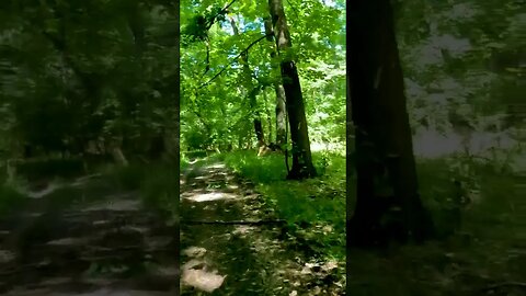
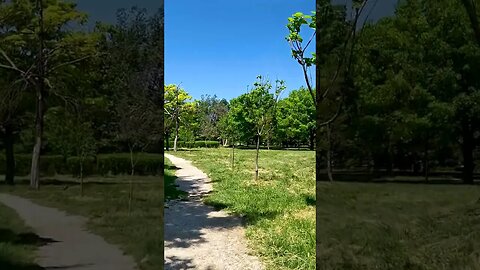
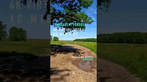
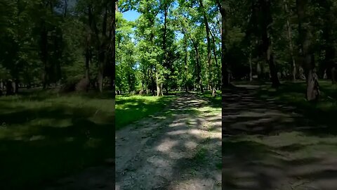
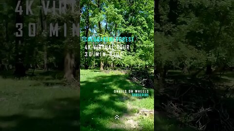
Calugareni Forest | Calugareni, Giurgiu | Ambiental music | 4k Virtual Tour | 🇷🇴
#virtualtour #bikeride #mtblife #shortsfeed #shortsyoutube #shortsvideo #shortfeed #shortvideo #cyclingworkout #indoorcycling #4kride #romania #shortsfeed #shortsbeta #shortfeed
This episode features a 4k Virtual Tour made at the Calugareni Forest, located in the Giurgiu county. A 30 minutes ride with ambiental music and info. This is a short XC MTB Ride with a distance of about 5 km start from Calugareni Forest, passing by the Neajlov river as we exit the forest area into the plainfields, on to the levy and back on to the road. Closed Captions [CC] which include historical facts and descriptions are available in all languages.
===============================================================================
🌎Complete Playlist of Virtual Tours: https://www.youtube.com/playlist?list=PLdyvAxFyPXo89pj1Q1oPwDmmVURBP1l8h 🌎
🏔️ Mountain road descents : https://www.youtube.com/playlist?list=PLdyvAxFyPXo8XTKj8xega-31flwsiEaV_ 🏔️
🏞️ Park rides : https://www.youtube.com/playlist?list=PLdyvAxFyPXo-aF6HRtKwq17l1m1LKvf5b 🏞️
🏨 Urban rides : https://www.youtube.com/playlist?list=PLdyvAxFyPXo8uQ-gTaZ3b38SmrEC13pwq 🏨
🌳 Forest rides : https://www.youtube.com/playlist?list=PLdyvAxFyPXo8-7xZMAHzDJmQRP4Dx7ffy 🌳
📢 𝗣𝗹𝗲𝗮𝘀𝗲 𝗦𝘂𝗯𝘀𝗰𝗿𝗶𝗯𝗲! 📢 - youtube.com/channel/UCib-JDIHF_Btivu010jNd5g?sub_confirmation=1
===============================================================================
✔️JOIN US:✔️
➤TikTok: https://www.tiktok.com/@snailsonwheelz?lang=en
➤Instagram: https://www.instagram.com/snails_on_wh33ls/?hl=ro
➤Facebook: https://www.facebook.com/snailsonwheels
===============================================================================
INFO :
The village of Calugareni is known in history for the battle that took place here on August 13/23 1595. The 10,000-strong Muntenian army, led by Mihai Viteazul (Michael The Brave- ruler of Wallachia between 1593-1600), tried to stop the invading Ottoman army led by Sinan Pasha, whose goal was to transform Wallachia into a pashalac.
Mihai Viteazul chose Călugăreni (Giurgiu County), on Neajlov, as a place of battle because it was a swampy area and he opted for this land because he could easily block the flanks of the Ottoman army.
The Muntenian army was stationed to the north of the locality, near the Calugareni forest, while the patrols kept an eye on the banks of Neajlov and Câlniştea rivers. The Ottoman vanguard was led by Hasan Pasha, the right flank was provided by Satırcı Mehmed Pasha, and the left by Haydar Pasha.
Mihai Viteazul attacked at dawn on August 13, 1595 with the bulk of his army (about 10,000 men). Because he was not sure of their good intentions, Mihai still keeps a corps of 1,200 horsemen, under the command of Pope Stoica from Fărcaşe, meant to ensure the retreat. The initial attack of the Muntenians reached the tent camp of the Turks.
Giurgiu is a county (județ) of Romania on the border with Bulgaria, in Muntenia, with the capital city at Giurgiu.
This county has a total area of 3,526 km2 (1,361 sq mi).
The county is situated on a plain – the Southern part of the Wallachian Plain. The landscape is flat, crossed by small rivers. The southern part is the valley of the Danube which forms the border with Bulgaria. In the North, the Argeș River and Dâmbovița River flow.
The county has two big areas of development: one close to the city of Giurgiu – The Free Trade Zone Giurgiu, and one in the North of the county due to its proximity with Bucharest.
The predominant industries in the county are:
Food and beverages industry.
Textile industry.
Chemical industry.
Wood and furniture industry.
Mechanical components industry.
Agriculture is the main occupation in the county. Both extensive agriculture, and small scale (for Bucharest markets), is practiced. 59% of the cultivated surface is irrigated.
The county recently became famous for its lăutari, especially the group Taraful Haiducilor.
The main tourist destinations are:
The city of Giurgiu
Here the tourists can visit:
The Clock Tower, made by the Turks when the Giurgiu was a raya
The Historical Museum
The theatre "Valah"
The first bridge built in angel from Europe,[clarification needed] over the Canalul Sfântul Gheorghe and Canalul Plantelor, with a specific construction over 100 years old; near this bridge is a new one from 2007
The Friendship Bridge over the Danube between Giurgiu and Ruse, Bulgaria
The churches painted by important painters like Grigorescu
The fluvial station on the Danube river "Port Giurgiu"
The street "Strada Gării" filled with markets
The beautiful parks from town where many statues and fountains can be found
Fishing along the Danube
The Călugăreni area
The monasteries from Giurgiu and Comana
Source : https://en.wikipedia.org/wiki/Giurgiu_County
5
views
Calugareni Forest | Calugareni, Giurgiu | Ambiental music | 4k Virtual Tour | 🇷🇴
#virtualtour #bikeride #mtblife #shortsfeed #shortsyoutube #shortsvideo #shortfeed #shortvideo #cyclingworkout #indoorcycling #4kride #romania #shortsfeed #shortsbeta #shortfeed
This episode features a 4k Virtual Tour made at the Calugareni Forest, located in the Giurgiu county. A 30 minutes ride with ambiental music and info. This is a short XC MTB Ride with a distance of about 5 km start from Calugareni Forest, passing by the Neajlov river as we exit the forest area into the plainfields, on to the levy and back on to the road. Closed Captions [CC] which include historical facts and descriptions are available in all languages.
===============================================================================
🌎Complete Playlist of Virtual Tours: https://www.youtube.com/playlist?list=PLdyvAxFyPXo89pj1Q1oPwDmmVURBP1l8h 🌎
🏔️ Mountain road descents : https://www.youtube.com/playlist?list=PLdyvAxFyPXo8XTKj8xega-31flwsiEaV_ 🏔️
🏞️ Park rides : https://www.youtube.com/playlist?list=PLdyvAxFyPXo-aF6HRtKwq17l1m1LKvf5b 🏞️
🏨 Urban rides : https://www.youtube.com/playlist?list=PLdyvAxFyPXo8uQ-gTaZ3b38SmrEC13pwq 🏨
🌳 Forest rides : https://www.youtube.com/playlist?list=PLdyvAxFyPXo8-7xZMAHzDJmQRP4Dx7ffy 🌳
📢 𝗣𝗹𝗲𝗮𝘀𝗲 𝗦𝘂𝗯𝘀𝗰𝗿𝗶𝗯𝗲! 📢 - youtube.com/channel/UCib-JDIHF_Btivu010jNd5g?sub_confirmation=1
===============================================================================
✔️JOIN US:✔️
➤TikTok: https://www.tiktok.com/@snailsonwheelz?lang=en
➤Instagram: https://www.instagram.com/snails_on_wh33ls/?hl=ro
➤Facebook: https://www.facebook.com/snailsonwheels
===============================================================================
INFO :
The village of Calugareni is known in history for the battle that took place here on August 13/23 1595. The 10,000-strong Muntenian army, led by Mihai Viteazul (Michael The Brave- ruler of Wallachia between 1593-1600), tried to stop the invading Ottoman army led by Sinan Pasha, whose goal was to transform Wallachia into a pashalac.
Mihai Viteazul chose Călugăreni (Giurgiu County), on Neajlov, as a place of battle because it was a swampy area and he opted for this land because he could easily block the flanks of the Ottoman army.
The Muntenian army was stationed to the north of the locality, near the Calugareni forest, while the patrols kept an eye on the banks of Neajlov and Câlniştea rivers. The Ottoman vanguard was led by Hasan Pasha, the right flank was provided by Satırcı Mehmed Pasha, and the left by Haydar Pasha.
Mihai Viteazul attacked at dawn on August 13, 1595 with the bulk of his army (about 10,000 men). Because he was not sure of their good intentions, Mihai still keeps a corps of 1,200 horsemen, under the command of Pope Stoica from Fărcaşe, meant to ensure the retreat. The initial attack of the Muntenians reached the tent camp of the Turks.
Giurgiu is a county (județ) of Romania on the border with Bulgaria, in Muntenia, with the capital city at Giurgiu.
This county has a total area of 3,526 km2 (1,361 sq mi).
The county is situated on a plain – the Southern part of the Wallachian Plain. The landscape is flat, crossed by small rivers. The southern part is the valley of the Danube which forms the border with Bulgaria. In the North, the Argeș River and Dâmbovița River flow.
The county has two big areas of development: one close to the city of Giurgiu – The Free Trade Zone Giurgiu, and one in the North of the county due to its proximity with Bucharest.
The predominant industries in the county are:
Food and beverages industry.
Textile industry.
Chemical industry.
Wood and furniture industry.
Mechanical components industry.
Agriculture is the main occupation in the county. Both extensive agriculture, and small scale (for Bucharest markets), is practiced. 59% of the cultivated surface is irrigated.
The county recently became famous for its lăutari, especially the group Taraful Haiducilor.
The main tourist destinations are:
The city of Giurgiu
Here the tourists can visit:
The Clock Tower, made by the Turks when the Giurgiu was a raya
The Historical Museum
The theatre "Valah"
The first bridge built in angel from Europe,[clarification needed] over the Canalul Sfântul Gheorghe and Canalul Plantelor, with a specific construction over 100 years old; near this bridge is a new one from 2007
The Friendship Bridge over the Danube between Giurgiu and Ruse, Bulgaria
The churches painted by important painters like Grigorescu
The fluvial station on the Danube river "Port Giurgiu"
The street "Strada Gării" filled with markets
The beautiful parks from town where many statues and fountains can be found
Fishing along the Danube
The Călugăreni area
The monasteries from Giurgiu and Comana
Source : https://en.wikipedia.org/wiki/Giurgiu_County
16
views
Calugareni Forest | Calugareni, Giurgiu | Ambiental music | 4k Virtual Tour | 🇷🇴
#virtualtour #bikeride #mtblife #shortsfeed #shortsyoutube #shortsvideo #shortfeed #shortvideo #cyclingworkout #indoorcycling #4kride #romania #shortsfeed #shortsbeta #shortfeed
This episode features a 4k Virtual Tour made at the Calugareni Forest, located in the Giurgiu county. A 30 minutes ride with ambiental music and info. This is a short XC MTB Ride with a distance of about 5 km start from Calugareni Forest, passing by the Neajlov river as we exit the forest area into the plainfields, on to the levy and back on to the road. Closed Captions [CC] which include historical facts and descriptions are available in all languages.
===============================================================================
🌎Complete Playlist of Virtual Tours: https://www.youtube.com/playlist?list=PLdyvAxFyPXo89pj1Q1oPwDmmVURBP1l8h 🌎
🏔️ Mountain road descents : https://www.youtube.com/playlist?list=PLdyvAxFyPXo8XTKj8xega-31flwsiEaV_ 🏔️
🏞️ Park rides : https://www.youtube.com/playlist?list=PLdyvAxFyPXo-aF6HRtKwq17l1m1LKvf5b 🏞️
🏨 Urban rides : https://www.youtube.com/playlist?list=PLdyvAxFyPXo8uQ-gTaZ3b38SmrEC13pwq 🏨
🌳 Forest rides : https://www.youtube.com/playlist?list=PLdyvAxFyPXo8-7xZMAHzDJmQRP4Dx7ffy 🌳
📢 𝗣𝗹𝗲𝗮𝘀𝗲 𝗦𝘂𝗯𝘀𝗰𝗿𝗶𝗯𝗲! 📢 - youtube.com/channel/UCib-JDIHF_Btivu010jNd5g?sub_confirmation=1
===============================================================================
✔️JOIN US:✔️
➤TikTok: https://www.tiktok.com/@snailsonwheelz?lang=en
➤Instagram: https://www.instagram.com/snails_on_wh33ls/?hl=ro
➤Facebook: https://www.facebook.com/snailsonwheels
===============================================================================
INFO :
The village of Calugareni is known in history for the battle that took place here on August 13/23 1595. The 10,000-strong Muntenian army, led by Mihai Viteazul (Michael The Brave- ruler of Wallachia between 1593-1600), tried to stop the invading Ottoman army led by Sinan Pasha, whose goal was to transform Wallachia into a pashalac.
Mihai Viteazul chose Călugăreni (Giurgiu County), on Neajlov, as a place of battle because it was a swampy area and he opted for this land because he could easily block the flanks of the Ottoman army.
The Muntenian army was stationed to the north of the locality, near the Calugareni forest, while the patrols kept an eye on the banks of Neajlov and Câlniştea rivers. The Ottoman vanguard was led by Hasan Pasha, the right flank was provided by Satırcı Mehmed Pasha, and the left by Haydar Pasha.
Mihai Viteazul attacked at dawn on August 13, 1595 with the bulk of his army (about 10,000 men). Because he was not sure of their good intentions, Mihai still keeps a corps of 1,200 horsemen, under the command of Pope Stoica from Fărcaşe, meant to ensure the retreat. The initial attack of the Muntenians reached the tent camp of the Turks.
Giurgiu is a county (județ) of Romania on the border with Bulgaria, in Muntenia, with the capital city at Giurgiu.
This county has a total area of 3,526 km2 (1,361 sq mi).
The county is situated on a plain – the Southern part of the Wallachian Plain. The landscape is flat, crossed by small rivers. The southern part is the valley of the Danube which forms the border with Bulgaria. In the North, the Argeș River and Dâmbovița River flow.
The county has two big areas of development: one close to the city of Giurgiu – The Free Trade Zone Giurgiu, and one in the North of the county due to its proximity with Bucharest.
The predominant industries in the county are:
Food and beverages industry.
Textile industry.
Chemical industry.
Wood and furniture industry.
Mechanical components industry.
Agriculture is the main occupation in the county. Both extensive agriculture, and small scale (for Bucharest markets), is practiced. 59% of the cultivated surface is irrigated.
The county recently became famous for its lăutari, especially the group Taraful Haiducilor.
The main tourist destinations are:
The city of Giurgiu
Here the tourists can visit:
The Clock Tower, made by the Turks when the Giurgiu was a raya
The Historical Museum
The theatre "Valah"
The first bridge built in angel from Europe,[clarification needed] over the Canalul Sfântul Gheorghe and Canalul Plantelor, with a specific construction over 100 years old; near this bridge is a new one from 2007
The Friendship Bridge over the Danube between Giurgiu and Ruse, Bulgaria
The churches painted by important painters like Grigorescu
The fluvial station on the Danube river "Port Giurgiu"
The street "Strada Gării" filled with markets
The beautiful parks from town where many statues and fountains can be found
Fishing along the Danube
The Călugăreni area
The monasteries from Giurgiu and Comana
Source : https://en.wikipedia.org/wiki/Giurgiu_County
11
views
Calugareni Forest | Calugareni, Giurgiu | Ambiental music | 4k Virtual Tour | 🇷🇴
#virtualtour #bikeride #mtblife #shortsfeed #shortsyoutube #shortsvideo #shortfeed #shortvideo #cyclingworkout #indoorcycling #4kride #romania #shortsfeed #shortsbeta #shortfeed
This episode features a 4k Virtual Tour made at the Calugareni Forest, located in the Giurgiu county. A 30 minutes ride with ambiental music and info. This is a short XC MTB Ride with a distance of about 5 km start from Calugareni Forest, passing by the Neajlov river as we exit the forest area into the plainfields, on to the levy and back on to the road. Closed Captions [CC] which include historical facts and descriptions are available in all languages.
===============================================================================
🌎Complete Playlist of Virtual Tours: https://www.youtube.com/playlist?list=PLdyvAxFyPXo89pj1Q1oPwDmmVURBP1l8h 🌎
🏔️ Mountain road descents : https://www.youtube.com/playlist?list=PLdyvAxFyPXo8XTKj8xega-31flwsiEaV_ 🏔️
🏞️ Park rides : https://www.youtube.com/playlist?list=PLdyvAxFyPXo-aF6HRtKwq17l1m1LKvf5b 🏞️
🏨 Urban rides : https://www.youtube.com/playlist?list=PLdyvAxFyPXo8uQ-gTaZ3b38SmrEC13pwq 🏨
🌳 Forest rides : https://www.youtube.com/playlist?list=PLdyvAxFyPXo8-7xZMAHzDJmQRP4Dx7ffy 🌳
📢 𝗣𝗹𝗲𝗮𝘀𝗲 𝗦𝘂𝗯𝘀𝗰𝗿𝗶𝗯𝗲! 📢 - youtube.com/channel/UCib-JDIHF_Btivu010jNd5g?sub_confirmation=1
===============================================================================
✔️JOIN US:✔️
➤TikTok: https://www.tiktok.com/@snailsonwheelz?lang=en
➤Instagram: https://www.instagram.com/snails_on_wh33ls/?hl=ro
➤Facebook: https://www.facebook.com/snailsonwheels
===============================================================================
INFO :
The village of Calugareni is known in history for the battle that took place here on August 13/23 1595. The 10,000-strong Muntenian army, led by Mihai Viteazul (Michael The Brave- ruler of Wallachia between 1593-1600), tried to stop the invading Ottoman army led by Sinan Pasha, whose goal was to transform Wallachia into a pashalac.
Mihai Viteazul chose Călugăreni (Giurgiu County), on Neajlov, as a place of battle because it was a swampy area and he opted for this land because he could easily block the flanks of the Ottoman army.
The Muntenian army was stationed to the north of the locality, near the Calugareni forest, while the patrols kept an eye on the banks of Neajlov and Câlniştea rivers. The Ottoman vanguard was led by Hasan Pasha, the right flank was provided by Satırcı Mehmed Pasha, and the left by Haydar Pasha.
Mihai Viteazul attacked at dawn on August 13, 1595 with the bulk of his army (about 10,000 men). Because he was not sure of their good intentions, Mihai still keeps a corps of 1,200 horsemen, under the command of Pope Stoica from Fărcaşe, meant to ensure the retreat. The initial attack of the Muntenians reached the tent camp of the Turks.
Giurgiu is a county (județ) of Romania on the border with Bulgaria, in Muntenia, with the capital city at Giurgiu.
This county has a total area of 3,526 km2 (1,361 sq mi).
The county is situated on a plain – the Southern part of the Wallachian Plain. The landscape is flat, crossed by small rivers. The southern part is the valley of the Danube which forms the border with Bulgaria. In the North, the Argeș River and Dâmbovița River flow.
The county has two big areas of development: one close to the city of Giurgiu – The Free Trade Zone Giurgiu, and one in the North of the county due to its proximity with Bucharest.
The predominant industries in the county are:
Food and beverages industry.
Textile industry.
Chemical industry.
Wood and furniture industry.
Mechanical components industry.
Agriculture is the main occupation in the county. Both extensive agriculture, and small scale (for Bucharest markets), is practiced. 59% of the cultivated surface is irrigated.
The county recently became famous for its lăutari, especially the group Taraful Haiducilor.
The main tourist destinations are:
The city of Giurgiu
Here the tourists can visit:
The Clock Tower, made by the Turks when the Giurgiu was a raya
The Historical Museum
The theatre "Valah"
The first bridge built in angel from Europe,[clarification needed] over the Canalul Sfântul Gheorghe and Canalul Plantelor, with a specific construction over 100 years old; near this bridge is a new one from 2007
The Friendship Bridge over the Danube between Giurgiu and Ruse, Bulgaria
The churches painted by important painters like Grigorescu
The fluvial station on the Danube river "Port Giurgiu"
The street "Strada Gării" filled with markets
The beautiful parks from town where many statues and fountains can be found
Fishing along the Danube
The Călugăreni area
The monasteries from Giurgiu and Comana
Source : https://en.wikipedia.org/wiki/Giurgiu_County
14
views
Calugareni Forest | Calugareni, Giurgiu | Ambiental music | 4k Virtual Tour | 🇷🇴
#virtualtour #bikeride #mtblife #shortsfeed #shortsyoutube #shortsvideo #shortfeed #shortvideo #cyclingworkout #indoorcycling #4kride #romania #shortsfeed #shortsbeta #shortfeed
This episode features a 4k Virtual Tour made at the Calugareni Forest, located in the Giurgiu county. A 30 minutes ride with ambiental music and info. This is a short XC MTB Ride with a distance of about 5 km start from Calugareni Forest, passing by the Neajlov river as we exit the forest area into the plainfields, on to the levy and back on to the road. Closed Captions [CC] which include historical facts and descriptions are available in all languages.
===============================================================================
🌎Complete Playlist of Virtual Tours: https://www.youtube.com/playlist?list=PLdyvAxFyPXo89pj1Q1oPwDmmVURBP1l8h 🌎
🏔️ Mountain road descents : https://www.youtube.com/playlist?list=PLdyvAxFyPXo8XTKj8xega-31flwsiEaV_ 🏔️
🏞️ Park rides : https://www.youtube.com/playlist?list=PLdyvAxFyPXo-aF6HRtKwq17l1m1LKvf5b 🏞️
🏨 Urban rides : https://www.youtube.com/playlist?list=PLdyvAxFyPXo8uQ-gTaZ3b38SmrEC13pwq 🏨
🌳 Forest rides : https://www.youtube.com/playlist?list=PLdyvAxFyPXo8-7xZMAHzDJmQRP4Dx7ffy 🌳
📢 𝗣𝗹𝗲𝗮𝘀𝗲 𝗦𝘂𝗯𝘀𝗰𝗿𝗶𝗯𝗲! 📢 - youtube.com/channel/UCib-JDIHF_Btivu010jNd5g?sub_confirmation=1
===============================================================================
✔️JOIN US:✔️
➤TikTok: https://www.tiktok.com/@snailsonwheelz?lang=en
➤Instagram: https://www.instagram.com/snails_on_wh33ls/?hl=ro
➤Facebook: https://www.facebook.com/snailsonwheels
===============================================================================
INFO :
The village of Calugareni is known in history for the battle that took place here on August 13/23 1595. The 10,000-strong Muntenian army, led by Mihai Viteazul (Michael The Brave- ruler of Wallachia between 1593-1600), tried to stop the invading Ottoman army led by Sinan Pasha, whose goal was to transform Wallachia into a pashalac.
Mihai Viteazul chose Călugăreni (Giurgiu County), on Neajlov, as a place of battle because it was a swampy area and he opted for this land because he could easily block the flanks of the Ottoman army.
The Muntenian army was stationed to the north of the locality, near the Calugareni forest, while the patrols kept an eye on the banks of Neajlov and Câlniştea rivers. The Ottoman vanguard was led by Hasan Pasha, the right flank was provided by Satırcı Mehmed Pasha, and the left by Haydar Pasha.
Mihai Viteazul attacked at dawn on August 13, 1595 with the bulk of his army (about 10,000 men). Because he was not sure of their good intentions, Mihai still keeps a corps of 1,200 horsemen, under the command of Pope Stoica from Fărcaşe, meant to ensure the retreat. The initial attack of the Muntenians reached the tent camp of the Turks.
Giurgiu is a county (județ) of Romania on the border with Bulgaria, in Muntenia, with the capital city at Giurgiu.
This county has a total area of 3,526 km2 (1,361 sq mi).
The county is situated on a plain – the Southern part of the Wallachian Plain. The landscape is flat, crossed by small rivers. The southern part is the valley of the Danube which forms the border with Bulgaria. In the North, the Argeș River and Dâmbovița River flow.
The county has two big areas of development: one close to the city of Giurgiu – The Free Trade Zone Giurgiu, and one in the North of the county due to its proximity with Bucharest.
The predominant industries in the county are:
Food and beverages industry.
Textile industry.
Chemical industry.
Wood and furniture industry.
Mechanical components industry.
Agriculture is the main occupation in the county. Both extensive agriculture, and small scale (for Bucharest markets), is practiced. 59% of the cultivated surface is irrigated.
The county recently became famous for its lăutari, especially the group Taraful Haiducilor.
The main tourist destinations are:
The city of Giurgiu
Here the tourists can visit:
The Clock Tower, made by the Turks when the Giurgiu was a raya
The Historical Museum
The theatre "Valah"
The first bridge built in angel from Europe,[clarification needed] over the Canalul Sfântul Gheorghe and Canalul Plantelor, with a specific construction over 100 years old; near this bridge is a new one from 2007
The Friendship Bridge over the Danube between Giurgiu and Ruse, Bulgaria
The churches painted by important painters like Grigorescu
The fluvial station on the Danube river "Port Giurgiu"
The street "Strada Gării" filled with markets
The beautiful parks from town where many statues and fountains can be found
Fishing along the Danube
The Călugăreni area
The monasteries from Giurgiu and Comana
Source : https://en.wikipedia.org/wiki/Giurgiu_County
5
views
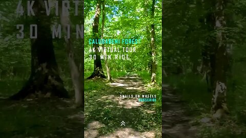
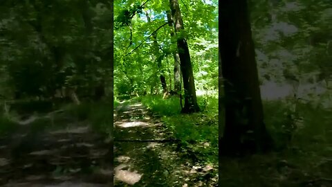
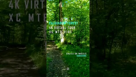
Calugareni Forest | Calugareni, Giurgiu | Ambiental music | 4k Virtual Tour | 🇷🇴
#forestride #indoorcycling #cyclinglife #forestsounds #virtualtour #virtualtours #cyclingpassion #cyclingaddict #cyclingadventure #cyclingvlog #cyclingworkout #4kride #romania #ambientalmusic #cycling
This episode features a 4k Virtual Tour made at the Calugareni Forest, located in the Giurgiu county. A 30 minutes ride with ambiental music and info. This is a short XC MTB Ride with a distance of about 5 km start from Calugareni Forest, passing by the Neajlov river as we exit the forest area into the plainfields, on to the levy and back on to the road. Closed Captions [CC] which include historical facts and descriptions are available in all languages.
===============================================================================
🌎Complete Playlist of Virtual Tours: https://www.youtube.com/playlist?list=PLdyvAxFyPXo89pj1Q1oPwDmmVURBP1l8h 🌎
🏔️ Mountain road descents : https://www.youtube.com/playlist?list=PLdyvAxFyPXo8XTKj8xega-31flwsiEaV_ 🏔️
🏞️ Park rides : https://www.youtube.com/playlist?list=PLdyvAxFyPXo-aF6HRtKwq17l1m1LKvf5b 🏞️
🏨 Urban rides : https://www.youtube.com/playlist?list=PLdyvAxFyPXo8uQ-gTaZ3b38SmrEC13pwq 🏨
🌳 Forest rides : https://www.youtube.com/playlist?list=PLdyvAxFyPXo8-7xZMAHzDJmQRP4Dx7ffy 🌳
📢 𝗣𝗹𝗲𝗮𝘀𝗲 𝗦𝘂𝗯𝘀𝗰𝗿𝗶𝗯𝗲! 📢 - youtube.com/channel/UCib-JDIHF_Btivu010jNd5g?sub_confirmation=1
===============================================================================
✔️JOIN US:✔️
➤TikTok: https://www.tiktok.com/@snailsonwheelz?lang=en
➤Instagram: https://www.instagram.com/snails_on_wh33ls/?hl=ro
➤Facebook: https://www.facebook.com/snailsonwheels
===============================================================================
INFO :
The village of Calugareni is known in history for the battle that took place here on August 13/23 1595. The 10,000-strong Muntenian army, led by Mihai Viteazul (Michael The Brave- ruler of Wallachia between 1593-1600), tried to stop the invading Ottoman army led by Sinan Pasha, whose goal was to transform Wallachia into a pashalac.
Mihai Viteazul chose Călugăreni (Giurgiu County), on Neajlov, as a place of battle because it was a swampy area and he opted for this land because he could easily block the flanks of the Ottoman army.
The Muntenian army was stationed to the north of the locality, near the Calugareni forest, while the patrols kept an eye on the banks of Neajlov and Câlniştea rivers. The Ottoman vanguard was led by Hasan Pasha, the right flank was provided by Satırcı Mehmed Pasha, and the left by Haydar Pasha.
Mihai Viteazul attacked at dawn on August 13, 1595 with the bulk of his army (about 10,000 men). Because he was not sure of their good intentions, Mihai still keeps a corps of 1,200 horsemen, under the command of Pope Stoica from Fărcaşe, meant to ensure the retreat. The initial attack of the Muntenians reached the tent camp of the Turks.
Giurgiu is a county (județ) of Romania on the border with Bulgaria, in Muntenia, with the capital city at Giurgiu.
This county has a total area of 3,526 km2 (1,361 sq mi).
The county is situated on a plain – the Southern part of the Wallachian Plain. The landscape is flat, crossed by small rivers. The southern part is the valley of the Danube which forms the border with Bulgaria. In the North, the Argeș River and Dâmbovița River flow.
The county has two big areas of development: one close to the city of Giurgiu – The Free Trade Zone Giurgiu, and one in the North of the county due to its proximity with Bucharest.
The predominant industries in the county are:
Food and beverages industry.
Textile industry.
Chemical industry.
Wood and furniture industry.
Mechanical components industry.
Agriculture is the main occupation in the county. Both extensive agriculture, and small scale (for Bucharest markets), is practiced. 59% of the cultivated surface is irrigated.
The county recently became famous for its lăutari, especially the group Taraful Haiducilor.
The main tourist destinations are:
The city of Giurgiu
Here the tourists can visit:
The Clock Tower, made by the Turks when the Giurgiu was a raya
The Historical Museum
The theatre "Valah"
The first bridge built in angel from Europe,[clarification needed] over the Canalul Sfântul Gheorghe and Canalul Plantelor, with a specific construction over 100 years old; near this bridge is a new one from 2007
The Friendship Bridge over the Danube between Giurgiu and Ruse, Bulgaria
The churches painted by important painters like Grigorescu
The fluvial station on the Danube river "Port Giurgiu"
The street "Strada Gării" filled with markets
The beautiful parks from town where many statues and fountains can be found
Fishing along the Danube
The Călugăreni area
The monasteries from Giurgiu and Comana
Source : https://en.wikipedia.org/wiki/Giurgiu_County
21
views
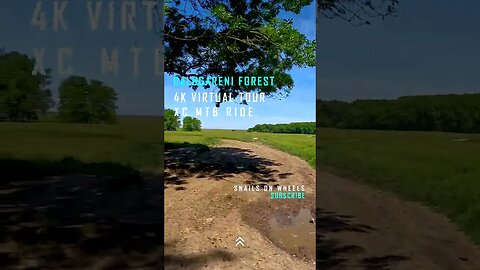
Calugareni Forest | Calugareni, Giurgiu | Ambiental music | 4k Virtual Tour | 🇷🇴
#forestride #indoorcycling #cyclinglife #forestsounds #virtualtour #virtualtours #cyclingpassion #cyclingaddict #cyclingadventure #cyclingvlog #cyclingworkout #4kride #romania #ambientalmusic #cycling
This episode features a 4k Virtual Tour made at the Calugareni Forest, located in the Giurgiu county. A 30 minutes ride with ambiental music and info. This is a short XC MTB Ride with a distance of about 5 km start from Calugareni Forest, passing by the Neajlov river as we exit the forest area into the plainfields, on to the levy and back on to the road. Closed Captions [CC] which include historical facts and descriptions are available in all languages.
===============================================================================
🌎Complete Playlist of Virtual Tours: https://www.youtube.com/playlist?list=PLdyvAxFyPXo89pj1Q1oPwDmmVURBP1l8h 🌎
🏔️ Mountain road descents : https://www.youtube.com/playlist?list=PLdyvAxFyPXo8XTKj8xega-31flwsiEaV_ 🏔️
🏞️ Park rides : https://www.youtube.com/playlist?list=PLdyvAxFyPXo-aF6HRtKwq17l1m1LKvf5b 🏞️
🏨 Urban rides : https://www.youtube.com/playlist?list=PLdyvAxFyPXo8uQ-gTaZ3b38SmrEC13pwq 🏨
🌳 Forest rides : https://www.youtube.com/playlist?list=PLdyvAxFyPXo8-7xZMAHzDJmQRP4Dx7ffy 🌳
📢 𝗣𝗹𝗲𝗮𝘀𝗲 𝗦𝘂𝗯𝘀𝗰𝗿𝗶𝗯𝗲! 📢 - youtube.com/channel/UCib-JDIHF_Btivu010jNd5g?sub_confirmation=1
===============================================================================
✔️JOIN US:✔️
➤TikTok: https://www.tiktok.com/@snailsonwheelz?lang=en
➤Instagram: https://www.instagram.com/snails_on_wh33ls/?hl=ro
➤Facebook: https://www.facebook.com/snailsonwheels
===============================================================================
INFO :
The village of Calugareni is known in history for the battle that took place here on August 13/23 1595. The 10,000-strong Muntenian army, led by Mihai Viteazul (Michael The Brave- ruler of Wallachia between 1593-1600), tried to stop the invading Ottoman army led by Sinan Pasha, whose goal was to transform Wallachia into a pashalac.
Mihai Viteazul chose Călugăreni (Giurgiu County), on Neajlov, as a place of battle because it was a swampy area and he opted for this land because he could easily block the flanks of the Ottoman army.
The Muntenian army was stationed to the north of the locality, near the Calugareni forest, while the patrols kept an eye on the banks of Neajlov and Câlniştea rivers. The Ottoman vanguard was led by Hasan Pasha, the right flank was provided by Satırcı Mehmed Pasha, and the left by Haydar Pasha.
Mihai Viteazul attacked at dawn on August 13, 1595 with the bulk of his army (about 10,000 men). Because he was not sure of their good intentions, Mihai still keeps a corps of 1,200 horsemen, under the command of Pope Stoica from Fărcaşe, meant to ensure the retreat. The initial attack of the Muntenians reached the tent camp of the Turks.
Giurgiu is a county (județ) of Romania on the border with Bulgaria, in Muntenia, with the capital city at Giurgiu.
This county has a total area of 3,526 km2 (1,361 sq mi).
The county is situated on a plain – the Southern part of the Wallachian Plain. The landscape is flat, crossed by small rivers. The southern part is the valley of the Danube which forms the border with Bulgaria. In the North, the Argeș River and Dâmbovița River flow.
The county has two big areas of development: one close to the city of Giurgiu – The Free Trade Zone Giurgiu, and one in the North of the county due to its proximity with Bucharest.
The predominant industries in the county are:
Food and beverages industry.
Textile industry.
Chemical industry.
Wood and furniture industry.
Mechanical components industry.
Agriculture is the main occupation in the county. Both extensive agriculture, and small scale (for Bucharest markets), is practiced. 59% of the cultivated surface is irrigated.
The county recently became famous for its lăutari, especially the group Taraful Haiducilor.
The main tourist destinations are:
The city of Giurgiu
Here the tourists can visit:
The Clock Tower, made by the Turks when the Giurgiu was a raya
The Historical Museum
The theatre "Valah"
The first bridge built in angel from Europe,[clarification needed] over the Canalul Sfântul Gheorghe and Canalul Plantelor, with a specific construction over 100 years old; near this bridge is a new one from 2007
The Friendship Bridge over the Danube between Giurgiu and Ruse, Bulgaria
The churches painted by important painters like Grigorescu
The fluvial station on the Danube river "Port Giurgiu"
The street "Strada Gării" filled with markets
The beautiful parks from town where many statues and fountains can be found
Fishing along the Danube
The Călugăreni area
The monasteries from Giurgiu and Comana
Source : https://en.wikipedia.org/wiki/Giurgiu_County
18
views

Calugareni Forest | Calugareni, Giurgiu | Ambiental music | 4k Virtual Tour | 🇷🇴
#forestride #indoorcycling #cyclinglife #forestsounds #virtualtour #virtualtours #cyclingpassion #cyclingaddict #cyclingadventure #cyclingvlog #cyclingworkout #4kride #romania #ambientalmusic #cycling
This episode features a 4k Virtual Tour made at the Calugareni Forest, located in the Giurgiu county. A 30 minutes ride with ambiental music and info. This is a short XC MTB Ride with a distance of about 5 km start from Calugareni Forest, passing by the Neajlov river as we exit the forest area into the plainfields, on to the levy and back on to the road. Closed Captions [CC] which include historical facts and descriptions are available in all languages.
===============================================================================
🌎Complete Playlist of Virtual Tours: https://www.youtube.com/playlist?list=PLdyvAxFyPXo89pj1Q1oPwDmmVURBP1l8h 🌎
🏔️ Mountain road descents : https://www.youtube.com/playlist?list=PLdyvAxFyPXo8XTKj8xega-31flwsiEaV_ 🏔️
🏞️ Park rides : https://www.youtube.com/playlist?list=PLdyvAxFyPXo-aF6HRtKwq17l1m1LKvf5b 🏞️
🏨 Urban rides : https://www.youtube.com/playlist?list=PLdyvAxFyPXo8uQ-gTaZ3b38SmrEC13pwq 🏨
🌳 Forest rides : https://www.youtube.com/playlist?list=PLdyvAxFyPXo8-7xZMAHzDJmQRP4Dx7ffy 🌳
📢 𝗣𝗹𝗲𝗮𝘀𝗲 𝗦𝘂𝗯𝘀𝗰𝗿𝗶𝗯𝗲! 📢 - youtube.com/channel/UCib-JDIHF_Btivu010jNd5g?sub_confirmation=1
===============================================================================
✔️JOIN US:✔️
➤TikTok: https://www.tiktok.com/@snailsonwheelz?lang=en
➤Instagram: https://www.instagram.com/snails_on_wh33ls/?hl=ro
➤Facebook: https://www.facebook.com/snailsonwheels
===============================================================================
INFO :
The village of Calugareni is known in history for the battle that took place here on August 13/23 1595. The 10,000-strong Muntenian army, led by Mihai Viteazul (Michael The Brave- ruler of Wallachia between 1593-1600), tried to stop the invading Ottoman army led by Sinan Pasha, whose goal was to transform Wallachia into a pashalac.
Mihai Viteazul chose Călugăreni (Giurgiu County), on Neajlov, as a place of battle because it was a swampy area and he opted for this land because he could easily block the flanks of the Ottoman army.
The Muntenian army was stationed to the north of the locality, near the Calugareni forest, while the patrols kept an eye on the banks of Neajlov and Câlniştea rivers. The Ottoman vanguard was led by Hasan Pasha, the right flank was provided by Satırcı Mehmed Pasha, and the left by Haydar Pasha.
Mihai Viteazul attacked at dawn on August 13, 1595 with the bulk of his army (about 10,000 men). Because he was not sure of their good intentions, Mihai still keeps a corps of 1,200 horsemen, under the command of Pope Stoica from Fărcaşe, meant to ensure the retreat. The initial attack of the Muntenians reached the tent camp of the Turks.
Giurgiu is a county (județ) of Romania on the border with Bulgaria, in Muntenia, with the capital city at Giurgiu.
This county has a total area of 3,526 km2 (1,361 sq mi).
The county is situated on a plain – the Southern part of the Wallachian Plain. The landscape is flat, crossed by small rivers. The southern part is the valley of the Danube which forms the border with Bulgaria. In the North, the Argeș River and Dâmbovița River flow.
The county has two big areas of development: one close to the city of Giurgiu – The Free Trade Zone Giurgiu, and one in the North of the county due to its proximity with Bucharest.
The predominant industries in the county are:
Food and beverages industry.
Textile industry.
Chemical industry.
Wood and furniture industry.
Mechanical components industry.
Agriculture is the main occupation in the county. Both extensive agriculture, and small scale (for Bucharest markets), is practiced. 59% of the cultivated surface is irrigated.
The county recently became famous for its lăutari, especially the group Taraful Haiducilor.
The main tourist destinations are:
The city of Giurgiu
Here the tourists can visit:
The Clock Tower, made by the Turks when the Giurgiu was a raya
The Historical Museum
The theatre "Valah"
The first bridge built in angel from Europe,[clarification needed] over the Canalul Sfântul Gheorghe and Canalul Plantelor, with a specific construction over 100 years old; near this bridge is a new one from 2007
The Friendship Bridge over the Danube between Giurgiu and Ruse, Bulgaria
The churches painted by important painters like Grigorescu
The fluvial station on the Danube river "Port Giurgiu"
The street "Strada Gării" filled with markets
The beautiful parks from town where many statues and fountains can be found
Fishing along the Danube
The Călugăreni area
The monasteries from Giurgiu and Comana
Source : https://en.wikipedia.org/wiki/Giurgiu_County
13
views
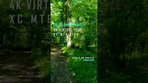
Calugareni Forest | Calugareni, Giurgiu | Ambiental music | 4k Virtual Tour | 🇷🇴
#forestride #indoorcycling #cyclinglife #forestsounds #virtualtour #virtualtours #cyclingpassion #cyclingaddict #cyclingadventure #cyclingvlog #cyclingworkout #4kride #romania #ambientalmusic #cycling
This episode features a 4k Virtual Tour made at the Calugareni Forest, located in the Giurgiu county. A 30 minutes ride with ambiental music and info. This is a short XC MTB Ride with a distance of about 5 km start from Calugareni Forest, passing by the Neajlov river as we exit the forest area into the plainfields, on to the levy and back on to the road. Closed Captions [CC] which include historical facts and descriptions are available in all languages.
===============================================================================
🌎Complete Playlist of Virtual Tours: https://www.youtube.com/playlist?list=PLdyvAxFyPXo89pj1Q1oPwDmmVURBP1l8h 🌎
🏔️ Mountain road descents : https://www.youtube.com/playlist?list=PLdyvAxFyPXo8XTKj8xega-31flwsiEaV_ 🏔️
🏞️ Park rides : https://www.youtube.com/playlist?list=PLdyvAxFyPXo-aF6HRtKwq17l1m1LKvf5b 🏞️
🏨 Urban rides : https://www.youtube.com/playlist?list=PLdyvAxFyPXo8uQ-gTaZ3b38SmrEC13pwq 🏨
🌳 Forest rides : https://www.youtube.com/playlist?list=PLdyvAxFyPXo8-7xZMAHzDJmQRP4Dx7ffy 🌳
📢 𝗣𝗹𝗲𝗮𝘀𝗲 𝗦𝘂𝗯𝘀𝗰𝗿𝗶𝗯𝗲! 📢 - youtube.com/channel/UCib-JDIHF_Btivu010jNd5g?sub_confirmation=1
===============================================================================
✔️JOIN US:✔️
➤TikTok: https://www.tiktok.com/@snailsonwheelz?lang=en
➤Instagram: https://www.instagram.com/snails_on_wh33ls/?hl=ro
➤Facebook: https://www.facebook.com/snailsonwheels
===============================================================================
INFO :
The village of Calugareni is known in history for the battle that took place here on August 13/23 1595. The 10,000-strong Muntenian army, led by Mihai Viteazul (Michael The Brave- ruler of Wallachia between 1593-1600), tried to stop the invading Ottoman army led by Sinan Pasha, whose goal was to transform Wallachia into a pashalac.
Mihai Viteazul chose Călugăreni (Giurgiu County), on Neajlov, as a place of battle because it was a swampy area and he opted for this land because he could easily block the flanks of the Ottoman army.
The Muntenian army was stationed to the north of the locality, near the Calugareni forest, while the patrols kept an eye on the banks of Neajlov and Câlniştea rivers. The Ottoman vanguard was led by Hasan Pasha, the right flank was provided by Satırcı Mehmed Pasha, and the left by Haydar Pasha.
Mihai Viteazul attacked at dawn on August 13, 1595 with the bulk of his army (about 10,000 men). Because he was not sure of their good intentions, Mihai still keeps a corps of 1,200 horsemen, under the command of Pope Stoica from Fărcaşe, meant to ensure the retreat. The initial attack of the Muntenians reached the tent camp of the Turks.
Giurgiu is a county (județ) of Romania on the border with Bulgaria, in Muntenia, with the capital city at Giurgiu.
This county has a total area of 3,526 km2 (1,361 sq mi).
The county is situated on a plain – the Southern part of the Wallachian Plain. The landscape is flat, crossed by small rivers. The southern part is the valley of the Danube which forms the border with Bulgaria. In the North, the Argeș River and Dâmbovița River flow.
The county has two big areas of development: one close to the city of Giurgiu – The Free Trade Zone Giurgiu, and one in the North of the county due to its proximity with Bucharest.
The predominant industries in the county are:
Food and beverages industry.
Textile industry.
Chemical industry.
Wood and furniture industry.
Mechanical components industry.
Agriculture is the main occupation in the county. Both extensive agriculture, and small scale (for Bucharest markets), is practiced. 59% of the cultivated surface is irrigated.
The county recently became famous for its lăutari, especially the group Taraful Haiducilor.
The main tourist destinations are:
The city of Giurgiu
Here the tourists can visit:
The Clock Tower, made by the Turks when the Giurgiu was a raya
The Historical Museum
The theatre "Valah"
The first bridge built in angel from Europe,[clarification needed] over the Canalul Sfântul Gheorghe and Canalul Plantelor, with a specific construction over 100 years old; near this bridge is a new one from 2007
The Friendship Bridge over the Danube between Giurgiu and Ruse, Bulgaria
The churches painted by important painters like Grigorescu
The fluvial station on the Danube river "Port Giurgiu"
The street "Strada Gării" filled with markets
The beautiful parks from town where many statues and fountains can be found
Fishing along the Danube
The Călugăreni area
The monasteries from Giurgiu and Comana
Source : https://en.wikipedia.org/wiki/Giurgiu_County
11
views