
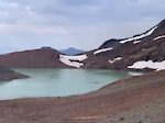
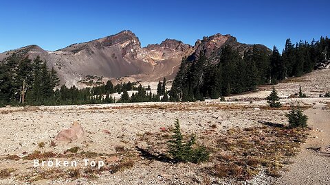
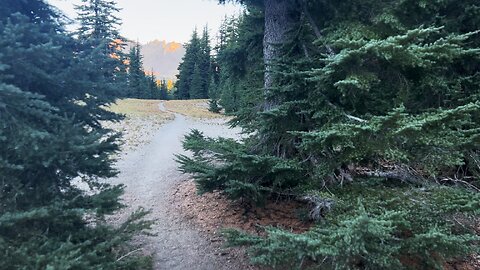
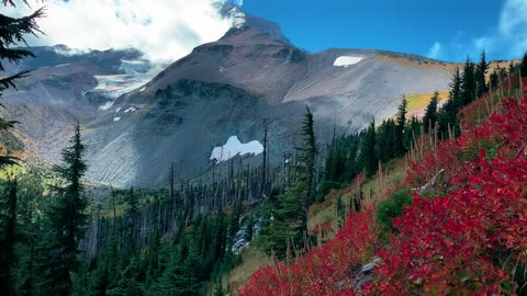
Alpine Bliss Traversing Up the Alpine Zone of Three Sisters Wilderness! | No Name Lake | 4K | Oregon
This seventh segment is Alpine Bliss in the Alpine Tundra Wonderland Zone at the base of Broken Top as we continue to ascend up and around the Mountain through Three Sisters Wilderness towards No Name Lake!
This was a 14-mile, 2600 FT Elevation Gain Day-Hike in Central Oregon, Three Sisters Wilderness, Deschutes National Forest, starting at Todd Trailhead and hiking to No Name Lake, Bend Glacier, & the Broken Top Zone as an EPIC Out and Back hike (PLEASE NOTE - this would be considered the "Longer Version" hike to get to No Name Lake & Bend Glacier from the South aka Todd Trailhead. You can also get to this destination by taking the "Shorter Version", Broken Top Trail. I prefer to do the longer version because it captures several very gorgeous and majestic sections of Three Sisters Wilderness that you wouldn't otherwise traverse if doing the shorter, more direct route. This entire section of Three Sisters Wilderness is a bit of a premium Alpine Wonderland, so why not capture it all is my perspective - to each their own of course. Lastly, I would mention that you can also get to No Name Lake & Bend Glacier from the East by means of Tam McArthur Rim Trail (permit required at Recreation.gov), I have that whole hike captured here as well in a separate Playlist: https://www.youtube.com/playlist?list=PLuGUSVzluAAmGSHgRwFLJprD8gBfZG53P
The East Tam McArthur Rim approach and longer Todd Trailhead South approach are my two recommended hikes out of the three).
This is one of my favorite hikes in all of Oregon, featuring my favorite Alpine Cirque Lake (No Name Lake), my favorite mountain (Broken Top), and my favorite Wilderness Area (Three Sisters). The hike starts at 6100 FT and your highest point is around 8200 FT. Due to the elevation range, this hike is only accessible around 10 weeks or so a year give or take based on the annual snowfall, from around 8/1 - 10/15, what I colloquially refer to as the "Alpine Window". I would recommend doing this earlier in the day (starting at sunrise if possible) with fluids on your person because large parts of this hike are fully exposed to the sun. The temperature was high 30's in the morning with a high in the low 70's in the heart of the day. This was hiked on 10/12/2022 and there were no mosquitoes (they are typically gone sometime in late August or September).
As far as road conditions, its Cascade Scenic Byway to the turnoff for Todd Lake - that stretch of National Forest Road is very bumpy for a few tenths of a mile to the parking lot. Most cars should be able to make it if they drive slow and cautiously, although do so AT YOUR OWN RISK! The road does not in my opinion require 4-Wheel Drive - do watch for road conditions, particularly snow/ice depending on the time of year.
53
views
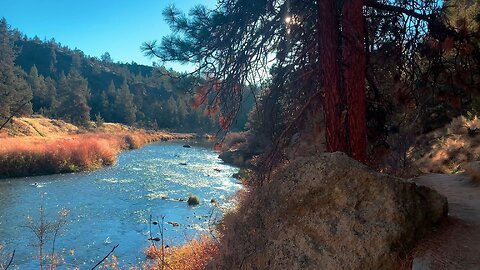
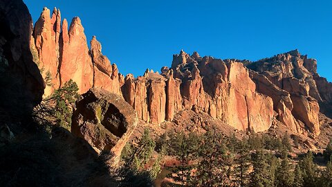
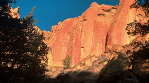
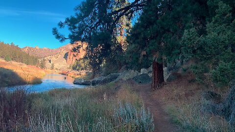
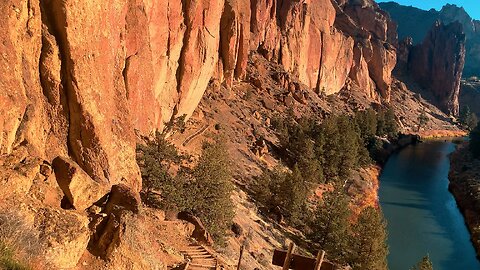
Hiking the INCREDIBLE Shoreline of Crooked River @ Smith Rock State Park! | Central Oregon | 4K
This was an EPIC day-hike in Central Oregon at Sunrise exploring the INCREDIBLE “River Trail” at Smith Rock State Park, easily a TOP 3 State Park in the entire State of Oregon in my humble opinion! This hike was timed for the epic sunrise glow on the GORGEOUS canyon faces, starting at River Trail Trailhead before sunrise and hiking parallel to Crooked River ultimately to Monkey Face and a bit beyond as my turnaround point. I explored several of the primary “side trails” aka “climbers trails” of River Trail – Morning Glory Wall, Dihedrals, Asterisk Pass, and a few others with beautiful panoramic expansive viewpoints. Weather was below freezing chilly and quite windy with a low of 29, high of 54, with beautiful classic blue clear sky. This was hiked on 11/8/2021 with fall colors in transition or full bloom, the trail was completely clear of snow, and there were NO Mosquitoes! As far as road conditions, it could not be more easy, paved roads all the way to the parking lot. In my opinion, the road most definitely DOES NOT require 4-Wheel Drive. As far as permits, the River Trail Trailhead DOES NOT require a Recreation.gov permit but IS a State Park.
59
views
2
comments
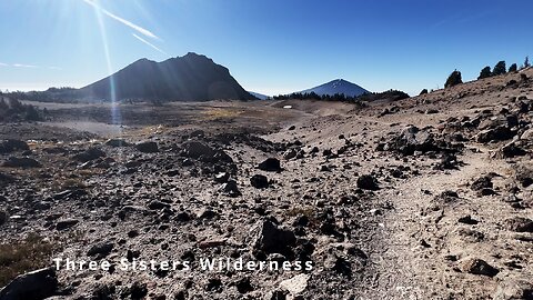
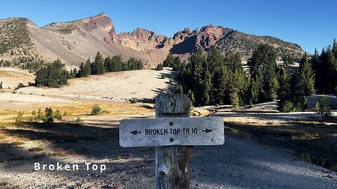
Ascending INCREDIBLE Broken Top Trail Hiking Three Sisters Wilderness! | No Name Lake | 4K | Oregon
This sixth segment starts with spectacular views of Broken Top hiking to the base of "The Climb", the hardest section % grade steep incline wise of the entire hike (please pardon a few seconds of shakiness while doing part of the steep ascent), continue up a scenic section of Broken Top Trail, discuss the 2022 Cedar Creek Fire and hiking strategies to minimize the impact on your hiking, look back at beautiful views of Mount Bachelor, and ascend up into the Mountain-rific Alpine Tundra Zone, the "Upper Third" last portion of our hike to No Name Lake from Todd Trailhead.
This was a 14-mile, 2600 FT Elevation Gain Day-Hike in Central Oregon, Three Sisters Wilderness, Deschutes National Forest, starting at Todd Trailhead and hiking to No Name Lake, Bend Glacier, & the Broken Top Zone as an EPIC Out and Back hike (PLEASE NOTE - this would be considered the "Longer Version" hike to get to No Name Lake & Bend Glacier from the South aka Todd Trailhead. You can also get to this destination by taking the "Shorter Version", Broken Top Trail. I prefer to do the longer version because it captures several very gorgeous and majestic sections of Three Sisters Wilderness that you wouldn't otherwise traverse if doing the shorter, more direct route. This entire section of Three Sisters Wilderness is a bit of a premium Alpine Wonderland, so why not capture it all is my perspective - to each their own of course. Lastly, I would mention that you can also get to No Name Lake & Bend Glacier from the East by means of Tam McArthur Rim Trail (permit required at Recreation.gov), I have that whole hike captured here as well in a separate Playlist: https://www.youtube.com/playlist?list=PLuGUSVzluAAmGSHgRwFLJprD8gBfZG53P
The East Tam McArthur Rim approach and longer Todd Trailhead South approach are my two recommended hikes out of the three).
This is one of my favorite hikes in all of Oregon, featuring my favorite Alpine Cirque Lake (No Name Lake), my favorite mountain (Broken Top), and my favorite Wilderness Area (Three Sisters). The hike starts at 6100 FT and your highest point is around 8200 FT. Due to the elevation range, this hike is only accessible around 10 weeks or so a year give or take based on the annual snowfall, from around 8/1 - 10/15, what I colloquially refer to as the "Alpine Window". I would recommend doing this earlier in the day (starting at sunrise if possible) with fluids on your person because large parts of this hike are fully exposed to the sun. The temperature was high 30's in the morning with a high in the low 70's in the heart of the day. This was hiked on 10/12/2022 and there were no mosquitoes (they are typically gone sometime in late August or September).
As far as road conditions, its Cascade Scenic Byway to the turnoff for Todd Lake - that stretch of National Forest Road is very bumpy for a few tenths of a mile to the parking lot. Most cars should be able to make it if they drive slow and cautiously, although do so AT YOUR OWN RISK! The road does not in my opinion require 4-Wheel Drive - do watch for road conditions, particularly snow/ice depending on the time of year.
137
views
5
comments
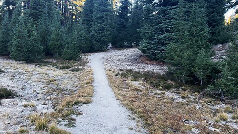
Traversing a TRUE ALPINE WONDERLAND Hiking Up Three Sisters Wilderness! | No Name Lake | 4K | Oregon
This fifth segment starts at Little Crater Creek Crossing, followed by another Crater Creek Crossing, ascends part of pristine light gray sanded gorgeous Three Sisters Wilderness, discusses why it's better to keep Three Sisters a Wilderness Area rather than a National Park, merges officially with the shorter version of Broken Top Trail towards No Name Lake, discusses where Park Rangers are typically located verifying Recreation.gov permits, and hikes a spectacular zone with Broken Top views!
This was a 14-mile, 2600 FT Elevation Gain Day-Hike in Central Oregon, Three Sisters Wilderness, Deschutes National Forest, starting at Todd Trailhead and hiking to No Name Lake, Bend Glacier, & the Broken Top Zone as an EPIC Out and Back hike (PLEASE NOTE - this would be considered the "Longer Version" hike to get to No Name Lake & Bend Glacier from the South aka Todd Trailhead. You can also get to this destination by taking the "Shorter Version", Broken Top Trail. I prefer to do the longer version because it captures several very gorgeous and majestic sections of Three Sisters Wilderness that you wouldn't otherwise traverse if doing the shorter, more direct route. This entire section of Three Sisters Wilderness is a bit of a premium Alpine Wonderland, so why not capture it all is my perspective - to each their own of course. Lastly, I would mention that you can also get to No Name Lake & Bend Glacier from the East by means of Tam McArthur Rim Trail (permit required at Recreation.gov), I have that whole hike captured here as well in a separate Playlist: https://www.youtube.com/playlist?list=PLuGUSVzluAAmGSHgRwFLJprD8gBfZG53P
The East Tam McArthur Rim approach and longer Todd Trailhead South approach are my two recommended hikes out of the three).
This is one of my favorite hikes in all of Oregon, featuring my favorite Alpine Cirque Lake (No Name Lake), my favorite mountain (Broken Top), and my favorite Wilderness Area (Three Sisters). The hike starts at 6100 FT and your highest point is around 8200 FT. Due to the elevation range, this hike is only accessible around 10 weeks or so a year give or take based on the annual snowfall, from around 8/1 - 10/15, what I colloquially refer to as the "Alpine Window". I would recommend doing this earlier in the day (starting at sunrise if possible) with fluids on your person because large parts of this hike are fully exposed to the sun. The temperature was high 30's in the morning with a high in the low 70's in the heart of the day. This was hiked on 10/12/2022 and there were no mosquitoes (they are typically gone sometime in late August or September).
As far as road conditions, its Cascade Scenic Byway to the turnoff for Todd Lake - that stretch of National Forest Road is very bumpy for a few tenths of a mile to the parking lot. Most cars should be able to make it if they drive slow and cautiously, although do so AT YOUR OWN RISK! The road does not in my opinion require 4-Wheel Drive - do watch for road conditions, particularly snow/ice depending on the time of year.
80
views
Exploring the "Southern Tip" River Shoreline @ Smith Rock State Park! | Central Oregon | 4K
This was an EPIC day-hike in Central Oregon at Sunrise exploring the INCREDIBLE “River Trail” at Smith Rock State Park, easily a TOP 3 State Park in the entire State of Oregon in my humble opinion! This hike was timed for the epic sunrise glow on the GORGEOUS canyon faces, starting at River Trail Trailhead before sunrise and hiking parallel to Crooked River ultimately to Monkey Face and a bit beyond as my turnaround point. I explored several of the primary “side trails” aka “climbers trails” of River Trail – Morning Glory Wall, Dihedrals, Asterisk Pass, and a few others with beautiful panoramic expansive viewpoints. Weather was below freezing chilly and quite windy with a low of 29, high of 54, with beautiful classic blue clear sky. This was hiked on 11/8/2021 with fall colors in transition or full bloom, the trail was completely clear of snow, and there were NO Mosquitoes! As far as road conditions, it could not be more easy, paved roads all the way to the parking lot. In my opinion, the road most definitely DOES NOT require 4-Wheel Drive. As far as permits, the River Trail Trailhead DOES NOT require a Recreation.gov permit but IS a State Park.
96
views
Exploring the "Phoenix Buttress" Rock Climbing Zone @ Smith Rock State Park! | Central Oregon | 4K
This was an EPIC day-hike in Central Oregon at Sunrise exploring the INCREDIBLE “River Trail” at Smith Rock State Park, easily a TOP 3 State Park in the entire State of Oregon in my humble opinion! This hike was timed for the epic sunrise glow on the GORGEOUS canyon faces, starting at River Trail Trailhead before sunrise and hiking parallel to Crooked River ultimately to Monkey Face and a bit beyond as my turnaround point. I explored several of the primary “side trails” aka “climbers trails” of River Trail – Morning Glory Wall, Dihedrals, Asterisk Pass, and a few others with beautiful panoramic expansive viewpoints. Weather was below freezing chilly and quite windy with a low of 29, high of 54, with beautiful classic blue clear sky. This was hiked on 11/8/2021 with fall colors in transition or full bloom, the trail was completely clear of snow, and there were NO Mosquitoes! As far as road conditions, it could not be more easy, paved roads all the way to the parking lot. In my opinion, the road most definitely DOES NOT require 4-Wheel Drive. As far as permits, the River Trail Trailhead DOES NOT require a Recreation.gov permit but IS a State Park.
118
views
GORGEOUS Views of Broken Top Exploring Three Sisters Wilderness! | 4K | Central Oregon
This was a 14-mile, 2600 FT Elevation Gain Day-Hike in Central Oregon, Three Sisters Wilderness, Deschutes National Forest, starting at Todd Trailhead and hiking to No Name Lake, Bend Glacier, & the Broken Top Zone as an EPIC Out and Back hike (PLEASE NOTE - this would be considered the "Longer Version" hike to get to No Name Lake & Bend Glacier from the South aka Todd Trailhead. You can also get to this destination by taking the "Shorter Version", Broken Top Trail. I prefer to do the longer version because it captures several very gorgeous and majestic sections of Three Sisters Wilderness that you wouldn't otherwise traverse if doing the shorter, more direct route. This entire section of Three Sisters Wilderness is a bit of a premium Alpine Wonderland, so why not capture it all is my perspective - to each their own of course. Lastly, I would mention that you can also get to No Name Lake & Bend Glacier from the East by means of Tam McArthur Rim Trail (permit required at Recreation.gov), I have that whole hike captured here as well in a separate Playlist: https://www.youtube.com/playlist?list=PLuGUSVzluAAmGSHgRwFLJprD8gBfZG53P
The East Tam McArthur Rim approach and longer Todd Trailhead South approach are my two recommended hikes out of the three).
This is one of my favorite hikes in all of Oregon, featuring my favorite Alpine Cirque Lake (No Name Lake), my favorite mountain (Broken Top), and my favorite Wilderness Area (Three Sisters). The hike starts at 6100 FT and your highest point is around 8200 FT. Due to the elevation range, this hike is only accessible around 10 weeks or so a year give or take based on the annual snowfall, from around 8/1 - 10/15, what I colloquially refer to as the "Alpine Window". I would recommend doing this earlier in the day (starting at sunrise if possible) with fluids on your person because large parts of this hike are fully exposed to the sun. The temperature was high 30's in the morning with a high in the low 70's in the heart of the day. This was hiked on 10/12/2022 and there were no mosquitoes (they are typically gone sometime in late August or September).
As far as road conditions, its Cascade Scenic Byway to the turnoff for Todd Lake - that stretch of National Forest Road is very bumpy for a few tenths of a mile to the parking lot. Most cars should be able to make it if they drive slow and cautiously, although do so AT YOUR OWN RISK! The road does not in my opinion require 4-Wheel Drive - do watch for road conditions, particularly snow/ice depending on the time of year.
85
views
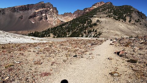
First Views of Broken Top Hiking to No Name Lake! | Three Sisters Wilderness | 4K | Central Oregon
This second segment starts just after crossing the threshold into Three Sisters Wilderness (permit required at Recreation.gov), captures the first trail views of Broken Top, discusses "The Alpine Window" hiking strategy, and ends with 5 minutes of Silent hiking through the absolutely gorgeous Alpine Wonderland that is Three Sisters Wilderness.
This was a 14-mile, 2600 FT Elevation Gain Day-Hike in Central Oregon, Three Sisters Wilderness, Deschutes National Forest, starting at Todd Trailhead and hiking to No Name Lake, Bend Glacier, & the Broken Top Zone as an EPIC Out and Back hike (PLEASE NOTE - this would be considered the "Longer Version" hike to get to No Name Lake & Bend Glacier from the South aka Todd Trailhead. You can also get to this destination by taking the "Shorter Version", Broken Top Trail. I prefer to do the longer version because it captures several very gorgeous and majestic sections of Three Sisters Wilderness that you wouldn't otherwise traverse if doing the shorter, more direct route. This entire section of Three Sisters Wilderness is a bit of a premium Alpine Wonderland, so why not capture it all is my perspective - to each their own of course. Lastly, I would mention that you can also get to No Name Lake & Bend Glacier from the East by means of Tam McArthur Rim Trail (permit required at Recreation.gov), I have that whole hike captured here as well in a separate Playlist: https://www.youtube.com/playlist?list=PLuGUSVzluAAmGSHgRwFLJprD8gBfZG53P
The East Tam McArthur Rim approach and longer Todd Trailhead South approach are my two recommended hikes out of the three).
This is one of my favorite hikes in all of Oregon, featuring my favorite Alpine Cirque Lake (No Name Lake), my favorite mountain (Broken Top), and my favorite Wilderness Area (Three Sisters). The hike starts at 6100 FT and your highest point is around 8200 FT. Due to the elevation range, this hike is only accessible around 10 weeks or so a year give or take based on the annual snowfall, from around 8/1 - 10/15, what I colloquially refer to as the "Alpine Window". I would recommend doing this earlier in the day (starting at sunrise if possible) with fluids on your person because large parts of this hike are fully exposed to the sun. The temperature was high 30's in the morning with a high in the low 70's in the heart of the day. This was hiked on 10/12/2022 and there were no mosquitoes (they are typically gone sometime in late August or September).
As far as road conditions, its Cascade Scenic Byway to the turnoff for Todd Lake - that stretch of National Forest Road is very bumpy for a few tenths of a mile to the parking lot. Most cars should be able to make it if they drive slow and cautiously, although do so AT YOUR OWN RISK! The road does not in my opinion require 4-Wheel Drive - do watch for road conditions, particularly snow/ice depending on the time of year.
80
views
BITE-SIZED WILDS | EAT YOUR HEART OUT SCENTED CANDLES! | Three Sisters Wilderness | 4K | Oregon
This was a 14-mile, 2600 FT Elevation Gain Day-Hike in Central Oregon, Three Sisters Wilderness, Deschutes National Forest, starting at Todd Trailhead and hiking to No Name Lake, Bend Glacier, & the Broken Top Zone as an EPIC Out and Back hike (PLEASE NOTE - this would be considered the "Longer Version" hike to get to No Name Lake & Bend Glacier from the South aka Todd Trailhead. You can also get to this destination by taking the "Shorter Version", Broken Top Trail. I prefer to do the longer version because it captures several very gorgeous and majestic sections of Three Sisters Wilderness that you wouldn't otherwise traverse if doing the shorter, more direct route. This entire section of Three Sisters Wilderness is a bit of a premium Alpine Wonderland, so why not capture it all is my perspective - to each their own of course. Lastly, I would mention that you can also get to No Name Lake & Bend Glacier from the East by means of Tam McArthur Rim Trail (permit required at Recreation.gov), I have that whole hike captured here as well in a separate Playlist: https://www.youtube.com/playlist?list=PLuGUSVzluAAmGSHgRwFLJprD8gBfZG53P
The East Tam McArthur Rim approach and longer Todd Trailhead South approach are my two recommended hikes out of the three).
This is one of my favorite hikes in all of Oregon, featuring my favorite Alpine Cirque Lake (No Name Lake), my favorite mountain (Broken Top), and my favorite Wilderness Area (Three Sisters). The hike starts at 6100 FT and your highest point is around 8200 FT. Due to the elevation range, this hike is only accessible around 10 weeks or so a year give or take based on the annual snowfall, from around 8/1 - 10/15, what I colloquially refer to as the "Alpine Window". I would recommend doing this earlier in the day (starting at sunrise if possible) with fluids on your person because large parts of this hike are fully exposed to the sun. The temperature was high 30's in the morning with a high in the low 70's in the heart of the day. This was hiked on 10/12/2022 and there were no mosquitoes (they are typically gone sometime in late August or September).
As far as road conditions, its Cascade Scenic Byway to the turnoff for Todd Lake - that stretch of National Forest Road is very bumpy for a few tenths of a mile to the parking lot. Most cars should be able to make it if they drive slow and cautiously, although do so AT YOUR OWN RISK! The road does not in my opinion require 4-Wheel Drive - do watch for road conditions, particularly snow/ice depending on the time of year.
81
views
2
comments
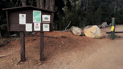
Getting Started @ Todd Trailhead to No Name Lake - Details, Tips & Hiking Strategies! | 4K | Oregon
This first segment of the hike takes us through the short initial Todd Lake connector section over to the Todd Trailhead proper towards No Name Lake, ascends a section of Deschutes National Forest, and officially enters Three Sisters Wilderness (permit required at Recreation.gov).
This was a 14-mile, 2600 FT Elevation Gain Day-Hike in Central Oregon, Three Sisters Wilderness, Deschutes National Forest, starting at Todd Trailhead and hiking to No Name Lake, Bend Glacier, & the Broken Top Zone as an EPIC Out and Back hike (PLEASE NOTE - this would be considered the "Longer Version" hike to get to No Name Lake & Bend Glacier from the South aka Todd Trailhead. You can also get to this destination by taking the "Shorter Version", Broken Top Trail. I prefer to do the longer version because it captures several very gorgeous and majestic sections of Three Sisters Wilderness that you wouldn't otherwise traverse if doing the shorter, more direct route. This entire section of Three Sisters Wilderness is a bit of a premium Alpine Wonderland, so why not capture it all is my perspective - to each their own of course. Lastly, I would mention that you can also get to No Name Lake & Bend Glacier from the East by means of Tam McArthur Rim Trail (permit required at Recreation.gov), I have that whole hike captured here as well in a separate Playlist: https://www.youtube.com/playlist?list=PLuGUSVzluAAmGSHgRwFLJprD8gBfZG53P
The East Tam McArthur Rim approach and longer Todd Trailhead South approach are my two recommended hikes out of the three).
This is one of my favorite hikes in all of Oregon, featuring my favorite Alpine Cirque Lake (No Name Lake), my favorite mountain (Broken Top), and my favorite Wilderness Area (Three Sisters). The hike starts at 6100 FT and your highest point is around 8200 FT. Due to the elevation range, this hike is only accessible around 10 weeks or so a year give or take based on the annual snowfall, from around 8/1 - 10/15, what I colloquially refer to as the "Alpine Window". I would recommend doing this earlier in the day (starting at sunrise if possible) with fluids on your person because large parts of this hike are fully exposed to the sun. The temperature was high 30's in the morning with a high in the low 70's in the heart of the day. This was hiked on 10/12/2022 and there were no mosquitoes (they are typically gone sometime in late August or September).
As far as road conditions, its Cascade Scenic Byway to the turnoff for Todd Lake - that stretch of National Forest Road is very bumpy for a few tenths of a mile to the parking lot. Most cars should be able to make it if they drive slow and cautiously, although do so AT YOUR OWN RISK! The road does not in my opinion require 4-Wheel Drive - do watch for road conditions, particularly snow/ice depending on the time of year.
45
views
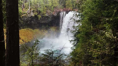
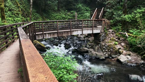
BITE-SIZED WILDS | The Mighty Majestic Koosah "Sky" Falls! | 64 FT Waterfall | Central Oregon | 4K
This was a day-hike in Central Oregon, Willamette National Forest, starting at world class legendary Koosah & Sahalie Falls Trailhead and hiking a 2.9 Mile Loop crossing two bridges and hiking both sides of National Wild & Scenic McKenzie River completely circumnavigating the area with multiple vantage points of BOTH Waterfalls with only 360 FT Elevation Gain, making it a low Elevation Gain, well-graded trail. The temperature was in the 40's for most of the hike with VERY heavy rain and dark gloomy overcast sky, which frankly only added to the beauty. This was hiked on 4/8/2022 and there were of course NO Mosquitoes. As far as road conditions, it's highway to the paved parking lot so it is as easy as it gets - In my opinion, the road most definitely DOES NOT require 4-Wheel Drive, however do watch for road conditions, particularly snow/ice depending on the time of year. On this day it was raining so heavily I had full windshield wipers going through heavy rain & fog in the morning so conditions are always unpredictable and a factor.
I highly recommending taking a stacking 3-Pack-Hike approach and combining this hike with Tamolitch Blue Pool, 4 miles, that is only a few minutes away down the highway, as well as if feeling truly ambitious even Clear Lake Loop, 4.9 miles, as well, making it a full day in the area of EPIC hiking - that would be the ultimate one stop shopping approach - these three hikes are the highlights of the entire area! If you do all three, start very early in the day to give yourself time to complete them all at a comfortable, leisurely pace. If you decide to pick off multiple hikes in one trip, whether you do two of the hikes or all three, make sure to hydrate/snack as necessary in the car rides between the locations Trailheads as your own little pit stops.
47
views
BITE-SIZED WILDS | Serious Alpine Eye Candy @ Elk Cove @ Mount Hood! | Timberline Loop | Oregon | HD
This was a 15.2 mile, 3100 FT Elevation Gain Day-Hike in Oregon, Mount Hood Wilderness, focusing on the NW Quadrant of the approximately 40-mile EPIC Timberline Loop that goes around Mount Hood (one of the two best alpine backpacking hikes in Oregon along with Broken Top Loop), starting at Top Spur Trailhead, climbing up to the Timberline Loop, briefly going to the Mount Hood Viewpoint Ridge South of Bald Mountain (as a little bit of a viewpoint cherry picking hack) before turning around and doing the lion’s share of the hike exploring the NW quadrant of Timberline Trail hiking past Cairn Shelter to the INCREDIBLE Mount Hood Viewpoint Section above the Elk Cove Camping Zone as our turnaround point of this out and back Day-Hike. Weather was a low in the low 30's, high in the 50's, overcast day and very windy. This was hiked on 9/12/2021, trail was completely clear of snow, and there were NO Mosquitoes! On Alltrails, this hike is called "Timberline Trail Around Mount Hood", hiking a section of the NW Quadrant. As far as road conditions, it's highway until a turnoff paved road that isn’t too bumpy but does have some large pot holes in the middle of it periodically you need to swerve around. The last 1.5 miles is gravel and very doable but requires cautious and slow driving, particularly around somewhat blind corners and a narrow road. In my opinion, the road DOES NOT require 4-Wheel Drive. As far as permits, the Top Spur Trailhead DOES NOT require a Recreation.gov permit.
97
views
2
comments
Strategically Located Injury "Safety Stations" @ Smith Rock State Park! | Central Oregon | 4K
This was an EPIC day-hike in Central Oregon at Sunrise exploring the INCREDIBLE “River Trail” at Smith Rock State Park, easily a TOP 3 State Park in the entire State of Oregon in my humble opinion! This hike was timed for the epic sunrise glow on the GORGEOUS canyon faces, starting at River Trail Trailhead before sunrise and hiking parallel to Crooked River ultimately to Monkey Face and a bit beyond as my turnaround point. I explored several of the primary “side trails” aka “climbers trails” of River Trail – Morning Glory Wall, Dihedrals, Asterisk Pass, and a few others with beautiful panoramic expansive viewpoints. Weather was below freezing chilly and quite windy with a low of 29, high of 54, with beautiful classic blue clear sky. This was hiked on 11/8/2021 with fall colors in transition or full bloom, the trail was completely clear of snow, and there were NO Mosquitoes! As far as road conditions, it could not be more easy, paved roads all the way to the parking lot. In my opinion, the road most definitely DOES NOT require 4-Wheel Drive. As far as permits, the River Trail Trailhead DOES NOT require a Recreation.gov permit but IS a State Park.
59
views

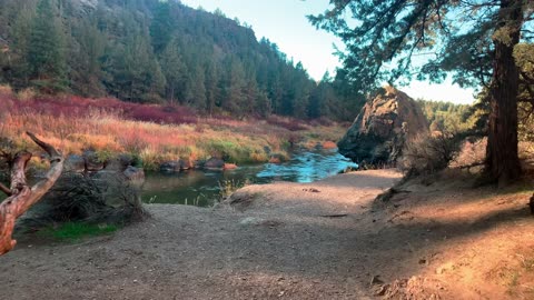
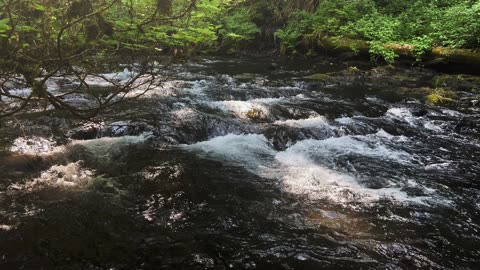
TRANQUIL & RELAXING South Santiam River Shoreline @ Trout Creek Campground! | Central Oregon | 4K
Exploring the gorgeous Shoreline of South Santiam River @ Trout Creek Campground (bookable at Recreation.gov), Willamette National Forest, Central Oregon in 4K! This video was made on 5/21/23. Mosquitoes were non-existent.
70
views
2
comments
GORGEOUS High Desert Paradise Hike to Shoreline Cave! | Smith Rock State Park | Central Oregon | 4K
This was an EPIC day-hike in Central Oregon at Sunrise exploring the INCREDIBLE “River Trail” at Smith Rock State Park, easily a TOP 3 State Park in the entire State of Oregon in my humble opinion! This hike was timed for the epic sunrise glow on the GORGEOUS canyon faces, starting at River Trail Trailhead before sunrise and hiking parallel to Crooked River ultimately to Monkey Face and a bit beyond as my turnaround point. I explored several of the primary “side trails” aka “climbers trails” of River Trail – Morning Glory Wall, Dihedrals, Asterisk Pass, and a few others with beautiful panoramic expansive viewpoints. Weather was below freezing chilly and quite windy with a low of 29, high of 54, with beautiful classic blue clear sky. This was hiked on 11/8/2021 with fall colors in transition or full bloom, the trail was completely clear of snow, and there were NO Mosquitoes! As far as road conditions, it could not be more easy, paved roads all the way to the parking lot. In my opinion, the road most definitely DOES NOT require 4-Wheel Drive. As far as permits, the River Trail Trailhead DOES NOT require a Recreation.gov permit but IS a State Park.
72
views
2
comments
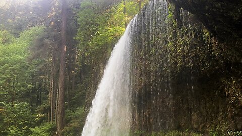
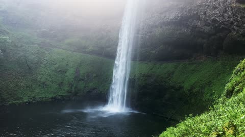
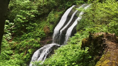
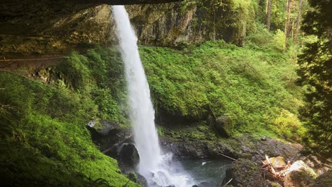
PEACE & RELAXATION @ Silver Creek! | Trail of Ten Falls | Silver Falls State Park | Oregon | 4K
This was a 7.4 mile, 1200 FT Elevation Gain Loop Hike of the ABSOLUTELY INCREDIBLE Trail of Ten Falls, Silver Falls State Park, Oregon, in 4K! This is unquestionably the BEST WATERFALL HIKE IN OREGON, and a TOP 5 WATERFALL HIKE IN THE ENTIRE USA, so it is truly EPIC and absolutely worth putting on your bucket list to experience. They almost designated this a National Park many years ago (I'm glad they didn't for logistical reasons), it is truly a natural beauty wonderland to behold. This was hiked on 5/20/23, the weather was classic Spring in Oregon with some sunshine and overcast, and there were no mosquitoes.
I hiked the Loop Clockwise and would recommend the same route. The Ten Waterfalls in order hiking Clockwise are:
1) South Falls - 177 FT (can walk behind!) (hiking beside South Fork Silver Creek)
2) Lower South Falls - 93 FT (can walk behind!) (hiking beside South Fork Silver Creek)
3) Lower North Falls - 30 FT (hiking beside North Fork Silver Creek)
4) Double Falls - 178 FT (hiking beside North Fork Silver Creek)
5) Drake Falls - 27 FT (hiking beside North Fork Silver Creek)
6) Middle North Falls - 106 FT (can walk behind!) (hiking beside North Fork Silver Creek)
7) Twin Falls - 31 FT (hiking beside North Fork Silver Creek)
8) North Falls - 136 FT (can walk behind!) (hiking beside North Fork Silver Creek)
9) Upper North Falls - 65 FT
10) Winter Falls - 134 FT
My favorites were the four you could walk behind, not just for that reason but they were also the most beautiful Waterfall Basins and most awe-inspiring overall. All Ten Waterfalls are very high quality and each one could be a destination hike on its own, so for them to be put together all in one EPIC Sensory Overload Waterfall Loop Hike is truly spectacular!
122
views
2
comments

Hiking Exploring the West Section of "River Trail"! | Smith Rock State Park | Central Oregon | 4K
This was an EPIC day-hike in Central Oregon at Sunrise exploring the INCREDIBLE “River Trail” at Smith Rock State Park, easily a TOP 3 State Park in the entire State of Oregon in my humble opinion! This hike was timed for the epic sunrise glow on the GORGEOUS canyon faces, starting at River Trail Trailhead before sunrise and hiking parallel to Crooked River ultimately to Monkey Face and a bit beyond as my turnaround point. I explored several of the primary “side trails” aka “climbers trails” of River Trail – Morning Glory Wall, Dihedrals, Asterisk Pass, and a few others with beautiful panoramic expansive viewpoints. Weather was below freezing chilly and quite windy with a low of 29, high of 54, with beautiful classic blue clear sky. This was hiked on 11/8/2021 with fall colors in transition or full bloom, the trail was completely clear of snow, and there were NO Mosquitoes! As far as road conditions, it could not be more easy, paved roads all the way to the parking lot. In my opinion, the road most definitely DOES NOT require 4-Wheel Drive. As far as permits, the River Trail Trailhead DOES NOT require a Recreation.gov permit but IS a State Park.
100
views
3
comments
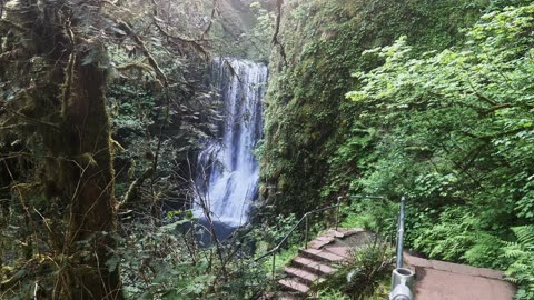
BEAUTY & SERENE SILENCE @ Majestic Falls! | McDowell Creek County Park | Oregon | 4K
McDowell Creek County Park is managed by Linn County in Oregon. The area can be best captured by a very comfortable 1.7 mile, approximately 300 FT Elevation Gain Loop that parallels both Falls Creek and McDowell Creek and hikes by Royal Terrace Falls (119 FT, Tiered Waterfall) and Majestic Falls (39 FT, Curtain Waterfall). Lower McDowell Falls is near the lower parking lot and not part of the classic Loop Trail. To access it, go to the right of the Trailhead Signage Map through a series of individual day use picnic sites and you will fine a narrow trail that leads down to Creekside with two different vantage points of Lower McDowell Falls (Tiered Waterfall). In my humble opinion, this is a world class Waterfall hike with three GORGEOUS Waterfalls, a bit of an undiscovered gem and most definitely worth hiking and exploring!
90
views
SERENE SILENCE @ Middle North Waterfall | Trail of Ten Falls | Silver Falls State Park | Oregon | 4K
This was a 7.4 mile, 1200 FT Elevation Gain Loop Hike of the ABSOLUTELY INCREDIBLE Trail of Ten Falls, Silver Falls State Park, Oregon, in 4K! This is unquestionably the BEST WATERFALL HIKE IN OREGON, and a TOP 5 WATERFALL HIKE IN THE ENTIRE USA, so it is truly EPIC and absolutely worth putting on your bucket list to experience. They almost designated this a National Park many years ago (I'm glad they didn't for logistical reasons), it is truly a natural beauty wonderland to behold. This was hiked on 5/20/23, the weather was classic Spring in Oregon with some sunshine and overcast, and there were no mosquitoes.
I hiked the Loop Clockwise and would recommend the same route. The Ten Waterfalls in order hiking Clockwise are:
1) South Falls - 177 FT (can walk behind!) (hiking beside South Fork Silver Creek)
2) Lower South Falls - 93 FT (can walk behind!) (hiking beside South Fork Silver Creek)
3) Lower North Falls - 30 FT (hiking beside North Fork Silver Creek)
4) Double Falls - 178 FT (hiking beside North Fork Silver Creek)
5) Drake Falls - 27 FT (hiking beside North Fork Silver Creek)
6) Middle North Falls - 106 FT (can walk behind!) (hiking beside North Fork Silver Creek)
7) Twin Falls - 31 FT (hiking beside North Fork Silver Creek)
8) North Falls - 136 FT (can walk behind!) (hiking beside North Fork Silver Creek)
9) Upper North Falls - 65 FT
10) Winter Falls - 134 FT
My favorites were the four you could walk behind, not just for that reason but they were also the most beautiful Waterfall Basins and most awe-inspiring overall. All Ten Waterfalls are very high quality and each one could be a destination hike on its own, so for them to be put together all in one EPIC Sensory Overload Waterfall Loop Hike is truly spectacular!
81
views
SOOTHING SILENCE @ South Waterfall! | Trail of Ten Falls | Silver Falls State Park | Oregon | 4K
This was a 7.4 mile, 1200 FT Elevation Gain Loop Hike of the ABSOLUTELY INCREDIBLE Trail of Ten Falls, Silver Falls State Park, Oregon, in 4K! This is unquestionably the BEST WATERFALL HIKE IN OREGON, and a TOP 5 WATERFALL HIKE IN THE ENTIRE USA, so it is truly EPIC and absolutely worth putting on your bucket list to experience. They almost designated this a National Park many years ago (I'm glad they didn't for logistical reasons), it is truly a natural beauty wonderland to behold. This was hiked on 5/20/23, the weather was classic Spring in Oregon with some sunshine and overcast, and there were no mosquitoes.
I hiked the Loop Clockwise and would recommend the same route. The Ten Waterfalls in order hiking Clockwise are:
1) South Falls - 177 FT (can walk behind!) (hiking beside South Fork Silver Creek)
2) Lower South Falls - 93 FT (can walk behind!) (hiking beside South Fork Silver Creek)
3) Lower North Falls - 30 FT (hiking beside North Fork Silver Creek)
4) Double Falls - 178 FT (hiking beside North Fork Silver Creek)
5) Drake Falls - 27 FT (hiking beside North Fork Silver Creek)
6) Middle North Falls - 106 FT (can walk behind!) (hiking beside North Fork Silver Creek)
7) Twin Falls - 31 FT (hiking beside North Fork Silver Creek)
8) North Falls - 136 FT (can walk behind!) (hiking beside North Fork Silver Creek)
9) Upper North Falls - 65 FT
10) Winter Falls - 134 FT
My favorites were the four you could walk behind, not just for that reason but they were also the most beautiful Waterfall Basins and most awe-inspiring overall. All Ten Waterfalls are very high quality and each one could be a destination hike on its own, so for them to be put together all in one EPIC Sensory Overload Waterfall Loop Hike is truly spectacular!
87
views

EXPLORING THE SPECTACULAR SHORELINE of Crooked River! | Smith Rock State Park | Central Oregon | 4K
This was an EPIC day-hike in Central Oregon at Sunrise exploring the INCREDIBLE “River Trail” at Smith Rock State Park, easily a TOP 3 State Park in the entire State of Oregon in my humble opinion! This hike was timed for the epic sunrise glow on the GORGEOUS canyon faces, starting at River Trail Trailhead before sunrise and hiking parallel to Crooked River ultimately to Monkey Face and a bit beyond as my turnaround point. I explored several of the primary “side trails” aka “climbers trails” of River Trail – Morning Glory Wall, Dihedrals, Asterisk Pass, and a few others with beautiful panoramic expansive viewpoints. Weather was below freezing chilly and quite windy with a low of 29, high of 54, with beautiful classic blue clear sky. This was hiked on 11/8/2021 with fall colors in transition or full bloom, the trail was completely clear of snow, and there were NO Mosquitoes! As far as road conditions, it could not be more easy, paved roads all the way to the parking lot. In my opinion, the road most definitely DOES NOT require 4-Wheel Drive. As far as permits, the River Trail Trailhead DOES NOT require a Recreation.gov permit but IS a State Park.
92
views
SERENE SILENCE @ Lower South Waterfall! | Trail of Ten Falls | Silver Falls State Park | Oregon | 4K
This was a 7.4 mile, 1200 FT Elevation Gain Loop Hike of the ABSOLUTELY INCREDIBLE Trail of Ten Falls, Silver Falls State Park, Oregon, in 4K! This is unquestionably the BEST WATERFALL HIKE IN OREGON, and a TOP 5 WATERFALL HIKE IN THE ENTIRE USA, so it is truly EPIC and absolutely worth putting on your bucket list to experience. They almost designated this a National Park many years ago (I'm glad they didn't for logistical reasons), it is truly a natural beauty wonderland to behold. This was hiked on 5/20/23, the weather was classic Spring in Oregon with some sunshine and overcast, and there were no mosquitoes.
I hiked the Loop Clockwise and would recommend the same route. The Ten Waterfalls in order hiking Clockwise are:
1) South Falls - 177 FT (can walk behind!) (hiking beside South Fork Silver Creek)
2) Lower South Falls - 93 FT (can walk behind!) (hiking beside South Fork Silver Creek)
3) Lower North Falls - 30 FT (hiking beside North Fork Silver Creek)
4) Double Falls - 178 FT (hiking beside North Fork Silver Creek)
5) Drake Falls - 27 FT (hiking beside North Fork Silver Creek)
6) Middle North Falls - 106 FT (can walk behind!) (hiking beside North Fork Silver Creek)
7) Twin Falls - 31 FT (hiking beside North Fork Silver Creek)
8) North Falls - 136 FT (can walk behind!) (hiking beside North Fork Silver Creek)
9) Upper North Falls - 65 FT
10) Winter Falls - 134 FT
My favorites were the four you could walk behind, not just for that reason but they were also the most beautiful Waterfall Basins and most awe-inspiring overall. All Ten Waterfalls are very high quality and each one could be a destination hike on its own, so for them to be put together all in one EPIC Sensory Overload Waterfall Loop Hike is truly spectacular!
75
views
Hiking UP to EPIC "Asterisk Pass" High Desert Paradise | Smith Rock State Park | Central Oregon | 4K
This was an EPIC day-hike in Central Oregon at Sunrise exploring the INCREDIBLE “River Trail” at Smith Rock State Park, easily a TOP 3 State Park in the entire State of Oregon in my humble opinion! This hike was timed for the epic sunrise glow on the GORGEOUS canyon faces, starting at River Trail Trailhead before sunrise and hiking parallel to Crooked River ultimately to Monkey Face and a bit beyond as my turnaround point. I explored several of the primary “side trails” aka “climbers trails” of River Trail – Morning Glory Wall, Dihedrals, Asterisk Pass, and a few others with beautiful panoramic expansive viewpoints. Weather was below freezing chilly and quite windy with a low of 29, high of 54, with beautiful classic blue clear sky. This was hiked on 11/8/2021 with fall colors in transition or full bloom, the trail was completely clear of snow, and there were NO Mosquitoes! As far as road conditions, it could not be more easy, paved roads all the way to the parking lot. In my opinion, the road most definitely DOES NOT require 4-Wheel Drive. As far as permits, the River Trail Trailhead DOES NOT require a Recreation.gov permit but IS a State Park.
46
views
GLORIOUS & MAGNIFICENT Royal Terrace Falls! | McDowell Creek County Park | Oregon | 4K
McDowell Creek County Park is managed by Linn County in Oregon. The area can be best captured by a very comfortable 1.7 mile, approximately 300 FT Elevation Gain Loop that parallels both Falls Creek and McDowell Creek and hikes by Royal Terrace Falls (119 FT, Tiered Waterfall) and Majestic Falls (39 FT, Curtain Waterfall). Lower McDowell Falls is near the lower parking lot and not part of the classic Loop Trail. To access it, go to the right of the Trailhead Signage Map through a series of individual day use picnic sites and you will fine a narrow trail that leads down to Creekside with two different vantage points of Lower McDowell Falls (Tiered Waterfall). In my humble opinion, this is a world class Waterfall hike with three GORGEOUS Waterfalls, a bit of an undiscovered gem and most definitely worth hiking and exploring!
35
views
PEACEFUL TRANQUILITY @ North Waterfall! | Trail of Ten Falls | Silver Falls State Park | Oregon | 4K
This was a 7.4 mile, 1200 FT Elevation Gain Loop Hike of the ABSOLUTELY INCREDIBLE Trail of Ten Falls, Silver Falls State Park, Oregon, in 4K! This is unquestionably the BEST WATERFALL HIKE IN OREGON, and a TOP 5 WATERFALL HIKE IN THE ENTIRE USA, so it is truly EPIC and absolutely worth putting on your bucket list to experience. They almost designated this a National Park many years ago (I'm glad they didn't for logistical reasons), it is truly a natural beauty wonderland to behold. This was hiked on 5/20/23, the weather was classic Spring in Oregon with some sunshine and overcast, and there were no mosquitoes.
I hiked the Loop Clockwise and would recommend the same route. The Ten Waterfalls in order hiking Clockwise are:
1) South Falls - 177 FT (can walk behind!) (hiking beside South Fork Silver Creek)
2) Lower South Falls - 93 FT (can walk behind!) (hiking beside South Fork Silver Creek)
3) Lower North Falls - 30 FT (hiking beside North Fork Silver Creek)
4) Double Falls - 178 FT (hiking beside North Fork Silver Creek)
5) Drake Falls - 27 FT (hiking beside North Fork Silver Creek)
6) Middle North Falls - 106 FT (can walk behind!) (hiking beside North Fork Silver Creek)
7) Twin Falls - 31 FT (hiking beside North Fork Silver Creek)
8) North Falls - 136 FT (can walk behind!) (hiking beside North Fork Silver Creek)
9) Upper North Falls - 65 FT
10) Winter Falls - 134 FT
My favorites were the four you could walk behind, not just for that reason but they were also the most beautiful Waterfall Basins and most awe-inspiring overall. All Ten Waterfalls are very high quality and each one could be a destination hike on its own, so for them to be put together all in one EPIC Sensory Overload Waterfall Loop Hike is truly spectacular!
70
views