

Enjoyed this channel? Join my Locals community for exclusive content at
backpackersunited.locals.com!
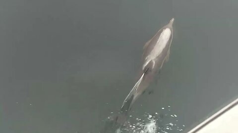
Pilot Dolphins ride the wave of a fishing vessel off the Bow
Follow me
https://www.instagram.com/skibum96/
Rumble Referrel link
https://rumble.com/register/AdventuresWithChris/
Rumble channel
https://rumble.com/c/c-1235824
6
views
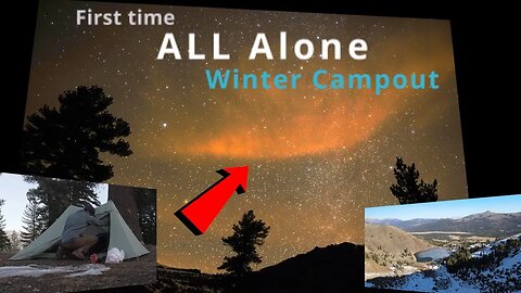
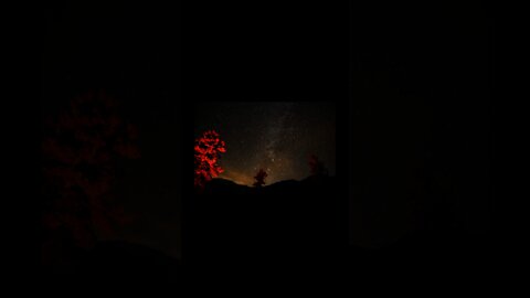
Winter Wonderland: Camping at a Frozen Alpine Lake Under the Milky Way
Winter camping at a frozen alpine lake in Tahoe, California is a truly magical experience. Imagine waking up in a cozy tent, nestled amongst the snow-covered pines, with the crisp, cold air filling your lungs. As you step outside, you are greeted by the breathtaking sight of a frozen alpine lake, its surface glistening in the moonlight. The Milky Way stretches overhead, a glittering display of stars that seems almost close enough to touch. As you make your way down to the lake, you can't help but feel a sense of awe and wonder at the natural beauty that surrounds you. Whether you're an experienced winter camper or a novice, the peaceful solitude and stunning surroundings of a frozen alpine lake in Tahoe are sure to leave a lasting impression.
Follow me
https://www.instagram.com/skibum96/
Rumble Referrel link
https://rumble.com/register/AdventuresWithChris/
Rumble channel
https://rumble.com/c/c-1235824
8
views
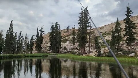
Tenkara fishing in Heaven
Follow me
https://www.instagram.com/skibum96/
Rumble Referrel link
https://rumble.com/register/AdventuresWithChris/
Rumble channel
https://rumble.com/c/c-1235824
14
views

Great Dane Puppy Gets the Zoomies
My 7 Month old Great Dane Puppy 'Kona' who has the case of the Zoomies and only one thing can cure it...... Play Time!
Follow me
https://www.instagram.com/skibum96/
Rumble Referral link
https://rumble.com/register/AdventuresWithChris/
Rumble channel
https://rumble.com/c/c-1235824
2
views
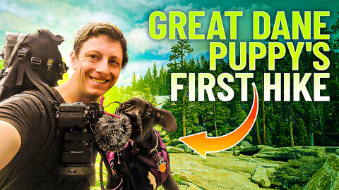
Bassi Falls! Great Dane puppy's First Hike!
Took my 6 month old Great Dane puppy Kona on her very first hike to Bassi Falls in the Crystal Basin Range of California. Located in the Western Sierra Nevada Mountians!
Follow me
https://www.instagram.com/skibum96/
Rumble Referrel link
https://rumble.com/register/AdventuresWithChris/
Rumble channel
https://rumble.com/c/c-1235824
7
views
The Best 24/7 LoFi and 4K Drone Footage
Music from Lofi Girls
https://www.youtube.com/watch?v=5qap5aO4i9A
All footage is captured by myself
2
views
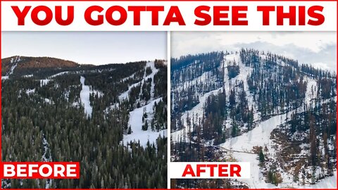
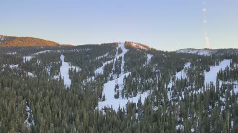
Will This Ski Resort Ever Be The Same? | Sierra At Tahoe Ski Resort
Drone video showing ariel footage of the Sierra At Tahoe Ski Resort before and after the Caldor Wildfire burned over 1 million acres of national forest lands. Over 900 structures and cabins were destroyed in the blaze. The Sierra Education Foundation has set up a Go Fund Me with 100% of donations going to support employees impacted by the fire.
https://www.gofundme.com/f/employees-of-sierraattahoe-caldor-fire-relief
Help Support me!
~~~~~~~~~~~
Paypal Donations: Skibum96buisness@gmail.com
Follow me
https://www.instagram.com/skibum96/
18
views
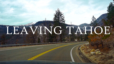
Scenic Drive | South Lake Tahoe to ice house Rd | Music : LoFi
Footage of damage done to The area long Hwy 50 from south lake tahoe to Ice House Rd from the Caldor Wildfire.
Follow me
https://www.instagram.com/skibum96/
Rumble Referrel link
https://rumble.com/register/AdventuresWithChris/
Rumble channel
https://rumble.com/c/c-1235824
6
views
The Story of the Lovers Leap: A Reminder of Nature's Power
Before and after drone footage of the forests surrounding the famous Trad wall Lover's Leap from before and after the Caldor Wildfire. The footage shows the dramatic change in the landscape from the wildfire, once lush green forests of Junipers is turned to ash and dust in a matter of a day. Lover's Leap is a steep granite cliff band in El Dorado County, California, United States, a landmark which catches the eye as one travels by, and a popular destination for climbers. The origin of its name is unknown, but common to most Lover's Leaps, one version from local folklore says two Native Americans lovers leapt to their deaths from the summit. Aerial view of the Lover's Leap area above Twin Bridges showing the aftermath of the Caldor Fire. Captured after UAV restrictions have been lifted of the area.
Follow me
https://www.instagram.com/skibum96/
Rumble Referrel link
https://rumble.com/register/AdventuresWithChris/
Rumble channel
https://rumble.com/c/c-1235824
8
views
Crater Lake Astrophotography timelapse. #Shorts
#Shorts
Follow me
https://www.instagram.com/skibum96/
Rumble Referrel link
https://rumble.com/register/AdventuresWithChris/
Rumble channel
https://rumble.com/c/c-1235824
I decided to go on a birthday Backpacking trip out to crater lake to do some camping and astrophotography. I set up at Crater lake near markleeville after 2 miles of rough 4x4 road and hiked the remaining mile into the lake as the ice on the road was impassible. I had crater lake all to myself and set up at sunset for some amazing astrophotography due to the new moon.
14
views
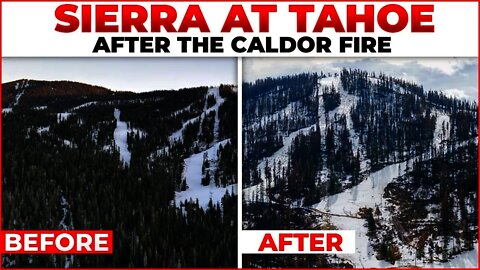
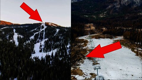
Sierra At Tahoe Drone footage Before and After the Caldor Fire
00:00 Intro
00:05 West Bowl @ Sierra at Tahoe Meets Caldor Fire
00:31 Sierra At Tahoe Last Winter
00:59 Echo Summit looking towards Sierra
01:04 360 Caldor Fire destruction on Echo Summit
02:17 Powder horn before the fire
02:35 West Bowl fly in
03:05 Main lodge before the fire
03:30 West bowl close up
03:40 West Bowl close up panning
03:52 Sierra at Tahoe freeway forest
04:10 Sierra At Tahoe entry road reveal destruction
04:39 Eagle Rock - After
05:10 Eagle Rock - Before
05:45 West Bowl- Before, down low, thick green Forest
05:49 West Bowl - After, Dead Forest
06:18 Lovers Leap and Mt Raulston and Sierra at Tahoe reveal
*Media looking to repost this footage, please reach out to me on my buisness email connected to my channel.*
Follow me:
https://www.instagram.com/skibum96/
Sierra-at-Tahoe is a ski and snowboard resort in Twin Bridges, California south of Lake Tahoe. Sierra-at-Tahoe is approximately 16 miles (26 km) south of Stateline, Nevada and 12 miles south of South Lake Tahoe on U.S. Route 50 and is contained within the Eldorado National Forest. Sierra-at-Tahoe (often shortened to "Sierra") is a medium sized ski area in the Lake Tahoe region, and is well known for being a more family oriented resort and also having a high annual snowfall. Sierra-at-Tahoe's terrain is 25 percent beginner, 50 percent Intermediate, and 25 percent advanced. Remains after the Caldor Fire. US 50, Echo Summit, Sierra At Tahoe
The majority of the ski resorts in the Lake Tahoe region are on the northern end of the lake, near Truckee, California and Reno, Nevada. Sierra-at-Tahoe, Kirkwood and Heavenly are located on the southern side of the lake, approximately 75 miles (120 km) from Reno. It is common for visitors to ski amongst these three resorts when staying in southern Lake Tahoe area and not venture to the northern lake resorts such as Squaw Valley, Northstar at Tahoe, Sugar Bowl, which are approximately 50-70 miles away.
"As repairs continue following the Caldor Fire’s destruction at Sierra-at-Tahoe, resort management has announced they don’t expect their slopes to open in 2021.
“We have substantial work ahead of us before we are able to announce our opening day for this season and it is unlikely that we will open in 2021,” stated Sierra-at-Tahoe officials in a post to social media. “We have set our sights on resuming operations in early 2022.”"
https://www.tahoedailytribune.com/new...
#snowboarding #skiing #wintersports #turism #bayarea #Holiday #travel #USFS #bluebird
106
views
1
comment
Sierra at Tahoe after the Caldor Fire
#shorts
Full Video can be watched Here: https://youtu.be/JjT1zMXUePc
Follow me:
https://www.instagram.com/skibum96/
Sierra-at-Tahoe is a ski and snowboard resort in Twin Bridges, California south of Lake Tahoe. Sierra-at-Tahoe is approximately 16 miles (26 km) south of Stateline, Nevada and 12 miles south of South Lake Tahoe on U.S. Route 50 and is contained within the Eldorado National Forest. Sierra-at-Tahoe (often shortened to "Sierra") is a medium sized ski area in the Lake Tahoe region, and is well known for being a more family oriented resort and also having a high annual snowfall. Sierra-at-Tahoe's terrain is 25 percent beginner, 50 percent Intermediate, and 25 percent advanced.
The majority of the ski resorts in the Lake Tahoe region are on the northern end of the lake, near Truckee, California and Reno, Nevada. Sierra-at-Tahoe, Kirkwood and Heavenly are located on the southern side of the lake, approximately 75 miles (120 km) from Reno. It is common for visitors to ski amongst these three resorts when staying in southern Lake Tahoe area and not venture to the northern lake resorts such as Squaw Valley, Northstar at Tahoe, Sugar Bowl, which are approximately 50-70 miles away.
"As repairs continue following the Caldor Fire’s destruction at Sierra-at-Tahoe, resort management has announced they don’t expect their slopes to open in 2021.
“We have substantial work ahead of us before we are able to announce our opening day for this season and it is unlikely that we will open in 2021,” stated Sierra-at-Tahoe officials in a post to social media. “We have set our sights on resuming operations in early 2022.”"
https://www.tahoedailytribune.com/news/sierra-at-tahoe-may-not-open-until-early-2022/
#snowboarding #skiing #wintersports #turism #bayarea #Holiday #travel #USFS
38
views
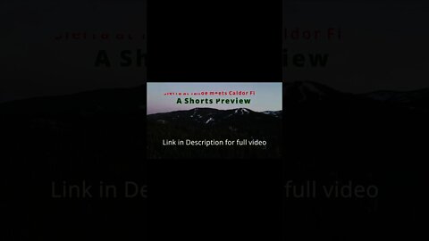
Exclusive Sneak Peak: Sierra at Tahoe, West Bowl after the Caldor fire
#shorts
Full Video: https://youtu.be/JjT1zMXUePc
Follow me:
https://www.instagram.com/skibum96/
Sierra-at-Tahoe is a ski and snowboard resort in Twin Bridges, California south of Lake Tahoe. Sierra-at-Tahoe is approximately 16 miles (26 km) south of Stateline, Nevada and 12 miles south of South Lake Tahoe on U.S. Route 50 and is contained within the Eldorado National Forest. Sierra-at-Tahoe (often shortened to "Sierra") is a medium sized ski area in the Lake Tahoe region, and is well known for being a more family oriented resort and also having a high annual snowfall. Sierra-at-Tahoe's terrain is 25 percent beginner, 50 percent Intermediate, and 25 percent advanced.
The majority of the ski resorts in the Lake Tahoe region are on the northern end of the lake, near Truckee, California and Reno, Nevada. Sierra-at-Tahoe, Kirkwood and Heavenly are located on the southern side of the lake, approximately 75 miles (120 km) from Reno. It is common for visitors to ski amongst these three resorts when staying in southern Lake Tahoe area and not venture to the northern lake resorts such as Squaw Valley, Northstar at Tahoe, Sugar Bowl, which are approximately 50-70 miles away.
"As repairs continue following the Caldor Fire’s destruction at Sierra-at-Tahoe, resort management has announced they don’t expect their slopes to open in 2021.
“We have substantial work ahead of us before we are able to announce our opening day for this season and it is unlikely that we will open in 2021,” stated Sierra-at-Tahoe officials in a post to social media. “We have set our sights on resuming operations in early 2022.”"
https://www.tahoedailytribune.com/news/sierra-at-tahoe-may-not-open-until-early-2022/
43
views

Lovers Leap before the Caldor Fire
left to right drone sweeping shot of the very popular and famous cliff face called Lovers Leap in California during the winter of 2020.
Learn more about the climbing routes and restrictions here:
https://www.mountainproject.com/area/...
Follow me:
https://www.instagram.com/skibum96/
#CaldorFire #Calfire #beforedestruction
Lovers leap,california,HDR,winter,snow,drone timelapse,Tahoe,National forest,Rock climbing,sport climbing,Alex Honnald,free climbing, Tahoe, 2020
52
views
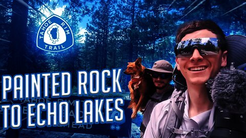
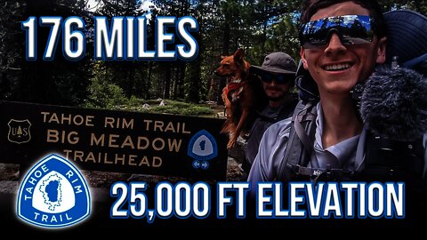
Painted Rock to Big Meadow | Tahoe Rim Trail Thru Hike With a Dog June 2021| Episode 6
Follow me:
https://www.instagram.com/skibum96/
~~Timestamps~~
00:00 Intro
00:50 Painted Rock, Tahoe City
02:00 Tahoe City. only resupply location on the Tahoe Rim Trail.
02:17 Twin Peaks Tahoe California.
05:17 Cute dog rolls around in a snow bank
05:39 Top of Twin Peaks. Best lunch spot with a view in Tahoe?
06:19 Granite chief Wilderness. Least hiked side..
06:58 scenic trail section on the Tahoe Rim Trail
07:30 Chapters to be continued. . . .
WEST SHORE SPLENDOR
Between Barker Pass and Tahoe City the trail dips in and out of flowery meadows and swoops around craggy volcanic peaks. The joint Tahoe Rim Trail / Pacific Crest National Scenic Trail north of Barker Pass rolls across open hillsides decorated with wildflowers. Near Twin Peaks, the TRT splits from the PCT and turns east toward Lake Tahoe. The trail soon drops steeply into thickly wooded Ward Canyon, where the scent of pine and the rustling of aspen leaves fill the air. It then meanders for a few miles past a small waterfall and alongside a gurgling creek before climbing back out of the canyon. Close to Tahoe City, lush and lovely Page Meadows provide enchanting spring and summer wildflowers, vibrant fall color and year-round wildlife watching. The trail reenters the trees for a last downhill to the banks of the Truckee River and then the trailhead.
EXPLORE DESOLATION WILDERNESS
Between Echo Lake and Barker Pass, the trail leads deep into the granite heart of the Desolation Wilderness, where cool blue lakes lie cradled in ice-polished basins. The joint Tahoe Rim Trail/ Pacific Crest National Scenic Trail heads north from Echo Lakes across a rugged wilderness of glacial moraines and smooth granite ridges. Tumbling streams and serene lakes nourish pine groves and flower-filled meadows. The clear water and meandering shoreline of beautiful Lake Aloha offer delightful swimming and camping spots. The central portion of this segment is noted for its long steep approaches up and over Dic ks Pass and for its equally breath-taking views. North of the pass, the Velma Lakes mark the trail’s entrance into a much drier and less open landscape, where thick conifer stands are interrupted by small meadows crowded with wildflowers. The gently rolling trail leads down out of Desolation Wilderness and eventually to shallow Richardson Lake. Several dirt roads cross the trail as it slowly rises to the Barker Pass trailhead. Small creeks and meadows punctuate the generally forested northern portion of the segment.
ENTER THE LAKES REGION
Between Big Meadow and Echo Summit, the trail wanders from meadows to lakes to creeks, and through dense stands of pine, fir and aspen. The trail heads south from Big Meadow trailhead across a gently rolling landscape of grassy meadows and fragrant conifer stands. The shaded shores of Round Lake is nestled beneath high cliffs. Further on, the TRT merges with the Pacific Crest National Scenic Trail (PCT) and swings north through flower filled Meiss Meadows and alongside the cool head waters of the Upper Truckee River. The trail then climbs past granite lined shores of Showers Lake and through a rocky bowl where seasonal creeks tumble down steep ridges into lush meadows. Further north the landscape becomes more rugged and much drier, and opens into occasional views of Lake Tahoe. The trail drops over a granite ridge in a long steep downhill traverse before leveling off. A small stream outlined with ferns and flowers provides a refreshing respite before the short ascent to the Echo Summit Trailhead.
155
views
8/28/2021 Caldor Fire Timelapse #Shorts
Status Updates
CURRENT SITUATION:
The nighttime inversion layer returned bringing a reduction in fire spread, spotting, and visibility. Down-canyon winds and low humidity increased fire activity in Division D. Firing operations continued in the Eastern flanks, while firefighters took advantage of the slow easterly winds to improve control lines. The terrain continues to be challenging for fire crews throughout the fire. Damage inspection teams continue to inspect properties and infrastructure throughout the area.
To better provide public and firefighter safety due to extreme fire conditions throughout Northern California, and strained firefighter resources throughout the Country, the USDA Forest Service Pacific Southwest Region is announcing a temporary closure of nine National Forests. This closure will be effective on August 22, 2021, at 11:59 p.m. through September 6, 2021, at 11:59 p.m. The closure order can be found at https://tinyurl.com/USFSClosure.
Local Assistance Center: Address: 6699 Campus Drive, Placerville, CA 95667. Located at Folsom Lake Community College, El Dorado Campus, Fitness Center Building. Hours: Monday through Friday 10:00 a.m. to 5:00 p.m., Wednesdays 1:00 p.m. to 7:00 p.m.
Subscribe to email alerts: https://lp.constantcontactpages.com/su/bqzL6B6/caldorfire
Highway 50 will be closed in both directions from the Sly Park Road exit to Meyers (Highway 50 and Highway 89 junction).
EVACUATION CENTERS:
EL DORADO COUNTY
Shelter
Green Valley Community Church
3500 Missouri Flat Road
Placerville, CA
Shelter
Cameron Park CSD
2502 Country Club Drive
Cameron Park, CA
Shelter
Rolling Hills Church
800 White Rock Road
El Dorado Hills, CA
NEVADA
Shelter
Douglas County Community Center
1329 Waterloo Lane
Gardnerville, NV
Animal Evacuation Centers:
EL DORADO COUNTY
El Dorado County Animal Services (small animals)
6435 Capitol Ave.
Diamond Springs, CA
For animal evacuation questions or assistance call (530) 621-5795
Saureel Vineyards (large animals) FULL
1140 Cold Springs Road
Placerville, CA
(530) 621-5795
AMADOR COUNTY
South County Large Animal Rescue (SCLAR)
Amador County Fairgrounds (large and farm animals)
El Dorado County residents only
18621 Sherwood Street
Plymouth, CA
Amador County Animal Response Team- ACART
Amador County Fairgrounds (large and small animals)
18621 Sherwood Street
Plymouth, CA
For Amador County residents only
(209) 257-9444
NEVADA
Douglas County Animal Services (small animal)
921 Dump Road
Gardnerville, NV
(775) 782-9061
East to West Coast Grooming
1368 Hwy 395, Unit B1
Gardnerville, NV
(775) 450-1743
Douglas County Animal Services (livestock)
Douglas County Fairgrounds
920 Dump Road
Gardnerville, NV
(775) 782-9061
#Shorts #Caldor Fire #147,000acresburned
63
views
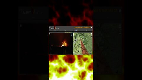
Cal Fire battles 100ft Flames on the West of Kyburz, Caldor Fire #shorts
#shorts
Time-lapse as the Caldor Fire Continues to burn and get away from Calfire. 100 foot can be seen on timelapse.
Get most up-to-date Information here:
https://www.fire.ca.gov/incidents/2021/8/14/caldor-fire/
https://www.sfgate.com/bayarea/article/Caldor-Fire-triggers-new-evacuations-including-16414181.php
00:00 intro
00:30 100ft flames overnight on the Caldor fire
00:55 end
10
views
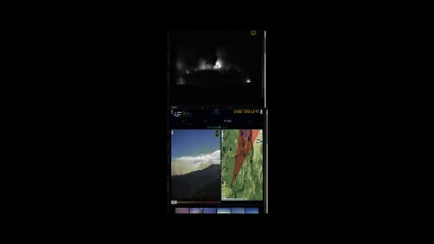
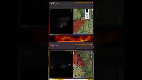
Caldor Fire Timelapse #Shorts
#shorts Timelapse as the Caldor Fire Continues to burn and get away from Calfire. Top screen is the North East side of the Fire Burning towards South Lake Tahoe and sierra at tahoe ski resort. Lower screen is as it burns towards Somerville.
9
views
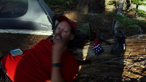
Interview with a Thru hiking social outcast "different socks" after hiking 17,000 Miles since 1992
Hiking the Tahoe Rim Trail with dog man and pepper we picked a campsite with views of Squaw Valley Ski Resort and the Vast Granite Chief Wilderness area. Soon after we Set up our cowboy camps for the night hoping that the wind would blow all night long so that we could get a break from the mosquitos that have been attacking us as we venture farther along on the California portion of the TRT. Soon a strange man with a old-school external frame pack heading clockwise decided this would be his camp as well. In the short time that we chatted dogman and I realized that this guy was very unique and I asked if I could interview him on camera. . . .
54
views
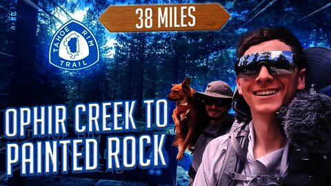
Ophir Creek to Painted Rock | Tahoe Rim Trail With a Dog June 2021| Episode 4
Follow me:
https://www.instagram.com/skibum96/
~~Timestamps~~
00:00 Intro
01:00 Glacier on the Tahoe Rim Trail?
01:30 Is this the best view in North shore of Lake Tahoe?
02:48 Bolsa root meadows
03:30 Nevada/California TRT crossing
04:00 Waves of blue. How is my body doing?
05:30 Revive GPS Track. Ophir Creek to Painted Rock
06:00 Half way done with the Tahoe Rim Trail!
06:35 Brockway Summit to Watson Lake
07:00 Watson lake view of Lake Tahoe
07:50 Revive GPS track. Brockway Summit to Painted Rock,
08:18 Interview with 'Different Socks' 17,000 miles hiked
10:24 End
ASCEND TO THE HIGHEST POINT ON THE TRT
Between Brockway and Tahoe Meadows, the TRT winds through thick forests, open meadows, and across the feet of ancient volcanoes. In springtime fields of yellow mules ears sparkle against the backdrop of Lake Tahoe. This segment is prized for its spectacular windswept vistas of Lake Tahoe, the Sierra and the Carson Range.
The trail climbs away from Brockway for several miles and into thick and fragrant stands of pine, fir and tobacco brush. It crosses sun-splashed meadows where bright wildflowers are backed by distant lake views. The interior of the segment enters Nevada and the Humboldt-Toiyabe National Forest and treks along the volcanic summits and slopes of the Mt. Rose Wilderness and includes the highest point on the TRT, 10,338′ Relay Peak. Long ridge traverses afford horizon-spanning, nearly continuous views south across the entire Tahoe Basin and northwest over the Sierra to Mt. Lassen and beyond.
As the route leaves the Wilderness, crossing a saddle where the views change from the west to the east, a 0.7 mi spur trail ascends to the summit of 10,490′ Mt Houghton, offering expansive views in all directions. Continuing on, towering pines reappear to shelter the trail along its descent to the base of a 130′ waterfall, the highest on the trail. Hikers pass the junction of the trail to the top of Mt. Rose, then continue to the parking lot at the Mt. Rose trailhead.
BIG VIEWS AND CURIOUS LAVA FORMATIONS
Between Tahoe City and Brockway Summit, the Tahoe Rim Trail meanders through groves of fir, cedar and aspen and across open hillsides covered with manzanita. The trail climbs steadily from Tahoe City into a mixed forest. Side trails and open slopes offer opportunities to explore cinder cones and ancient lava flows. Midway between the trailheads the terrain flattens and a denser forest provides cool, quiet shade. The trail continues past the Lava Cliffs, a lovely overlook of Lake Tahoe and the peaks lining its north shore, before dropping down to Watson Lake. This shallow lake is thickly fringed with wildflowers in spring and early summer, and is a pleasant spot for fishing, picknicking and camping. Between Watson Lake and Brockway the trail crosses gently rolling slopes covered with a patchwork of small meadows and thick forests.
58
views
Thru Hiking the Tahoe Rim Trail with a dog! Episode 3
ENJOY THE MOST PHOTOGRAPHED SPOT ON THE TRT
Follow me:
https://www.instagram.com/skibum96/
~~Timestamps~~
00:00 Intro
00:42 Prettiest stretch of the Tahoe Rim Trail?
00:50 GPS track
01:00 Is this Heaven?
01:44 Flume Trail
02:52 Cute Doggo
03:25 Gps Track day 5 Ophir Creek to Brockway Summit.
04:52 Mt Rose Water Fall - last water for 15 miles
05:30 Relay Peak- Best views
10:00 Is that a Cave?
10:42 end
Between Tahoe Meadows (8740′) and Spooner Summit (7150′), the TRT roams high above sparkling Lake Tahoe and Marlette Lakes, through sun-warmed conifer stands, and across steep, flower-strewn slopes. This segment is celebrated for its magnificent views, stretching across Lake Tahoe and the high Sierra and past the jagged ranges of the Great Basin. The route is rich in historical reminders, skirting lakes and flumes built to supply water to distant miners on the Comstock. It traverses both dense forests that sprang up after clear-cutting a century ago, and ancient red fir stands spared the ax by their remoteness.
Between the lush grasses of Tahoe Meadows and Twin Lakes, the trail winds through rolling, wooded terrain. Breaks in the trees showcase grand vistas of the Tahoe Basin and Washoe Valley. The steeper, often open interior of the segment travels through Lake Tahoe Nevada State Park including possible side trips to North Canyon Campground and Marlette Lake. A TRT spur leads to Christopher’s Loop and a glorious cliff perch that seems to float above Lake Tahoe’s translucent shallows and Sand Harbor at the trail’s most photographed spot. The trail segment reaches its highest point as it threads between the bare rock of Snow Valley Peak (9214′) and shimmering aspen groves that turn North Canyon to gold each fall. Near Spooner Summit, the trail slips back into the pines, but still offers occasional panoramic lake and valley views.
ASCEND TO THE HIGHEST POINT ON THE TRT
Between Brockway and Tahoe Meadows, the TRT winds through thick forests, open meadows, and across the feet of ancient volcanoes. In springtime fields of yellow mules ears sparkle against the backdrop of Lake Tahoe. This segment is prized for its spectacular windswept vistas of Lake Tahoe, the Sierra and the Carson Range.
The trail climbs away from Brockway for several miles and into thick and fragrant stands of pine, fir and tobacco brush. It crosses sun-splashed meadows where bright wildflowers are backed by distant lake views. The interior of the segment enters Nevada and the Humboldt-Toiyabe National Forest and treks along the volcanic summits and slopes of the Mt. Rose Wilderness and includes the highest point on the TRT, 10,338′ Relay Peak. Long ridge traverses afford horizon-spanning, nearly continuous views south across the entire Tahoe Basin and northwest over the Sierra to Mt. Lassen and beyond.
As the route leaves the Wilderness, crossing a saddle where the views change from the west to the east, a 0.7 mi spur trail ascends to the summit of 10,490′ Mt Houghton, offering expansive views in all directions. Continuing on, towering pines reappear to shelter the trail along its descent to the base of a 130′ waterfall, the highest on the trail. Hikers pass the junction of the trail to the top of Mt. Rose, then continue to the parking lot at the Mt. Rose trailhead.
73
views
Thru Hiking the Tahoe Rim Trail with a dog! Episode 2
Shadowing the rugged peaks of the Carson Range, this trail segment weaves between the huge trunks of ancient firs and over sun-splashed granite outcrops. Ridge top crossings showcase panoramic views of the Tahoe Basin and Carson Valley. Open stands of Jeffrey pine alternate with the cool stillness of red fir forests and the cheerful rustlings of aspen groves. A diverse array of birds and small animals inhabit the area and alert hikers may catch a glimpse of marmots frolicking across boulders or coyotes and mule deer slipping between the trees.
From Spooner Summit (7150′), the trail switchbacks upward through fragrant conifers and across small meadows brightened in spring by the cheerful yellow blooms of mule’s ear. Nearby stand aspens whose broad trunks bear inscriptions carved long ago by lonely Basque Shepherds. A long traverse up the volcanic flanks of South Camp Peak (8866′) leads to the highest point on the segment (8830′) and a stunning view that sweeps across the entire length of Lake Tahoe. Along the descent to Kingsbury, dense woods occasionally part to reveal glimpses of sparkling water framed between the branches of lush firs. Just south of South Camp Peak, a dirt road crosses the TRT and rises steeply to the top of Genoa Peak (9150′), overlooking Carson Valley.
Follow me:
https://www.instagram.com/skibum96/
~~Timestamps~~
00:00 Intro
00:24 morning!
01:00 Kingsbury grade
01:30 first vista
01:50 Sunset over Stateline
02:19 Day 3!
02:53 Morning!
03:08 sticky situation
04:05 Genoa ridge vista
04:48 Trail Magic
05:50 the trail finds a way
06:53 Spooner Lake swimming
10:38 siesta is over
10:54 Spooner lake to Marlette Lake
11:19 Sunset
12:01 Sunset Timelapse
18
views
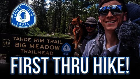
Thru Hiking the Tahoe Rim Trail with a dog! Episode 1
My First Thru Hike! I am so excited! I am joined on this journey with my cousin Kyle and his doggo 'Pepper'. Follow along in this series as we Travel together all the way around Lake Tahoe! Backpacking along the trail.
Follow me:
https://www.instagram.com/skibum96/
Between Kingsbury Grade South and Big Meadow, the trail follows the spine of the Carson Range from sun-drenched meadows to cool pine forests and windswept mountain passes. Starting at Kingsbury Grade the trail climbs through a dense forest of large red firs and white pines, majestic survivors of the Comstock logging era. Further south, open ridges and rocky outcrops showcase breathtaking views of the Carson Valley. Hemlock-ringed Star Lake offers inviting campsites and a nice fishing spot for brown trout. This secluded lake nestles at the feet of three of the highest mountain peaks in the Tahoe Basin, Freel Peak, Jobs Sister and Jobs Peak. The more rugged central portion of the segment weaves through monumental old growth junipers and across granite passes with stunning vistas of Lake Tahoe and the Sierra. From here the TRT descends gently south to the Big Meadow trailhead through forests and past small meadows dotted with flowers in the spring and summer and outlined with the golden shimmer of aspen leaves in the fall. Two miles before the end one can take a 0.6 mi shortcut to Grass Lake, an alternate trailhead.
~~Timestamps~~
00:00 Intro
00:37 Mile 1 - 10, Luther Pass(Big Meadow) to Freel Peak
02:50 Day 2
05:28 Star Lake
06:21 Male Brook Trout
07:39 Views of Desolation
08:17 Views of Nevada
09:02 Incline Village
10:00 end
45
views
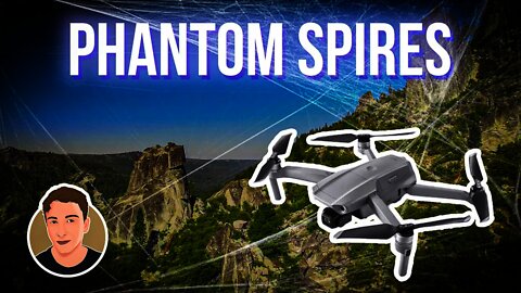
Phantom Spires in South Lake Tahoe California. Trad climbing spot.
Follow me:
https://www.instagram.com/skibum96/
All Music is owned and created by, ANtarcticbreeze Music https://soundcloud.com/antarcticbreeze
---------
Phantom Spires is a rock climbing area west of south Lake Tahoe consisting of granitic rock formations, or spires, among low scrub and old burned pines.
Various sport and trad routes have been established, mostly single-pitch, though some might be more convenient to do in two pitches. Some of the routes have walk-offs, but others require rappelling. Compared to Lovers Leap, it's less crowded, warmer and windier, with shorter routes.
I have included only a small sampling of the climbs available - a far better guide is South Lake Tahoe Climbing : SuperTopos, Chris McNamara, SuperTopo, 2004.
https://www.summitpost.org/phantom-spires/155056
best hidden lake tahoe gem. secret lake tahoe spot. local spot.
11
views