NBC26 Storm Shield Weather Forecast
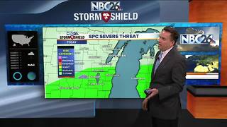
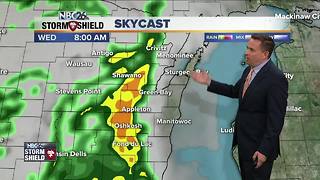
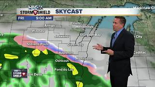
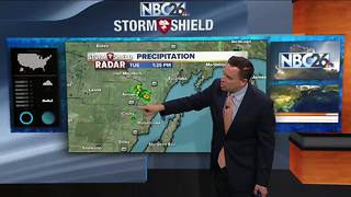
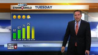
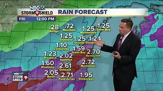
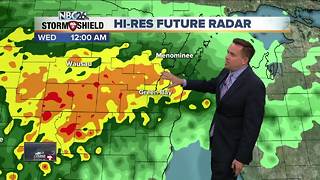
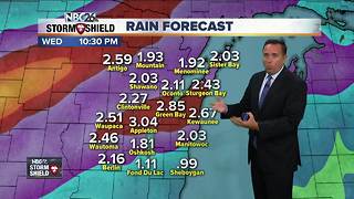
After a wet & cool Wednesday.....high pressure will build back into the area late tonight! Thursday, we should have a break with highs in the low- to mid-60s. We should see some sunshine. By Friday, our temperatures will only be in the 40s. Rain looks to develop late Thursday night going into Friday. Right now, the placement of a stationary front is going to be key as to who sees the most rain. Gusty NE winds off of Lake Michigan will keep temps 15-20° below normal for mid-May. Current model trends are actually trying to push the frontal boundary into southern Wisconsin for Saturday. That would mean much less rain for us. Either way, it's going to be chilly with highs only in the low-50s. Sunday through next Tuesday looks milder and dry. The Wolf River near Shiocton, & New London remain under a River Flood Warning for the time being with minor flooding currently being observed. The Fox River is experiencing minor flooding in Green Lake County.
-
 2:32
2:32
WGBA
5 years agoNBC26 Storm Shield Weather Forecast
-
 4:11
4:11
WGBA
5 years agoNBC26 Storm Shield Weather Forecast
-
 3:34
3:34
WGBA
5 years agoNBC26 Storm Shield Weather Forecast
-
 2:16
2:16
WGBA
5 years agoNBC26 Storm Shield Weather Forecast
-
 1:44
1:44
WGBA
5 years agoNBC26 Storm Shield Weather Forecast
4 -
 2:49
2:49
WGBA
5 years agoNBC26 Storm Shield Weather Forecast
-
 4:05
4:05
WGBA
5 years agoNBC26 Storm Shield Weather Forecast
-
 3:57
3:57
WGBA
5 years agoNBC26 Storm Shield Weather Forecast
4 -
 4:03
4:03
WGBA
5 years agoNBC26 Storm Shield Weather Forecast
1 -
 4:42
4:42
WGBA
5 years agoNBC26 Storm Shield weather forecast
5