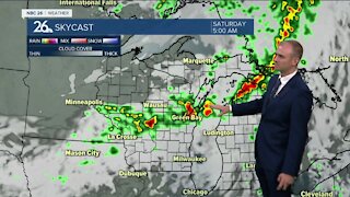
Gino Recchia NBC26 Storm Shield Weather Forecast
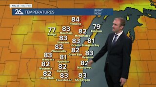
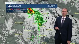
A dusting to a half inch of snow fell across Northeast Wisconsin yesterday and there is the potential for additional snowfall as we head into the weekend but it will be dependent on where you live. As for today, our skies are starting partly cloudy but we will see an increase in clouds later in the afternoon and evening. This is from the next snow storm that will impact parts of the Midwest. High temperatures today will climb into the upper teens and lower 20s with winds out of the north and northeast around 5 to 10 mph. Temperatures will fall into the single digits overnight except by the lakeside areas due to the northeast wind flow at 10 to 15 mph keeping the lakeside areas warmer from the onshore wind flow. This will play an important part on the potential for lake effect snow showers. Light snowfall will begin to lift north during late tonight, especially for areas along and south from Oshkosh to Manitowoc. The snowfall will begin to shift south out of the area by sunrise, however there will be some lake effect snow showers persisting into the early afternoon for Manitowoc and Sheboygan Counties. A dusting to two inches of snow will fall for areas along and south of that Oshkosh to Manitowoc line however, lakeside areas from Manitowoc to Sheboygan Counties could see an added 1 to 3 inches of snowfall from this lake effect snow band. Because of this risk, a winter weather advisory has been issued for Sheboygan County until noon Sunday. The coldest temperatures of the week falls on Sunday with highs near 10 degrees. morning lows will be near to below zero with wind chill values between -10 and -20 degrees. Another chance of snow comes in on Tuesday and perhaps carry over to Wednesday. Still questions remain with this storm due to how it will develop and its track. If it pans out perfectly, we may have to grab the shovels and snow blowers. More updates to come with this!
-
 1:57
1:57
WGBA
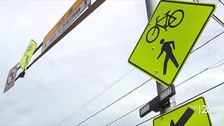
7 months agoHow the City of Green Bay is hoping a $1.6M investment will make the community safer for pedestrians
901 -
 2:33
2:33
WGBA
2 years agoGino Recchia NBC26 Weather Forecast
15 -
 3:46
3:46
WGBA
2 years agoGino Recchia NBC26 Weather Forecast
13 -
 3:32
3:32
WGBA
2 years agoGino Recchia NBC26 Weather Forecast
17 -
 3:08
3:08
WGBA
2 years agoGino Recchia NBC26 Weather Forecast
17 -
 3:24
3:24
WGBA
2 years agoGino Recchia NBC26 Weather Forecast
14 -
 1:55
1:55
WGBA
2 years agoGino Recchia NBC26 Weather Forecast
9 -
 4:18
4:18
WGBA
2 years agoGino Recchia NBC26 Weather Forecast
11 -
 2:53
2:53
WGBA
2 years agoGino Recchia NBC26 Weather Forecast
13 -
 3:59
3:59
WGBA
2 years agoGino Recchia NBC26 Weather Forecast
13