Gino Recchia NBC26 Storm Shield Weather Forecast
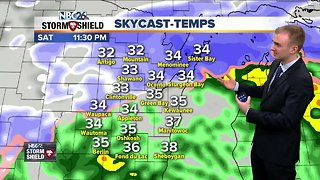
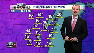
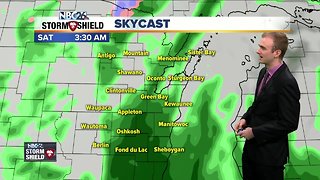
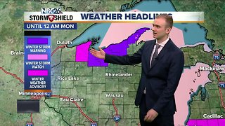
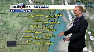
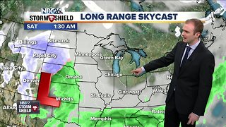
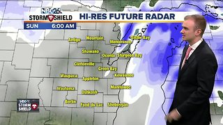
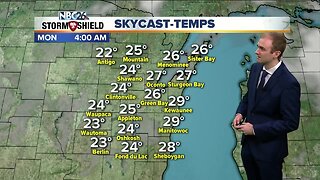
Light to moderate snow showers will continue for the next few hours this evening but they will end tonight once this storm system moves out of the Great Lakes. Winds will remain out of the north tonight around 5 to 15 mph bringing cooler temperatures to the area. We will also have skies clear overnight. This will bring a nice and sun filled weekend to the region. High temperatures will rise into the lower and mid 20s for Saturday. While it will feel considerably colder than highs on early Friday morning, these numbers are what is to be expected this time of year in Northeast Wisconsin. Winds will be out of the north around 5 to 10 mph. We have another beautiful day on Sunday as well. Temperatures will be slightly warmer with highs in the lower to mid 30s. With light winds. Monday is New Years Eve! Besides the celebration for the upcoming year, there is the potential for accumulating snowfall. There remains some questions exactly how this storm will pan out. There will be two low pressure systems, one moving across the Canadian border and another one lifting through Northern Illinois from the Gulf of Mexico. If these two storm system combine into one larger storm system, that would result in Northeast Wisconsin getting several inches of snowfall which would carry over to New Years Day. This is something that definitely needs close monitoring.
-
 3:11
3:11
WGBA
5 years agoGino Recchia NBC26 Storm Shield Weather Forecast
-
 3:58
3:58
WGBA
5 years agoGino Recchia NBC26 Storm Shield Weather Forecast
17 -
 1:42
1:42
WGBA
5 years agoGino Recchia NBC26 Storm Shield Weather Forecast
-
 4:01
4:01
WGBA
5 years agoGino Recchia NBC26 Storm Shield Weather Forecast
9 -
 3:07
3:07
WGBA
5 years agoGino Recchia NBC26 Storm Shield Weather Forecast
2 -
 2:52
2:52
WGBA
5 years agoGino Recchia NBC26 Storm Shield Weather Forecast
8 -
 3:23
3:23
WGBA
5 years agoGino Recchia NBC26 Storm Shield Weather Forecast
13 -
 4:00
4:00
WGBA
5 years agoGino Recchia NBC26 Storm Shield Weather Forecast
17 -
 10:05
10:05
WGBA
5 years agoGino Recchia NBC26 Storm Shield Weather Forecast
16 -
 3:49
3:49
WGBA
4 years agoGino Recchia NBC26 Weather Forecast
33