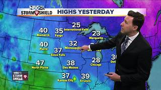
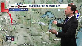
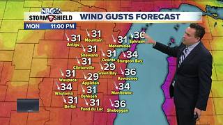
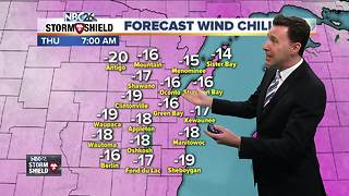
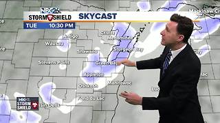
Michael Fish's NBC26 Storm Shield weather forecast
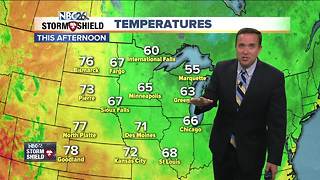
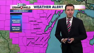
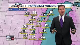
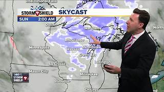
We'll have some patchy fog, drizzle and mild air ahead moving in ahead an approaching low pressure system. Highs will pop all the way up into the low-40s. Tonight, with that mild, moist air going over the cold snowpack, we'll see fog develop around the area, with some being locally dense. There will also be a chance of a little rain with very mild overnight lows in the upper-30s/lower-40s. Thursday will be the most active day of the week with areas of rain. This may start to change over to a little snow in the afternoon well off to the NW. We'll have very mild temperatures in the 40s to start the day, but they'll fall a bit as we head through the afternoon. Right now, any snow accumulation should be minor, but the farther you live to the NW, you could see just a little more, but still minor. Thursday night, as this low pressure system departs, it'll be blustery and turning colder. If there's a leftover rain or snow shower, that'll end. Overnight lows will plummet into the upper-single digits above zero. It'll be cold and blustery on Friday with some sunshine. Get ready for that punch of winter to be back with highs only in the upper-teens. The weekend will also be cold with highs only in the teens with a chance of light snow on Sunday night going into Monday.
-
 1:45
1:45
WGBA
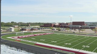
7 months agoFond du Lac Cardinals start the football season with a new $5.3 million nest
63 -
 2:48
2:48
WGBA
6 years agoMichael Fish's NBC26 Storm Shield Weather Forecast
-
 3:16
3:16
WGBA
6 years agoMichael Fish's NBC26 Storm Shield weather forecast
2 -
 4:16
4:16
WGBA
6 years agoNBC26 Storm Shield Weather Forecast
2 -
 4:27
4:27
WGBA
6 years agoNBC26 Storm Shield Weather Forecast
2 -
 1:51
1:51
WGBA
6 years agoMichael Fish's NBC26 weather forecast
1 -
 2:54
2:54
WGBA
6 years agoMichael Fish's NBC26 weather forecast
1 -
 3:33
3:33
WGBA
6 years agoMichael Fish's NBC26 weather forecast
-
 2:50
2:50
WGBA
6 years agoMichael Fish's NBC26 weather forecast
-
 2:49
2:49
WGBA
6 years agoMIchael Fish's NBC26 weather forecast
2