
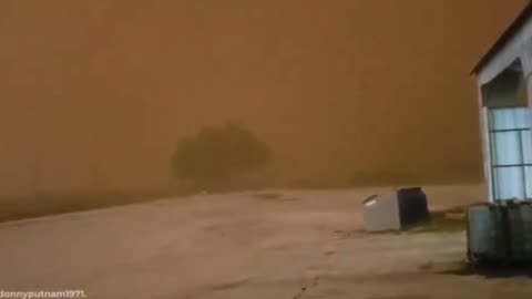
Sandstorm Turns Day Into Night in a Matter of Minutes
Sandstorm Turns a Day Into Night in a Matter of Minutes
174
views
1
comment
The Science of Hail - Meteorology - Weather Basics
Chunks of ice that fall from the sky can cause serious damage to property, and injuries to people and animals. But how does hail form?
Hail is a form of solid precipitation.[1] It is distinct from ice pellets (American English "sleet"), though the two are often confused.[2] It consists of balls or irregular lumps of ice, each of which is called a hailstone.[3] Ice pellets generally fall in cold weather, while hail growth is greatly inhibited during low surface temperatures.
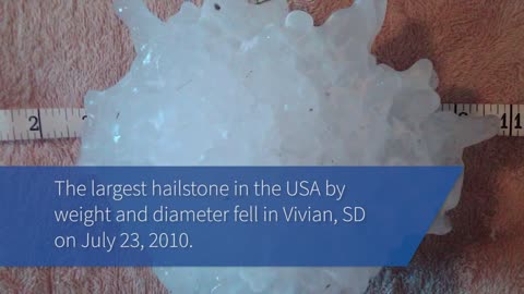
Estimating Hail Size
Hail size is often estimated by comparing it to a known object. Most hailstorms are made up of a mix of different sizes, and only the very largest hail stones pose serious risk to people caught in the open. When reporting hail, estimates comparing the hail to a known object with definite size are good, but measurements using a ruler, calipers, or a tape measure are best.
Pea = 1/4 inch diameter
Mothball = 1/2 inch diameter
Penny = 3/4 inch diameter
Nickel = 7/8 inch
Quarter = 1 inch — hail quarter size or larger is considered severe
Ping-Pong Ball = 1 1/2 inch
Golf Ball = 1 3/4 inches
Tennis Ball = 2 1/2 inches
Baseball = 2 3/4 inches
Tea cup = 3 inches
Softball = 4 inches
Grapefruit = 4 1/2 inches
More More Meteorology Videos
https://rumble.com/playlists/JfAj918PQuc
91
views
3
comments

Hail storm in Damon Texas on 3/24/24 destroys 1,000’s of acres of solar farms
Hail storm in Damon texas on 3/24/24 destroys 1,000’s of acres of solar farms
Hail is a form of solid precipitation.[1] It is distinct from ice pellets (American English "sleet"), though the two are often confused. It consists of balls or irregular lumps of ice, each of which is called a hailstone. Ice pellets generally fall in cold weather, while hail growth is greatly inhibited during low surface temperatures.
Estimating Hail Size
Hail size is often estimated by comparing it to a known object. Most hailstorms are made up of a mix of different sizes, and only the very largest hail stones pose serious risk to people caught in the open. When reporting hail, estimates comparing the hail to a known object with definite size are good, but measurements using a ruler, calipers, or a tape measure are best.
Pea = 1/4 inch diameter
Mothball = 1/2 inch diameter
Penny = 3/4 inch diameter
Nickel = 7/8 inch
Quarter = 1 inch — hail quarter size or larger is considered severe
Ping-Pong Ball = 1 1/2 inch
Golf Ball = 1 3/4 inches
Tennis Ball = 2 1/2 inches
Baseball = 2 3/4 inches
Tea cup = 3 inches
Softball = 4 inches
Grapefruit = 4 1/2 inches
A photovoltaic power station, also known as a solar park, solar farm, or solar power plant, is a large-scale grid-connected photovoltaic power system (PV system) designed for the supply of merchant power. They are different from most building-mounted and other decentralized solar power because they supply power at the utility level, rather than to a local user or users. Utility-scale solar is sometimes used to describe this type of project.
911
views
6
comments
What is a Blizzard? Weather Basics - Meteorology
This is a brief video about the conditions needed for a blizzard
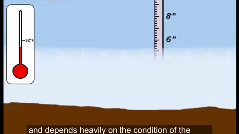
A blizzard is a severe snowstorm characterized by strong sustained winds and low visibility, lasting for a prolonged period of time—typically at least three or four hours. A ground blizzard is a weather condition where snow is not falling but loose snow on the ground is lifted and blown by strong winds. Blizzards can have an immense size and usually stretch to hundreds or thousands of kilometres.
More Meteorology Videos
https://rumble.com/playlists/JfAj918PQuc
58
views
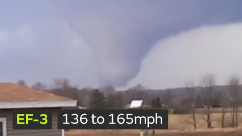
What is the Enhanced Fujita Tornado Scale - Weather Basics - Meteorology
Enhanced Fujita Scale or EF Scale, which became operational on February 1, 2007, is used to assign a tornado a 'rating' based on estimated wind speeds and related damage. When tornado-related damage is surveyed, it is compared to a list of Damage Indicators (DIs) and Degrees of Damage (DoD) which help estimate better the range of wind speeds the tornado likely produced. From that, a rating (from EF0 to EF5) is assigned.
Enhanced Fujita Scale
EFU Unknown No surveyable damage
EF0 65–85 mph Light damage
EF1 86–110 mph Moderate damage
EF2 111–135 mph Considerable damage
EF3 136–165 mph Severe damage
EF4 166–200 mph Devastating damage
EF5 >200 mph Incredible damage
The Enhanced Fujita scale (abbreviated as EF-Scale) rates tornado intensity based on the severity of the damage they cause. It is used in some countries, including the United States, Canada, France, China, and Mongolia
More Meteorology Videos
https://rumble.com/playlists/JfAj918PQuc
165
views

How Do Rainbows Form? - Weather Basics
How Do Rainbows Form?
rainbow is an optical phenomenon caused by refraction, internal reflection and dispersion of light in water droplets resulting in a continuous spectrum of light appearing in the sky. The rainbow takes the form of a multicoloured circular arc. Rainbows caused by sunlight always appear in the section of sky directly opposite the Sun. Rainbows can be caused by many forms of airborne water. These include not only rain, but also mist, spray, and airborne dew.
Rainbows can be full circles. However, the observer normally sees only an arc formed by illuminated droplets above the ground,[3] and centered on a line from the Sun to the observer's eye.
In a primary rainbow, the arc shows red on the outer part and violet on the inner side. This rainbow is caused by light being refracted when entering a droplet of water, then reflected inside on the back of the droplet and refracted again when leaving it.
In a double rainbow, a second arc is seen outside the primary arc, and has the order of its colours reversed, with red on the inner side of the arc. This is caused by the light being reflected twice on the inside of the droplet before leaving it.
More Meteorology Videos
https://rumble.com/playlists/JfAj918PQuc
167
views
3
comments
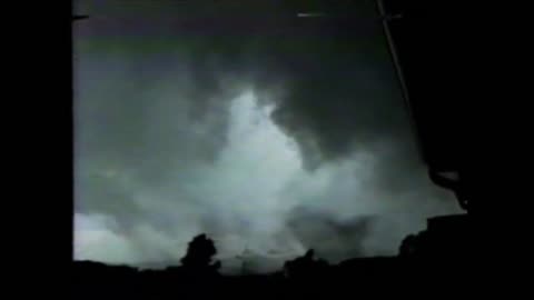
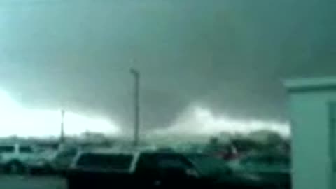
F4 tornado strikes Bullitt County, KY - May 28, 1996
F4 tornado strikes Bullitt County, KY - May 28, 1996
F-4 tornado crossed through our communities causing more than $100,000,000 in damage. Miraculously no one was killed and only 10 people were hurt by this tornado that was on the ground for 30 miles. At its widest it was half a mile wide!
Violent Tornado videos
https://rumble.com/playlists/GYezmaWENak
215
views
4
comments

EF4 Tornado Hitting the St. Louis International Airport April 22, 2011
On April 22, 2011, a violent EF4 tornado, with winds of 170 mph (270 km/h), struck the St. Louis metropolitan area. The tornado, which was the strongest to hit St. Louis County or City since January 1967, moved through many suburbs and neighborhoods, damaging and destroying many homes and businesses. The worst damage was in the Bridgeton area, where a few homes were completely leveled. In its 21.3-mile (34.3 km) track across the St. Louis metropolitan area, the tornado damaged thousands of homes, left thousands without power, and caused heavy damage to St. Louis Lambert International Airport, closing it for nearly 24 hours.
More violent tornado videos
https://rumble.com/playlists/GYezmaWENak
545
views
1
comment
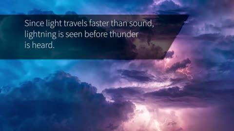
The Science Behind Lightning - Meteorology
The Science Behind Lightning
You already know “When Thunder Roars, Go Indoors” and “See A Flash, Dash Inside!” But do you know what causes lightning and thunder in the first place?
More Meteorology Videos
https://rumble.com/playlists/JfAj918PQuc
83
views
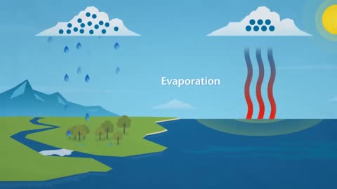
How Does Rain Form? What is the Water Cycle?
How Does Rain Form? What is the Water Cycle?
The water cycle shows the continuous movement of water within the Earth and atmosphere. It is a complex system that includes many different processes. Liquid water evaporates into water vapor, condenses to form clouds, and precipitates back to earth in the form of rain and snow
More Meteorology Videos
https://rumble.com/playlists/JfAj918PQuc
151
views
3
comments
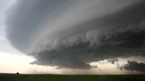
Thunderstorm Types - Meteorology - Weather
Single cell:
These are short lived, and while hail and gusty wind can develop, they are typically not severe. Like all thunderstorms, these can still produce dangerous lightning.
Multi-cell cluster:
These form in clusters with numerous cells that merge together. Their speed can make a difference in the amount of rain an area receives, and they occasionally produce large hail and damaging wind.
Squall line:
A multi-cell line that can extend for hundreds of miles. These can persist for many hours and produce damaging winds and hail.
Supercell:
These powerful storms responsible for most tornadoes in the US. They also produce extreme winds, flash flooding, and very large hailstones.
This video includes footage from:
Author: Grahame Kelaher
Author webpage: https://vimeo.com/user16504279
Licence: ATTRIBUTION LICENSE 3.0 (http://creativecommons.org/licenses/b...)
Downloaded at Mazwai.com
thunderstorm, also known as an electrical storm or a lightning storm, is a storm characterized by the presence of lightning and its acoustic effect on the Earth's atmosphere, known as thunder. Relatively weak thunderstorms are sometimes called thundershowers. Thunderstorms occur in a type of cloud known as a cumulonimbus. They are usually accompanied by strong winds[1] and often produce heavy rain[1] and sometimes snow, sleet, or hail,[1] but some thunderstorms produce little precipitation or no precipitation at all. Thunderstorms may line up in a series or become a rainband, known as a squall line. Strong or severe thunderstorms include some of the most dangerous weather phenomena, including large hail, strong winds, and tornadoes. Some of the most persistent severe thunderstorms, known as supercells, rotate as do cyclones. While most thunderstorms move with the mean wind flow through the layer of the troposphere that they occupy, vertical wind shear sometimes causes a deviation in their course at a right angle to the wind shear direction
Many hazardous weather events are associated with thunderstorms. Under the right conditions, rainfall from thunderstorms causes flash flooding, killing more people each year than hurricanes, tornadoes or lightning. Lightning is responsible for many fires around the world each year, and causes fatalities. Hail up to the size of softballs damages cars and windows, and kills livestock caught out in the open. Strong (up to more than 120 mph) straight-line winds associated with thunderstorms knock down trees, power lines and mobile homes. Tornadoes (with winds up to about 300 mph) can destroy all but the best-built man-made structures.
Where are severe thunderstorms most common?
The greatest severe weather threat in the U.S. extends from Texas to southern Minnesota. But, no place in the United States is completely safe from the threat of severe weather.
What is the difference between a Severe Thunderstorm WATCH and a Severe Thunderstorm WARNING?
A Severe Thunderstorm WATCH is issued by the NOAA Storm Prediction Center meteorologists who are watching the weather 24/7 across the entire U.S. for weather conditions that are favorable for severe thunderstorms. A watch can cover parts of a state or several states. Watch and prepare for severe weather and stay tuned to NOAA Weather Radio to know when warnings are issued.
A Severe Thunderstorm WARNING is issued by your local NOAA National Weather Service Forecast Office meteorologists who watch a designated area 24/7 for severe weather that has been reported by spotters or indicated by radar. Warnings mean there is a serious threat to life and property to those in the path of the storm. ACT now to find safe shelter! A warning can cover parts of counties or several counties in the path of danger.
More Meteorology Videos
https://rumble.com/playlists/JfAj918PQuc
206
views
2
comments

Strong earthquake in Japan shake buildings in Tokyo, nearby areas
Strong earthquake in Japan shake buildings in Tokyo, nearby areas
5.3 earthquake
March 21, 2024
209
views

1974 Kentucky Tornado Super Outbreak Full Documentary | “April 3rd - One Year Later!”
1974 Kentucky Tornado Super Outbreak Full Documentary - “April 3rd - One Year Later!”
204
views
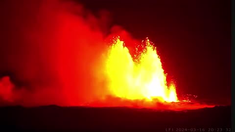
Volcano Erupts for Fourth Time Since December on Iceland Peninsula
Lava spewed Saturday from a new volcanic fissure on Iceland’s Reykjanes peninsula, the fourth eruption to hit the area since December, authorities said
March 16, 2024
204
views
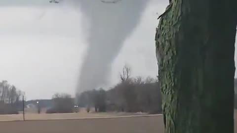
Developing Large Tornado near St. Marys, Ohio 3-14-2024
Large Tornado Developing near St. Marys, Ohio 3-14-2024
205
views
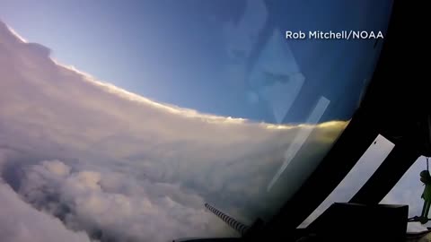
Flying Into the Eye of Cat 5 Hurricane Irma 2017
Flying into the eye of Cat 5 Hurricane Irma 2017
Video showing a flight through the eye of Hurricane Irma from a Tuesday morning flight on NOAA's Hurricane Hunter aircraft
Hurricane Irma was an extremely powerful Cape Verde hurricane that caused widespread destruction across its path in early September 2017. Irma was the first Category 5 hurricane to strike the Leeward Islands on record, followed by Maria two weeks later. At the time, it was considered the most powerful hurricane on record in the open Atlantic region, outside of the Caribbean Sea and Gulf of Mexico, until it was surpassed by Hurricane Dorian two years later. It was also the third-strongest Atlantic hurricane at landfall ever recorded, just behind the 1935 Labor Day Hurricane and Dorian
201
views
2
comments
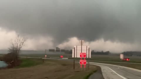
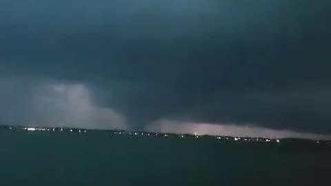
Double vortex tornado Hancock County, Ohio March 14, 2024
Double vortex tornado Hancock County, Ohio March 14, 2024
319
views
2
comments

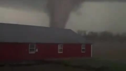
Lakeview, Ohio Struck by a Strong Tornado March 14, 2024
Lakeview, Ohio was struck by a Strong tornado that tore through the Lakeside RV Park.
March 14, 2024
If you don’t have a Rumble account and would like to comment or subscribe make one below
https://rumble.com/register/F5Tornado/
143
views
1
comment
Lakeview, Indian Lake OH Tornado March 14, 2024
Lake view, Indian lake OH Tornado
March 14, 2024
If you don’t have a Rumble account and would like to comment or subscribe make one below
https://rumble.com/register/F5Tornado/
3.09K
views
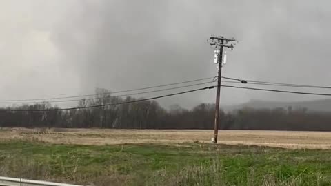
Large Tornado South of Wapakoneta Near Fryburg Ohio March 14, 2024
Large Tornado South of Wapakoneta Near Fryburg Ohio March 14, 2024
If you don’t have a Rumble account and would like to comment or subscribe make one below
https://rumble.com/register/F5Tornado/
1.29K
views

Tornado Crossing the Ohio River Near Madison IN MAR 14, 2024
Tornado Crossing the Ohio River Near Madison IN into KY
March 14, 2024
If you don’t have a Rumble account and would like to comment or subscribe make one below
https://rumble.com/register/F5Tornado/
246
views
Tornado in Carroll County Kentucky , just west of Carrollton 3-14-2024
Tornado in Carroll County Kentucky , just west of Carrollton
March 14, 2024
If you don’t have a Rumble account and would like to comment or subscribe make one below
https://rumble.com/register/F5Tornado/
336
views
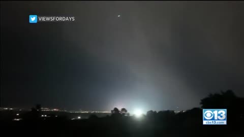
Rare Ball Lightning Captured On Video
Rare Ball Lightning Captured On Video
If you don’t have a Rumble account and would like to comment or subscribe make one below
https://rumble.com/register/F5Tornado/
273
views
1
comment
Enterprise, AL EF4 Tornado March 1, 2007
A tornado struck Enterprise, Coffee County, in March 2007, killing nine high school students at Enterprise High School and one other town resident, and injuring about 50 others.
If you don’t have a Rumble account and would like to comment or subscribe make one below
https://rumble.com/register/F5Tornado/
132
views